
A New Science-based Monitoring Tool To Improve Communities’ Brazil Nut Production
November 8, 2019
The vastness of the Bolivian Amazon makes it a daunting task to understand the plant species that live in it, where they are located, and the status of their health. Knowing where key plant species are in a forest can help answer questions that improve forest and biodiversity conservation decisions. Improved understanding of the forest and its composition also makes forest production easier for communities in conservation areas like Santa Rosa de Abuná, who live off harvesting forest products sustainably. Finding a mature Brazil nut tree can mean having to walk for an entire day or more in heavy forest terrain, since no forest inventory exists for most conservation areas in the country.
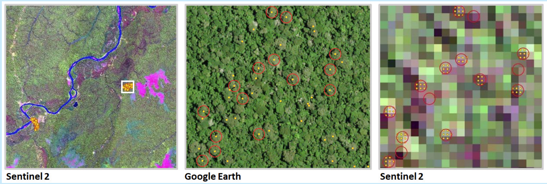
To this end, we have developed an innovative computer model to detect, analyze, and classify Brazil nut tree using remote sensing, drones and photogrammetric analysis. The model can analyze the density of Brazil nut trees using satellites with a 10 meter resolution and validate that information through a series of complex orthomosaics built with photographs taken by drones. To date, we have collected information on over 53,000 Brazil nut trees which helps clarify species density, potential production and forest health.
We have been able to pilot and roll out the tool to 11 of the 19 communities in the Santa Rosa de Abuná conservation area. The model was met with much excitement from the communities, as they recognize the benefit that this technology can bring to them to map, plan and reduce the on-the-ground effort needed to manage this labor- intensive forest product.
An exciting aspect of the potential of this tool is that, with some investment and adjustments, it can be used to detect and track other forest species. We are now determining what our next application of this incredible technology will be: it could support scientists in conducting scientific studies, help local authorities track illegal logging of high-value species, and in making the case to governments to prioritize the protection of forests.
This work was made possible thanks to the generosity and support from The Sheldon and Audrey Katz Foundation.
 Loading...


