
MAAP #17: Birth of A New Illegal Gold Mining Zone in The Peruvian Amazon [High Resolution View]
October 28, 2015
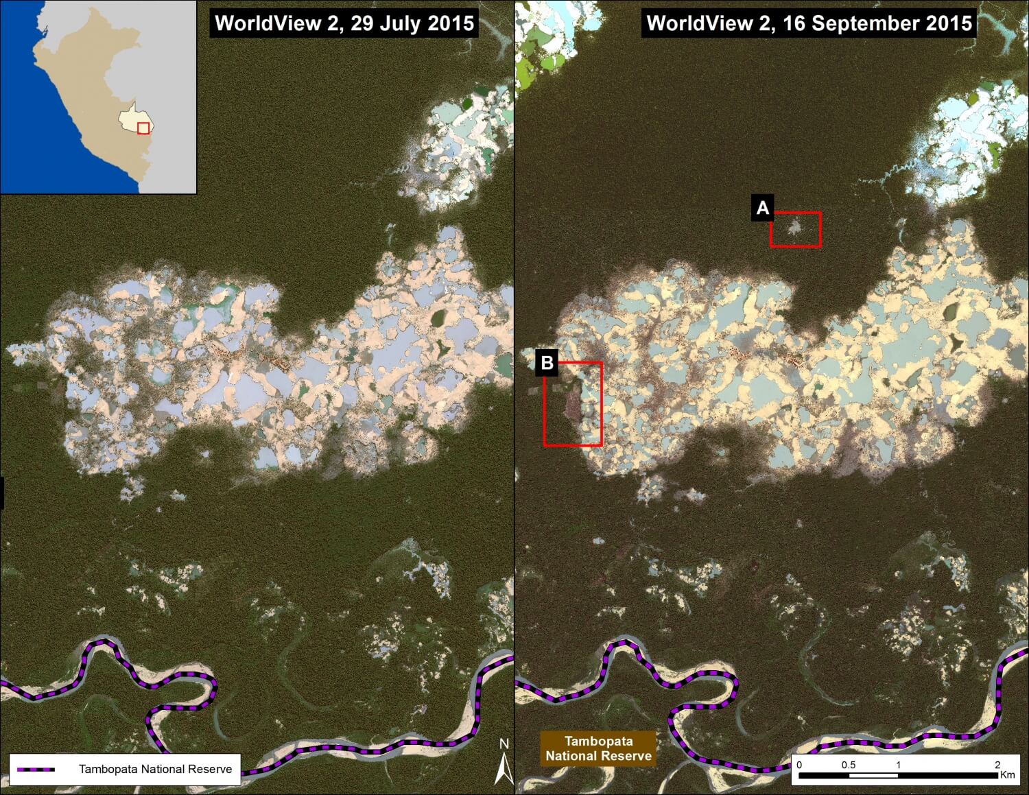
In MAAP #12, we featured a high resolution image from July 29, 2015 of the area known as “La Pampa,” a hotspot of illegal mining in the buffer zone of the Tambopata National Reserve (Madre de Dios region, Peru).
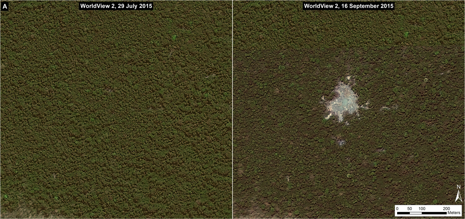
Just seven weeks later, we obtained a new high resolution image of La Pampa for September 16, 2015. Image 17a shows the birth of a new gold mining zone between the July image (left panel) and September image (right panel) (see the letter “A” in Image 17b for context). The current extent of this new clearing is 1.5 hectares. This mining activity is illegal since it is located within the buffer zone of the Tambopata National Reserve.
Reference Map
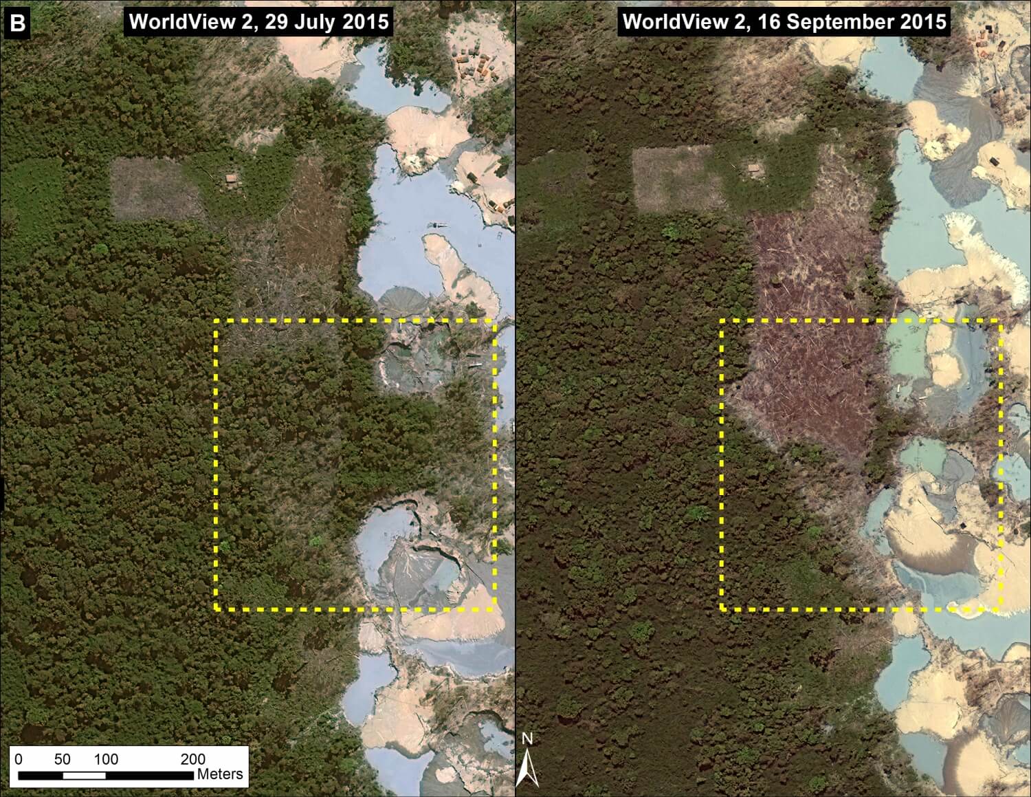
Image 17b is the reference map, showing the forest cover change between July (left panel) and September (right panel) 2015. In the right panel, the letter “A” corresponds to Image 17a, while the letter “B” corresponds to Image 17c.
Expanding Deforestation
Image 17c shows the deforestation expanding to the west between July (left panel) and September (right panel) 2015.
Citation
Finer M, Olexy T (2015) High Resolution View: Birth of a New Illegal Mining Zone. MAAP #17.
 Loading...


