
MAAP #31: Deforestation Continues Expansion in La Pampa (Buffer Zone Of Tambopata National Reserve)
April 12, 2016
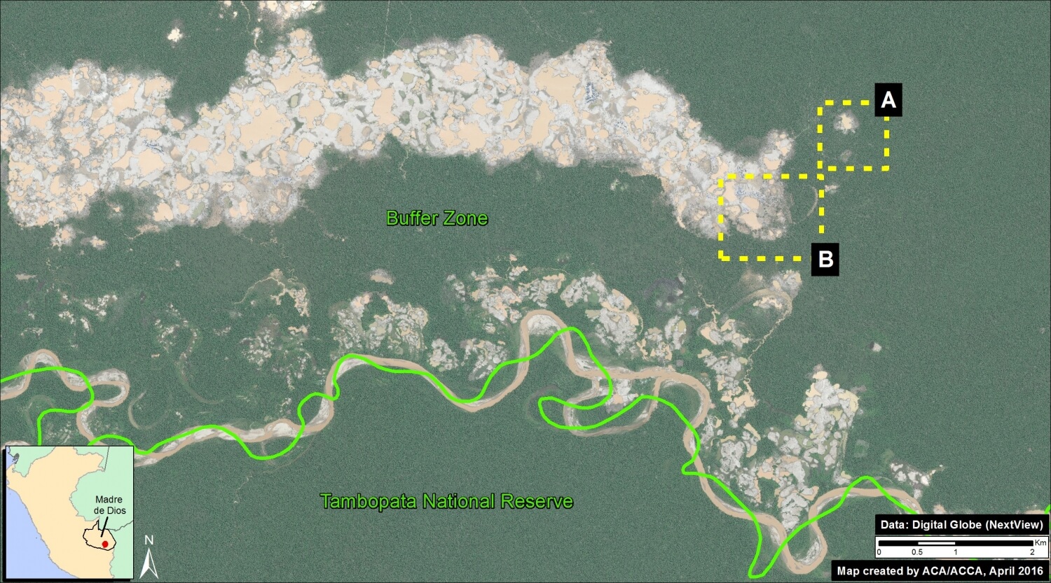
Illegal gold mining deforestation continues to expand in La Pampa, an area located in the buffer zone of Tambopata National Reserve in the Madre de Dios region. Here, we present a series of high-resolution (0.5 m) images that clearly illustrate this expansion. Image 31a shows the large, expanding mass of deforestation in La Pampa (as of November 2015) in relation to the Tambopata National Reserve and its buffer zone. Insets A and B indicate the high-resolution zoom areas, where further below we show the rapid deforestation of 76 hectares (188 acres) between November 2015 and April 2016.
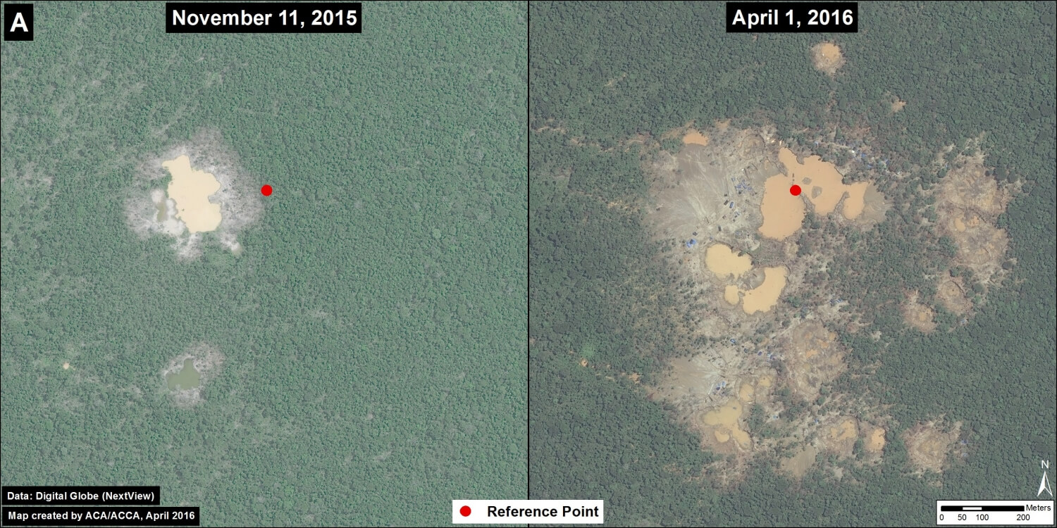
Zoom A: Rapid Advance of Deforestation
Image 31b shows the expansion of deforestation (28 hectares) between November 2015 (left panel) and April 2016 (right panel) in the eastern section of La Pampa. The red dot indicates the exact same point in both images across time.
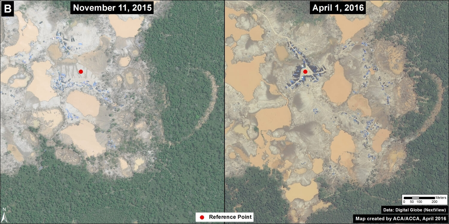
Zoom B: Formation of a Large Camp
Image 31c shows the formation of a large mining camp between November 2015 (left panel) and April 2016 (right panel) in the eastern section La Pampa. The red dot indicates the exact same point in both images across time. The image also shows the deforestation of 48 hectares around the camp.
Citation
Finer M, Olexy T (2016) Deforestation Continues Expansion in La Pampa (buffer zone of Tambopata National Reserve). MAAP: 31.
 Loading...


