
MAAP #47: Fires Degrade Southern Peruvian Amazon (Madre De Dios)
October 4, 2016
The Peruvian Amazon is experiencing an intense 2016 fire season due to one of its driest periods in decades. In recent weeks, we have presented a series of articles showing the power of the new GLAD alerts in detecting deforestation in near real time. Here, we go a step further and also evaluate alerts to detect fires in near real time. These fire alerts are based on the moderate resolution (375 meters) VIIRS sensor that detects heat sources and highlights areas where the temperature is significantly above normal.
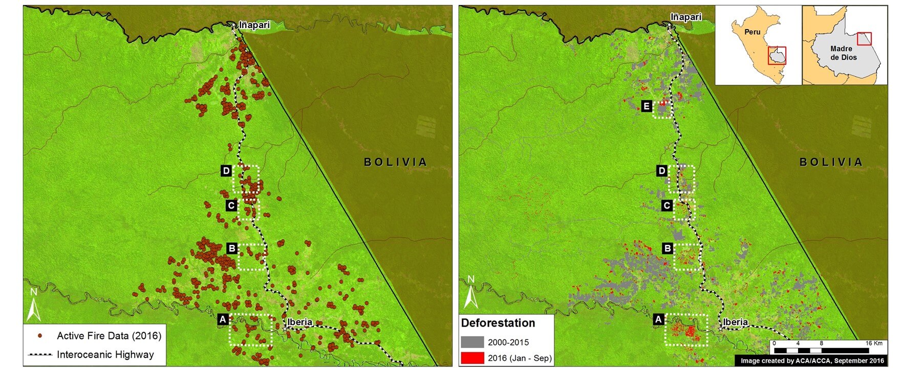
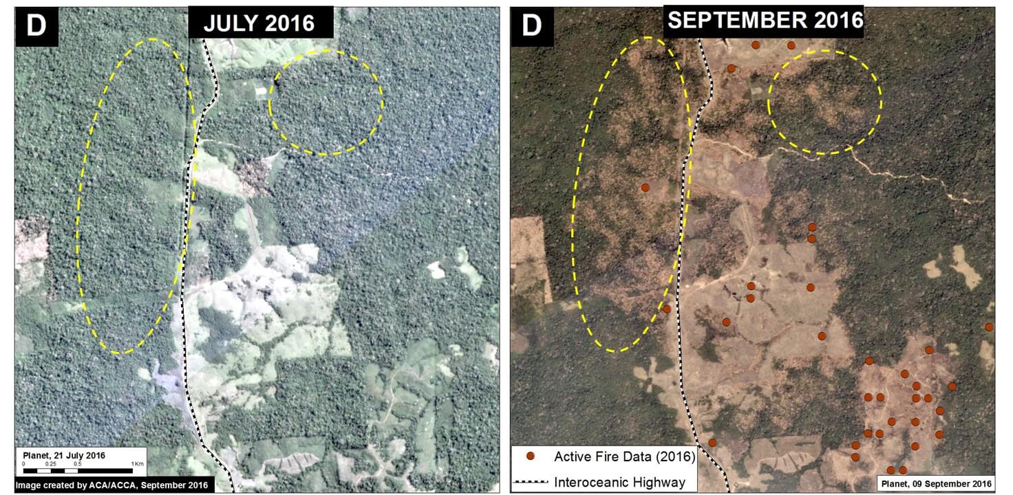
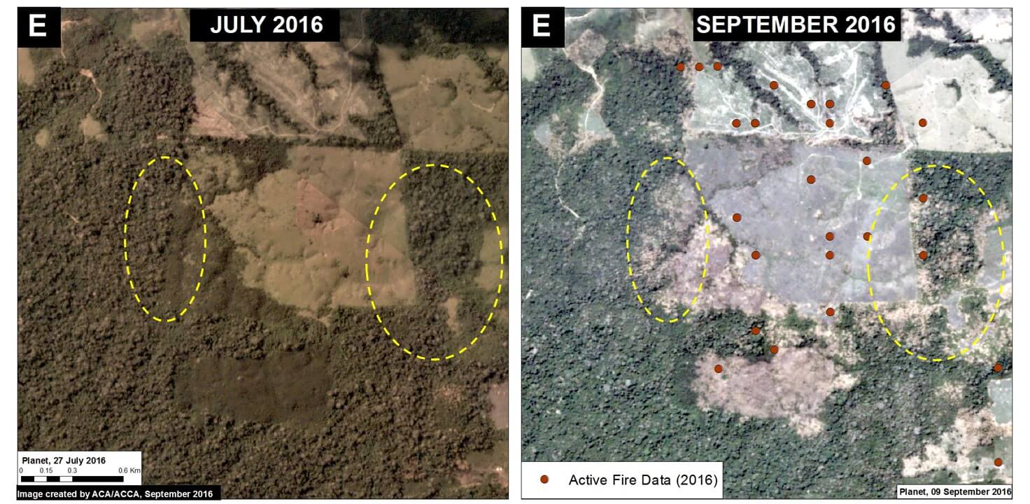
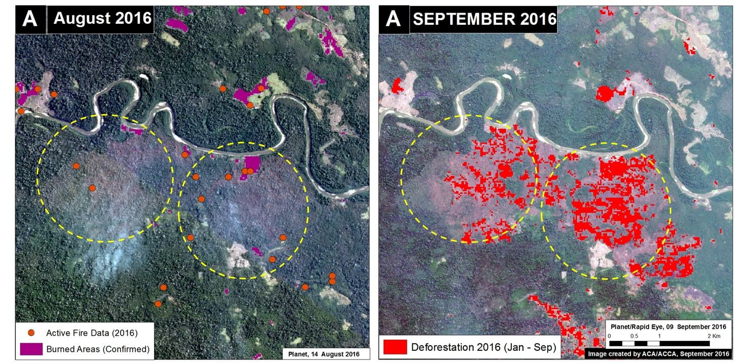
We compared, for the first time, these two types of alerts and found a correlation between fires and forest loss along a stretch of the Interoceanic Highway in the southern Peruvian Amazon (Madre de Dios region).
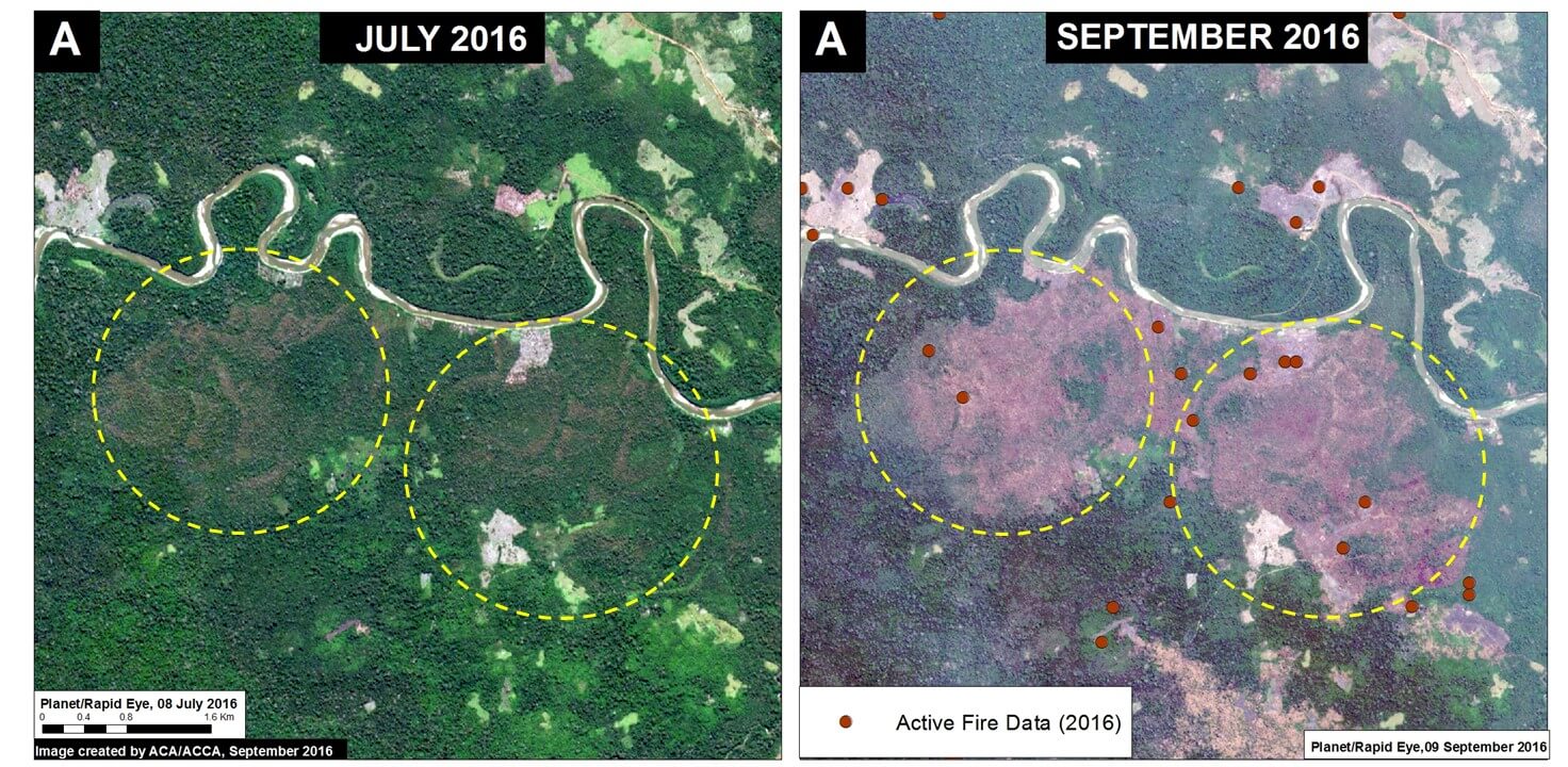
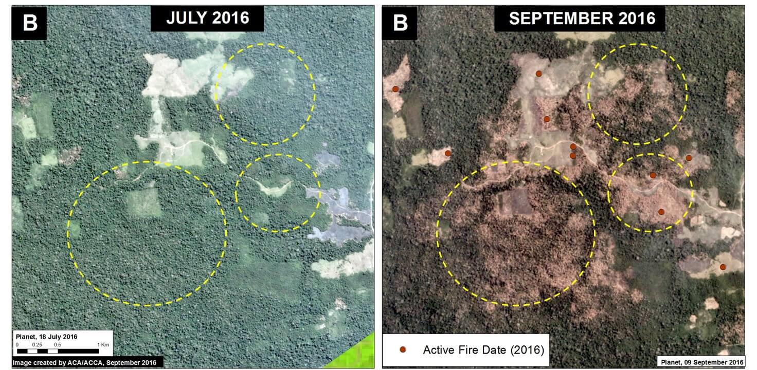
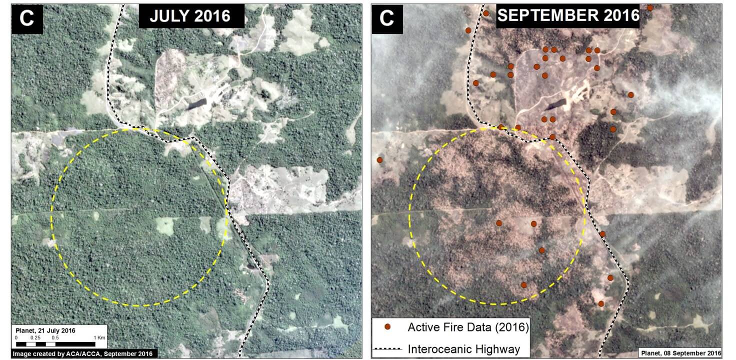
Image 47a shows the occurrence of fire alerts (left panel) in relation to deforestation alerts (right panel) during 2016 along the highway between the towns of Iberia and Iñapari. Insets A-E indicate the areas highlighted in the high-resolution zooms below, where approximately 600 hectares were affected by fires in 2016..
 Loading...


