Claim your free gift for Earth Month when you stand with nature!
Peru
Bolivia
Visit
Skip to content
Toggle navigation
Home
Who
We Are
Mission and Vision
Approach
Board of Directors
Staff
Supporters
Partners
Financials & Reports
Careers & Internships
Contact Us
The
Challenge
Why Protect The Amazon
Threats to the Amazon
Our
Approach
Protect Wild Places
Empower People
Put Science and Technology to Work
Monitoring of the Andes Amazon Program (MAAP)
Dashboards and Platforms
2020-2030 Strategy
Our Results
Where
We Work
On the Ground
Across the Amazon
Research & Biological Stations
Los Amigos Biological Station
Wayqecha Cloud Forest Biological Station
Manu (Villa Carmen) Biological Station
Tahuamanu Biological Station
Visit
the Amazon
Our Ecolodges
For Researchers
Los Amigos Biological Station
Manu (Villa Carmen) Biological Station
Wayqecha Cloud Forest Biological Station
Tahuamanu Biological Station
For Students and Universities
News
& Events
Recent News
Pressroom
Events
Take
Action
Donate
Your Impact
Ways to Give
Join Wild Keepers
Become a Business Supporter
Peru
Bolivia
Visit
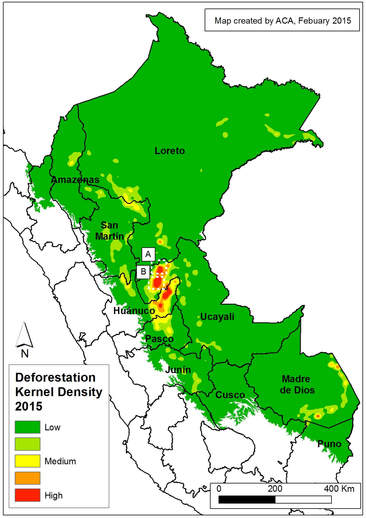
26a Kernell_2015a_v1_en (1)
26a Kernell_2015a_v1_en (1)
May 28, 2021
Help keep the Amazon wild.
Become a Wildkeeper
Donate
Visit the Amazon
Follow us
@AmazonConservation
on Instagram
Loading...

 Loading...


