
MAAP #72: New Gold Mining Deforestation Zone in Peruvian Amazon: The Upper Malinowski (Madre De Dios)
October 30, 2017
In a series of previous reports (MAAP # 60), we have described the dire gold mining deforestation in the southern Peruvian Amazon, most notably in the area known as “La Pampa” (see Base Map). However, over the past 3 years another critical area has emerged in the region: the Upper Malinowski. This area is located near the headwaters of the Malinowski River, upstream of La Pampa (see Base Map).
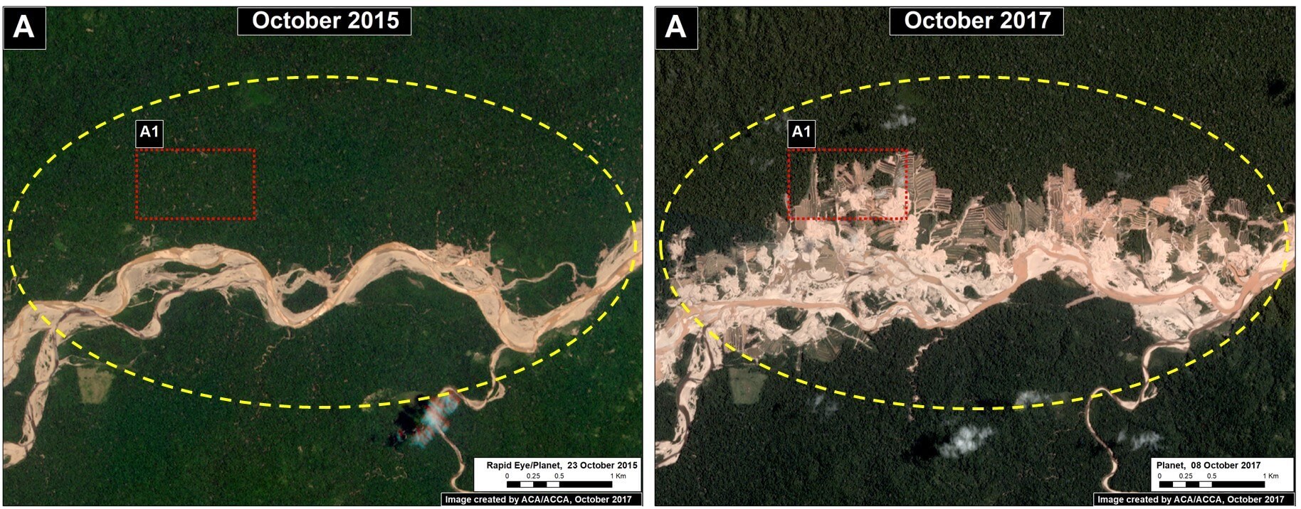
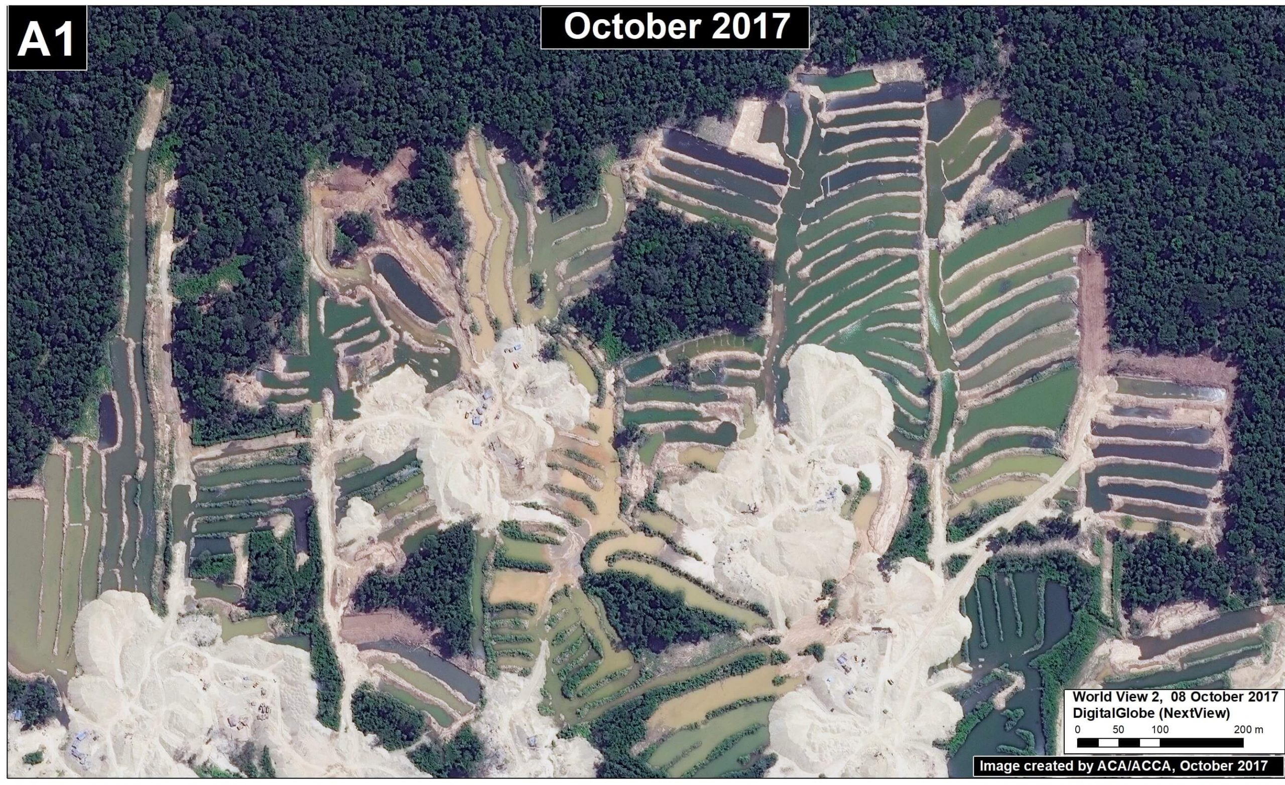
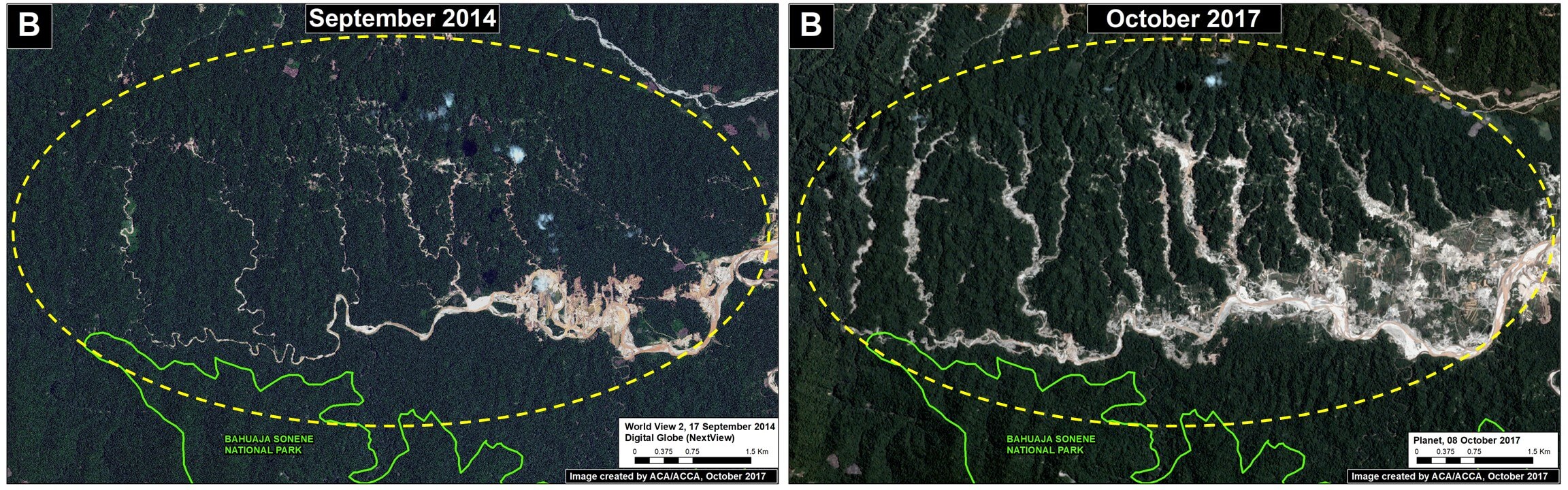
Here, we show satellite images of the rapid advance of gold mining deforestation in two sectors of the upper Malinowski. In total, we document the deforestation of 3,880 acres (1,570 hectares) between 2015 and 2017 inside the buffer zone of the Bahuaja Sonene National Park.
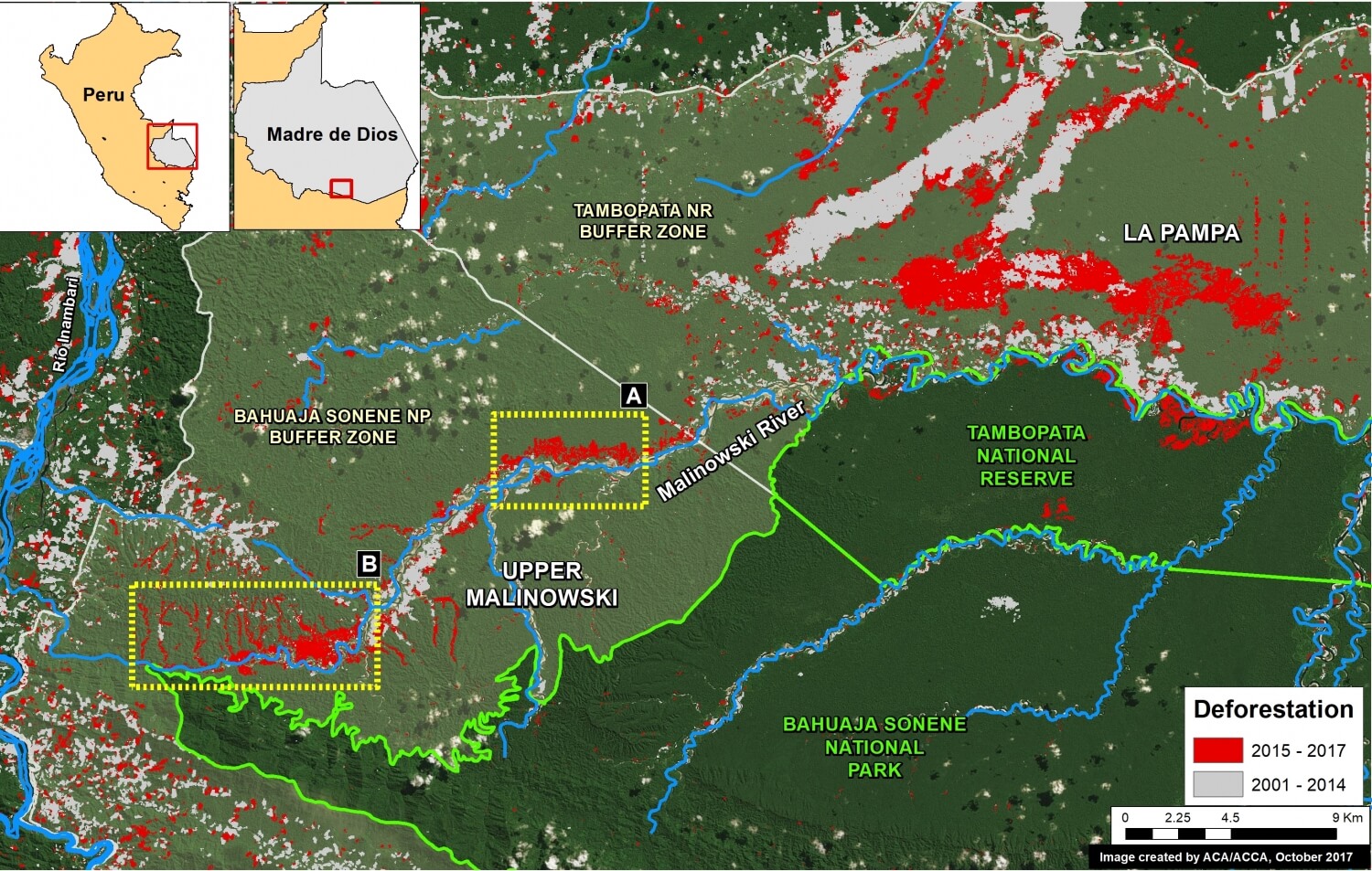
Mapa Base. Datos: SERNANP, UMD/GLAD, MINAM/PNCB, Hansen/UMD/Google/USGS/NASA
 Loading...


