
Our Novel Fire Monitoring App Detected 2,500 Major Fires in the Amazon In 2020
August 16, 2021
 Following 2019’s intense fire season in the Amazon that made international headlines, we recorded an even more severe year of fires in 2020, with over 5 million acres impacted.
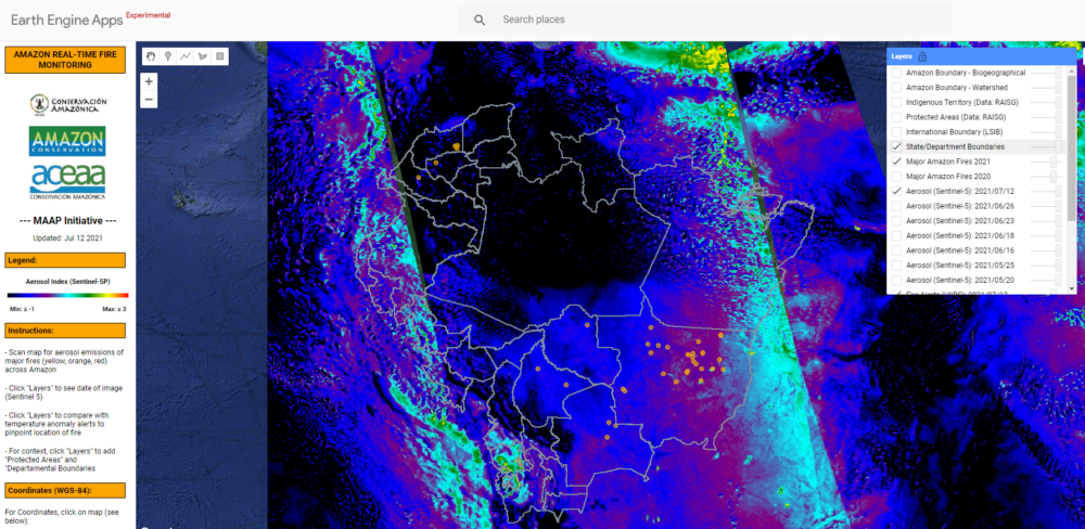
Thanks to the support of our donors, in the months preceding the fire season we improved and relaunched our Amazon real-time fire monitoring app, hosted by Google Earth Engine. This proved to be an effective and accessible new tool to detect major fires in real-time throughout the fire season.
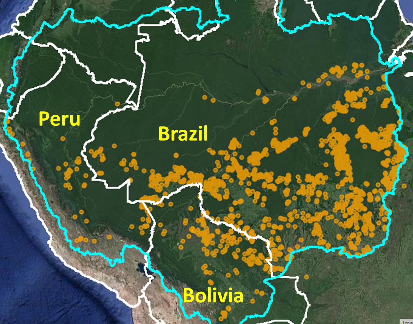
By combining aerosol emissions data with traditional fire alerts, we can now create comprehensive maps that identify the major fires in the Amazon on a daily basis. Through our app, we identified the first major fire of 2020 on May 28, in the Mato Grosso state in Brazil, and throughout the season documented over 2,500 major fires affecting forests mainly in Brazil, Bolivia, and Peru.
 Based on our extensive analysis, we determined that, like in 2019, the majority of the burning this year took place in Brazil, in areas that had been recently deforested for agricultural and cattle-ranching purposes. In contrast, the main source of fires in the Bolivian Amazon took place in standing forests, especially in the dry forests of the Chiquitanía. The vast majority of the fires across Bolivia, Brazil, and Peru were identified to be likely human-caused and illegal, in violation of government-implemented fire management regulations and moratoriums.
Being able to produce this information in real-time – as the fires began burning – allowed us to provide the government, local communities, and the media with the precise data needed to take action on the ground. This is one of the many ways we are expanding our fire management work, in addition to furthering fire prevention efforts by promoting fire-free, sustainable development in the region.
This story was featured in our 2020 Impact Report. Click here to read about other conservation successes from 2020.
 Loading...


