
MAAP #79: Seeing Through the Clouds: Monitoring Deforestation With Radar
March 12, 2018
MAAP has repeatedly emphasized the power and importance of Earth observation satellites with optical sensors (such as Landsat, Planet, DigitalGlobe).
However, they also have a key limitation: clouds block the data about Earth from reaching the sensor, a common problem in rainy regions like the Amazon.
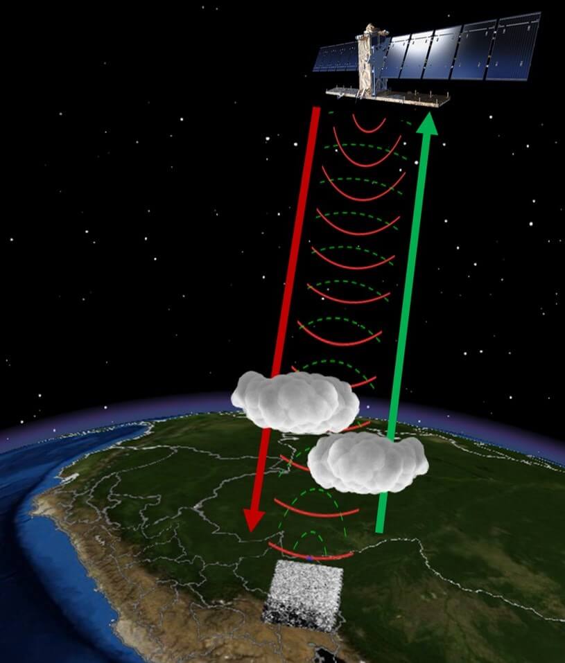
Fortunately, there is another powerful tool with a unique capability: satellites with radar sensors, which emit their own energy that can pass through the clouds (see Image).
Since 2014, the European Space Agency has provided free imagery from its radar satellites, known as Sentinel-1.
In the Peruvian Amazon, for example, Sentinel-1 obtains imagery every 12 days with a resolution of ~20 meters.
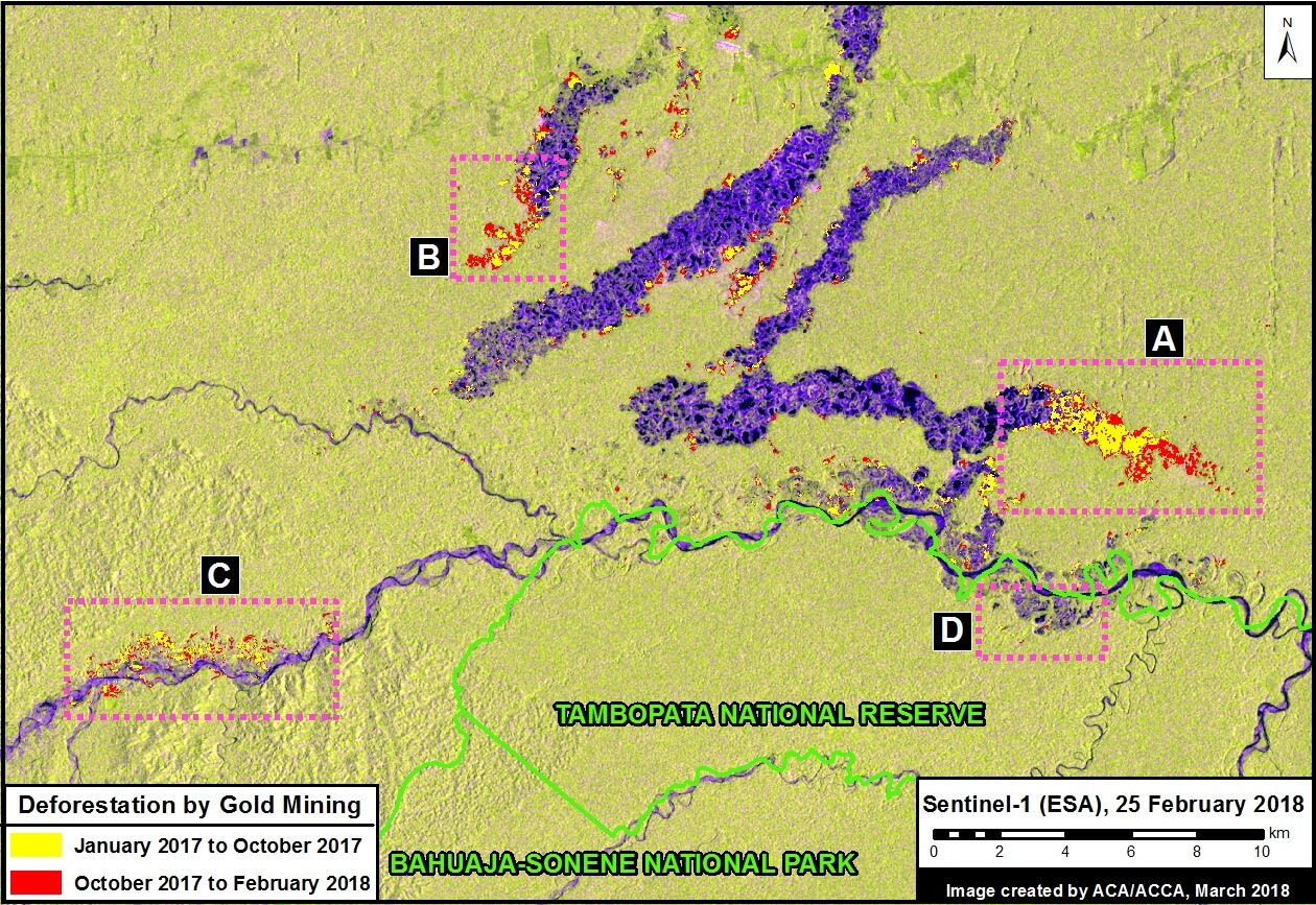
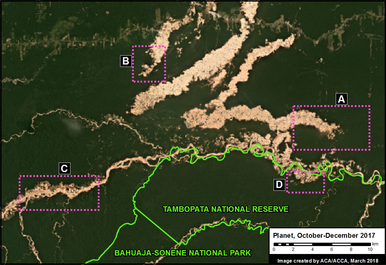
Here, we show the power of radar imagery in terms of near real-time deforestation monitoring. We focus on an area with ongoing deforestation due to gold mining in the southern Peruvian Amazon (Madre de Dios region).
 Loading...


