
MAAP #69: Alarming Deforestation Patterns in The Central Peruvian Amazon
September 26, 2017
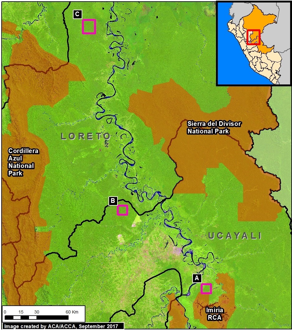
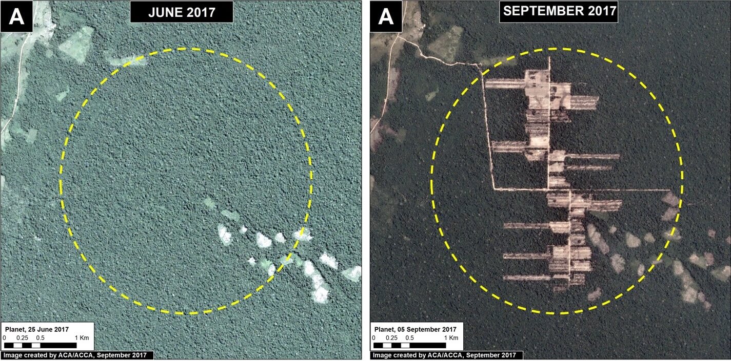
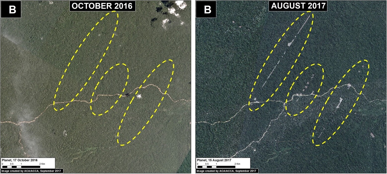
Thanks to early warning forest loss alerts (known as GLAD), we recently detected several alarming new deforestation patterns within remote, primary forest of the central Peruvian Amazon.
They appear to be related to medium or large-scale agricultural activities due to their distinct characteristics: straight access paths extending from secondary roads built deep into primary forest, and deforestation of rectangular/square plots.
These patterns are significant because they are very different than the usual patterns observed with small-scale agriculture in the Peruvian Amazon: scattered plots with no major linear features.
Here, we show satellite images of 3 areas in the central Peruvian Amazon (see Base Map) that have recently experienced these alarming patterns, and deserve urgent attention due to the threat of rapid deforestation of large swaths of primary forest.*
 Loading...


