Protected Areas
A. Yaguas National Park (Loreto)
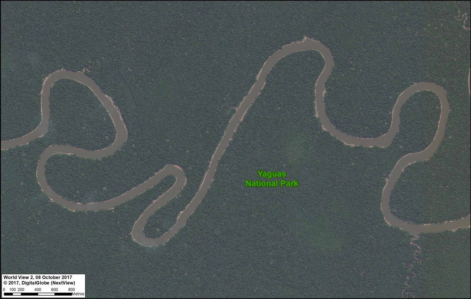
As Peru’s newest national park, created in January 2018, Yaguas National Park now protects a large (2,147,345 acres) and nearly intact stretch of the northern Peruvian Amazon. In featured Image A, we show the Yaguas River meandering through the primary forest of the eastern section of the new park.
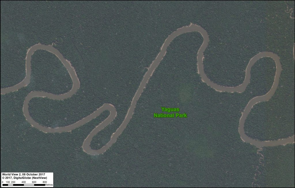
Image 80a. Parque Nacional Yaguas. Data: DigitalGlobe (Nextview)
B. Sierra del Divisor National Park (Ucayali)
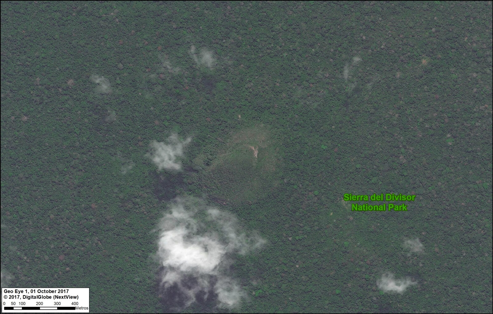
The second newest national park in Peru is Sierra del Divisor, created in 2015. Sierra del Divisor National Park protects more than three million acres in the remote central Peruvian Amazon, along the border with Brazil. Featured Image B shows an aerial view of the famous cone mountain in the southern part of the park.

Image 80b. Parque Nacional Sierra del Divisor. Data: DigitalGlobe (Nextview)
C. Tambopata National Reserve (Madre de Dios)
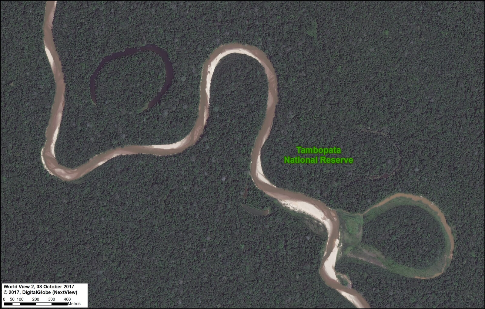
Tambopata National Reserve made headlines in 2015 due to an illegal gold mining invasion that has since been contained (MAAP #61). Fortunately, Tambopata, located in the southern Peruvian Amazon, is best known for its world-renowned biodiversity. Featured Image C shows a meandering tributary of the Tambopata River and the subsequent formation of oxbow lakes.
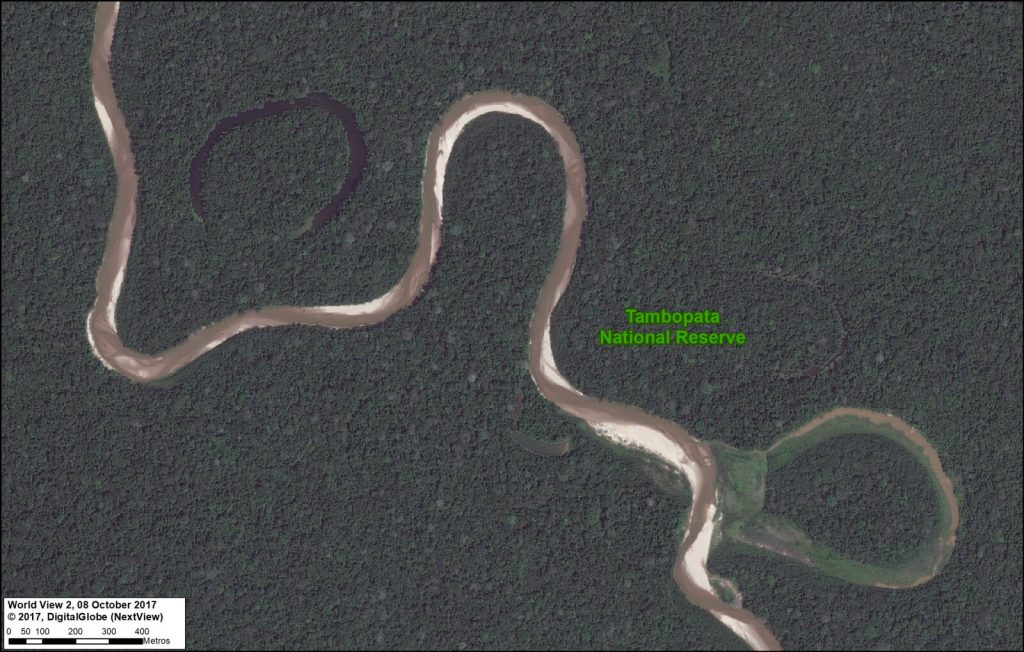
Image 80c. Reserva Nacional Tambopata. Data: DigitalGlobe (Nextview)
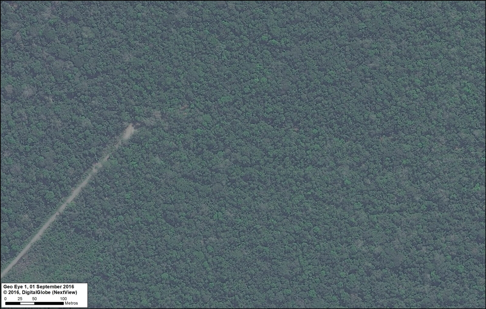
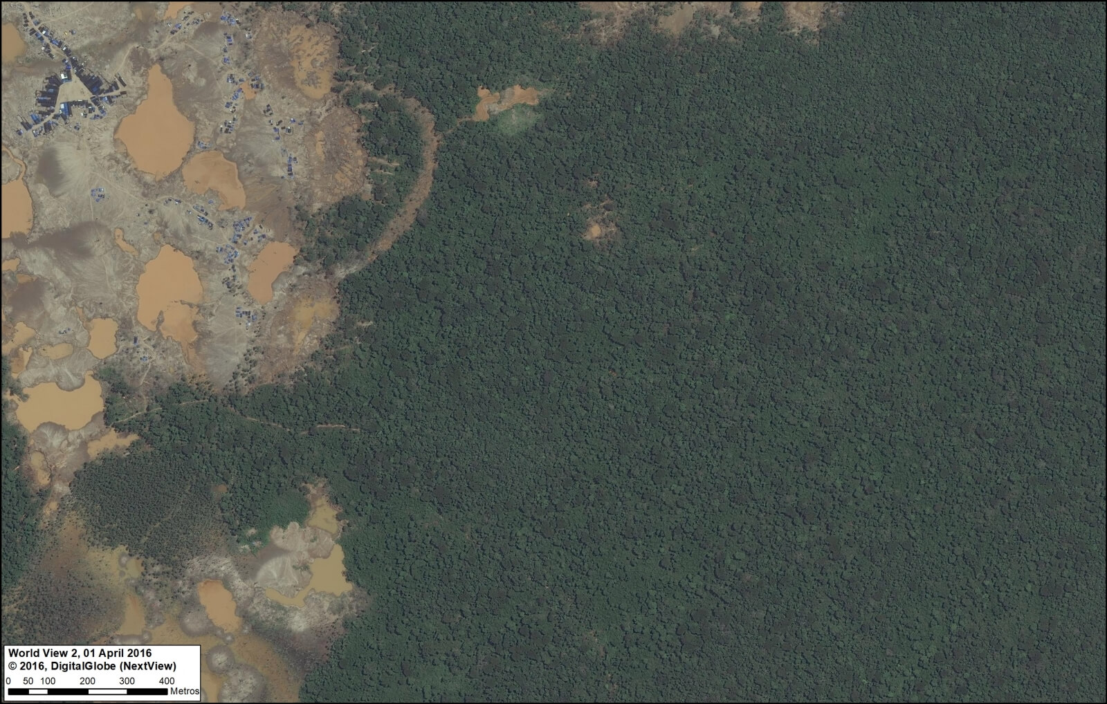
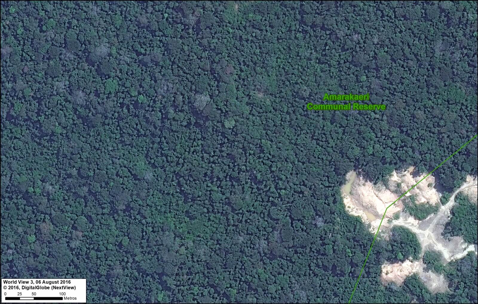
D. Amarakaeri Communal Reserve (Madre de Dios)
Amarakaeri Communal Reserve is an important protected area in the southern Peruvian Amazon that is jointly managed by indigenous communities (ECA Amarakaeri) and the national protected areas agency (SERNANP). Featured Image D shows a wild river winding through the rugged foothills of the southern portion of the reserve.
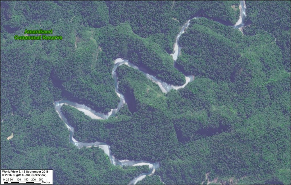
Image 80d. Reserva Comunal Amarakaeri. Data: DigitalGlobe (Nextview), SERNANP
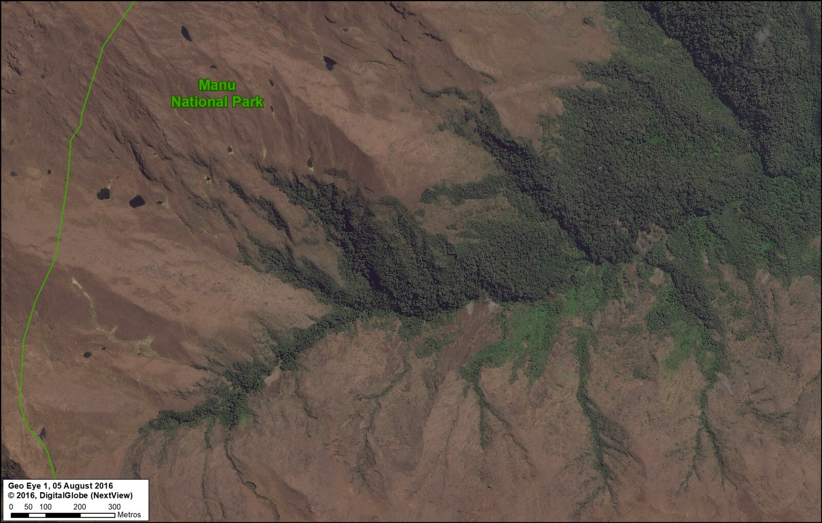
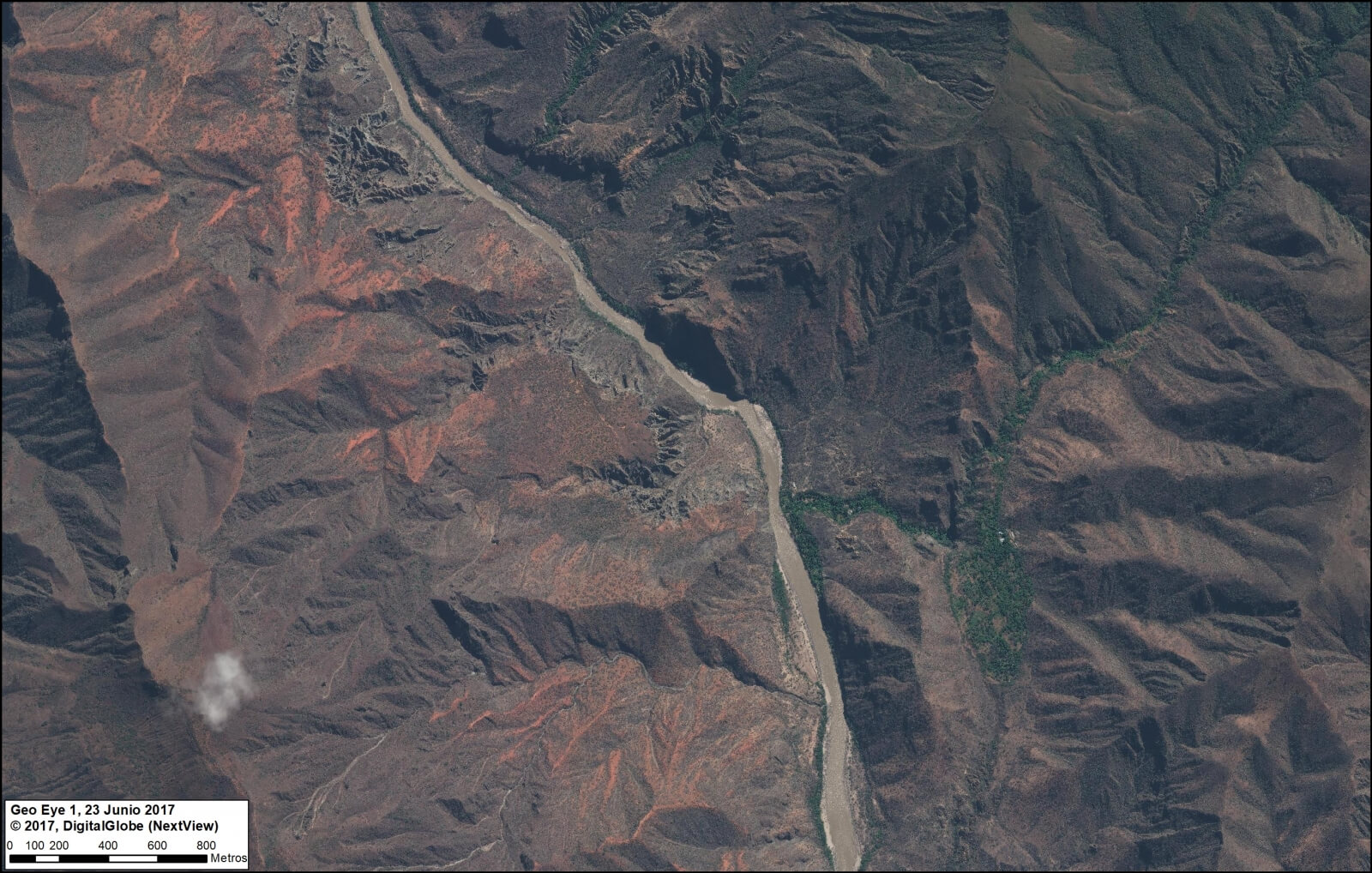
E. Manu National Park (Cusco sector)
Manu is one of the most famous national parks in the world, known for its diversity of habitats in the southern Peruvian Amazon, including lowland rainforest. Featured Image E shows the other extreme, the highlands and the transition beyond the tree-line to an ecosystem known as puna. Interestingly, this image shown an example of the upper-most headwaters where Amazonian rivers are born.
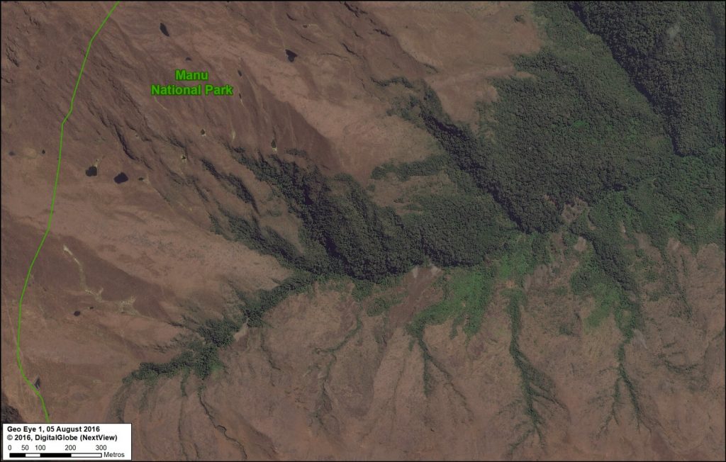
Image 80e. Parque Nacional Manu. Data: DigitalGlobe (Nextview), SERNANP
F. Regional Conservation Area Choquequirao (Cusco)
Choquequirao, one of the first examples of a regional conservation area in southern Peru, is located next to Machu Picchu. Featured Image F shows a high-elevation scene in the heart of the reserve, near the mountain peak known as Nevado Sacsarayoc.
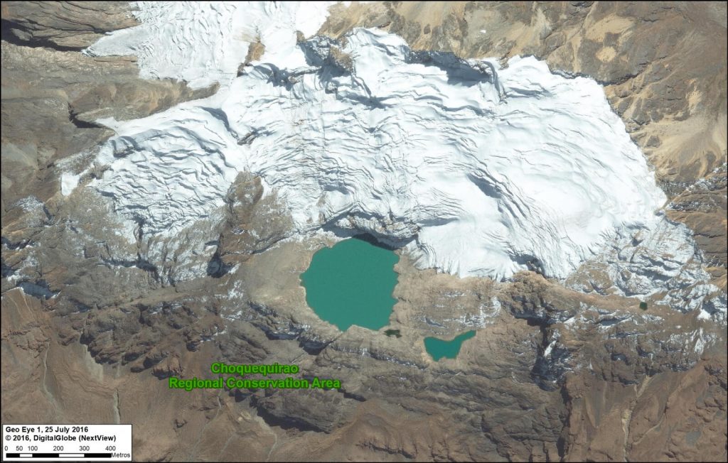
Image 80f. Choquequirao. Data: DigitalGlobe (Nextview)
G. Los Amigos Conservation Concession (Madre de Dios)
It’s not technically a protected area, but a forestry concession in the southern Peruvian Amazon. In fact, Los Amigos is the first private conservation concession in the world. Featured Image G shows the meandering course of a tributary of the Los Amigos river, and the surrounding primary forest, deep in the concession.
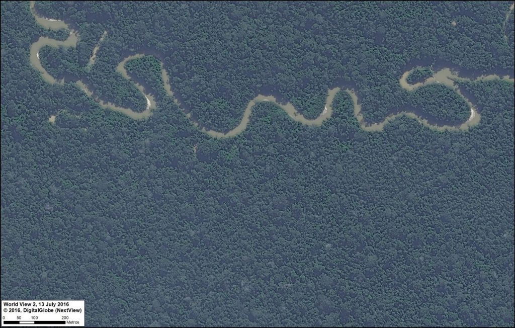
Image 80g. Los Amigos. Data: DigitalGlobe (Nextview)


 Loading...


