
Deforestation update: Our analysis of deforestation hotspots in the western Amazon
May 20, 2019
Through Amazon Conservation’s Monitoring of the Andean Amazon Project (MAAP), we identify, analyze, track, and publicize deforestation taking place in the Amazon in real-time using high-tech, satellite imagery. We use this information to make local authorities, policymakers, and the general public aware of what is happening on the ground.
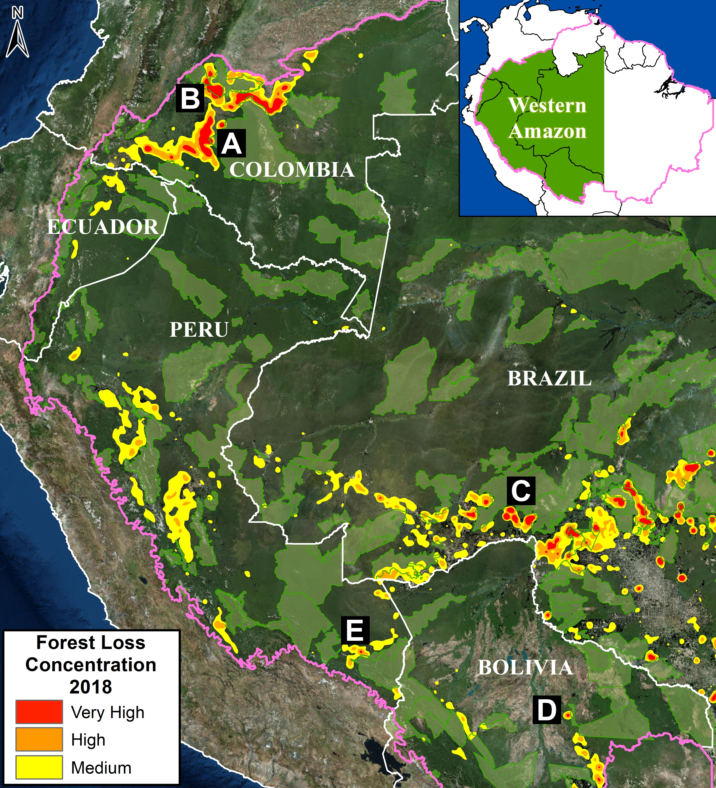 Recently, we conducted an in-depth analysis of 2018 data on forest cover loss and found that 2.5 million acres were deforested in the western Amazon (Colombia, Peru, Ecuador, Bolivia, and western Brazil) last year. An average of 5 acres was lost per minute to deforestation last year. Our additional analysis indicated that, of this total, 1.9 million acres were primary forests, which play a vital role as carbon sinks, mediators of the global water cycle and cradles of biodiversity.
The combination of forces driving deforestation varies in each country. Land grabbing, unsustainable agricultural activities and expansion, and gold mining were among the key drivers of deforestation that we identified in this region.
Read more on our 100th MAAP Report.
 Loading...


