
MAAP #94: Detecting Logging in The Peruvian Amazon With High Resolution Imagery
October 29, 2018
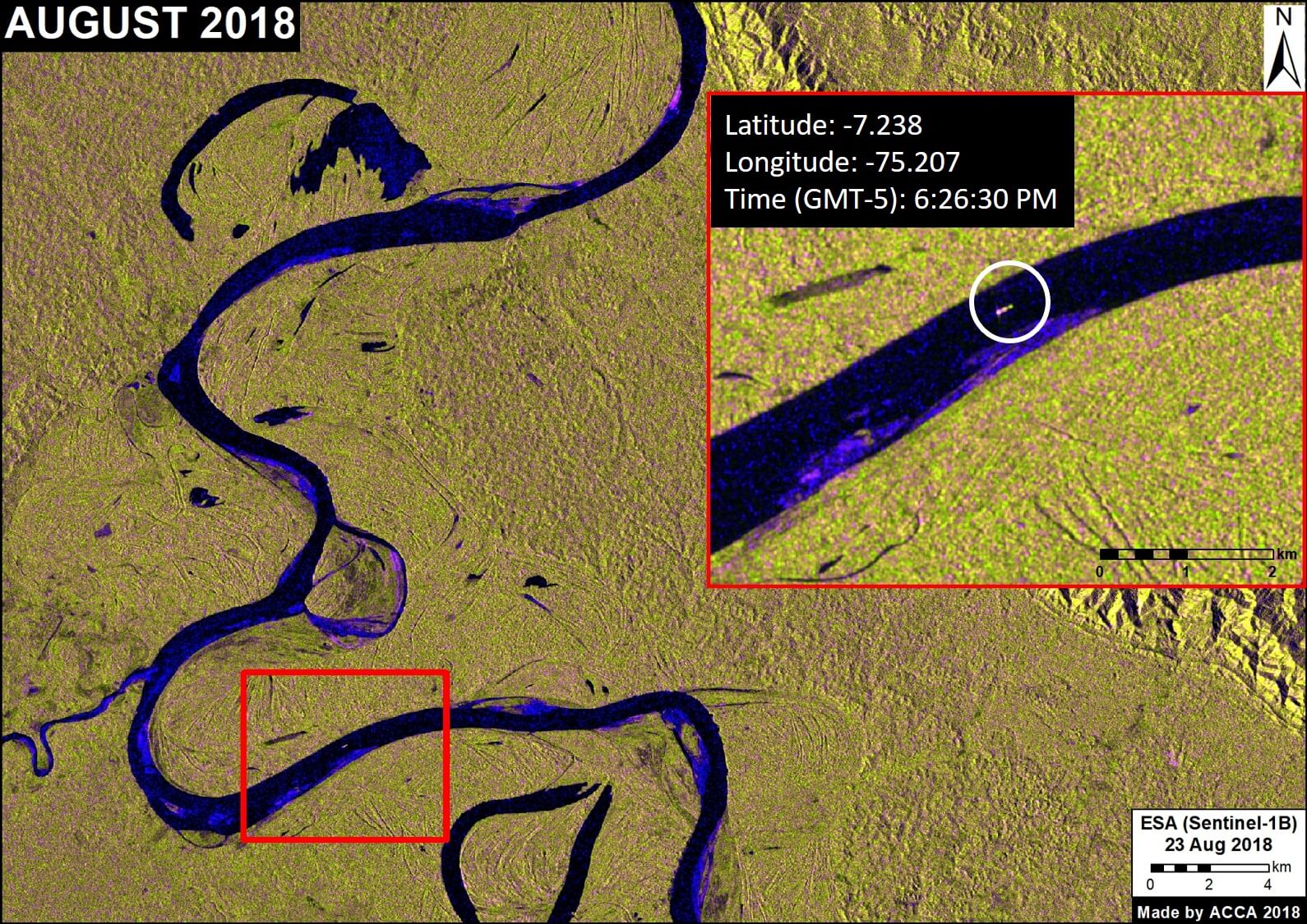
In MAAP # 85, we showed how medium and high-resolution satellites (such as Landsat, Planet and Sentinel-1) could be used to monitor the construction of logging roads in near-real time.
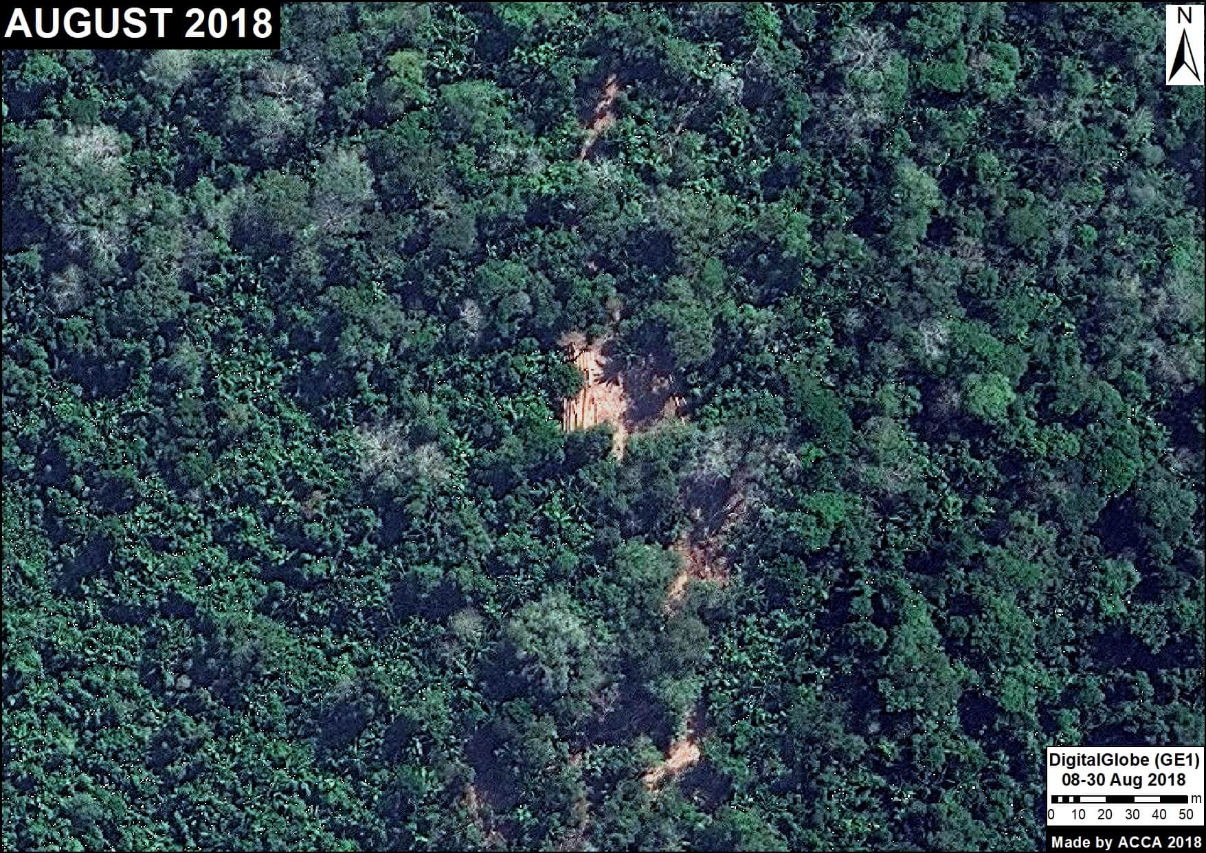
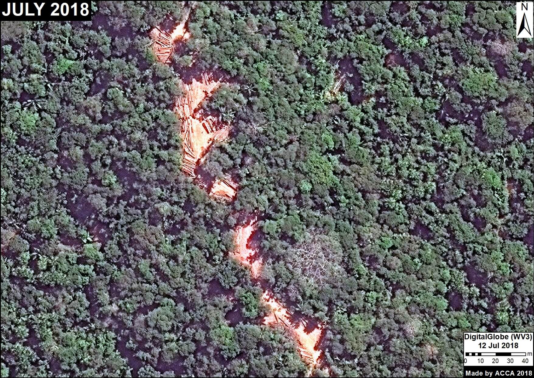
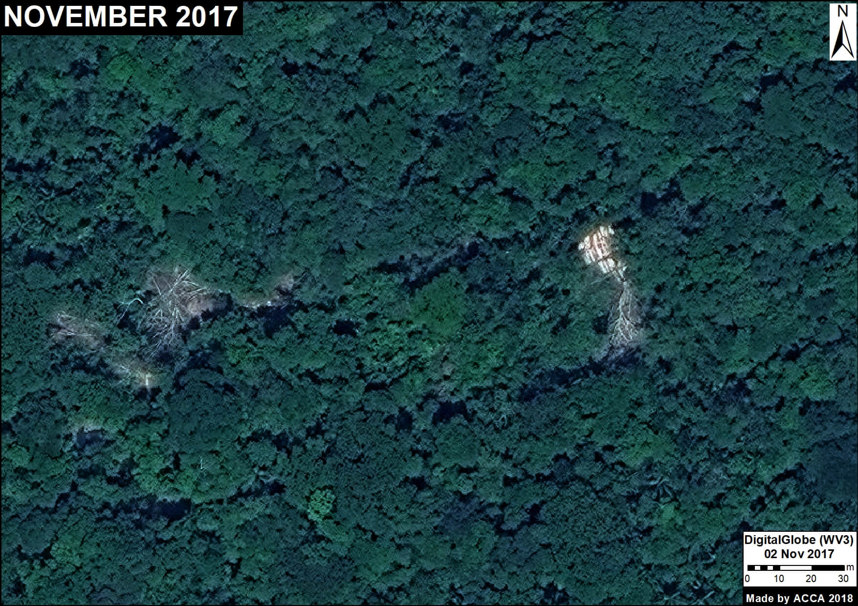
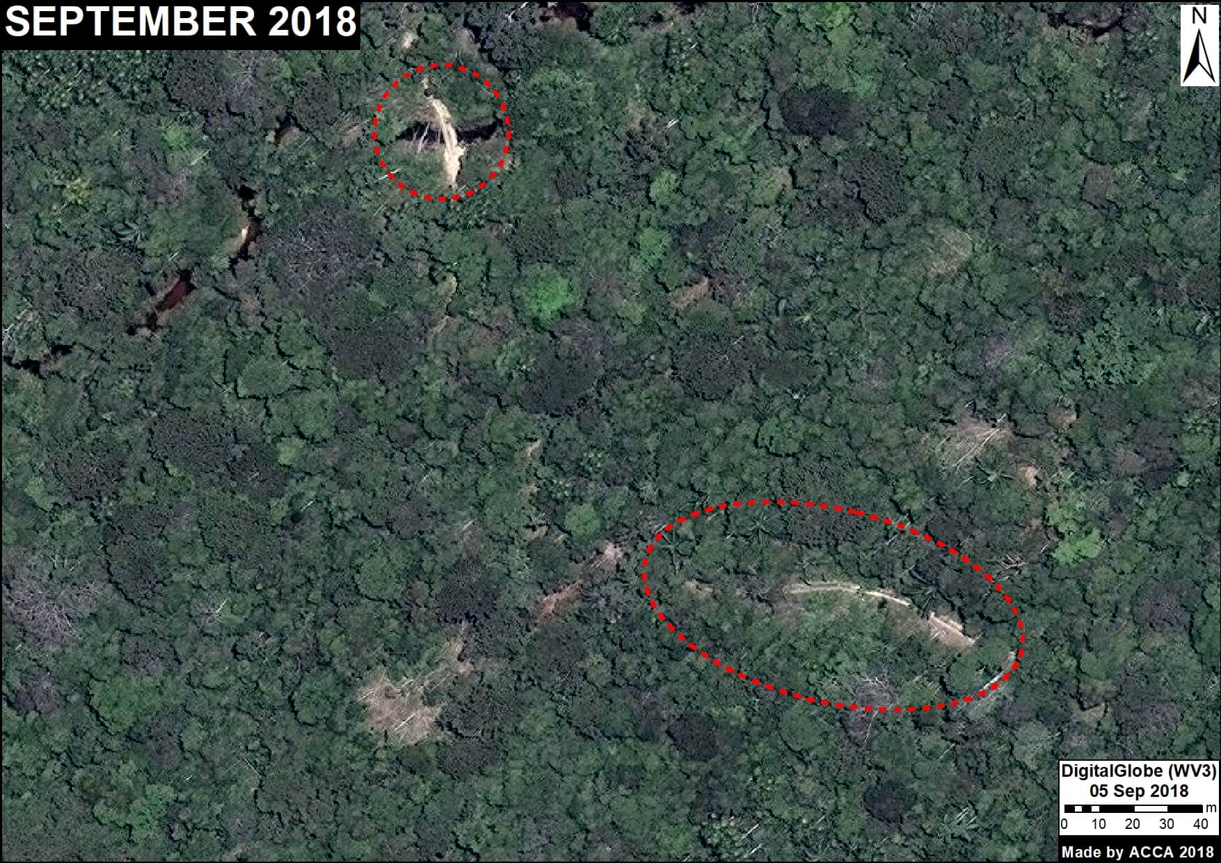
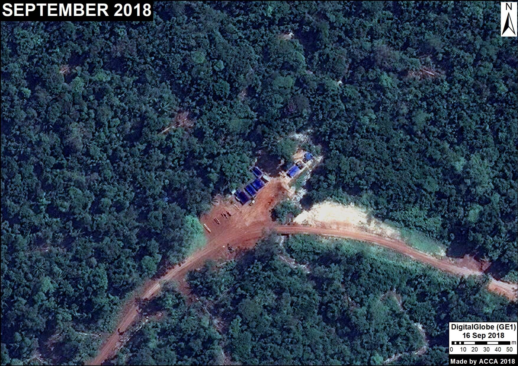
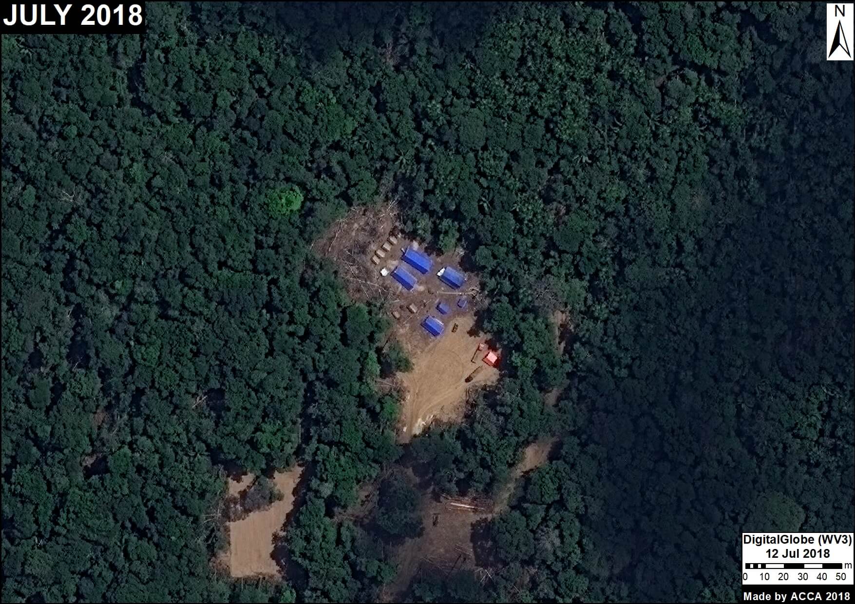
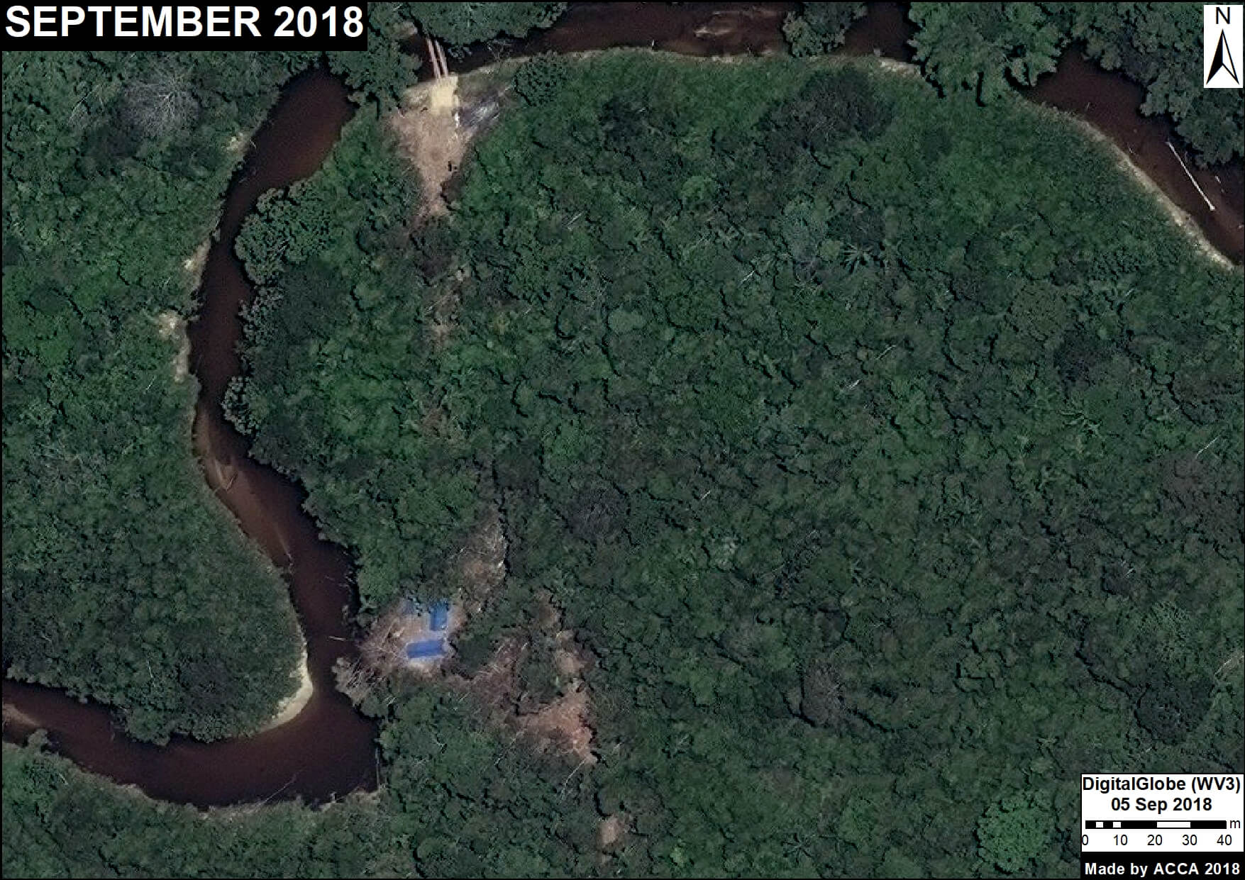
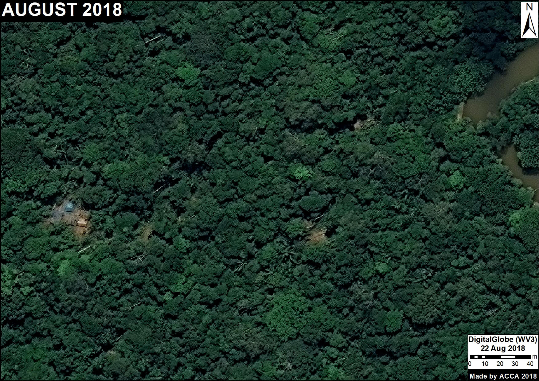
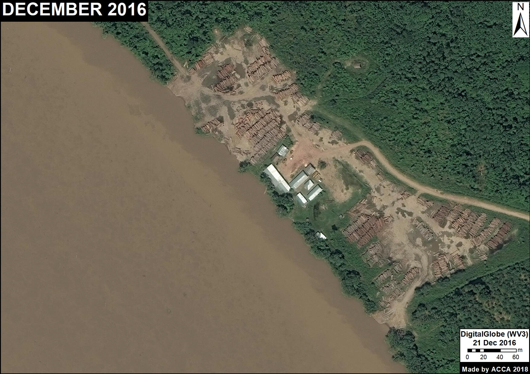
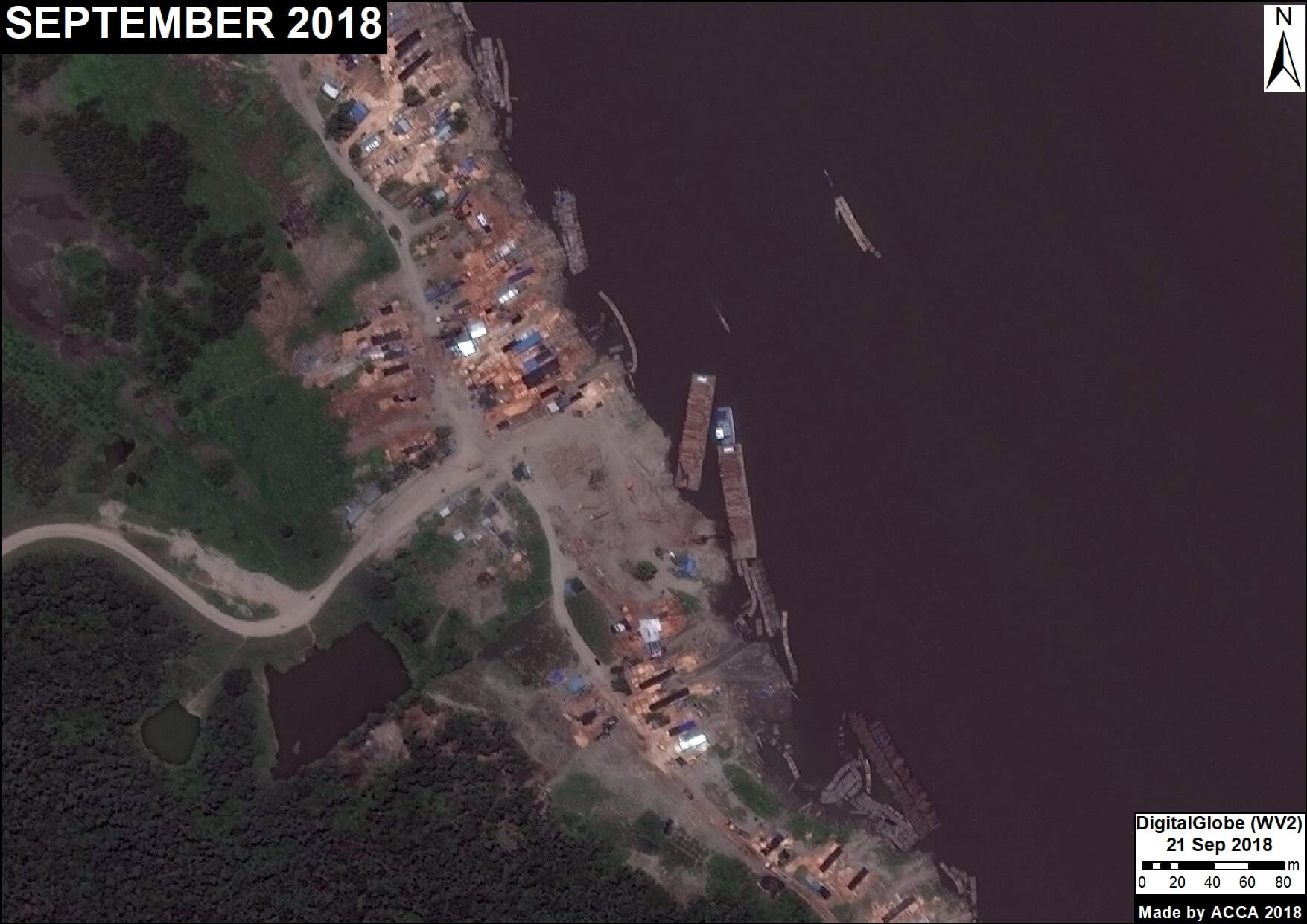
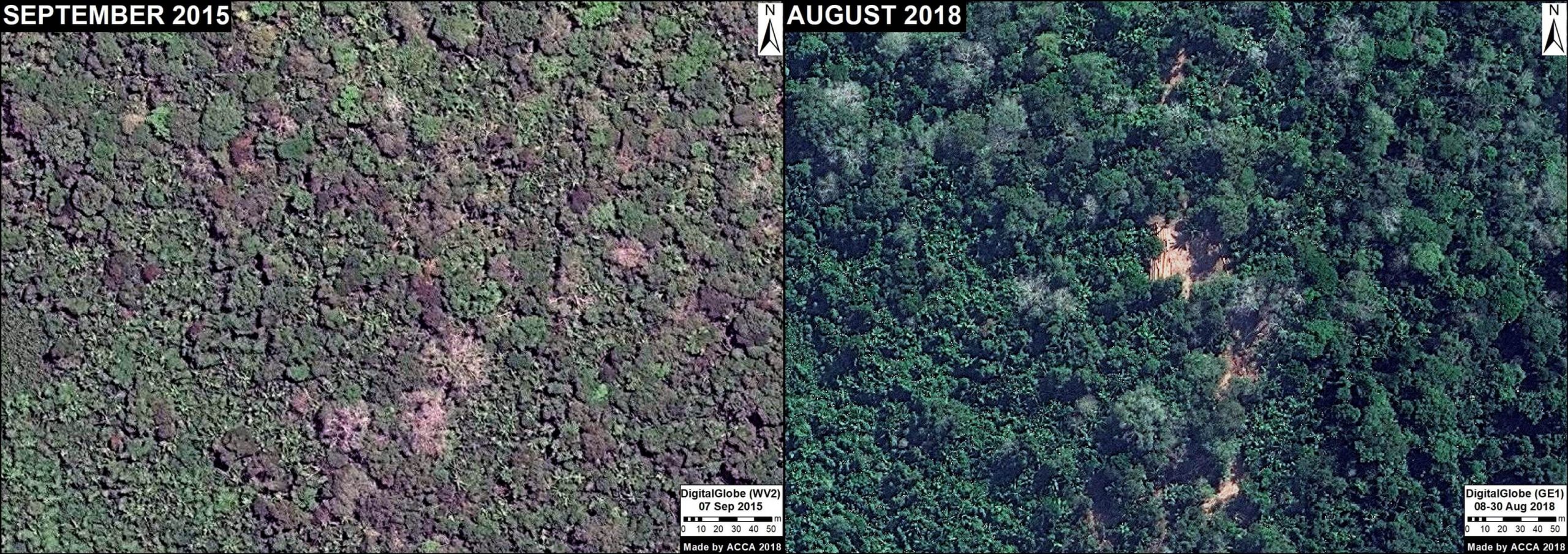
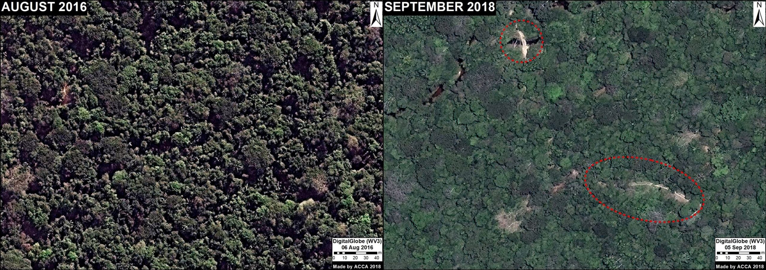
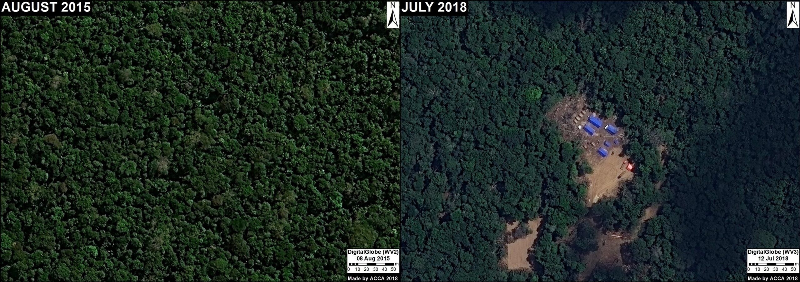
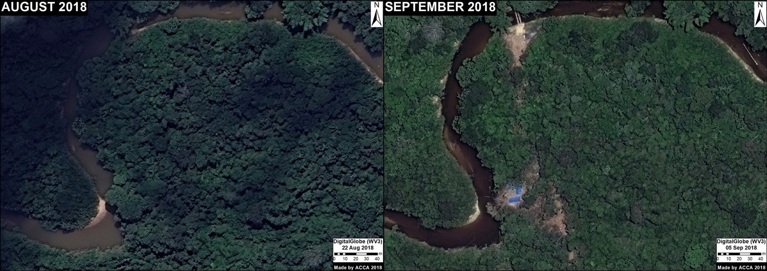
Here, we show the potential of very high-resolution satellites (such as DigitalGlobe and Planet’s Skysat), to identify the activities associated with logging, including illegal logging.
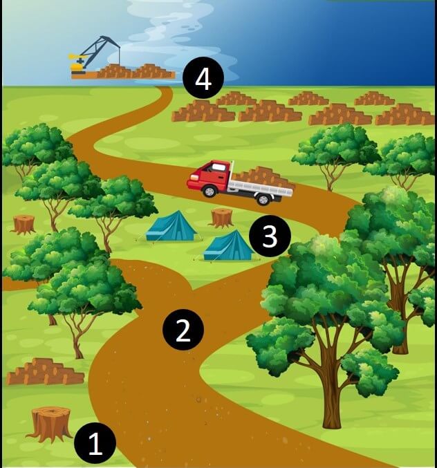
These activities include (see Base Map):
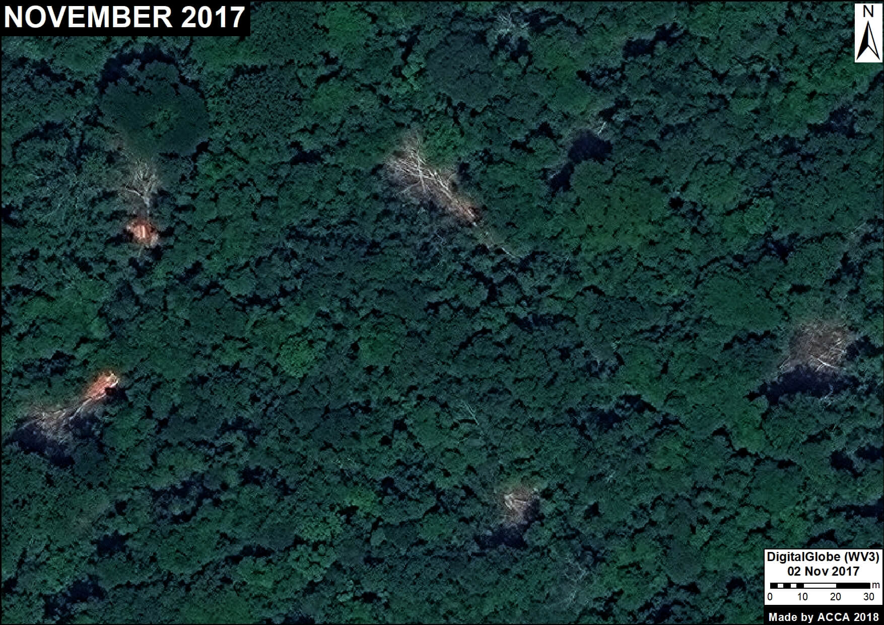
1. Selective logging of high-value trees,
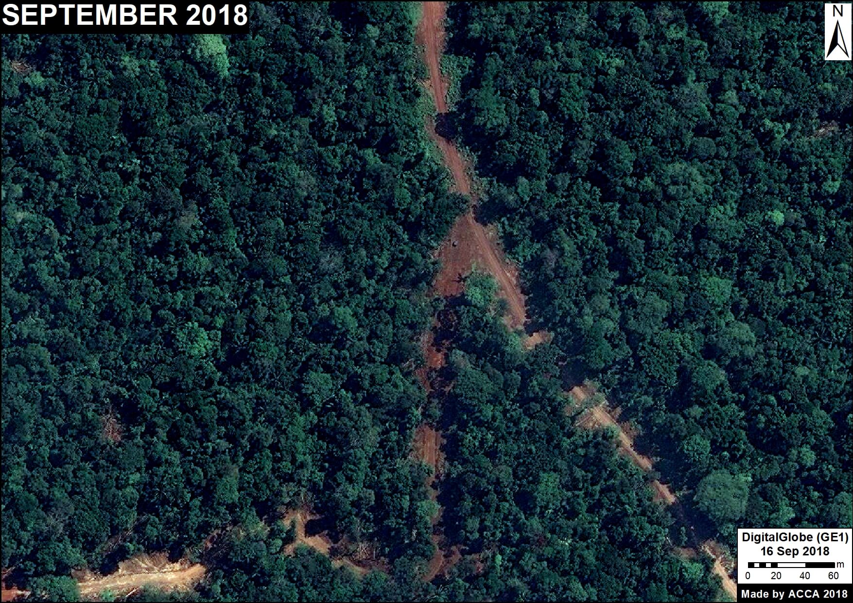
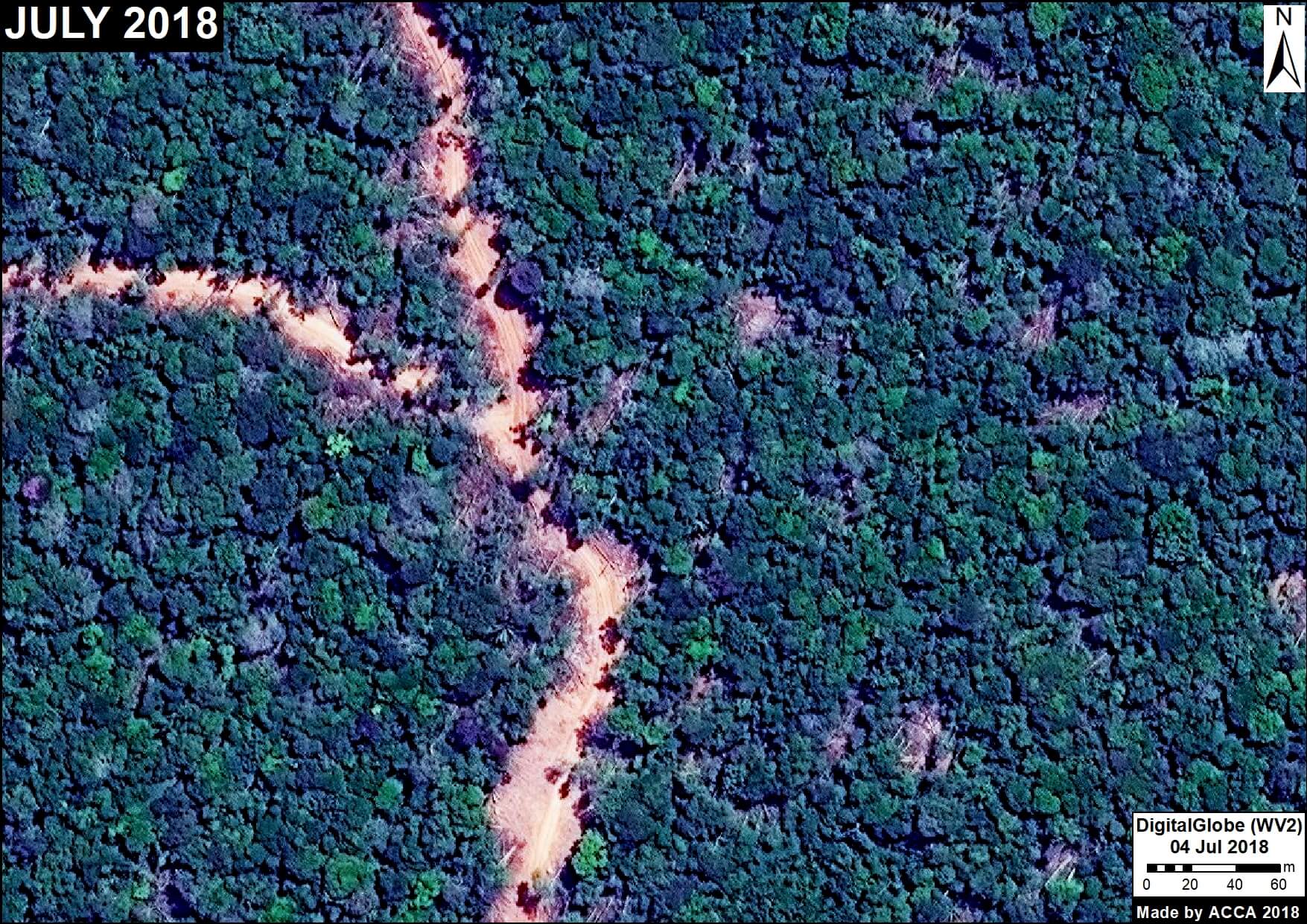
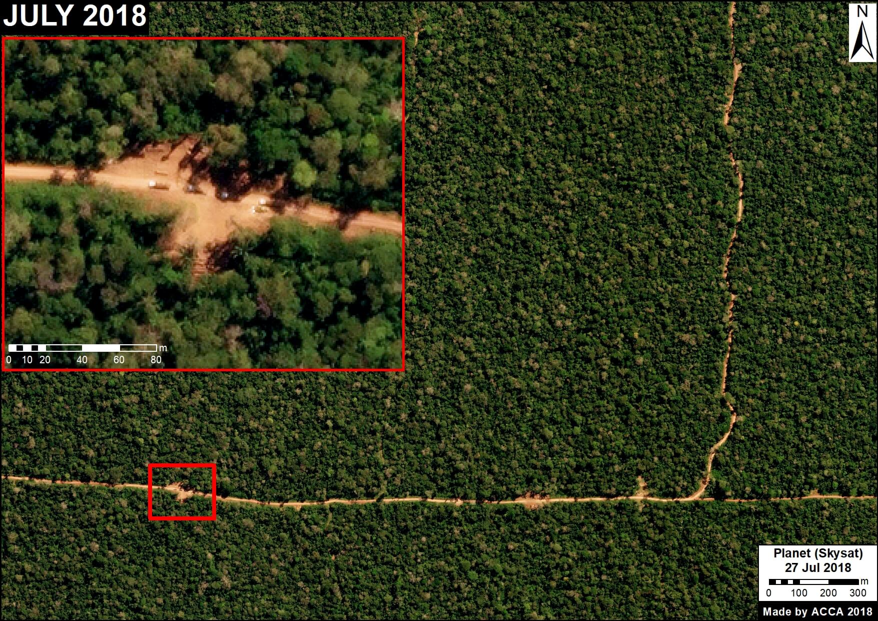
2. Construction of logging roads (access roads),
3. Logging camps
4. Storage and transport
Next, we show a series of very high-resolution images (>50 centimeters), which allow clear identification of these activities.
Note that we show images of both possible legal logging in authorized areas (Images 1,2,5,6,7,9,10) and confirmed illegal logging in unauthorized areas (Images 3,4,8,11,12).*
 Loading...


