MAAP Uses New Tools to Estimate Carbon in the Amazon
June 26, 2024
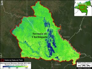
 In previous MAAP reports, such as MAAP #199, NASA’s GEDI data has helped measure an estimate of above-ground biomass density per hectare (Mg/ha) which can then be converted to aboveground carbon estimates. Despite this advance, these lasers used by NASA, have not yet achieved full coverage in the Amazon, leaving considerable gaps in the data and resulting maps.
Our newest report MAAP #213 features two new tools that will help us fill in these gaps and provide a more detailed estimate of aboveground biomass for specific areas.
The first is the OBI-WAN forest carbon reporting app, which uses statistical inference to produce mean, total, and uncertainty estimates for biomass baselines at any given scale (from local to worldwide). The second is a fused product from GEDI and TanDEM-X missions. The combination of lidar (GEDI) and radar (TanDEM-X) has started to produce unmatched maps that combine the ability of lidar to retrieve forest structure and the ability of radar to offer wall-to-wall coverage at multiple resolutions.
With the aid of these two tools, this report focuses on estimating aboveground carbon for two critical land designations in the Amazon: protected areas and indigenous territories. Both are critical to the long-term conservation of the Amazon, and we hope that providing precise carbon data will provide additional incentives for their long-term conservation.
Read the full report here.

 Loading...


