
MAAP #118: Real-time Amazon Fire Monitoring App
May 29, 2020
In time for the next fire season, we are relaunching an improved version of our Amazon real-time fire monitoring app, hosted by Google Earth Engine.
When fires burn, they emit gases and aerosols.* A new satellite (Sentinel-5P from the European Space Agency) detects these aerosol emissions.*
The major feature of the app is user-friendly and real-time identification of major fires across the Amazon, based on the aerosol emissions detected by Sentinel-5P.
Since the data updates daily and is not impacted by clouds, real-time monitoring really is possible. Our goal is to upload each day’s new image by midnight.
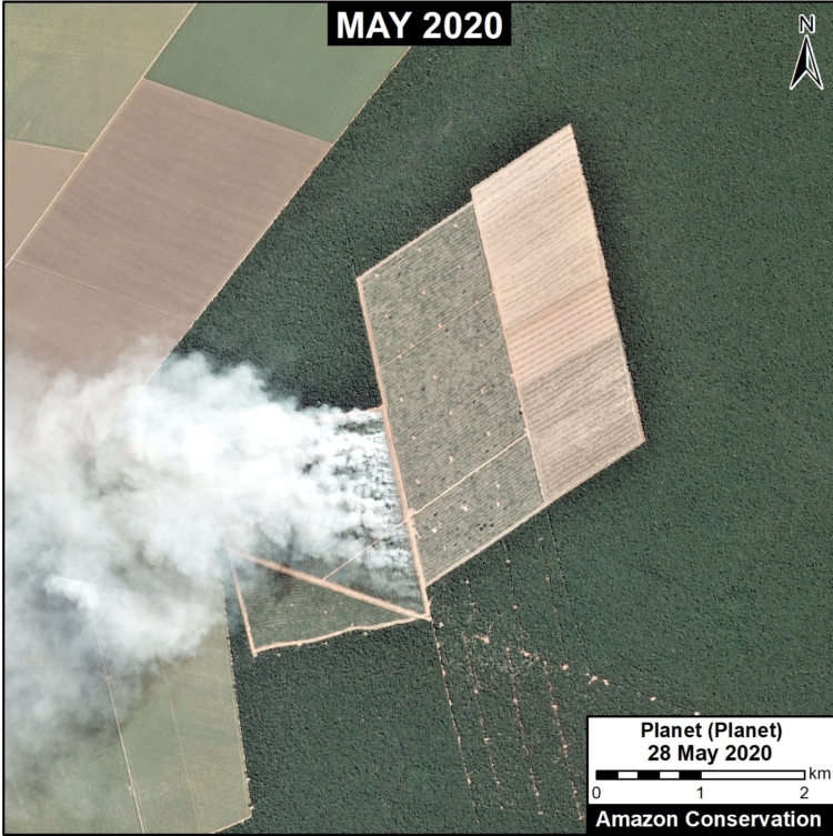
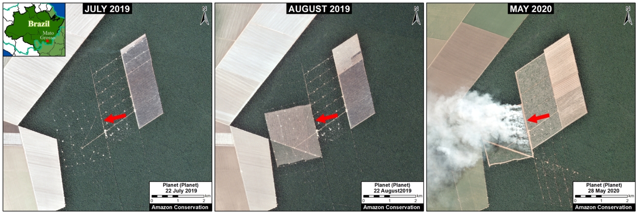
Using the app, we recently identified the first major Amazon fire of 2020 on May 28, in the state of Mato Grosso in Brazil. It was burning an area recently deforested in July 2019.
Below, we provide instructions on how to use the app, with the May 28 fire as an example.
Instructions &
How We Identified First Major Brazilian Amazon Fire of 2020
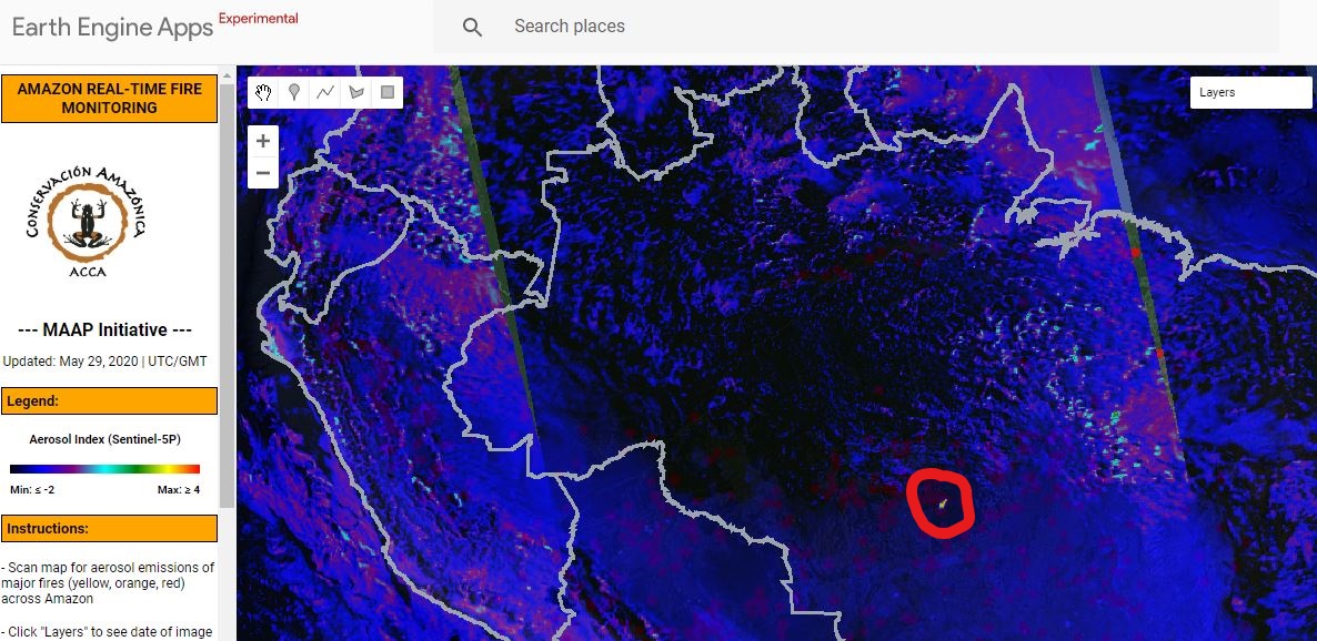
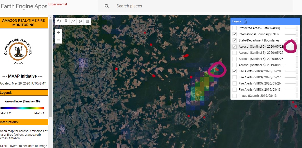
Step 1. Open real-time fire monitoring app, hosted by Google Earth Engine. Scan the Amazon for aerosol emissions of major fires (indicated in yellow, orange, and red). In this case, we spotted elevated emissions in the southeast Brazilian Amazon (on May 28, 2020).
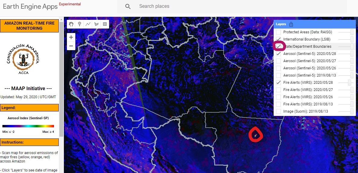
Step 2. Click the “Layers” menu in the upper right for more options. For example, clicking “State/Department Boundaries” we see the emissions are coming from Mato Grosso. Note you can also add “Protected Areas” and check the dates of the images and alerts.
Step 3. Zoom in on the aerosol emissions.
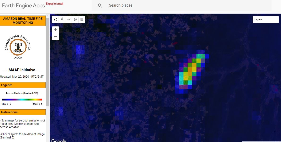
Step 4. Adjust (slide down) the transparency of the emissions layer to see the underlying fire alerts. We use the alerts to pinpoint the source of emissions (see purple circle). Obtain coordinates of the alerts by clicking on the map and then checking the “Coordinates” bar on the left (below Instructions).
Step 5. We entered the coordinates into Planet Explorer and found a high-resolution image for that same day (May 28), confirming the first major Amazon fire of 2020. The burned area was 357 hectares (882 acres).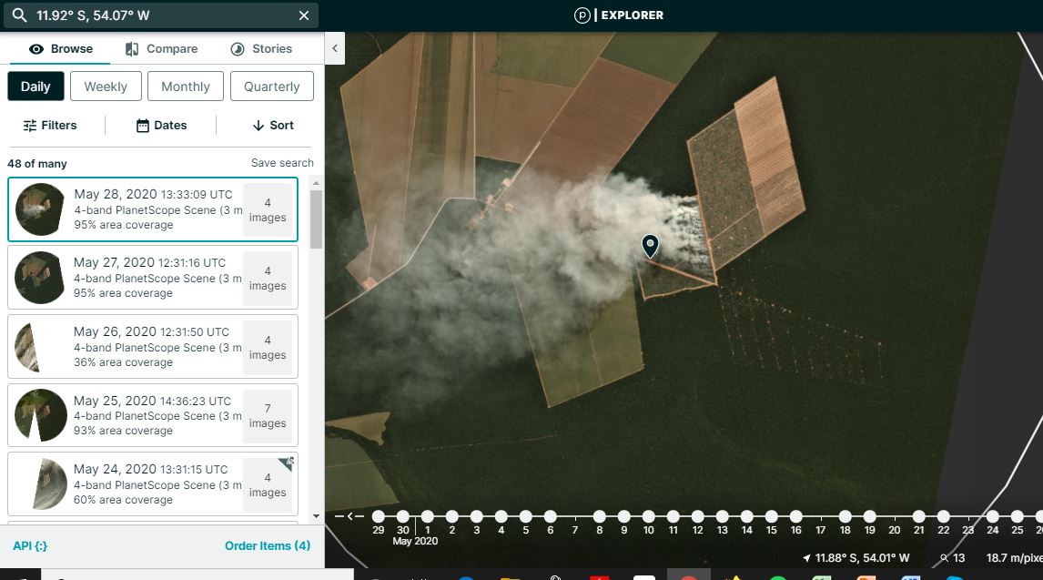
Predicting 2020 Brazilian Amazon Fires
Using the Planet archive, we discovered that this exact area was deforested between July and August 2019, and then burned in May 2020. This fits our recent major finding that many Brazilian Amazon fires are actually burning recently deforested areas (MAAP #113). For more on how to predict upcoming fires based on recent deforestation, see MAAP #119.
2020 Fire Forecast
The July – September 2020 forecast points to an active fire season in most of the western Amazon – much of central and southern Peru, northern Bolivia and the Brazilian states of Acre and Rondônia. This year’s forecast indicates an active fire season of similar magnitude to those of 2005 and 2010, when widespread fires were observed in the region.
To more information check:https://firecast.cast.uark.edu/
*Notes
- Aerosol definition: Suspension of fine solid particles or liquid droplets in air or another gas.
- The high values in the aerosol indices (AI) may also be due to other reasons such as emissions of volcanic ash or desert dust. Hence, some areas, such as the Salar de Uyuni, in western Bolivia, often have orange or red tones.
- The spatial resolution of the aerosol data is 7.5 sq km
- The fire alerts are satellite-based data of temperature anomalies on the ground at 375 m resolution.
. - Coordinates of first major 2020 Amazon fire: 11.92° S, 54.06° W
. - Here is link to short story about second major 2020 Amazon fire, also in Mato Grosso, on June 8. It burned an area deforested in 2018. Coordinates: 12.56° S, 54.03° W.
References
Acknowledgements
We thank E. Ortiz, S. Novoa, K. Fernandes, G. Palacios for helpful comments to earlier versions of this report.
This work was supported by the following major funders: USAID/NASA (SERVIR), Global Forest Watch Small Grants Fund (WRI), Norwegian Agency for Development Cooperation (NORAD), International Conservation Fund of Canada (ICFC), Metabolic Studio, and Erol Foundation.
Citation
Finer M, Villa L, Mamani N (2020) Real-time Amazon Fire Monitoring App. MAAP: #118.
 Loading...


