
MAAP #133: Deforestation Continues In National Parks Of Colombian Amazon
February 19, 2021
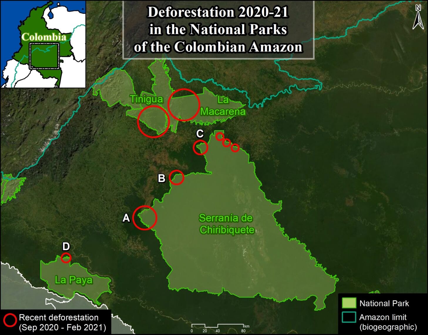
As we have indicated in previous reports (MAAP #120), there is an “arc of deforestation” in the northwest Colombian Amazon, impacting numerous protected areas and indigenous reserves.
Here, we emphasize that this deforestation currently impacts four National Parks: Tinigua, Macarena, Chiribiquete and La Paya.
In the Base Map, the red circles indicate the areas most impacted by recent deforestation within these parks.
The letters (A-D) indicate the location of the high-resolution satellite images (Planet) below.
While Tinigua and Macarena continue as the most impacted National Parks, below we focus on the new deforestation fronts in Chiribiquete and La Paya.
Specifically, we show the most recent and urgent deforestation, since September 2020 to the present (February 2021).
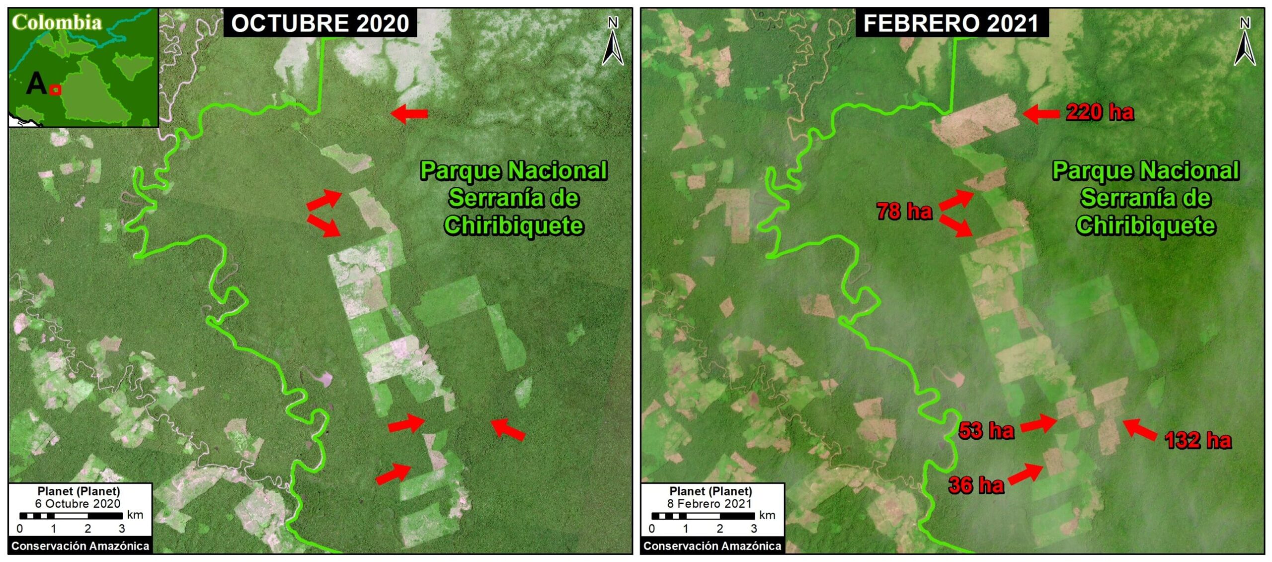
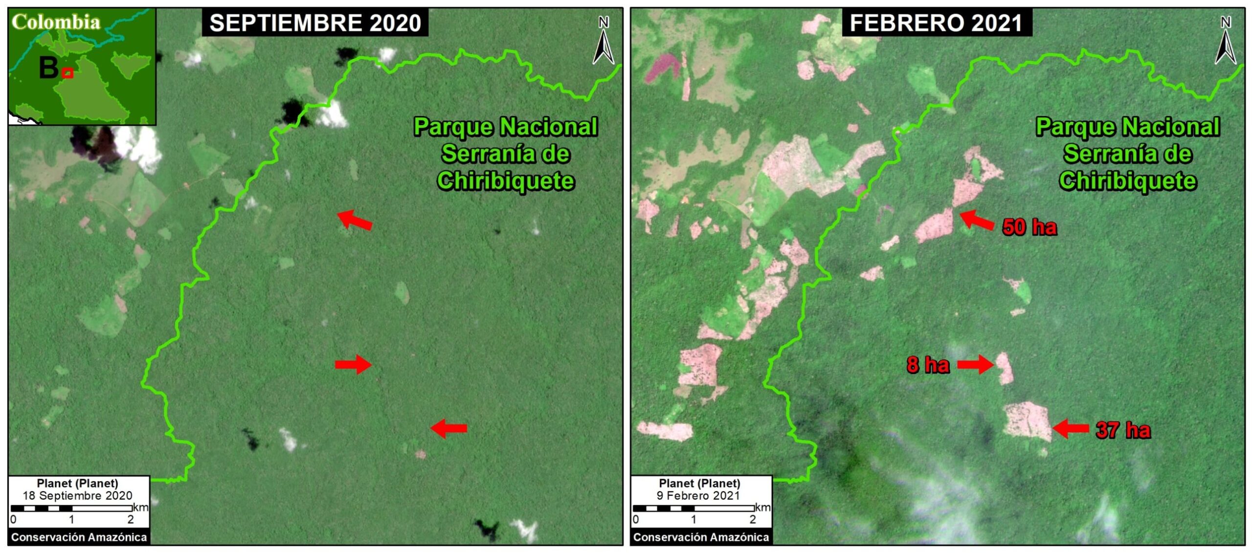
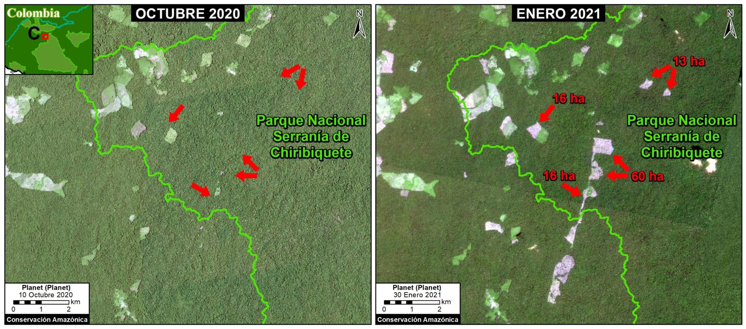
Chiribiquete National Park
Chiribiquete National Natural Park lost more than 1,000 hectares (2,500 acres) in the last six months, in six different areas of the park (see Base Map above). Much of this deforestation appears to be associated with the conversion of primary forest to illegal cattle pasture. The following satellite images show deforestation in three of these areas (A-C) between September 2020 (left panel) and February 2021 (right panel). *It is important to note that immediately prior to this publication authorities carried out a major intervention to crack down on the illegal activity within the park (see news here).
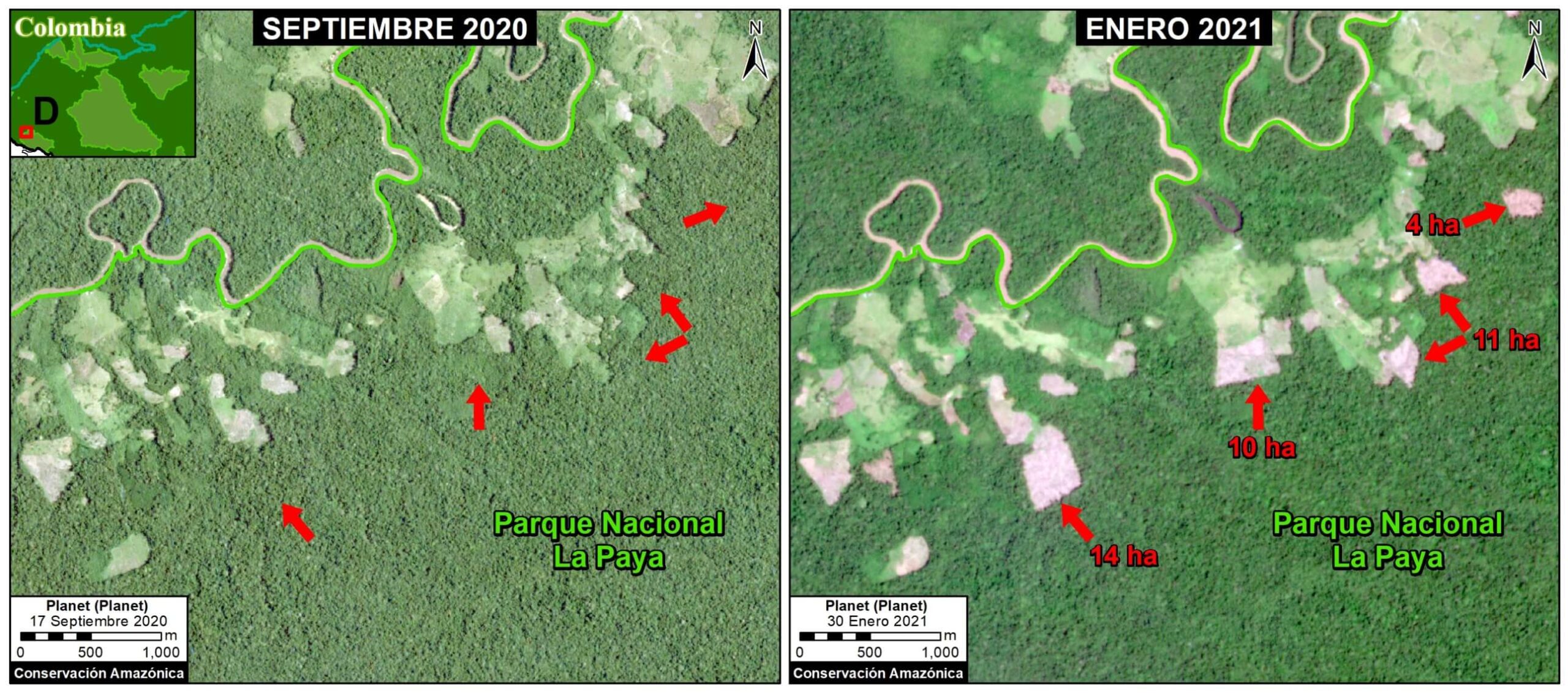
La Paya National Park
La Paya National Park lost more than 150 hectares (370 acres) in the last six months, in the northwest sector of the park (see Base Map above).
.
The following image shows an example of deforestation in this sector of the park between September 2020 (left panel) and January 2021 (right panel).
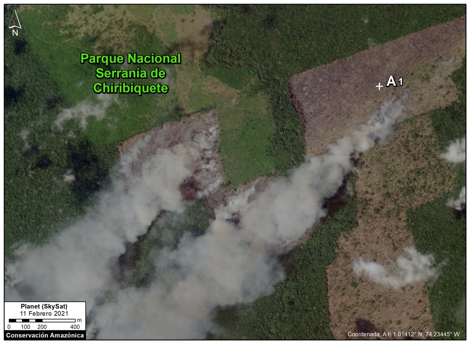
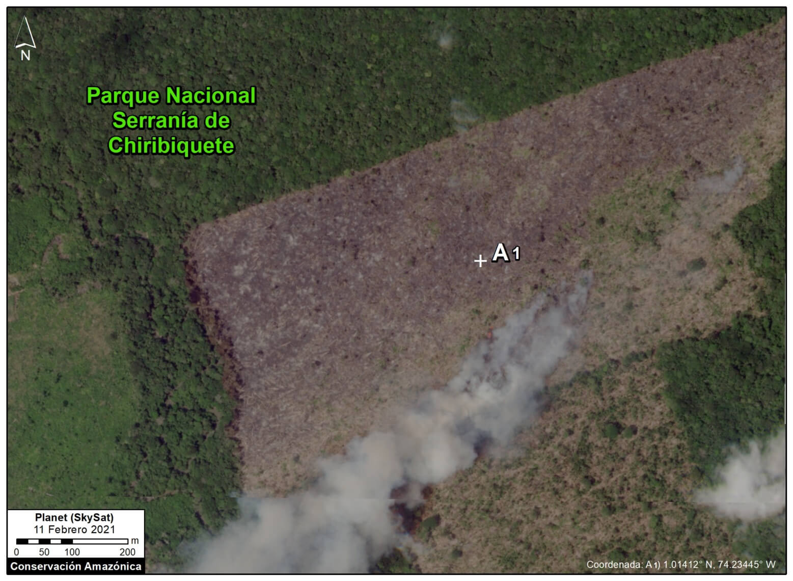
Fire Season
In addition, the fire season has started in the Colombian Amazon. Interestingly, now (February to March) is typically Colombia’s peak deforestation and fire season, in contrast with Brazil, Bolivia, and Peru, whose seasons peak between June and October.
The following very high-resolution images (Skyat) reveal the burning of recently deforested areas within Chiribiquete National Park.
Acknowledgmens
We thank R. Botero (FCDS) and G. Palacios for their helpful comments on this report.
Citation
Finer M, Mamani N (2021) Deforestation Continues in National Parks of Colombian Amazon. MAAP: 133.
 Loading...


