
MAAP #48: Oil Palm Deforestation in The Central Peruvian Amazon
October 18, 2016
In MAAP #26, we presented a 2015 Deforestation Hotspots map for the Peruvian Amazon, which showed that the highest concentration of deforestation is located in the central Amazon region.
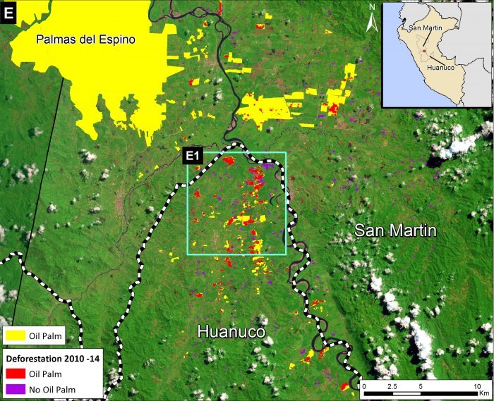
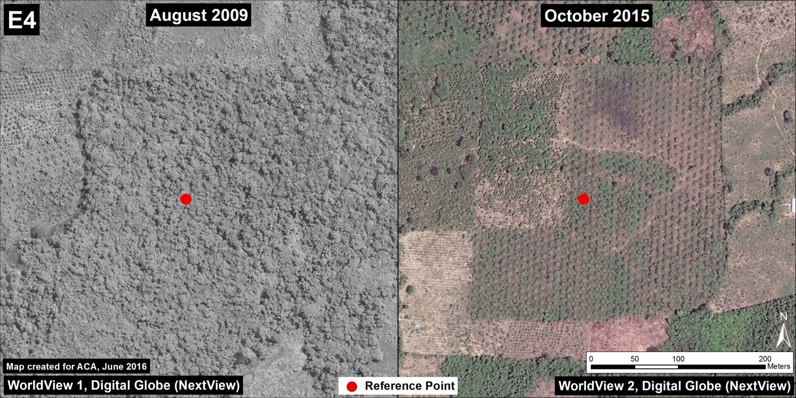
Here, we zoom in on one of these hotspots, located in the northern Huanuco region along its border with San Martin (see Inset E of Image 48a).*
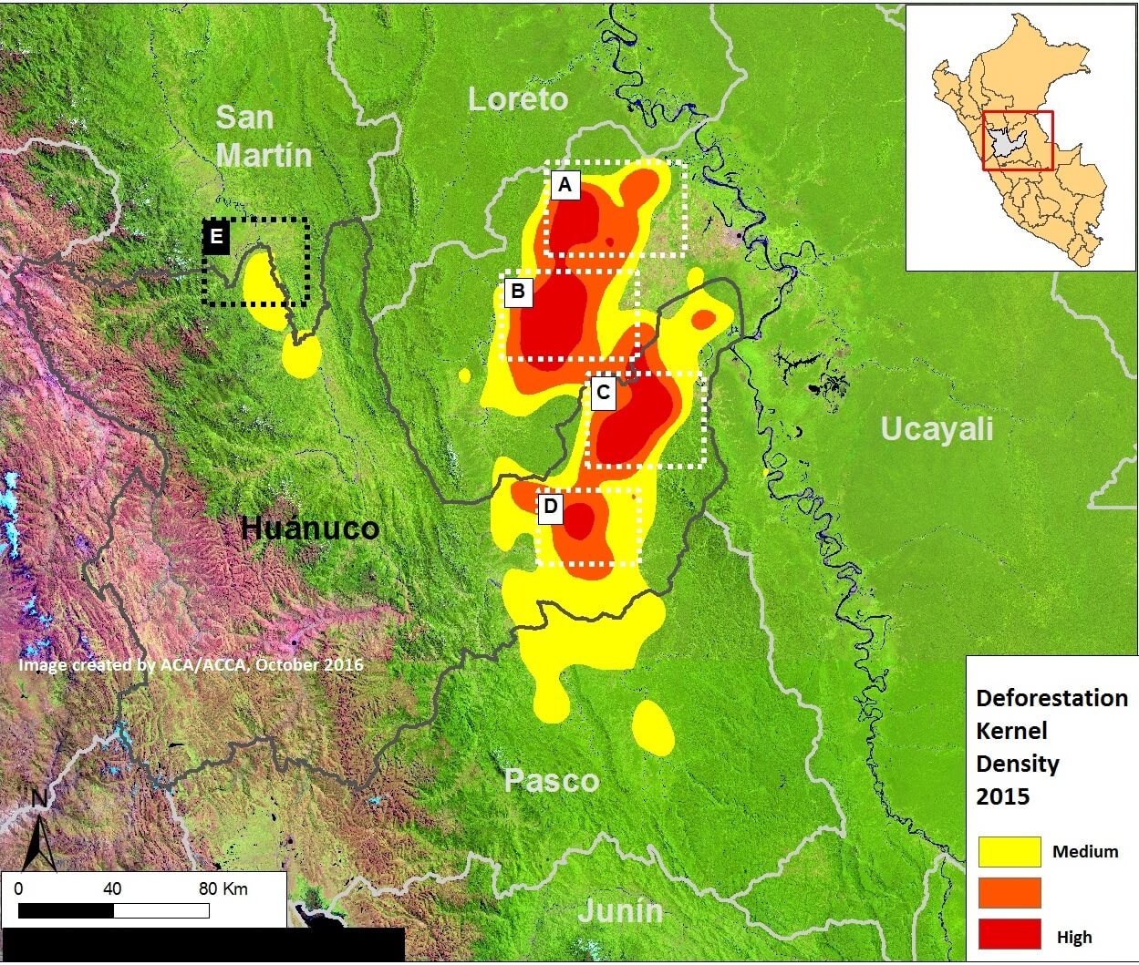
Image 48a. Data: UMD/GLAD
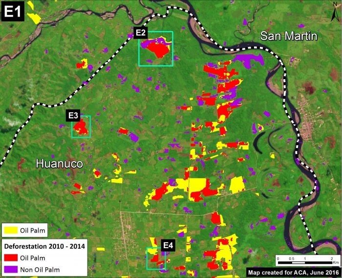
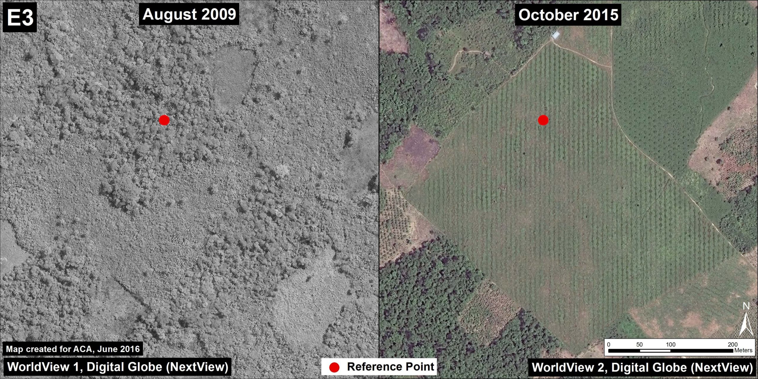
We found that the main deforestation driver in this hotspot was the establishment of small- and medium-scale oil palm plantations.**
*Note that we analyzed the hotspots in Insets A-D in MAAP #26 and MAAP #37.
** We defined small-scale as less than 5 hectares, medium-scale as 5-50 hectares, and large-scale as greater than 50 hectares
 Loading...


