
MAAP #99: Detecting Illegal Logging In The Peruvian Amazon
April 13, 2019
In the Peruvian Amazon, most of the logging is selective (not clearcutting), with the targets being higher-value species. Thus, illegal logging is difficult to detect with satellite imagery.
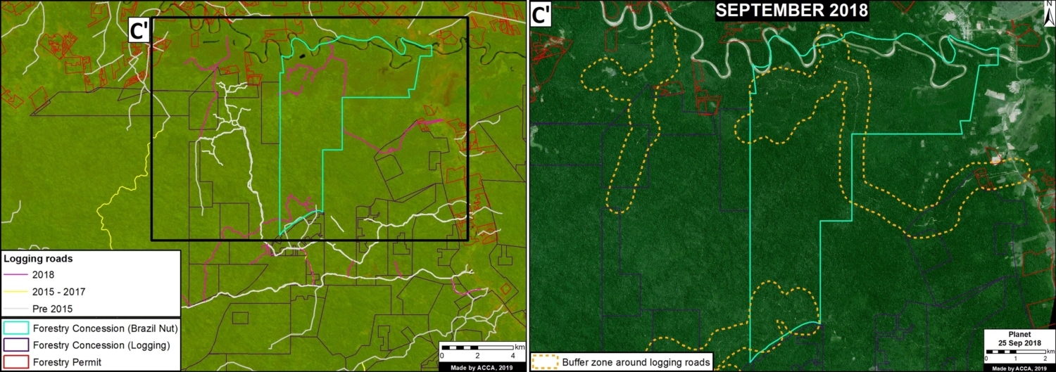
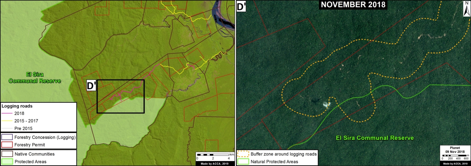
In MAAP #85, however, we presented the potential of satellite imagery in identifying logging roads, which are one of the main indicators of logging activity in the remote Amazon.
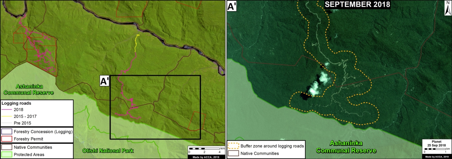
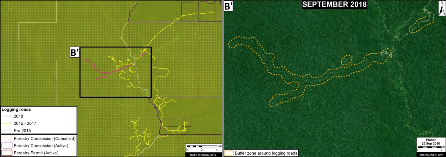
Here, we go a step further and show how to combine logging road data with additional land use data, such as forestry licenses and concessions, to identify possible illegal logging.
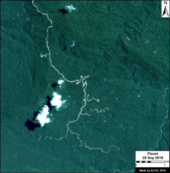
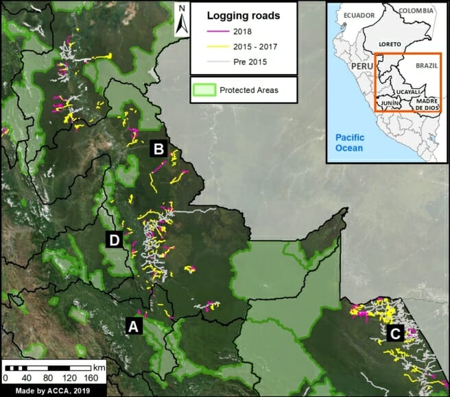
This analysis, based in the Peruvian Amazon, has two parts. First, we identify the construction of new logging roads in 2018, updating our previous dataset from 2015-17 (see Base Map).
Second, we analyze these new logging roads in relation to addition spatial information now available on government web portals,* in order to identify possible illegality.
*We analyzed information on several websites now available from national and regional authorities, such as SISFOR (OSINFOR), GEOSERFOR (SERFOR), and IDERs (Spatial Data Infrastructure of Regional governments). These new resources provide valuable information, however, may have limitations in ability to constantly update information on the status of concessions and forest permits.
 Loading...


