
MAAP #58: Link Between Peru’s Flooding and Warm Coastal Waters
April 25, 2017
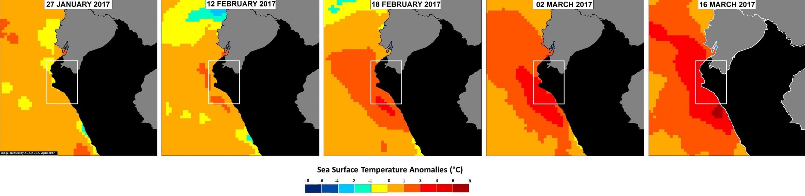
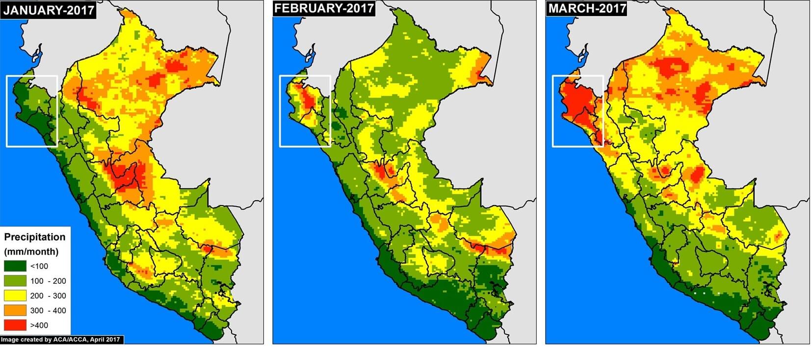
In previous articles MAAP #56 and MAAP #57, we presented a series of striking satellite images of the recent deadly floods in northern Peru. Satellites provide additional types of data critical to better understanding events such as extreme flooding. Here, we present two more types of satellite data related to the flooding: ocean water temperature and precipitation.
 Loading...


