
MAAP #92: New Deforestation Threats In The Peruvian Amazon (Part 2: Agriculture Expansion)
September 10, 2018
In this ongoing series, we describe major new projects that may lead to the rapid deforestation of large areas of primary Amazon forest.
The first report (MAAP #84) described the deforestation associated with the construction of the Yurimaguas – Jeberos road (see Base Map), which crosses extensive primary forest and a priority site for conservation in the Loreto region.
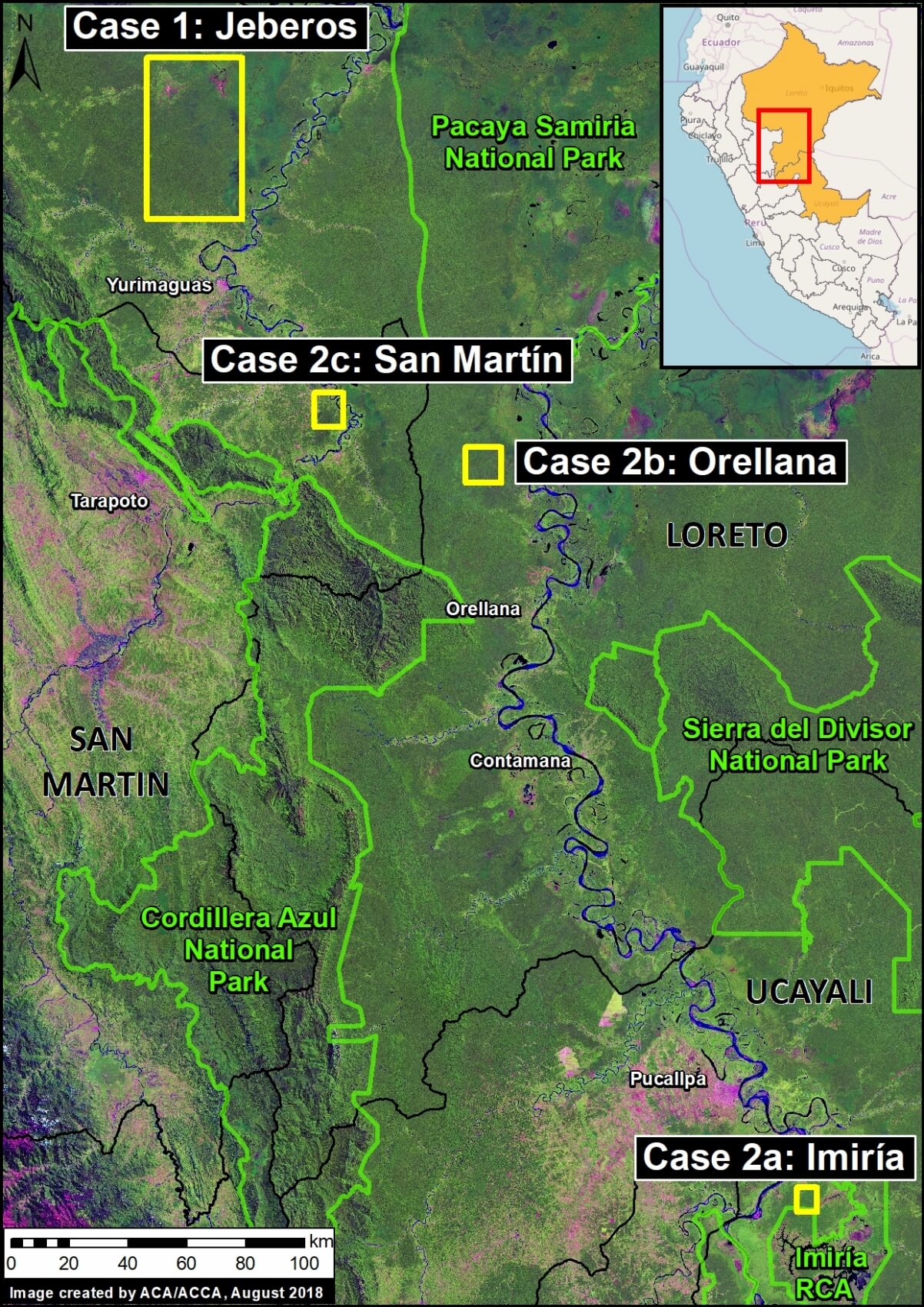
The current report describes the deforestation associated with major agricultural expansion in three areas in the northern Peruvian Amazon, referred to here as the “Imiria,” “Orellana“, and “San Martin” cases.
These three cases are important because they present characteristics of large-scale, agro-industrial activities (linear plots organized around an extensive new access road network).
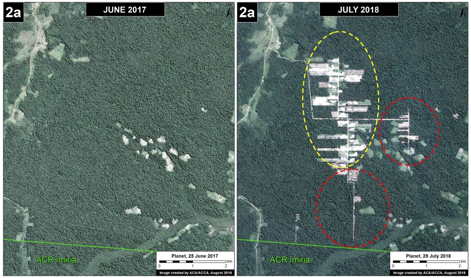
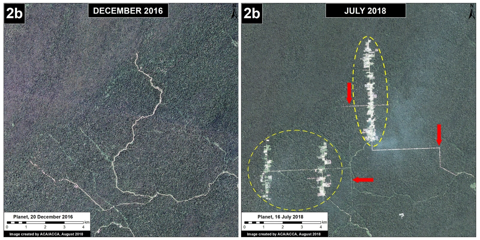
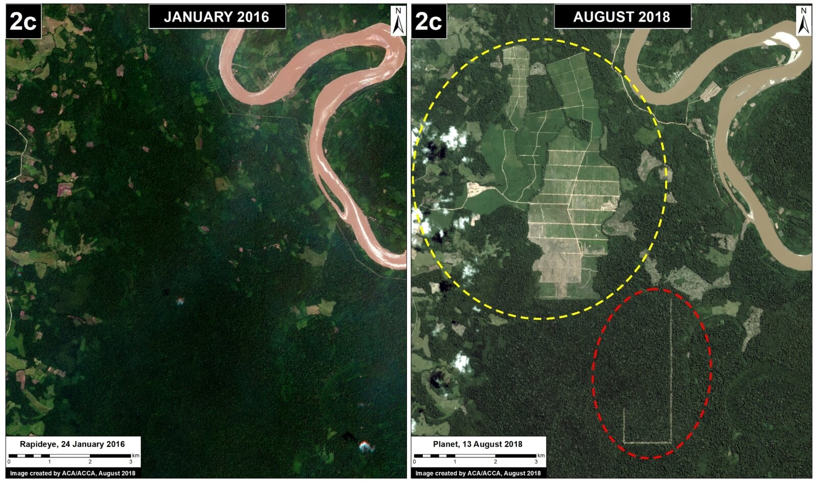
In all three cases, early warning alerts (GLAD/Global Forest Watch) initially detected the deforestation in 2017 (see MAAP #69) and their subsequent expansion in 2018. The total deforestation documented to date in these three cases is 3,600 acres.
Below, we show satellite images of the most recent deforestation due to agricultural expansion in these three areas. In these images, yellow circles indicate 2016-17 deforestation and red circles/arrows indicate the most recent 2018 deforestation.
 Loading...


