
MAAP #73: United States’ Only National Tropical Rainforest Ravaged by Hurricane Maria (Puerto Rico)
November 8, 2017
MAAP usually focuses on deforestation in the Andean Amazon region, but has a larger interest in tropical forests in general. Thus, we present this analysis in that larger framework.
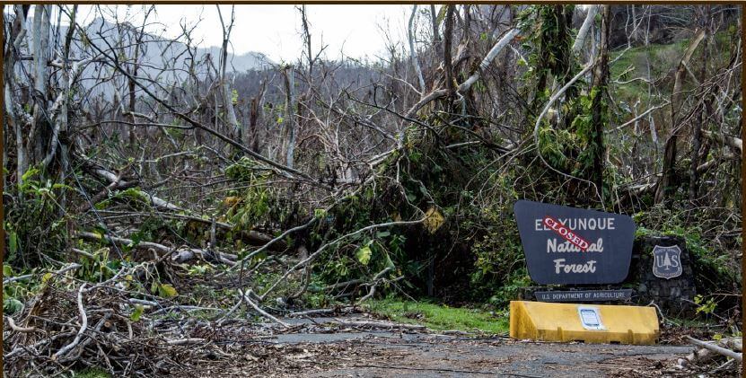
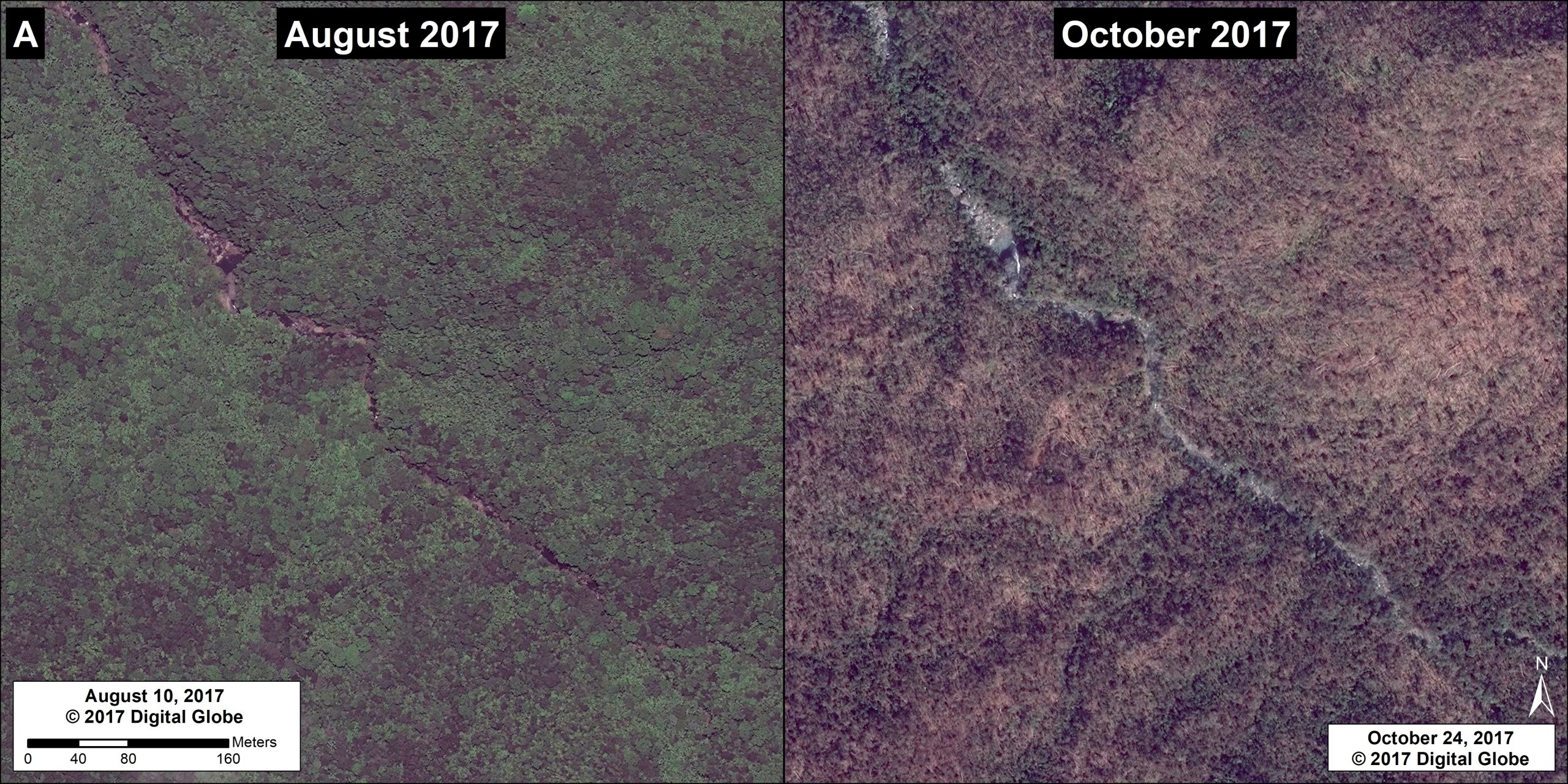
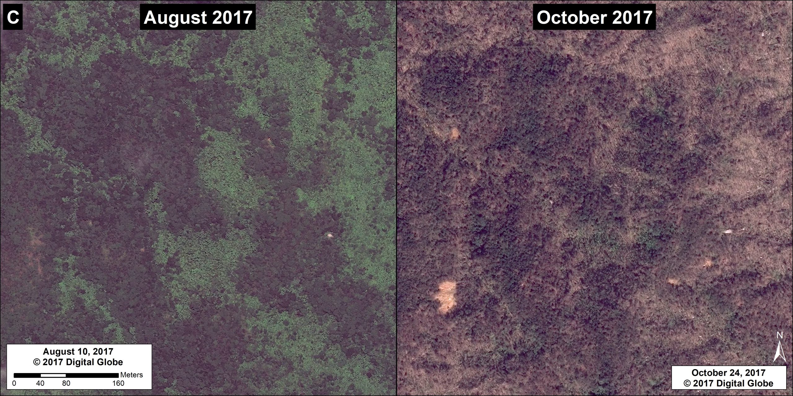
The New York Times recently reported that Hurricane Maria “obliterated” the United States’ only national tropical rain forest as the powerful Category 4 hurricane (with 150 mph winds) passed over Puerto Rico on September 20.
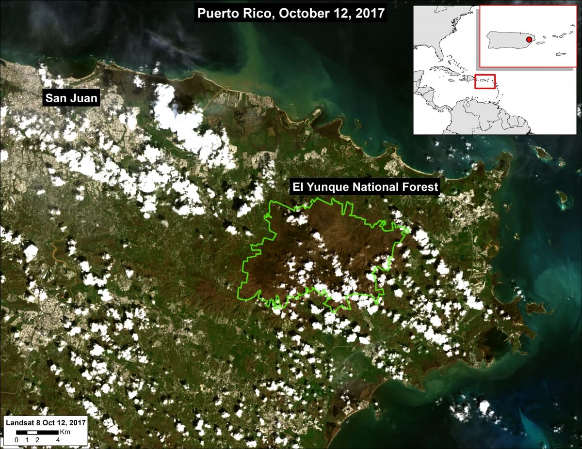
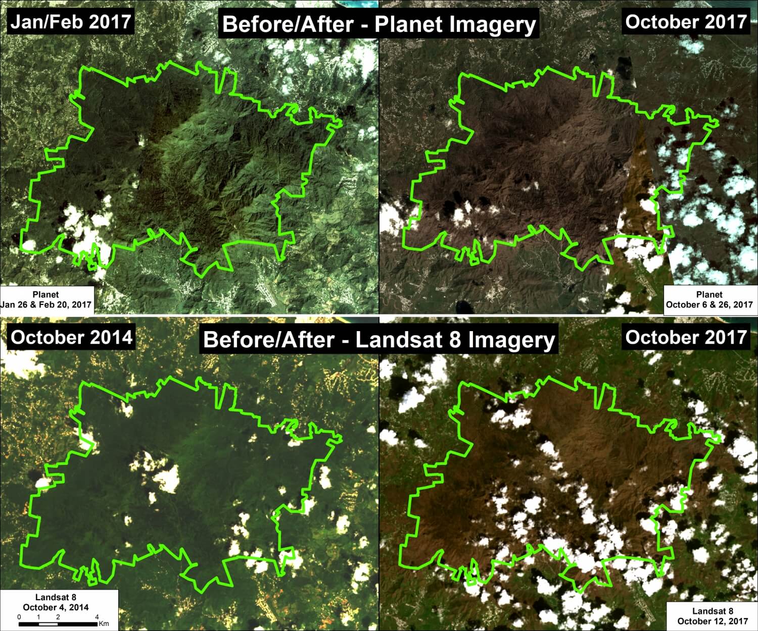
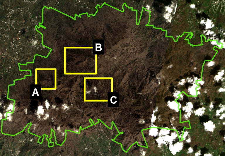
Here, we present a series of fresh satellite images from October that indeed show the severe impact to nearly all 28,400 acres of El Yunque National Forest (see Base Map). El Yunque is managed by the United States Forest Service and is the only tropical rain forest in the US national forest system.
Throughout the article, click on each image to enlarge.

 Loading...


