
MAAP #53: Wildfire Hotspots in The Peruvian Amazon In 2016
January 31, 2017
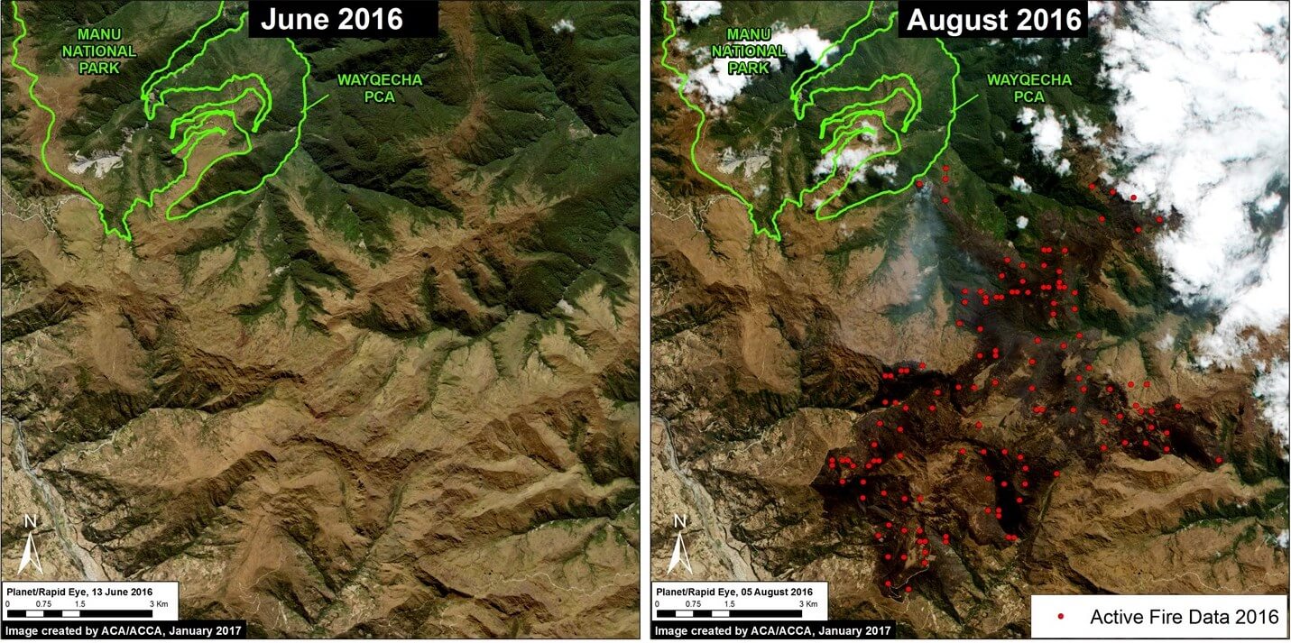
During 2016, Peru experienced an intense wildfire season, exacerbated by widespread drought conditions across the country.
The base map (Image 53, to the left) shows the 2016 fire alert hotspots.
These alerts are generated from a moderate-resolution (375 meters) satellite sensor (VIIRS) that detects significant new heat sources.
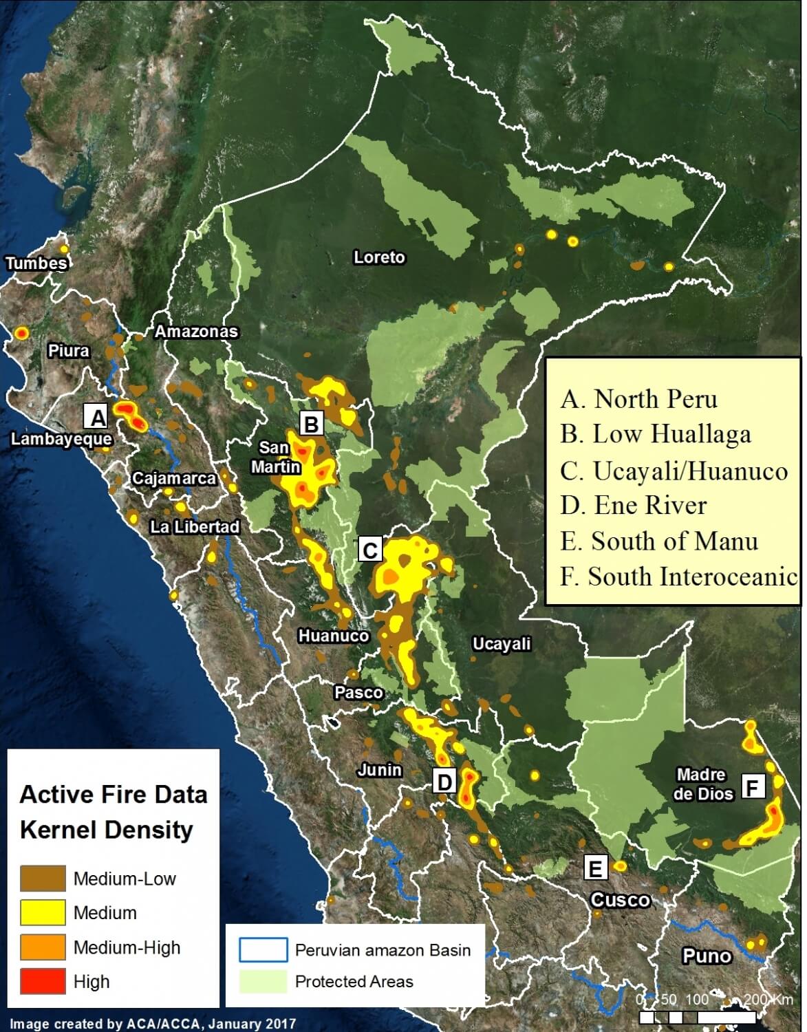
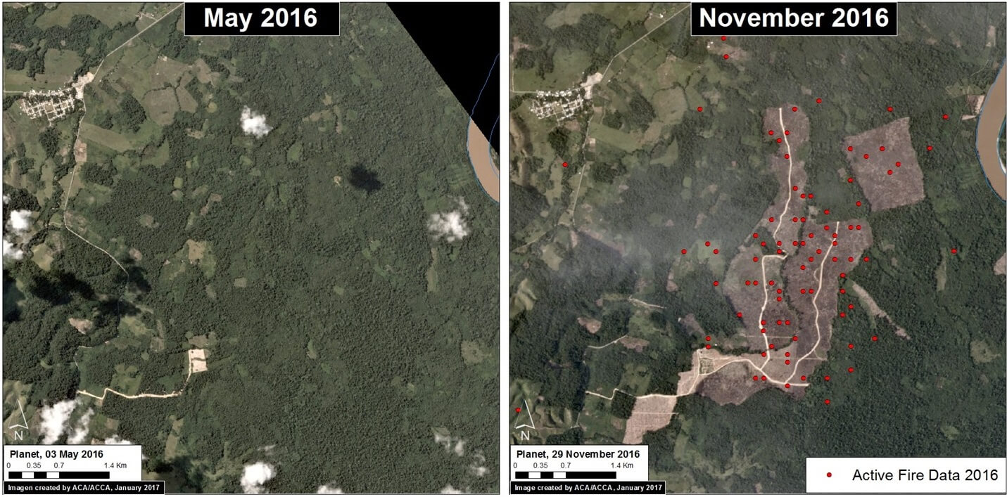
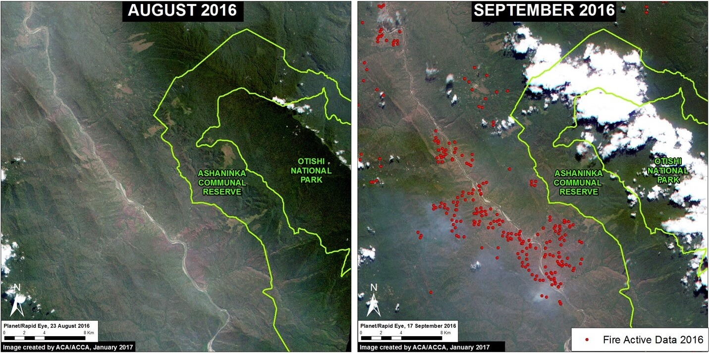
Although there has not yet been a comprehensive evaluation of the causes of these fires, evidence indicates that many are linked to agricultural practices that allow fires to escape to surrounding natural habitats.
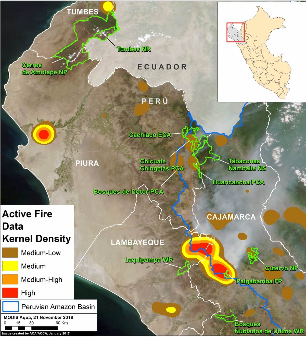
In the image, we highlight 5 significant fire hotspots in the Amazon basin, labeled A-E (A. Northern Peru; B. Lower Huallaga; C. Huánuco/Ucayali, D. Ene River, E. Southern Manu, F. Interoceanic Highway).
These areas are described in more detail below.
 Loading...


