
MAAP #68: 2017 Deforestation Hotspots in The Peruvian Amazon (Part 2)
September 19, 2017
In a previous report, MAAP #65, we presented information about deforestation hotspots in 2017 in the Peruvian Amazon, based on early warning alert data from January until mid-July.
Between July and August, the amount of alerts greatly increased, likely due to arrival of the dry season. Thus, this report includes new updated data until mid-August.*
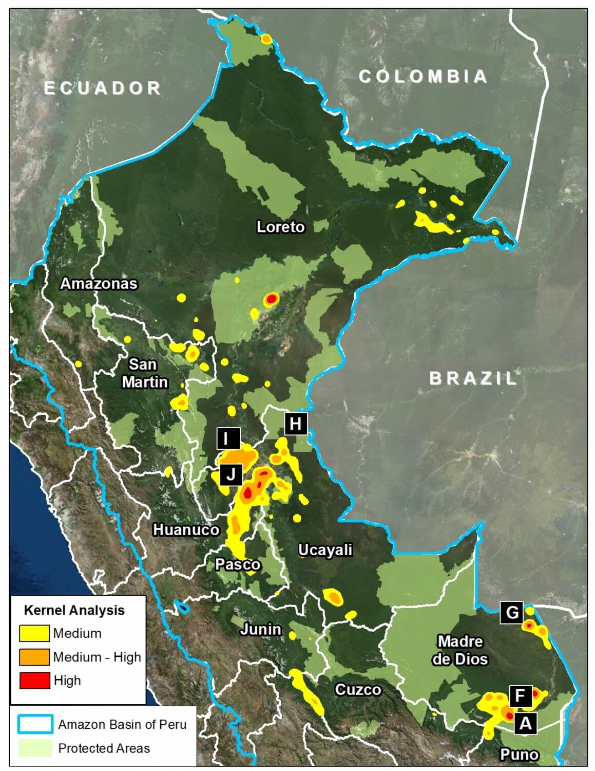
We find new deforestation hotspots in the regions of Madre de Dios and Ucayali (see base map).** At the national level, we now estimate the forest loss of 111,200 acres (45,000 hectares) thus far in 2017 (thru August 17).***
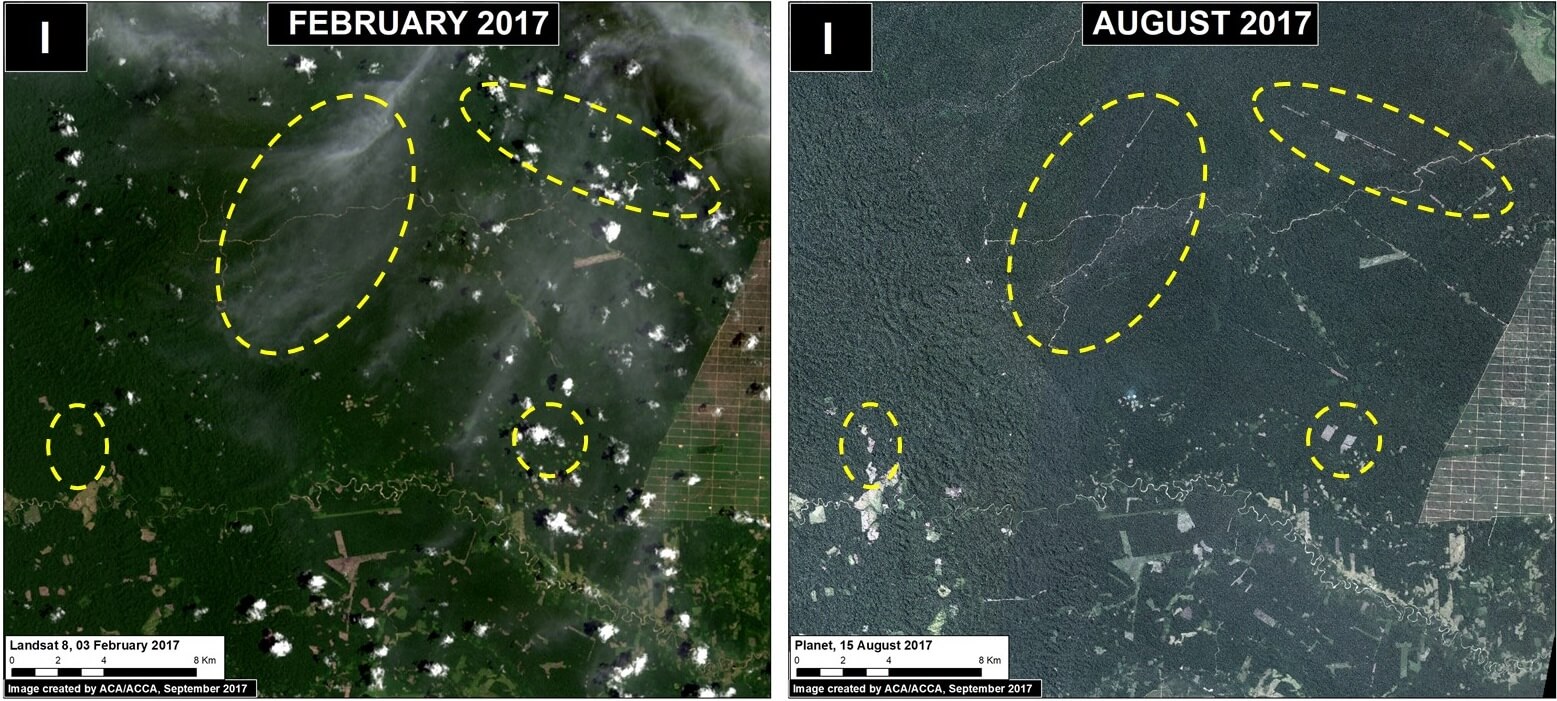
Below, we present satellite imagery of the following hotspots:
– La Pampa, Madre de Dios (Inset A)
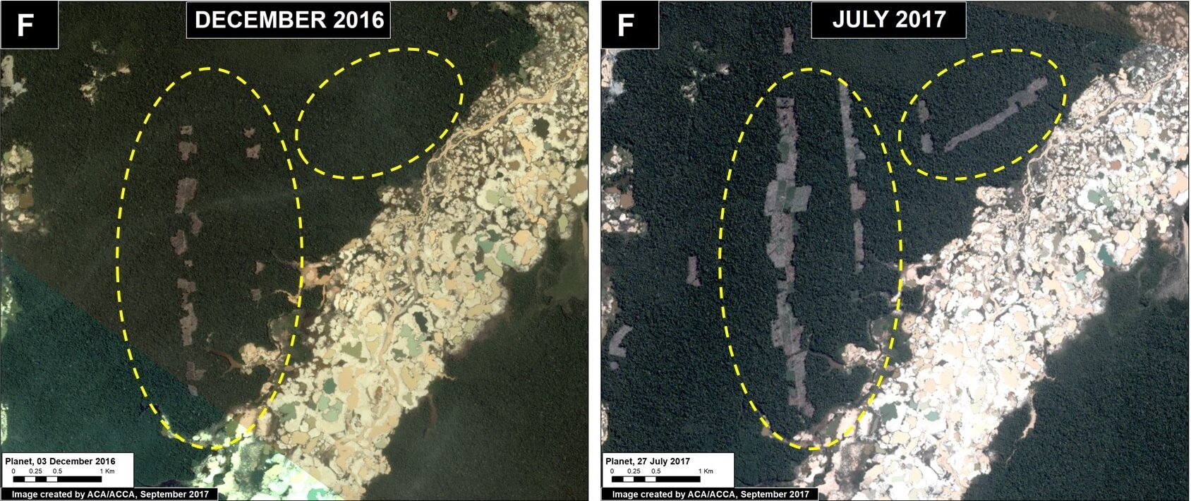
– Guacamayo, Madre de Dios (Inset F)
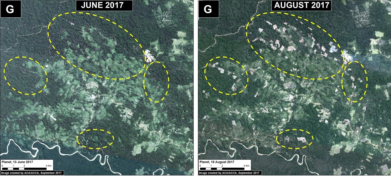
– Iberia, Madre de Dios (Inset G)
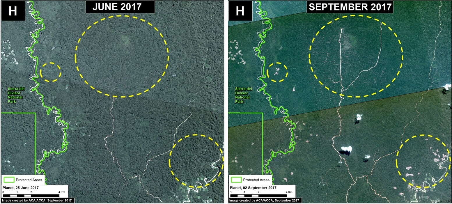
– South of Sierra del Divisor, Ucayali (Inset H)
– Nueva Requena, Ucayali (Inset I)
**The data were generated by the National Program of Forest Conservation for Climate Change Mitigation, Peruvian Ministry of Environment (PNCB/MINAM).
**See Hotspots A-E in MAAP #65
***We emphasize that our calculations are just estimates. Official forest loss data are produced annually by the Peruvian Ministry of Environment.

 Loading...


