
Not only do we do direct conservation work on the ground, we also partner with national and local governments, for-profit companies, local communities, indigenous groups, and other conservation nonprofits to ensure that local authorities have all the tools needed to take action to protect nature.
Many times it is difficult for the law to catch up to the crimes being committed against the Amazon and be able to prosecute offenders.
That is why we train judges and prosecutors to understand the latest in the technology that is being used to find, identify, and stop illegal deforestation, enabling them to present and accept the results of these technologies as evidence in trials.
In Bolivia, we have spent years of work as technical partners to the local and national governments.
That work culminated in the creation of set standards for the creation of new conservation areas, that are now applied at the national level to any new proposed areas and have become a standard in the field of conservation.
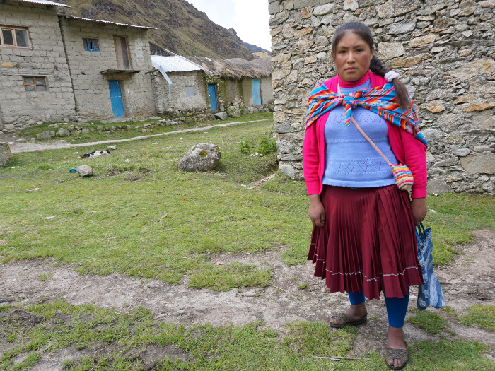
For years, we have been partnering with local indigenous communities to fight for their rights over their ancestral territories as well as aiding them in the conservation of their land.
For example, we helped establish the Wachiperi Haramba Queros Conservation Concession as the first conservation concession in Peru run by an indigenous community.
In addition, our Southwest Amazon Drone Center is helping train members of local communities to use drones to identify and report illegal deforestation to authorities who can put a stop to it.
One point of hardship the Peruvian government has faced has been to find the exact location of illicit activities in the Amazon, given the forests vast coverage and lack of access roads.
But thanks to our innovative MAAP Project, which identifies, monitors, and alerts local authorities of deforestation activities happening in near real-time from space – by using the latest satellites and radars.
Not only do we support these efforts through our MAAP project, we have also helped Peru establish their first Geographic Information System (GIS) office, adding to the capacity of local authorities to be self-sufficient in monitoring threats to nature.


The indigenous co-management organization of the Amarakeri Communal Reserve
Driving Down Illegal Deforestation in the Amazon Illegal deforestation in the Amazon often moves faster than governments can respond, especially in remote Indigenous territories affected by illegal gold mining. Over the past five years, Amazon Conservation’s Technology Meets Policy initiative worked to close that gap by linking real-time monitoring with coordinated enforcement and stronger governance. […]
Dear Supporters of Amazon Conservation, As I begin my tenure as Board Chair, I am honored to build on the extraordinary legacy that has defined Amazon Conservation for nearly 25 years. This organization has always stood apart for one simple reason: its commitment to pairing world-class science and technology with the experience, leadership, and resilience […]
From Nashville to the Amazon: Linking Business, Sustainability, and Ecosystems Business supporters are one of Amazon Conservation’s favorite avenues to raise awareness and support for our work because of their unhindered desire to give back to the planet. Whether directly donating to our work, promoting awareness of the Amazon’s importance to their clients, running campaigns […]
 Loading...


1025 Connecticut Ave NW · Suite 415 · Washington DC 20036 · USA
202-234-2356 / info@amazonconservation.org

