
A major deforestation surge continues in the northwest Colombian Amazon (MAAP #97).
In 2018, it resulted in the loss of 199,000 hectares (491,700 acres)*, making it the most concentrated deforestation hotspot in the entire western Amazon (MAAP #100).
Here, we provide a real-time update for 2019 based on early warning GLAD alerts.** The alerts indicate the loss of 56,300 hectares (139,100 acres) in the first five months of 2019 (January to May) in the Colombian Amazon.
The Base Map (see below) shows the deforestation hotspots are again concentrated in the northwest Colombian Amazon.
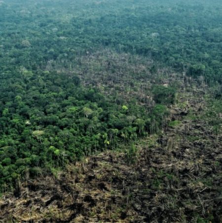
We focus on Chiribiquete National Park, showing satellite imagery and overflight photos for two sections of the park experiencing recent deforestation.***
We estimate the deforestation of 2,200 hectares (5,400 acres) inside the Park since its expansion in July 2018.
As described below, one of the main deforestation drivers in the region is conversion to pasture for land grabbing or cattle ranching.
 Loading...


