
In previous articles MAAP #56 and MAAP #57, we presented a series of striking satellite images of the recent deadly floods in northern Peru. Satellites provide additional types of data critical to better understanding events such as extreme flooding. Here, we present two more types of satellite data related to the flooding: ocean water temperature and precipitation.
Month: April 2017
The Women in Science of ACA share what inspires them to fight for the environment
Using a scientific approach to conservation is at the core of how we achieve our mission of protecting the Amazon. Our biological stations serve as research hubs for scientists from all over the world to study the rainforest, and we count on the leadership of three incredible women to support hundreds of studies every year. Check out some testimonials from these inspirational powerhouses changing the face of conservation in the Peruvian Amazon.
 For me, research and science are means of innovation, creativity, and communication; they are tools to help us discover the unknown with the hope for a better future. As a woman scientist, I would like to see more of us working and leading projects towards a more equitable, just and sustainable world, breaking down all gender-based stereotypes. I truly believe that we have the capability, strength and power to enrich and deepen the knowledge of nature, opening new opportunities for innovation and original solutions to the most difficult challenges on Earth.
– Carla Mere, biologist at ACA’s Los Amigos Research Station.
 Since I was a kid, I had the opportunity to live and be in touch with natural environments, which make my empathy and interest for animals and plants grow. I think I was lucky to receive a good education and motivation at home as well as at school, because I never thought I couldn’t be a scientist. Though it is not an easy path, especially in a developing country, I believe that here where we need science the most. Many times girls don’t even think about becoming scientists, but it is a worthy path that is needed so much right now to protect the only planet we have.
– Cecilia Barriga, biologist at Villa Carmen Research Station
 I have had the privilege of contributing to the creation and management of natural reserves, wildlife rescue operations, environmental education programs, and research on forest and wildlife ecology in the Tropics. Science allows me to fulfill my personal desire to contribute to nature conservation for the enjoyment of future generations. Now one of my main goals is to inspire young scientists and provide them with opportunities to follow their passion, to experience science first hand, and to fall in love with this profession, like I did.
– Sandra Almeyda, biologist at Wayqecha Research Station.
MAAP: Hydrocarbon-Related Deforestation in The Peruvian Amazon
Block 57 – Repsol
June 2017. Image: Planet
September 2017. Image: Planet
Block 67
Lote67, February 2018. Image: Planet
MAAP #57: High Resolution Satellite Images of The Flooding In Peru
In the previous MAAP #56, we showed a series of satellite images of the deadly floods that recently hit northern Peru.
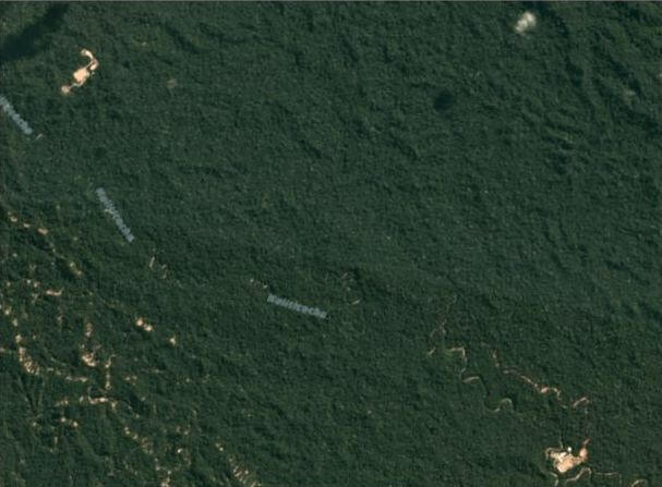
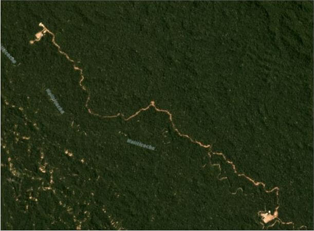
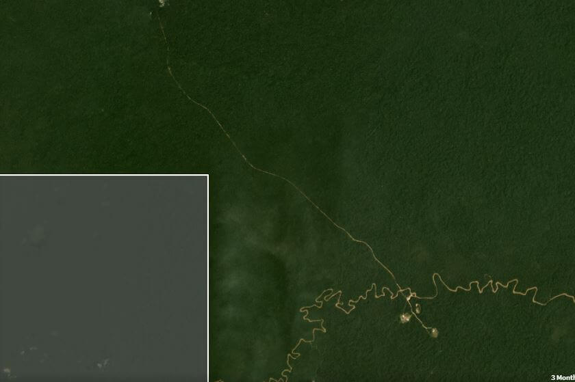
In this report, we show a series of new, very high resolution satellite images (50 cm) of the flooding. They show, in striking detail, some of the local impacts, including to croplands and the Pan-American Highway.
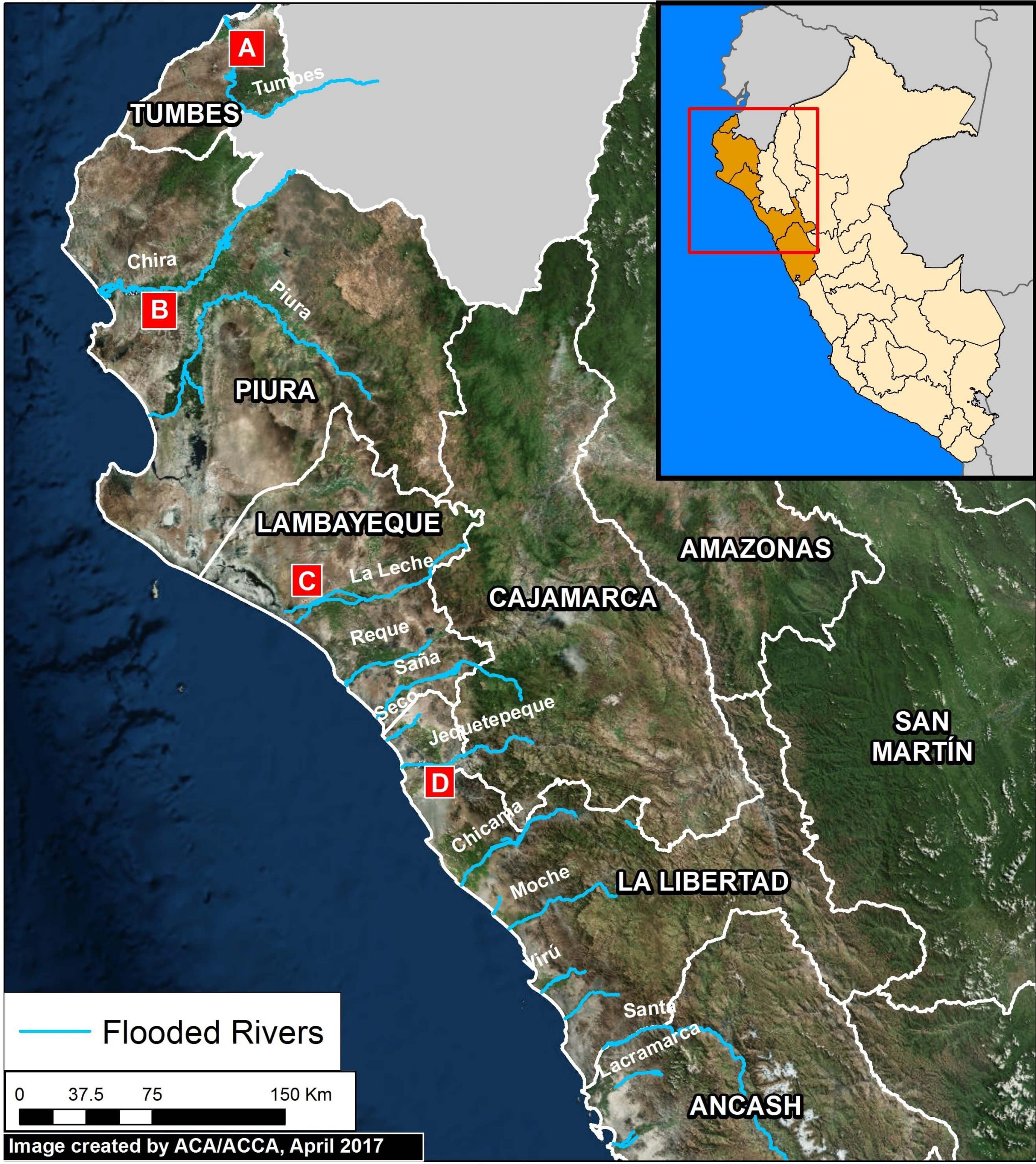
Image 57. Data: ESRI, INEI, MINAM. Click to enlarge.
Image 57 shows the 13 rivers that recently overflowed in northern Peru.
Below, we show images of the flooding around four of the rivers, labelled A-D.
MAAP #56: Major Flooding in Northern Peru From Coastal El Niño
Intense rainfall is causing severe and deadly flooding along the northern coast of Peru.
The cause is likely “coastal El Niño,” a phenomenon produced by abnormal ocean warming along the equatorial coast of the Pacific Ocean.
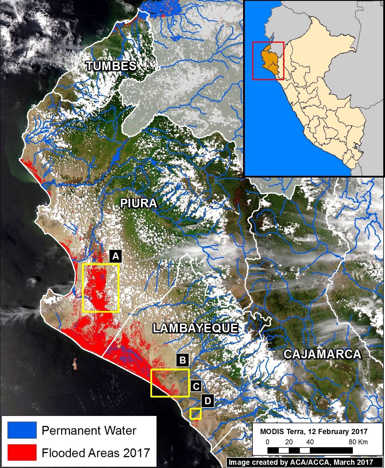
Image 56a. Datos: NASA, ESA, JRC/Google
Image 56a shows a preliminary estimate of the flooded areas along the northern coast (in red). We created this estimation via an analysis of radar images (Sentinel-1) that identified areas saturated with water.
Below, we show satellite images of the areas indicated by Insets A-D, which represent examples of flooding events.
Note that the red points indicate the same spots between panels.
 Loading...


