Illegal Gold Mining Clears Nearly 19,500 Acres Along Brazil–Colombia Border

New report finds 92% of mining-related deforestation occurred in Brazil, while rapid expansion into Colombia threatens Indigenous peoples living in voluntary isolation, despite repeated government operations.

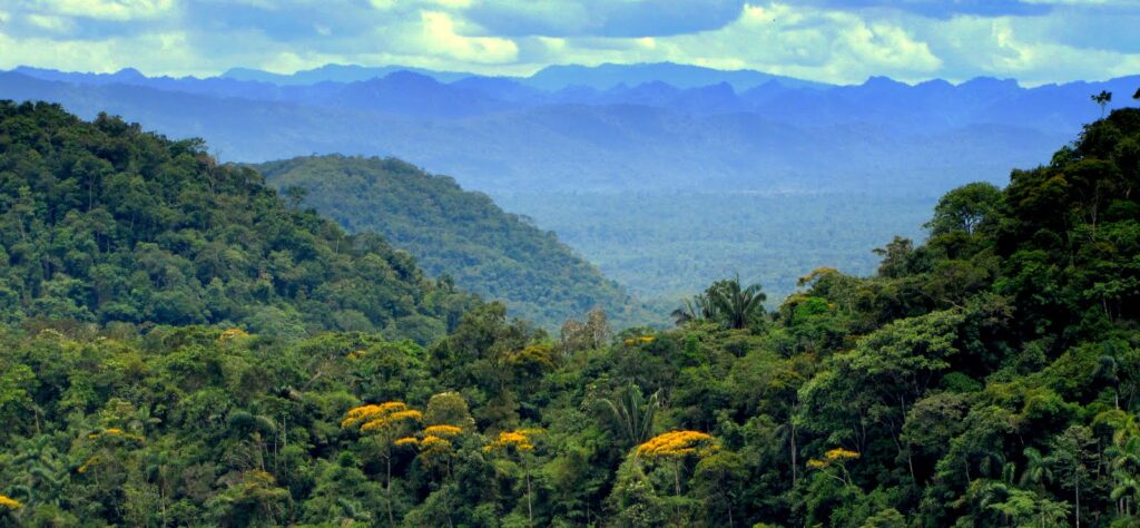
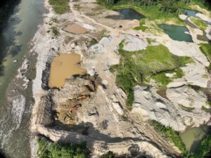
A new report from Amazon Conservation’s MAAP (Monitoring of the Andes Amazon Program), developed in collaboration with the Field Museum of Natural History, reveals that illegal gold mining has cleared 7,901 hectares (19,518 acres) of Amazon rainforest along the Puré–Puruê River, a remote region spanning the border between Brazil and Colombia. The analysis highlights three key findings:

  • Most deforestation is concentrated in Brazil: About 92% of total forest loss occurred along Brazil’s Puruê River, and 88% of all mining-related deforestation in the study area was recorded since 2022.
  • Mining is rapidly expanding into Colombia: Although Colombia accounts for only 8% of the total deforestation, illegal mining has expanded into Puré River National Park, threatening the territories and safety of the Yurí and Passé Indigenous peoples, who live in voluntary isolation.
  • Government operations have not stopped mining expansion: Despite seven enforcement operations, including three coordinated efforts between Brazil and Colombia, mining activity has repeatedly r

MAAP #251: Transboundary Illegal Gold Mining: Brazil (Puruê River) & Colombia (Puré River) highlights that Mining was first detected along Brazil’s Puruê River in 2001, but deforestation remained relatively limited for two decades, reaching 980 hectares (2,421 acres) by the end of 2021. Since then, the situation has changed dramatically. Since 2022, approximately 88% of all mining-related deforestation in the region has occurred, including 4,130 hectares (10,202 acres) cleared in 2022 and 2023 alone.

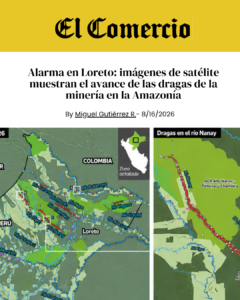
Today, mining operations extend along the Brazilian Puruê River from its confluence with the Japurá River to the Colombian border.

“We have been monitoring illegal gold mining across the entire Amazon, and this area stands out as one of the most emblematic cases of transboundary environmental crime,” said Dr. Matt Finer, lead author of the report, and Senior Reserach Specialist at Amazon Conservation.”Illegal gold miners have been ravaging the Brazil side (Purue River) for years, and now they are expanding deeper into the Colombia side (Pure River). The situation therefore requires a strategic, coordinated, binational response.”

Rapid escalation inside Colombia and a direct threat to Indigenous peoples in voluntary isolation
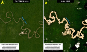
The pace of expansion is particularly concerning. Mining-related deforestation along Colombia’s Puré River was first detected in June 2024, when fewer than 5 hectares (12 acres) had been cleared. By the end of that year, the affected area had reached 38 hectares (94 acres). Deforestation doubled in early 2025 and continued to accelerate in 2026, with another 177 hectares (437 acres) cleared between January and May.

Previous MAAP monitoring also identified more than 50 mining dredges operating along the river inside Puré River National Park during 2024 and 2025.

All mining-related deforestation documented on the Colombian side lies within the national park, where mining is prohibited. The expansion poses serious risks to the Yurí and Passé Indigenous peoples, including potential violent encounters, disease transmission, mercury contamination, and disruption of their territories and traditional ways of life.

These risks extend beyond the Colombian side of the border. Evidence from the wider Puré–Puruê landscape indicates that Indigenous peoples living in voluntary isolation may move through a continuous forest territory spanning Colombia and Brazil, regardless of national boundaries. On the Brazilian side, indications of the presence of Indigenous peoples living in isolation require urgent investigation and precautionary protection by the competent authorities.

Mercury contamination and wider environmental impacts

The consequences of illegal gold mining extend beyond the areas directly cleared for extraction. Mercury used in mining can contaminate rivers and aquatic ecosystems, threatening downstream communities whose food security and livelihoods depend on fish and other aquatic resources.

The Puré–Puruê river corridor connects to the wider Japurá river system, so pollution and environmental damage can affect areas far beyond individual mining sites. Mining activity also creates spillover pressures on neighboring protected areas, including Brazil’s Juami-Japurá Ecological Station, and on Indigenous territories connected to the broader landscape.

Although Colombia has prohibited mercury use through legislation introduced in 2013 and strengthened in 2023, the report notes that mercury continues to be used in illegal gold mining in border areas such as the one examined in this analysis. These broader environmental impacts underscore the need to address illegal mining as an interconnected environmental and territorial security challenge.

Enforcement operations have not stopped mining expansion

The report documents seven government operations against illegal mining in the region: four focused on the Brazilian side, while three involved binational coordination between Colombian and Brazilian authorities in December 2023, May 2025, and November 2025. While these interventions temporarily reduced mining activity, deforestation resumed within months.

Following the May 2025 operation, mining-related deforestation in Colombia declined during June and July before increasing again by November. A similar pattern followed the November 2025 operation, with activity declining temporarily before rising again in March 2026.

The report also highlights the role of organized crime and logistical networks that sustain illegal mining. Brazilian municipalities such as Japurá, Maraã, and Jutaí serve as transportation and supply hubs, connecting mining operations to larger commercial centers, including Manaus.

These river networks facilitate the movement of equipment, fuel, supplies, and illegally extracted gold, making enforcement increasingly complex.

In August 2026, Colombia’s Ministry of the Interior issued an early warning calling for coordinated government action. However, the response has so far been limited to administrative coordination, without new operational deployments.

The findings reinforce the need for a sustained binational strategy that goes beyond isolated enforcement operations. The report recommends stronger territorial protection, coordinated action against criminal and logistical networks, and continued satellite monitoring to detect new mining activity and evaluate enforcement efforts.

The report calls for a long-term strategy that combines territorial protection, stronger governance, sustained binational coordination, and permanent monitoring. 

“Protecting the people and the biodiversity of the Amazon requires cooperation across borders. Sustained coordination between Brazil and Colombia can address threats and safeguard the connected forests and rivers Indigenous peoples depend on. For Indigenous peoples in voluntary isolation, protecting their territories and respecting their decision to remain uncontacted are essential to their survival,” according to Jeremy Campbell, Director of the Andes-Amazon Program at the Keller Science Action Center of the Field Museum. 
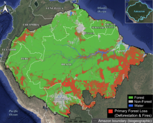
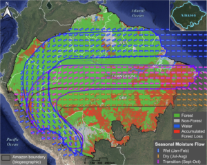
How Close Are We to the Amazon’s Tipping Point? New MAAP Report Reveals 15% of the Amazon’s Original Forest Lost, Flying River Routes to the Southwest Are Most Affected

Amazon Conservation’s latest analysis finds that 97 million hectares (240 million acres) of primary forest have been lost – an area the size of Texas and California combined – and that the moisture pathways that forests depend on during the dry and transition seasons are the most disrupted.

A new report from Amazon Conservation’s Monitoring of the Andes Amazon Program (MAAP) finds that 15% of the Amazon basin’s original primary forest is already gone, and that the losses are concentrated along the moisture routes some regions depend on most.

The report, MAAP #250: Amazon Tipping Point – Where Are We? (2026 Update), estimates that 97.06 million hectares (240 million acres) of primary forest have been lost across the Amazon biome’s nine countries through the end of 2025, mainly due to human-caused deforestation and fires. Total forest loss rose from 13.2% in 2021, as estimated in Amazon Conservation’s first assessment (MAAP #164), to 15% through 2025. Between 2022 and 2025 alone, an additional 13.04 million hectares (32.2 million acres) of primary forest were lost, an area nearly 15 times the size of Yellowstone National Park. This includes record-breaking losses due to fire in 2024, following the 2023’s strong El Niño season (MAAP #229). This additional loss of primary forest brings the Amazon closer to its tipping point, which scientific literature suggests could be triggered at around 25% forest loss, in combination with climate change impacts.

The analysis also breaks down forest loss along the Amazon’s seasonal flying rivers. It finds that the pathways carrying moisture during the dry and transition seasons have lost nearly three times more forest than the wet-season pathway. These pathways sustain forests in the southwestern Amazon, in Peru and Bolivia, where more than 70% of rainfall depends on moisture recycled by forests across the Basin.

These findings take on added urgency ahead of the very strong El Niño forecast expected to intensify for late 2026. MAAP #248 suggests that El Niño may disrupt the Amazon’s wet-season moisture flow, extending the dry and transition seasons and increasing the risk of forest fires. These are the same regions whose moisture pathways MAAP #250 finds are already the most deforested.

Matt Finer, Director of MAAP & Senior Research Specialist at Amazon Conservation, highlights that “media reports often indicate in general terms that the Amazon is approaching a tipping point, but this is the actual data indicating the magnitude of the problem. With 15% of the original Amazon lost to deforestation and fires, we are approaching the point at which the hydrological cycle that sustains rainforests may be permanently disrupted.”

Why monitoring the Amazon’s tipping point matters

The Amazon’s tipping point hypothesis suggests that parts of the rainforest could shift toward drier savanna ecosystems as deforestation reaches 25% and climate change disrupts rainfall patterns and intensifies dry seasons. However, this threshold is not definitive; the changes may be gradual and piecemeal, and the risk may vary considerably across the Amazon.

Amazon Conservation’s 2022 deforestation analysis illustrated this geographic variation. While an estimated 13.2% of the original Amazon biome forest had been lost at the time, loss in the eastern third of the biome (mainly in the Brazilian Amazon) was already approximately 30.8%, exceeding the hypothesized 25% threshold. In comparison, the central third had lost 10.8% and the western third 6.3%. This finding highlighted the importance of monitoring not only total forest loss, but also where it occurs in relation to the Amazon’s interconnected hydrological system. Because the rainforest generates around half of its own rainfall and recycles moisture up to six times through atmospheric flows known as flying rivers, disruptions to this fragile system in one area of the basin can have a domino effect elsewhere.

Flying Rivers Connect Forest Loss in the East to Rainfall in the West

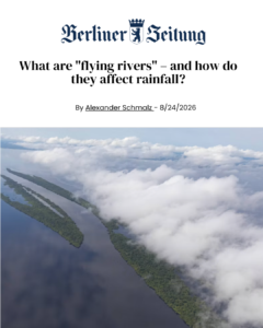
Flying rivers carry moisture from the Atlantic Ocean westward across the Amazon. Trees are a crucial part of this cycle: they draw water from the soil and release it back into the atmosphere as water vapor, helping sustain rainfall all the way to the Andes.

This connection means that deforestation in one region can have consequences beyond its immediate area. When the forests that help sustain these moisture flows are cleared, the amount of moisture reaching downwind regions may be reduced, potentially threatening ecosystems that depend on recycled rainfall. For this reason, the Amazon’s tipping point is unlikely to be a single, uniform event. Instead, it may unfold gradually, over decades rather than abruptly, and differently across regions, with some areas affected sooner and more severely than others.

In MAAP #232 (2025) and the subsequent white paper, Keeping the flying river flowing: How deforestation in the Brazilian Amazon threatens rainfall in Peru and Bolivia (2026), researchers examined these connections in greater detail. They identified the southwestern Amazon (primarily in Peru and Bolivia) as particularly vulnerable and found that these connections are exacerbated by changing seasons. During the dry and transition seasons, moisture reaching this region crosses the eastern and central Brazilian Amazon, including heavily deforested areas of Brazil’s southern Pará region.

Seasonal Trends Remain in 2026 Update

Amazon Conservation’s MAAP #250 brings these two lines of research together, updating forest-loss estimates through 2025 and applying the analysis to the three seasonal pathways identified in MAAP #232. The results show a clear contrast between seasons: The wet season pathway, which crosses relatively continuous and well-protected forests in the northern Amazon, remains comparatively intact, with just 3.2% forest loss. In contrast, pathways active during the transition and dry seasons have lost nearly three times as much connectivity, losing 9.1% and 8.6%, respectively. These findings are particularly relevant for the southwestern Amazon, where forest-driven moisture recycling plays an important role in sustaining rainforest ecosystems during the dry and transition seasons.

The update uses the same baseline developed for MAAP #164: a reconstruction of the Amazon’s original forest before European colonization, estimated at 647.6 million hectares (1.6 billion acres). Of the 97.06 million hectares lost, 84.28 million were due to deforestation and other non-fire causes, including natural events such as landslides and windstorms, and 12.78 million to fire. Brazil accounts for the largest share of total loss (79.4%), followed by Bolivia (6.2%), Peru (5.8%), and Colombia (4.5%). Bolivia now ranks second, up from fourth in the 2022 assessment.

Together, Amazon Conservation’s reports show that understanding the Amazon’s tipping point requires more than a single estimate of how much forest has been lost to date. Monitoring and understanding where deforestation occurs, how it intersects with seasonal moisture pathways, and which regions rely most on recycled rainfall can help identify areas of heightened vulnerability and inform conservation priorities. As pressures from deforestation, fires, and climate change continue, it is essential to start looking at the Amazon as an interconnected system rather than as isolated forests separated by country boundaries. A connected forest calls for connected science and conservation.

Read the full report: MAAP #250: Amazon Tipping Point – Where Are We? (2026 Update)

Additional resources: 

MAAP #164: Amazon Tipping Point – Where Are We?

MAAP #229: Amazon Deforestation & Fire Hotspots 2024

MAAP #248: Implications of upcoming major El Niño event on Amazon fires

Keeping the Flying Rivers Flowing: How Deforestation in the Brazilian Amazon Threatens Rainfall in Peru and Bolivia

A Superhero Win for Bolivia’s Forests, and a Way to Carry It Forward

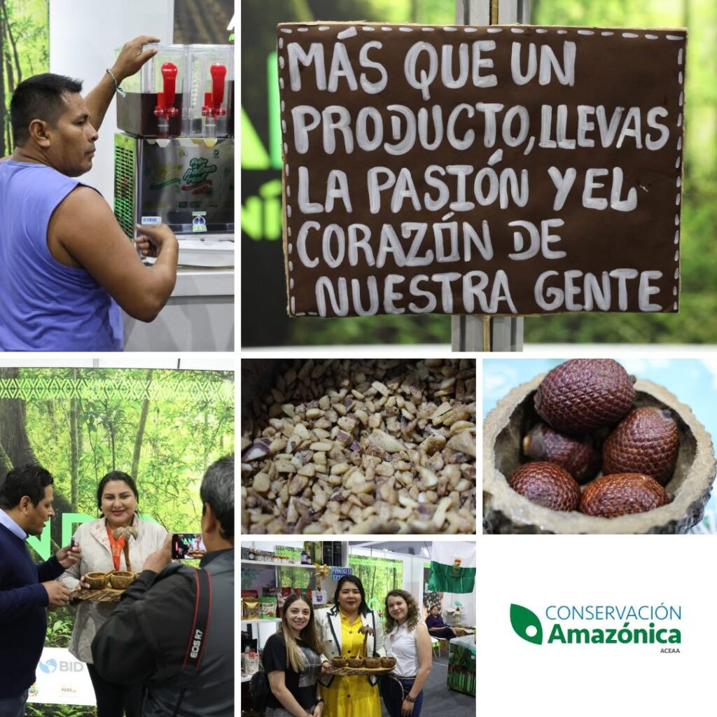
This week is National Estate Planning Awareness Week (NEPAW), and we have good news from the field to share. Our sister organization Conservación Amazónica-ACEAA‘s Pando Verde project in Bolivia’s Pando department in the Amazon has been named the 2026 winner in the Inter-American Development Bank (IDB) Lab’s category of “2026 Development Superheroes,” selected from 162 eligible projects.

Pando Verde’s work centers on adaptive management and innovation for resilient value chains in the Amazon. Put more simply, families who live in and depend on the forest can earn a good living from it, and that income gives everyone a reason to keep the forest standing.

A forest that pays its people to protect it

Pando, a department in the northern Bolivian Amazon, is still 92% forested, and its economy and culture are woven into that forest. Families gather Brazil nuts, açaí berries, royal palm, and majo palm, fruits valued for both their nutrition and their market value. The Brazil nut harvest alone involves more than 87,000 people and accounts for about half of family income in the region. Bolivia produces roughly 75% of the world’s Brazil nuts, and the harvest begins with collectors following trails that generations of their families have walked.

Pando Verde, implemented by our sister organization Conservación Amazónica-ACEAA with the support of the IDB Lab, works to make that way of life more resilient. The program helps producers manage these forest products sustainably, both ecologically and financially, using innovative tools like safety harnesses and on-site processing plants that make the production process more safe and efficient in order to strengthen the whole value chain. It reaches 31 communities and six community producer associations across 240,000 hectares, including several protected areas. In a region where deforestation is advancing, Pando stands out as an island of intact forest, and this project is part of how it stays that way.

Built with allies

None of this happened alone. Pando Verde, supported by IDB Lab under the Amazonía Forever program, has also been backed by the Amazon Bioeconomy and Forest Management Fund, and the Swedish International Development Cooperation Agency, along with the producer associations and local authorities who have shaped it from the start. The award belongs to all of them, and to the supporters whose generosity helped make the work possible. It also strengthens our resolve to protect the Amazon for the long term.

This resolve to protect the Amazon for the long term is what makes this week a fitting moment to highlight this news. Forests and the communities who steward them need protection that lasts well beyond any single year, and planning ahead is one of the most powerful ways to provide it.

Two steps you can take today

The first is to join the national movement during National Estate Planning Awareness Week by making or updating your will this week. Through our partner FreeWill, you can do it at no cost in about 20 minutes. It is a practical gift to the people you love, and it puts your wishes in writing.

The second is to consider including Amazon Conservation in your plans. A gift in your will can sustain forest protection and community-led livelihoods for years to come, so the work you care about continues far into the future.

Giving that works for you now

If you would like to support the Amazon today, a gift helps safeguard forests in the near term, and there are tax-smart ways to give. Many of our supporters give appreciated stock, recommend grants from Donor-Advised Funds, or make a Qualified Charitable Distribution from an IRA, all of which can be more tax-efficient than giving cash. As of 2026, QCDs can be made for up to $111,000 per person. You can also make a gift directly on our donation page.

Please check with your financial or tax advisor about the best approach for your situation.


Thank you for standing with the Amazon, and for helping a project like Pando Verde earn recognition on this scale.


New road between Acre and Peru could cause up to 133,000 hectares of deforestation in the Amazon rainforest, study finds

Leer en Español

Ler em português

New analysis assesses the impacts of BR-364 expansion on Acre’s forests and warns of risks to REDD+ investments and the communities that depend on these resources

A new analysis of planned road infrastructure expansion in Acre estimates that a paved international road between the Brazilian state and Pucallpa, Peru, could cause approximately 74,700 hectares of additional deforestation over ten years and 133,800 hectares over twenty years, beyond the losses projected from paving BR-364.
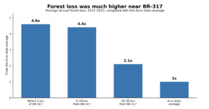
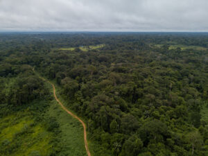
The report, “Acre at the Crossroads: How Road Expansion Threatens a Decade of REDD+ Progress in the Brazilian Amazon”, prepared by researchers from Amazon Conservation and SOS Amazônia, analyzes three infrastructure scenarios and uses as a historical reference the impacts observed along BR-317, the Interoceanic Highway, following its international connection with Peru.

Between 2011 and 2023, Acre’s average annual forest loss rate was 0.58%. In areas within five kilometers of BR-317, the rate reached 2.67% per year, 4.6 times the state average. Between five and 20 kilometers from the road, the rate was 2.54%, or 4.4 times the Acre average, while areas between 20 and 50 kilometers experienced a rate of 1.22%, or 2.1 times the state average.

Based on this historical experience, researchers estimated the impacts on forest areas that would become more accessible under different road expansion scenarios. Paving BR-364 between Rio Branco and Cruzeiro do Sul, combined with improvements to the connection with Porto Walter, could be associated with an additional 857,400 hectares of deforestation over ten years. With a new international road to Pucallpa, the projection reaches 932,100 hectares over the same period. The difference between the two scenarios is approximately 74,700 hectares over ten years and 133,800 hectares over twenty years.

These figures should not be interpreted as precise forecasts. Actual outcomes would depend on several factors, including enforcement and the management of protected areas along road corridors.

Environmental and economic gains at risk

Over the past two decades, Acre has built one of the world’s most established jurisdictional REDD+ programs. REDD+ stands for Reducing Emissions from Deforestation and Forest Degradation and is a mechanism designed to reward countries and jurisdictions for avoiding emissions associated with forest loss.

Since 2012, the REDD+ Early Movers (REM) program, an initiative that rewards verified emission reductions, has provided the state with approximately €56 million, equivalent to R$331 million, for around 21 million tons of verified emission reductions.

In 2025, Acre also signed a presale agreement with Standard Chartered Bank for credits corresponding to up to 40 million tons of emission reductions, with the potential to generate up to US$150 million in carbon credit revenue. The state’s Benefit Sharing Plan allocates 72% of net revenues from the sale of these credits to forest communities.

Maintaining this flow of resources is directly linked to continued reductions in deforestation. Projections presented by the state indicate the potential to generate up to US$1.83 billion between 2023 and 2027 from the sale of credits issued under TREES, the Architecture for REDD+ Transactions’ REDD+ Environmental Excellence Standard. These figures depend on both continued reductions in deforestation and demand in the voluntary carbon market.

“There is a tension between Acre’s existing REDD+ commitments and progress on reducing deforestation and the new risks associated with road expansion. Some of that new infrastructure is rightly needed but its impact in terms of putting additional forest cover at risk will need to be managed carefully. Some of these infrastructure projects, like the connection between Cruzeiro do Sul and Pucallpa, don’t stand the test of reason. After decades investing in a vision that sees Acre’s forests preserved, some consistency is needed.” says Blaise Bodin, Director of Policy and Strategy at Amazon Conservation.

Regional integration with forest protection

The analysis highlights the importance of infrastructure for Acre’s population and the economic and social benefits of regional integration, particularly in hard to reach areas, while emphasizing the need to incorporate medium and long term environmental and climate impacts into planning, with adequate impact assessment, licensing, monitoring, and enforcement.

 In the case of the proposed connection to Pucallpa, economic evidence included in the report also raises questions about the project’s viability. A 2022 assessment published by Conservation Strategy Fund calculated a negative net present value for both the Peruvian and Brazilian sections of the connection, with an internal rate of return below zero in both cases.
The MAP region, which encompasses Madre de Dios in Peru, Acre in Brazil, and Pando in Bolivia, contains more than 54 million hectares of relatively intact forest and communities with extensive experience in forest management. In Acre alone, the sustainable production of non timber forest products could generate up to US$71 million in net annual revenue while maintaining forest cover.

The Port of Chancay in Peru also expands opportunities to access Asian markets for products from the Amazon forest economy, including açaí, Brazil nuts, certified timber, and ingredients for the cosmetics and pharmaceutical industries.

Daniela Dias, Leader of The Protected Areas and Biodiversity Conservation Program at SOS Amazônia, remarks that “Acre has great potential to consolidate its existing climate policy by integrating different sectors around a development model that values standing forests. This is not about choosing conservation over development, but about strategic action to safeguard territorial integrity while creating sustainable economic opportunities through a model of bioeconomy based on local knowledge, REDD+ and environmental services.” 

About the study

“Acre at the Crossroads: How Road Expansion Threatens a Decade of REDD+ Progress in the Brazilian Amazon” examines the potential impacts of road infrastructure expansion in Acre on deforestation, the state’s climate commitments, and REDD+ related revenues. The modeling compares three infrastructure scenarios and uses historical data from BR-317 as a reference to estimate the risks associated with the expansion of BR-364 and a potential international connection to Pucallpa, Peru. The study was prepared by researchers from Amazon Conservation in partnership with SOS Amazônia.

Read the full report: https://www.amazonconservation.org/publication/

One Interconnected Planet: National Family Day

Celebrating National Family Day with a Legacy of Love
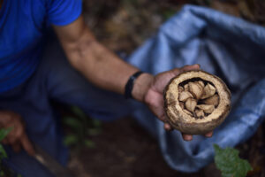
On National Family Day on September 28, we naturally focus our attention on protecting and celebrating the people who matter most to us. At Amazon Conservation, we believe that family extends beyond our immediate households to encompass our global community, including the local communities, forest guardians, and passionate advocates who stand together to defend the world’s most vital rainforest.

True lasting protection means looking beyond the horizon to ensure our loved ones are cared for, and the values and places we champion are safely anchored in the future. Establishing a clear, thoughtful estate plan is one of the most powerful ways to fulfill that responsibility, removing uncertainty for your household while declaring what matters most to you.

To honor your family today, we invite you to create or update your will through our partner FreeWill. As you map out this vital roadmap, we ask you to join us in securing the future of our planet by naming Amazon Conservation in your plans. A visionary legacy gift costs you nothing during your lifetime, but it guarantees that the vibrant biodiversity, clean water systems, and Indigenous territories of the Amazon remain protected for your children and grandchildren to inherit.

Take action for your family and our planet by starting your plan today.


Rise for the Amazon Day: The Amazonian Fruits Sustaining Forest-Based Economies

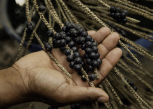
Açaí berries, Brazil nuts, and the fruit of the palma real (royal palm) do more than nourish people worldwide. They sustain families and protect forests in the Amazon. These fruits appear in smoothies, supplement bottles, and skincare products powering healthy lifestyles around the world, but their greater significance lies in the rainforest. Harvesting and producing these fruits form the basis for the forest-based economy, showing how a forest can be worth more standing than cleared.

A Forest Is Worth More Standing Than Cleared

Across the Amazon, deforestation often comes from short-term economic gain. Land cleared for cattle or crops can generate income quickly, while keeping forests intact does not always offer an immediate financial incentive. Strong forest-based economies change that equation. When communities earn their living from forest products, the forest itself becomes the source of lasting income. In Bolivia, families have built generations of livelihoods around these harvests, keeping trees intact and forests thriving. 

Açaí berries, Brazil nuts, and palma real are working examples of this. Communities in Bolivia have built harvest schedules around these three fruits, sustaining families for generations without cutting down the trees. The forest is not a resource to be cleared and sold. It is a valuable resource that continues producing, season after season, for as long as it remains standing.


Beyond One Harvest

A strong forest-based economy does more than generate income. It gives communities a direct, ongoing stake in keeping their forest intact, which is one of the most resilient and lasting forms of conservation there is. Effective long-term protection is far more likely when local communities depend on healthy forests for their livelihoods.

It also diversifies the local economy. While income from extractive activities only lasts as long as the forest is standing and resources are flowing, a forest-based economy offers a convincing alternative: sustainable income that keeps ecosystems healthy, forests standing, and strengthens community ties to the Amazon.


Strengthening Local Communities and Families

Our sister organization Conservación Amazónica-ACEAA in Bolivia has spent over a decade working with local families and community producer associations to strengthen this sustainable economy, by supporting the infrastructure, market access, and technical knowledge that turn a seasonal harvest into a reliable livelihood. It’s slower, less-dramatic work than a single conservation win, but it’s the kind that compounds. Every harvest season that a forest-based economy continues producing is another season the forest itself remains standing and another season local families will earn a stable source of income.


From the Canopy to Your Table

The açaí berries in your smoothie, the Brazil nut in your trail mix, the palma real oil in your favorite skincare product each represent a forest that’s still standing and a community whose future depends on keeping it that way.

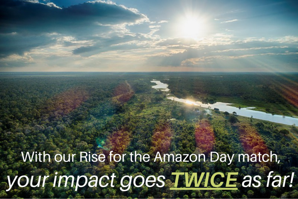
This Rise for the Amazon Day, you can help sustain that cycle. Thanks to a generous donor and our Board of Directors, every gift made for Rise for the Amazon Day will be matched dollar for dollar up to $20,000, doubling your impact on the forest-based economies that keep the Amazon intact.


Make a secure gift by September 5 and DOUBLE your impact!


Rise for the Amazon Day. September 5.
Protect the Amazon, and all that it provides.


Rise for the Amazon Day: One Woman is Helping Protect the Amazon’s Headwaters

The water that sustains the Amazon Rainforest in Brazil begins its journey thousands of miles away, high in the Andes Mountains of Peru. Rain that falls on the highest peaks, and glacier waters that melt and filter through fragile wetlands called bofedales, slowly make their way down into the rivers and streams that feed the entire Amazon Basin, sustaining its biodiversity and climate along the way. Protect that water at its source, and you protect everything downstream: the forest, the wildlife, and the millions of people who depend on it.

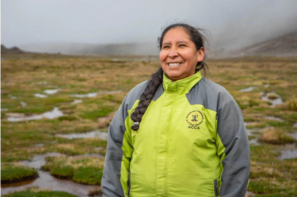
This is the work to which Marlene Mamani has dedicated her career.


Meet Marlene

Marlene Mamani Solórzano is a Peruvian biologist and a Specialist in Andean Restoration and Community Relations with our sister organization Conservación Amazónica–ACCA. For years, she has worked shoulder to shoulder with highland communities in Peru’s Cuzco Department to restore degraded bofedales and high-altitude grasslands, the very ecosystems that store and regulate water for the Amazon below.

Marlene was honored as a 2026 National Geographic Explorer, one of the most significant honors in conservation science, in recognition of her years of work restoring degraded ecosystems in Cuzco and building community capacity to prevent and respond to fire events. It’s a distinction that celebrates people developing real, innovative solutions to understand and protect the planet, and it comes with new funding to expand the work Marlene is already leading alongside Andean communities.


Restoration That Starts With Community

For Marlene, conservation only works when it’s rooted in partnership: between science, traditional knowledge, and the communities who live closest to these ecosystems. That partnership is already producing results. That work includes restoring degraded land and training community fire brigades for the prevention and control of forest fires so that communities are prepared to respond quickly when they’re needed most. 

That preparation matters more than ever. With El Niño conditions expected to bring even more severe weather this year, the fire risk in these high-Andean ecosystems is rising, and the communities on the front lines need to be prepared to respond. Thanks to funding from Marlene’s National Geographic Explorer recognition, nine community fire brigades from seven communities across Cuzco are being trained and six hectares of high-Andean bofedales and grasslands in the community of Japu are being restored. 

These may sound like small numbers, but bofedales and grasslands punch far above their weight. They store and regulate water, shelter unique biodiversity, and protect sustainable livelihoods for local communities, all while feeding the rivers that sustain the vast Amazon biome. 

Marlene says that true conservation happens hand in hand with communities. They know their land; they face its challenges firsthand; and they are essential to finding lasting solutions.


Why This Story Matters for Rise for the Amazon Day

The Amazon gives us so much: clean air, stable climate, unmatched biodiversity. But none of it is possible without water, and that water begins in places like the highlands Marlene works to protect. Her story is a reminder that safeguarding the Amazon means safeguarding it at every level, from the source of its rivers to the depths of its forest.

This September 5, you can help carry that work forward. Thanks to a generous donor and our Board of Directors, every gift made for Rise for the Amazon Day will be matched dollar for dollar, up to $20,000, so your support goes twice as far for people like Marlene and the communities she works alongside.


Make a secure gift today and DOUBLE your impact!


Rise for the Amazon Day. September 5.
Protect the Amazon, and all that it provides.


Kicking Off the Countdown to Rise for the Amazon Day

Join Us as We Rise for the Amazon on September 5

Imagine that the Amazon wrote us a letter. What would it say? Most likely, it would remind us of everything it quietly gives us, every single day, and ask what we’re willing to give back.

That’s the story we’re sharing as part of this year’s Rise for the Amazon Day: a letter from the Amazon itself, delivered in a short video that kicks off the next week of gratitude, action, and stories from the forest that makes so much of life on this planet possible.


What is Rise for the Amazon Day?

Originally established in Brazil to commemorate the creation of the State of Amazonas, Rise for the Amazon Day is a day for people everywhere to stand together in solidarity with the Amazon rainforest and the communities who call it home. Now in its second year, Rise for the Amazon Day is about recognizing everything the Amazon gives us, largely without acknowledgement or thanks: the food on our tables, the fresh air we breathe, carbon stores that help keep our climate in balance, and a safe haven for biodiversity found nowhere else on Earth, including plants with critical medicinal properties and migratory birds.

The Amazon regulates rainfall across South America and stores carbon that helps stabilize our global climate, functions found almost nowhere else on the planet at this scale. It has given us so much for so long. Now it’s our turn to give something back. 

But those gifts aren’t guaranteed. The Amazon is at a crossroads. Deforestation, fires, and a warming climate are pushing this vital ecosystem closer to a tipping point from which it may not recover, a point where it can no longer give us what it always has. At the same time, Indigenous communities, scientists, and local partners across nine countries are doing extraordinary work on the ground to protect it before that happens: defending forests, monitoring threats in real time, and building sustainable paths forward for the people who call the Amazon home.

What they need now is for the rest of us to rise with them.

This Year, Your Impact Goes Twice as Far

Thanks to the generosity of a dedicated donor and our Board of Directors, every gift made for Rise for the Amazon Day will be matched dollar for dollar, up to $20,000. That means when you give, you’re not just making a gift. You’re doubling your impact, and doubling the impact of the work protecting the forest that gives so much to all of us.

It’s one of the most powerful ways to make your voice, and your generosity, leave a long-lasting impact for the Amazon.

Rise With Us

Over the next week, we’ll share stories from the ground, from a community-led effort in Peru to conserve vital water resources and restore watersheds that feed the Amazon’s vast water system, to communities in Bolivia developing sustainable livelihoods that provide for their families today and for generations to come. We’ll also share simple ways you can get involved. These stories from the Amazon are addressed to all of us. On September 5, join us in responding through action.

Make a secure gift today and double your impact


Rise for the Amazon Day. September 5. Protect the Amazon, and all that it provides.


2,321 Hectares Impacted By Mining Activity In Southern Napo

A new analysis by Fundación EcoCiencia and Amazon Conservation shows a sustained expansion of mining activity across five areas in the cantons of Tena and Carlos Julio Arosemena Tola. Between 2025 and the first quarter of 2026, satellite monitoring identified 580 hectares of newly affected land.

Within the framework of the Monitoring of the Andes Amazon Program (MAAP), Fundación EcoCiencia and Amazon Conservation have documented the continued growth of mining operations in the southern part of Napo province. Satellite data reveal 2,321 hectares affected by mining between January 2017 and March 2026 in five zones within the cantons of Tena and Carlos Arosemena Tola. Of that total, 580 hectares correspond to new mining activity detected during 2025 and the first quarter of 2026.
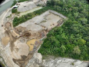
The report updates a previous assessment that had documented 1,741 hectares affected between 2017 and 2024. Through satellite monitoring, the new analysis examines five zones: the Jatunyacu, Anzu, and Huambuno rivers; the Puní–Cotona–Arajuno corridor; and a newly evaluated area along the Napo River near the communities of Sindy and San Carlos.

The findings reveal varying degrees of expansion across these monitored areas. The Anzu River shows the largest accumulated impact, reaching 806 hectares by March 2026, with roughly 13% of that area located outside the official mining cadastre. Along the Jatunyacu River, the affected area totals 561 hectares. In Huambuno, the impacted area reached 674 hectares as of March 2026, and approximately 23% of this activity occurs outside the mining cadastre.

One of the most notable developments is observed in the Puní–Cotona–Arajuno corridor, where the affected area increased from 112 hectares recorded up to January 2024 to 234 hectares by March 2026. In this corridor, 99% of the identified mining activity lies outside concessioned areas in the mining cadastre. During the first quarter of 2026 alone, the expansion exceeded 35% of the total area reported in 2025, underscoring a clear intensification of mining activity.

The report also identifies a new area of mining expansion along the Napo River, near the communities of Sindy and San Carlos. In this zone, the affected area grew from six hectares between 2023 and 2024 to 43 hectares in 2025, and 47 hectares by March 2026. Ninety‑four percent of this expansion lies outside the areas registered in the mining cadastre. Monitoring detected both small‑scale artisanal mining and larger operations using specialized machinery, including industrial classifier plants.

The analysis also documents several impacts associated with mining activity, such as the removal of forest cover, soil disturbance, changes in watercourses, erosion, and the formation of sedimentation pools. Along the Anzu River, interventions were identified near a petroglyph listed in the Ecuadorian Cultural Heritage Information System (SIPCE). Although no direct damage to the carving was observed, the report highlights the cultural sensitivity of the area and stresses the need to strengthen its protection.

In response to these findings, the report urges stronger monitoring, enforcement, and protection measures for the Napo River basin. It recommends integrating satellite imagery and drone surveillance with regular field inspections, community‑based monitoring, and sustained public oversight to ensure more effective control of mining activity.

Read the full report: 

https://www.maapprogram.org/mining-ecuador-napo/