
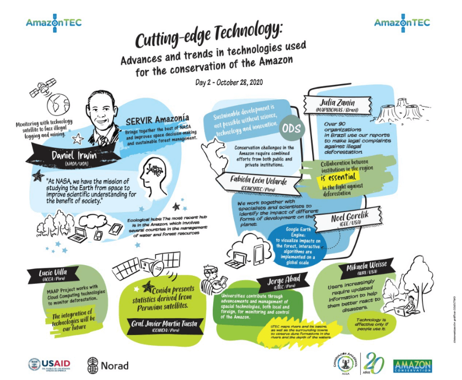
 AmazonTEC is a premier forum for discussing science and technology’s connection to policy and governance in the Amazon. Developed by Amazon Conservation’s Peruvian sister organization Conservación Amazónica – ACCA, AmazonTEC brings together forest users, technology experts, NGOs, governments, and other stakeholders in a forum to discuss the use of cutting-edge technology (satellites, mobile apps, drones, and more) in the advancement of public policy for environmental protection in the Amazon.
The third of five sessions of the annual AmazonTEC event, titled Políticas Públicas: Gobernanza y Tecnología para Proteger Nuestra Amazonía, demonstrated how technology is an effective tool in decision-making for the conservation and sustainable development of the Amazon. Click here to watch the recording of the third session (in Spanish).
Michelle Jennings, Director of USAID’s Office of the Environment and Sustainable Growth, Peru started off the event with welcoming remarks saying, “The use of new technologies makes it possible to monitor natural products and promote public policies to maintain the sustainability of the Amazon. We are all joining forces in developing a roadmap.” USAID is one of the supporters of the AmazonTEC program.
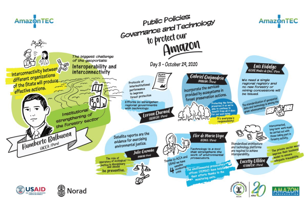
The Regional 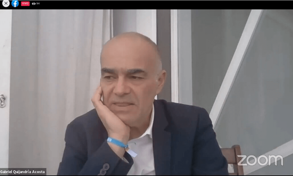 Technology and Policies panel began with Gabriel Quijandría, who serves as the Vice Minister of Strategic Development of Natural Resources of the Ministry of the Environment (MINAM), Peru. In this portion, panelists spoke about the difficulties they have experienced in using technology to protect the Amazon, as well as the changes in the regulatory frameworks, interaction between institutions, and how they addressed the solutions to the barriers presented.
Gabriel Quijandría talked about the value that natures services provide us, saying that the importance of standing forests will be more apparent if we quantify the economic value that their services provide. “Technology shows the services the forest provides, outside of those that are immediately visible, such as the regulation of the water cycle. Services like these must be valued so that there is a more solid argument about why the forests should remain standing,” he said.
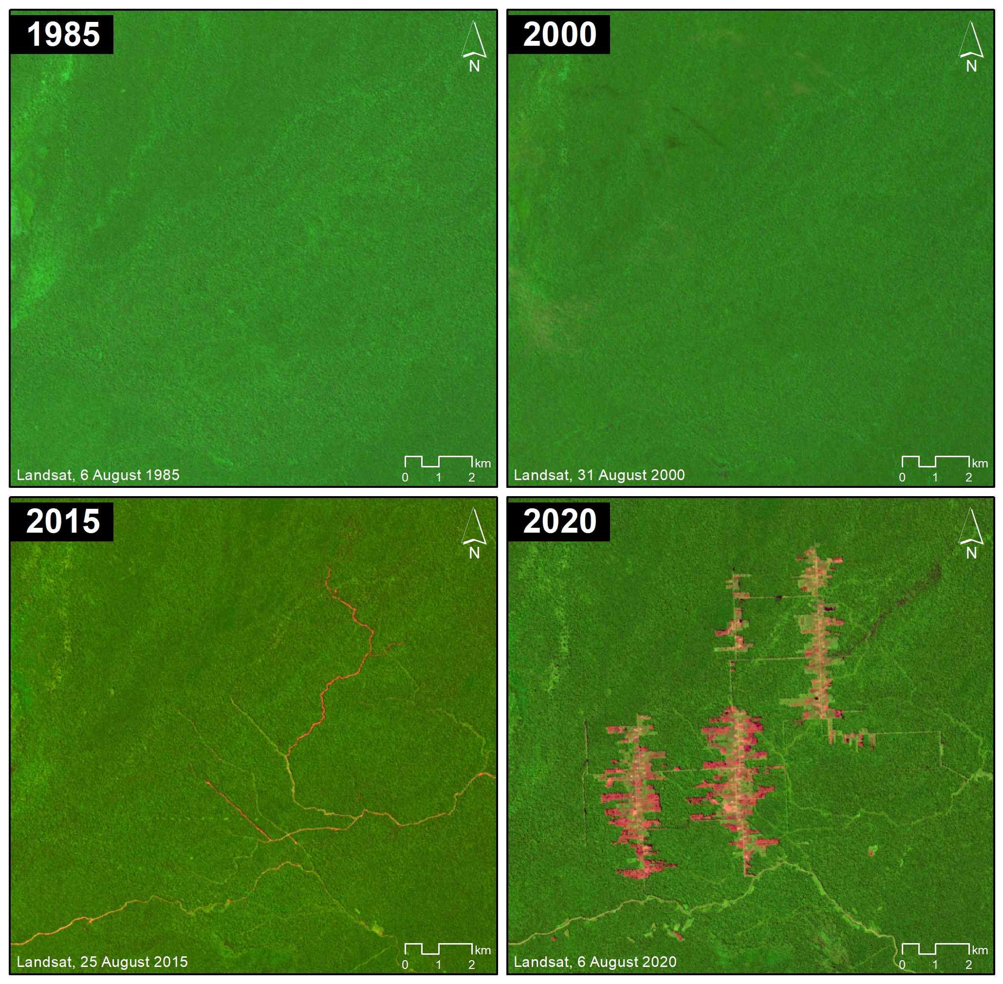
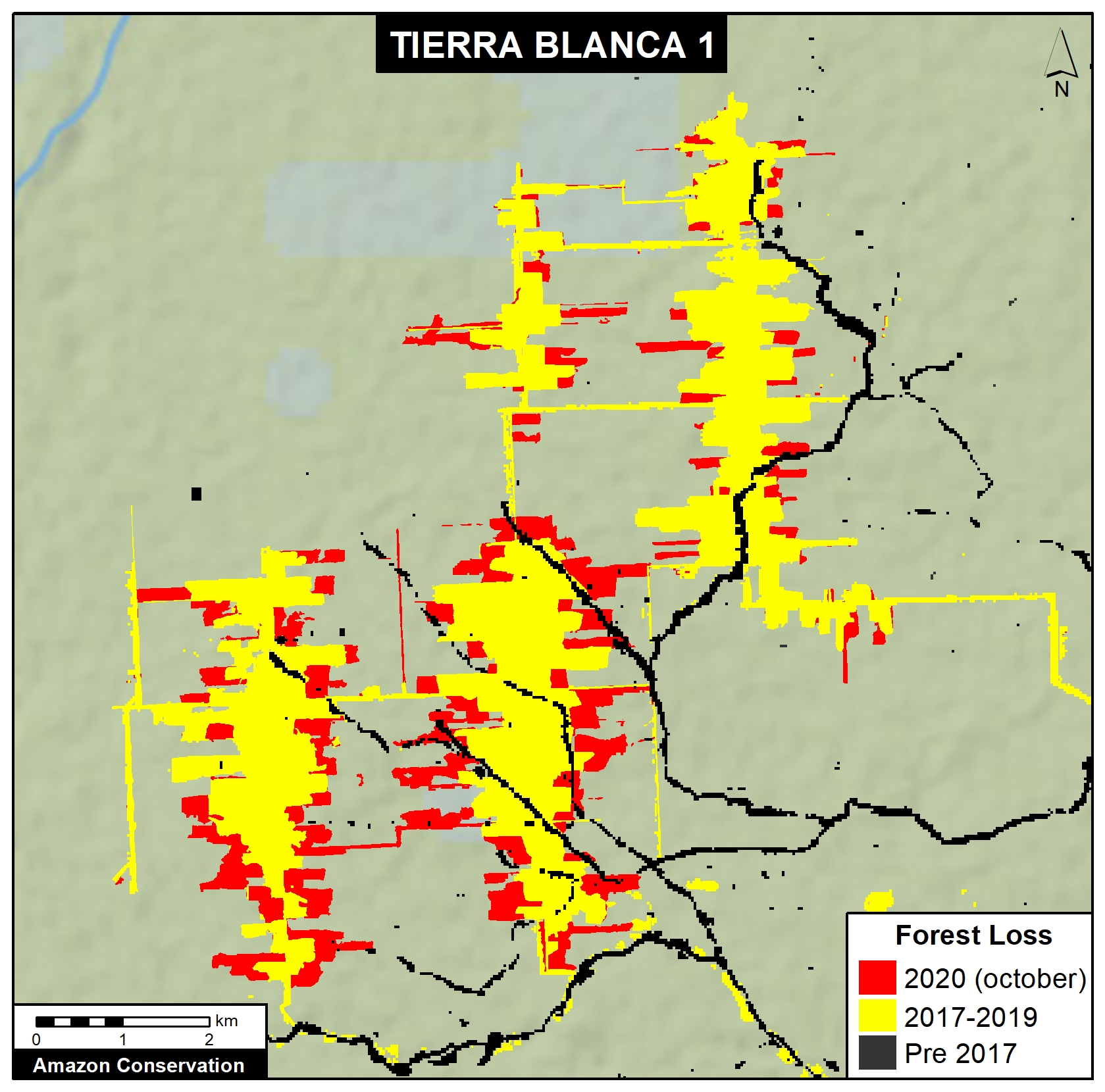
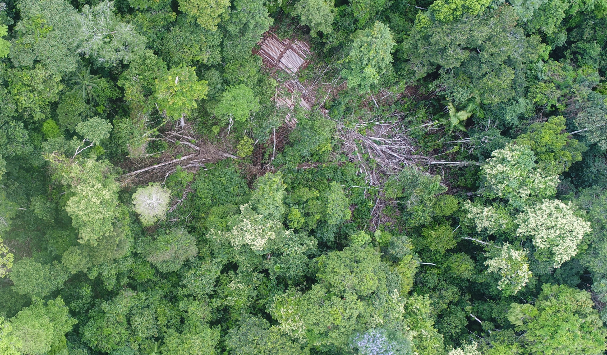
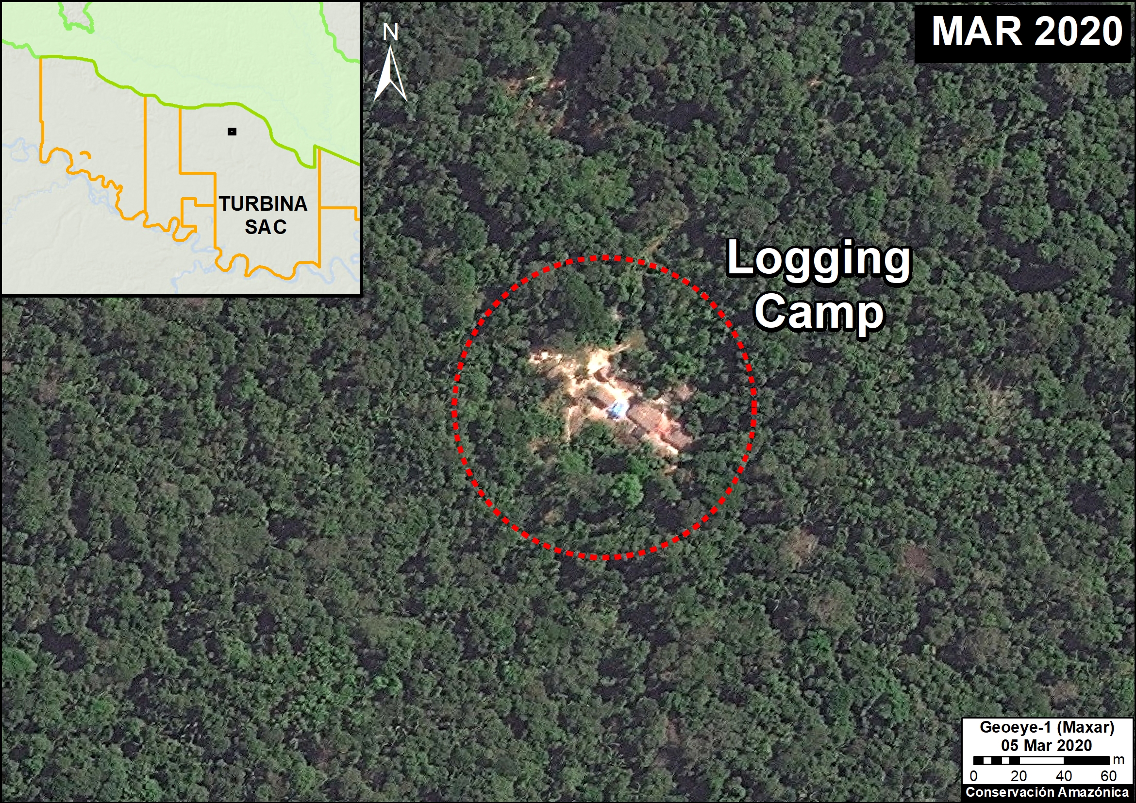
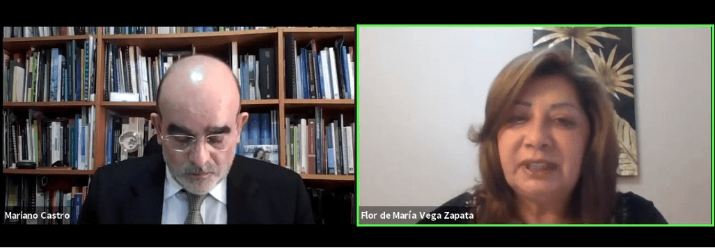 Flor de María Vega, Senior Prosecutor and National Coordinator of the Special Environmental Prosecutor’s Office (FEMA), Peru noted how satellite monitoring units improve their office’s capabilities because, “They are located in strategic regions that have the highest incidence of illegal activity, in order to support fiscal work through remote sensing of forest cover.” She also added that the office is looking into expanding their work, saying “In the future, we seek to have other monitoring units near areas of San Martín, Amazonas, Cusco and Puno, as well as in the north of the country.”
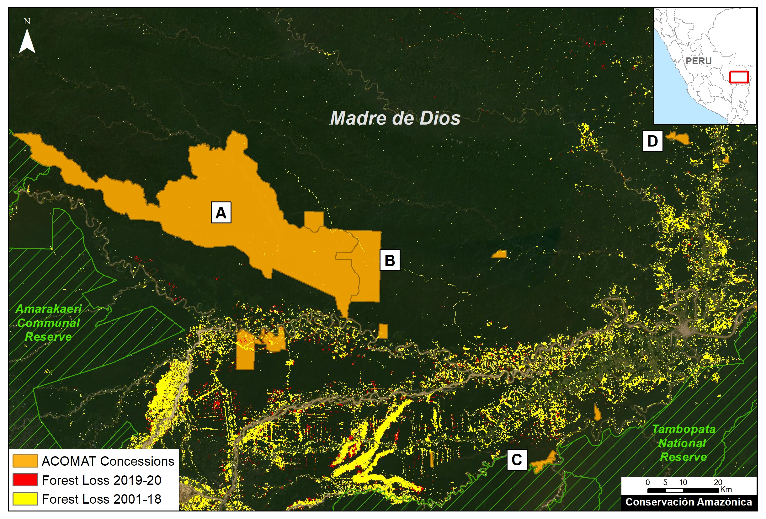
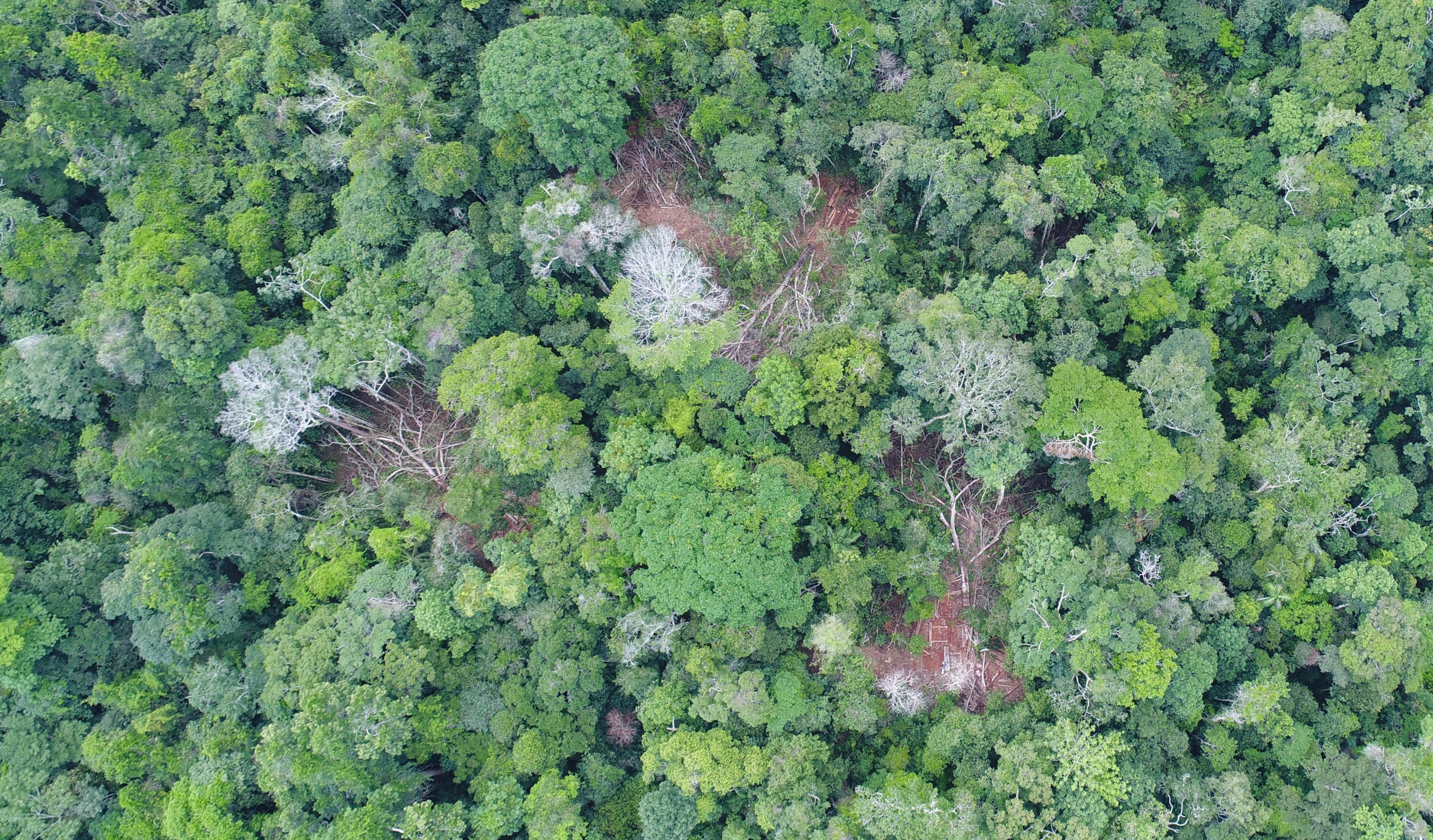
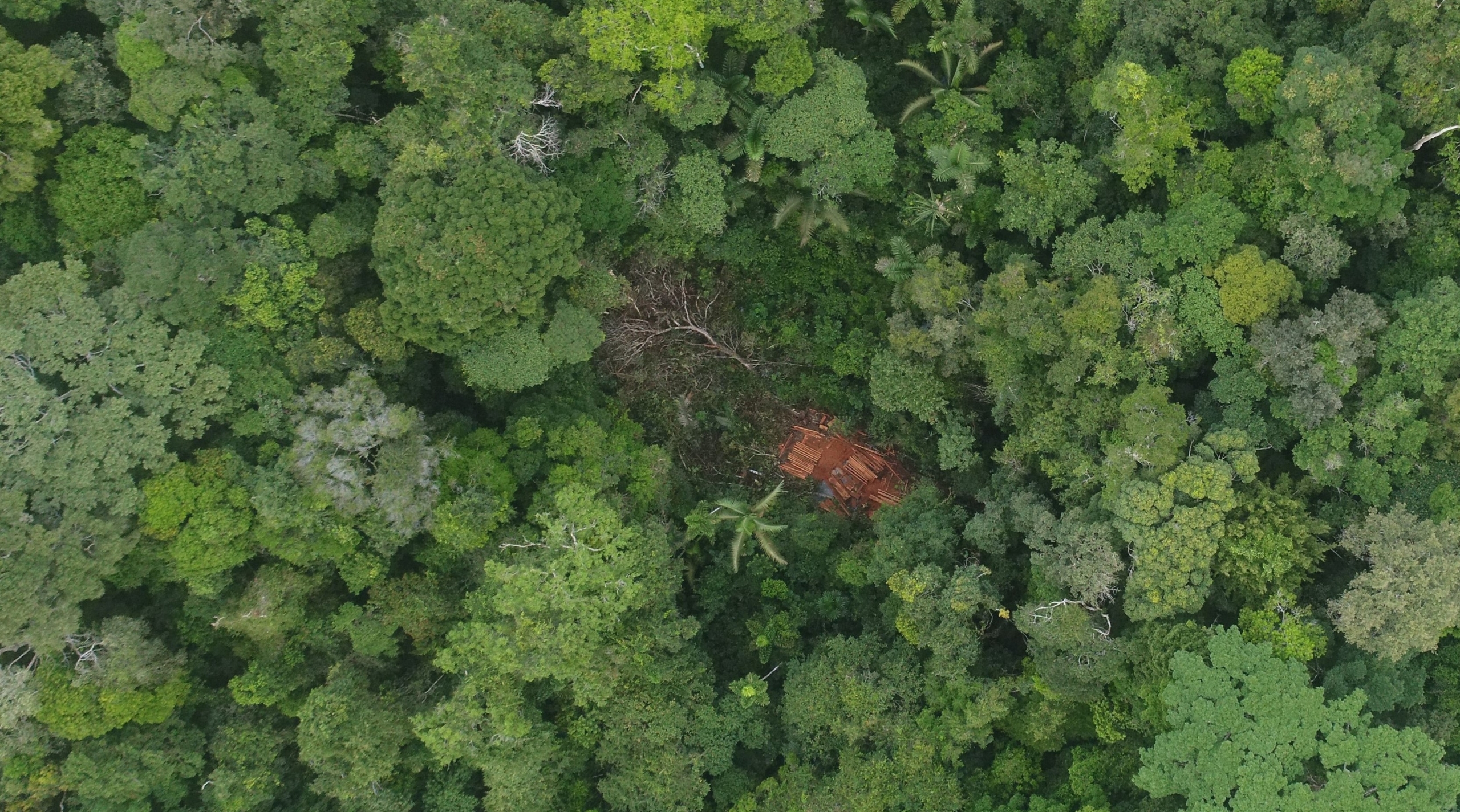
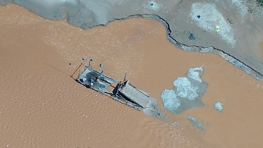
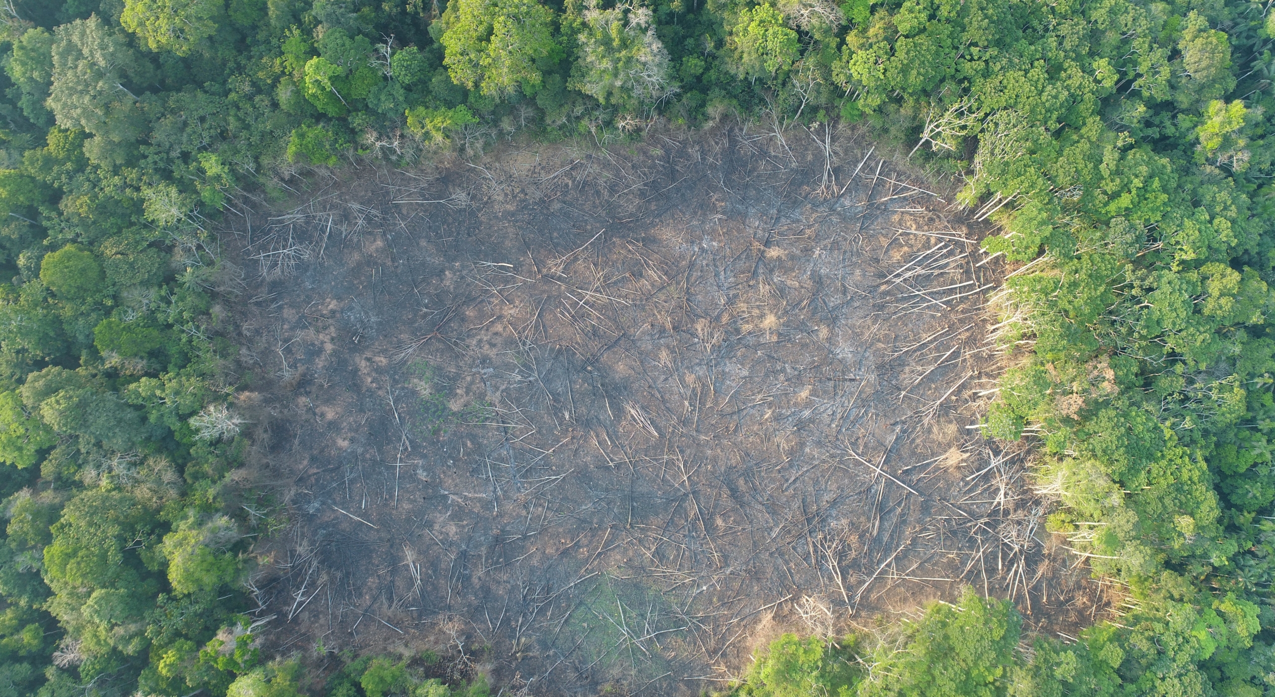
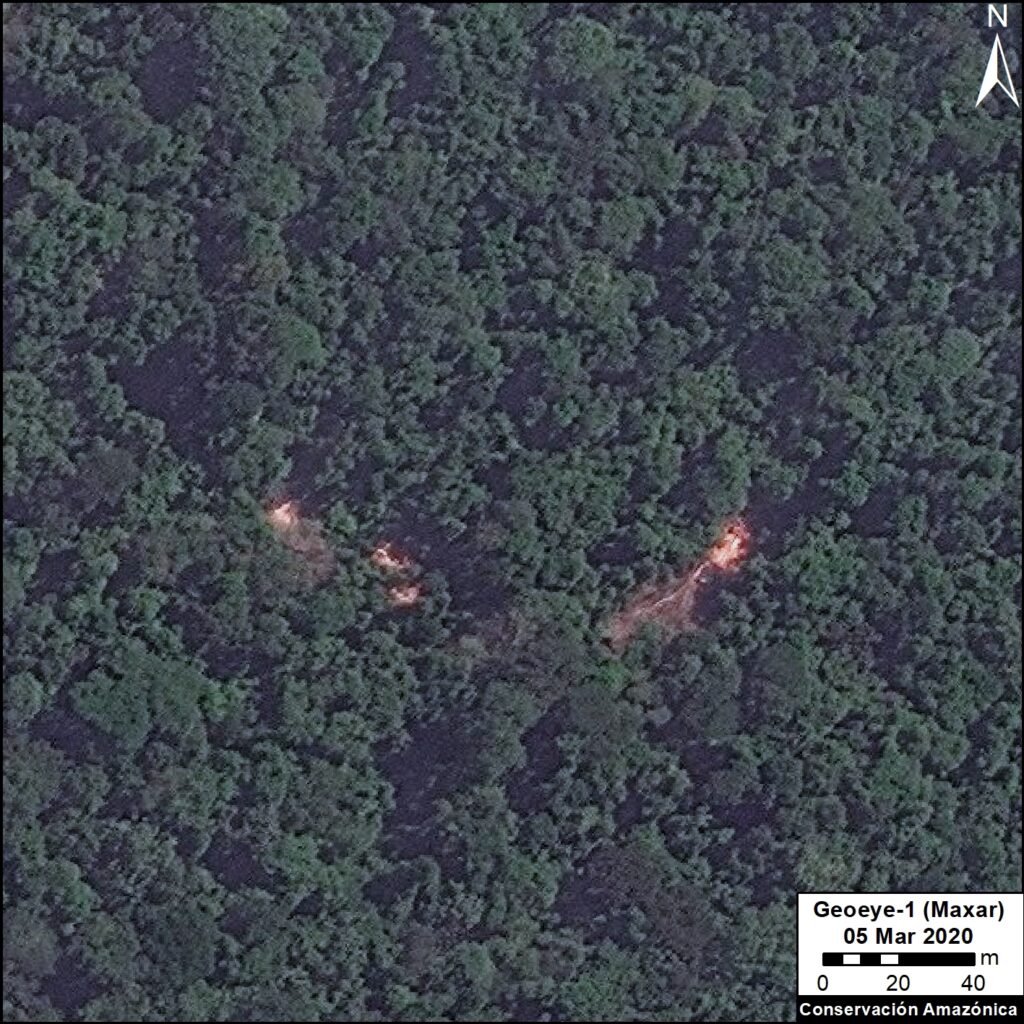
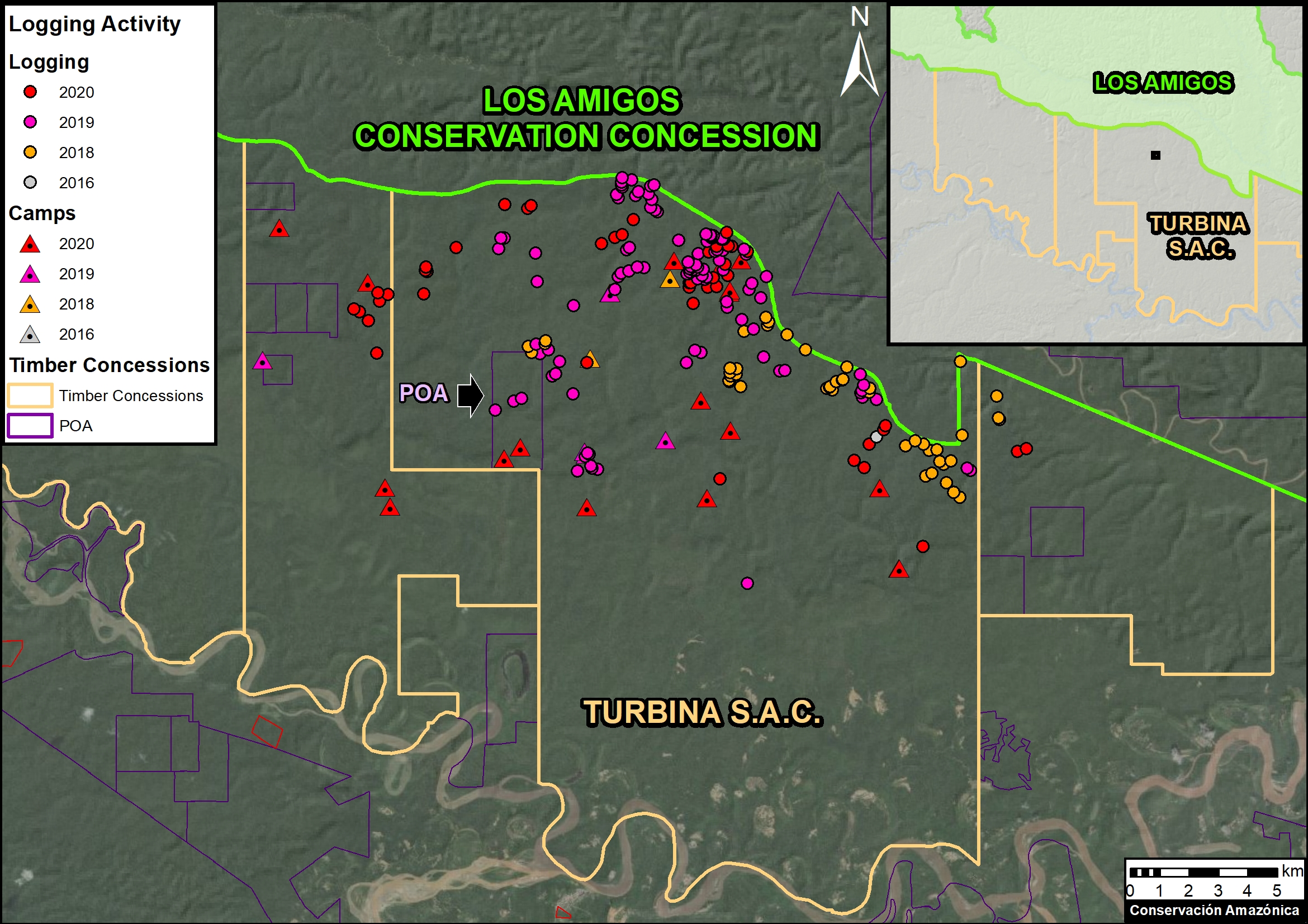
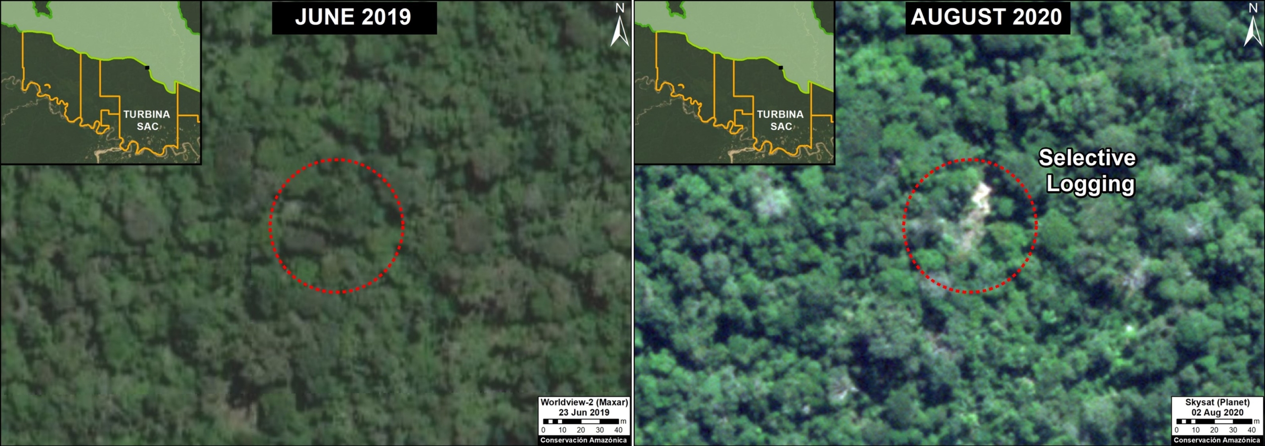
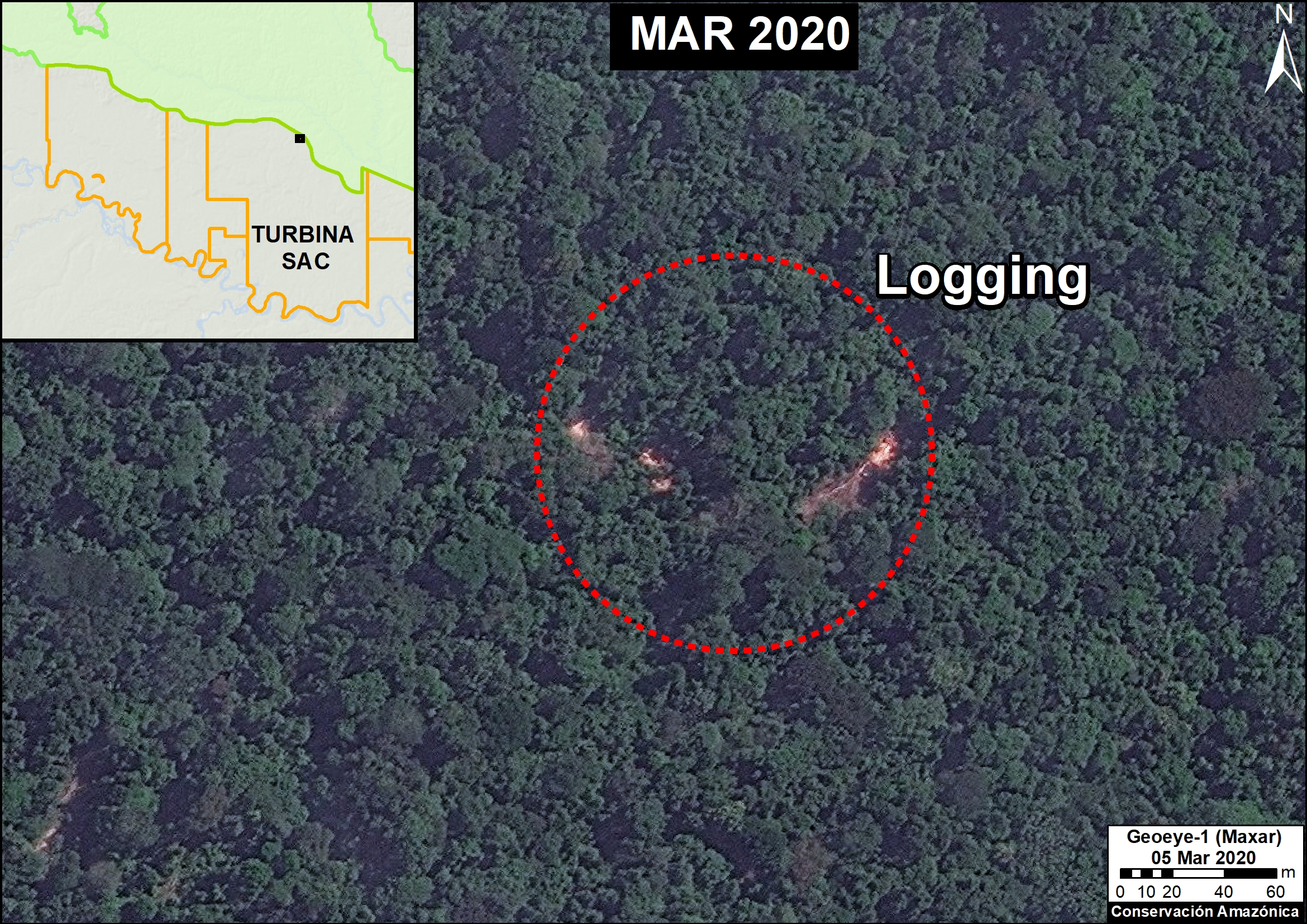
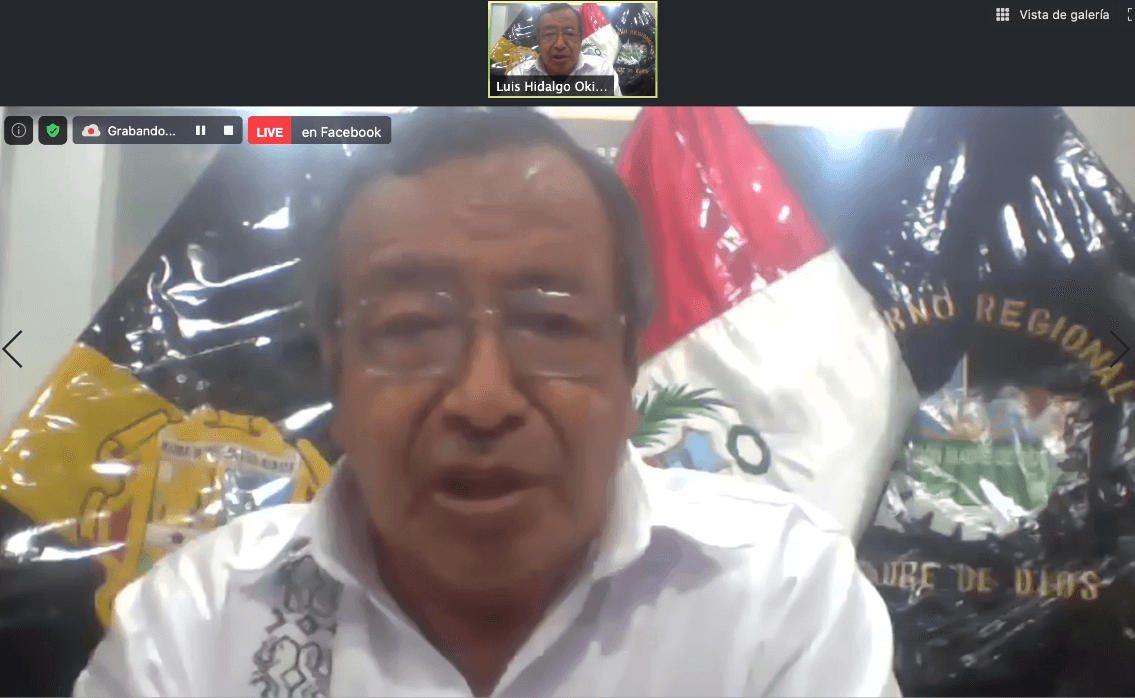 Luis Hidalgo Okimura added his perspective as the Regional Governor of Madre de Dios, Perú, saying that “From the regional level in Madre de Dios, a technological platform has been implemented to visualize the use and occupation of the territory. This allows us to identify the location of illegal activities such as mining or logging.”
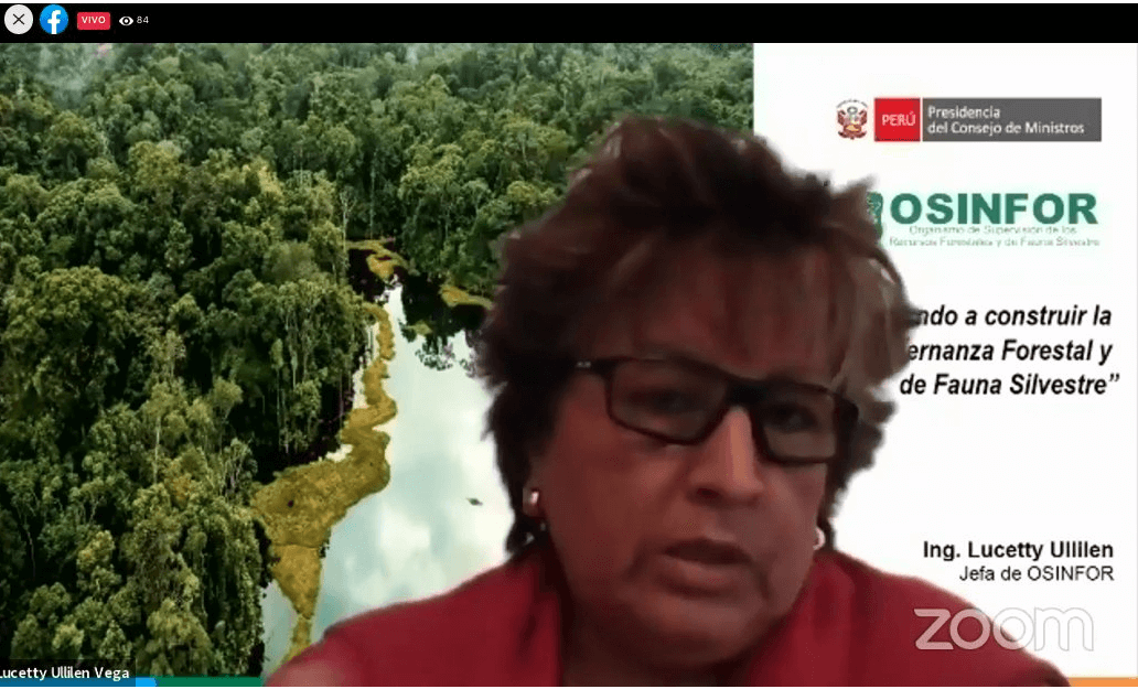 Lucetty Ullilen, Head of the Forest Resources and Wildlife Supervision Agency (OSINFOR) of Peru spoke about the expectation of improved interoperability between all these different organizations and agencies. “Our expectations are to continue innovating and articulate the different platforms for working with each other and between agencies. It is important to build a process that allows the application of new technologies to monitor and identify risk factors. We are looking at how we can optimize our supervisions to develop our actions using satellite images, drones etc. The idea is that we have to implement them well for them to be effective.”
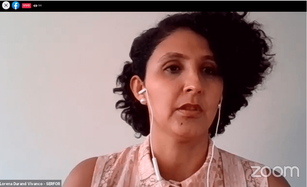 Lorena Durand, advisor to the Executive Directorate of the National Forest and Wildlife Service (SERFOR) in Peru talked about her agency’s role saying that, “The role of SERFOR is to accompany and monitor the regional governments in the implementation of their control and surveillance actions, for the legal and technological tools that have been created. We have been in talks with OSINFOR to exchange information between systems, so that we have the same information to make decisions. “
In conclusion, the panelists agreed that government interoperability is an ongoing challenge. It’s hard to ensure platforms & different activities carried out within the state can work collaboratively, but Vice Minister Gabriel Quijandría noted that everyone is in it together. Because the area that each agency can cover is still limited, there must be a way where information can be installed & shared because to visualize the world of interoperability of interconnected platforms there must be a uniform standard.
Click here to read more takeaways from #AmazonTEC2020:
- Experiences on the Ground Using Technology
- Advancements of Technology for the Conservation of the Amazon
- Public Policy, Governance and Technology for the Protection of the Amazon
- Towards a Regional Agenda for Action in the Amazon
- Building a Sustainable Amazon Through Science, Technology, and Governance


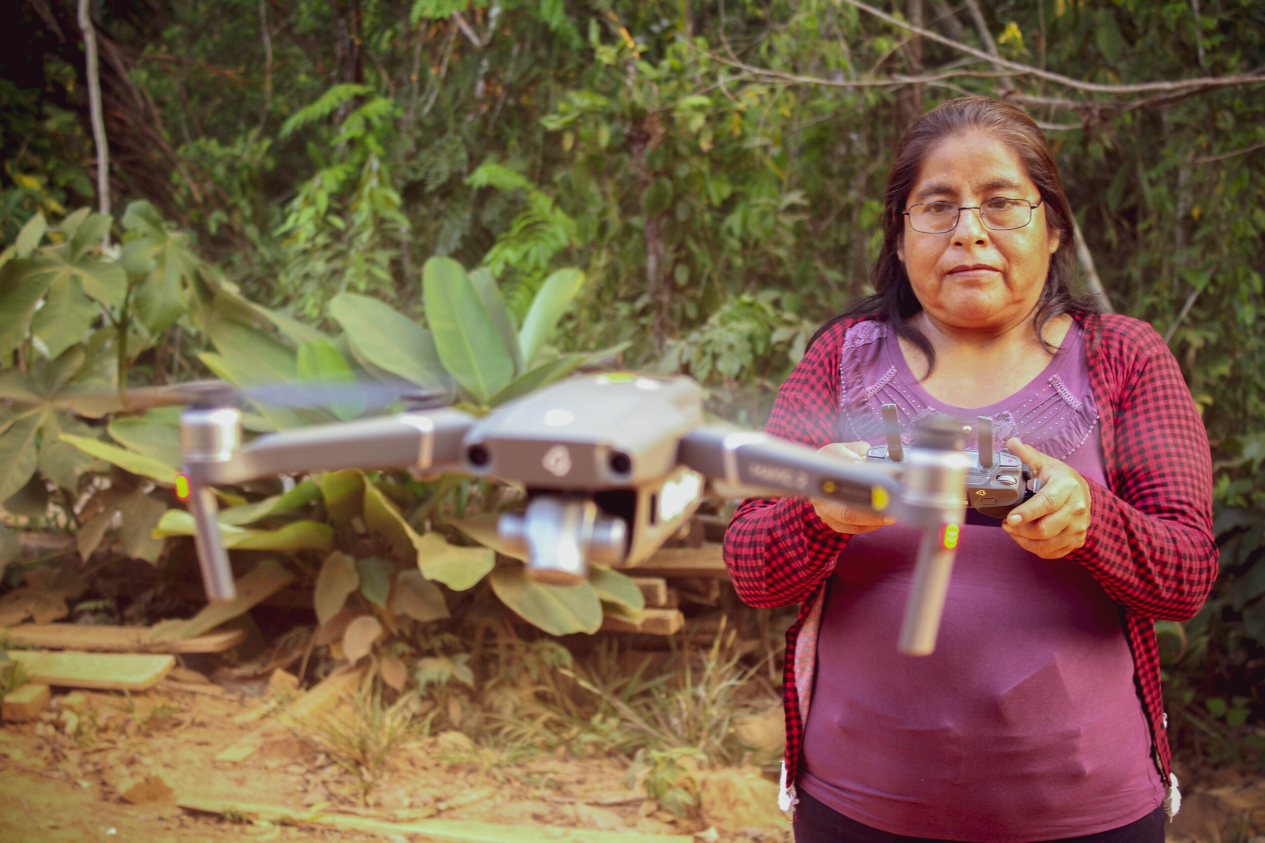
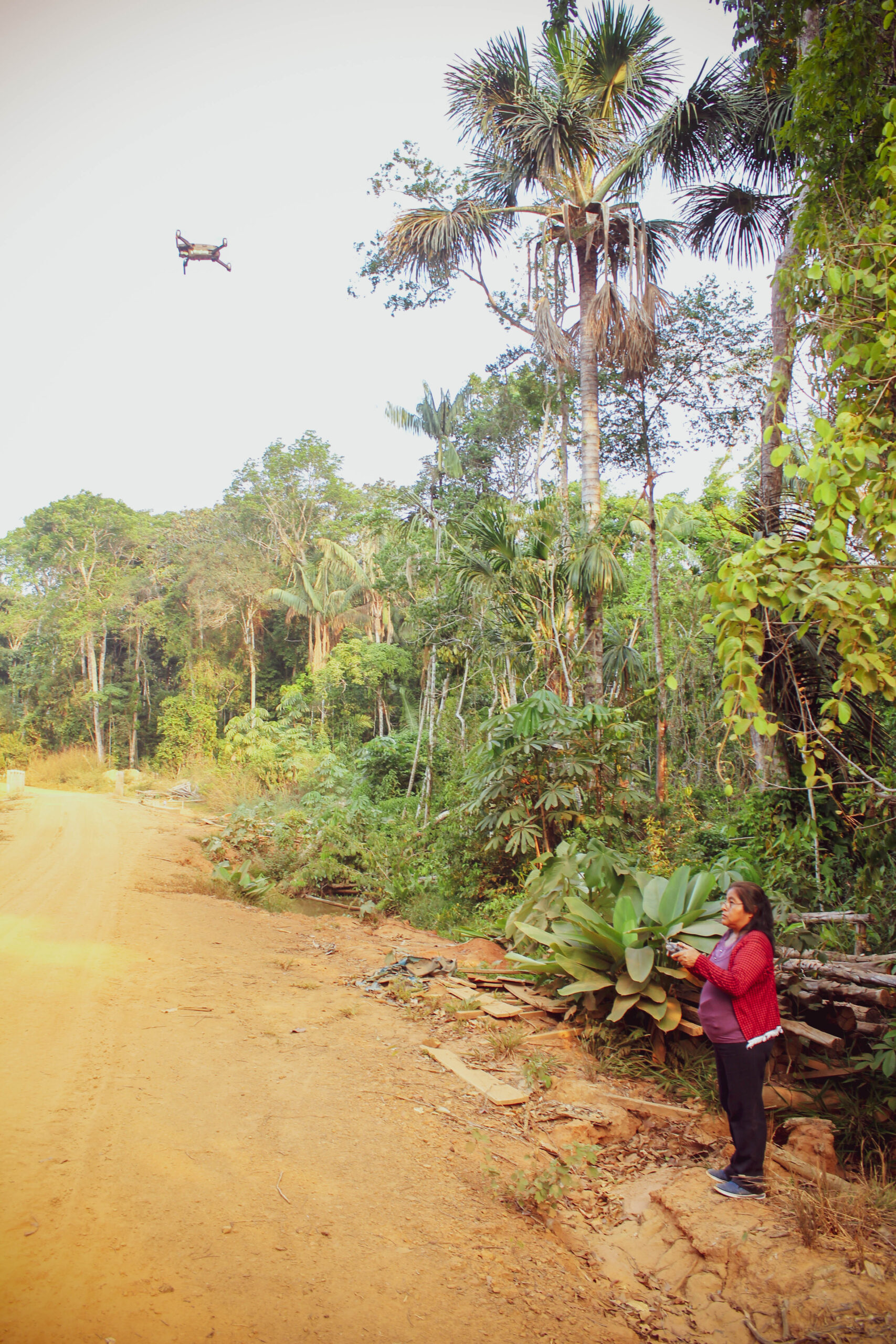
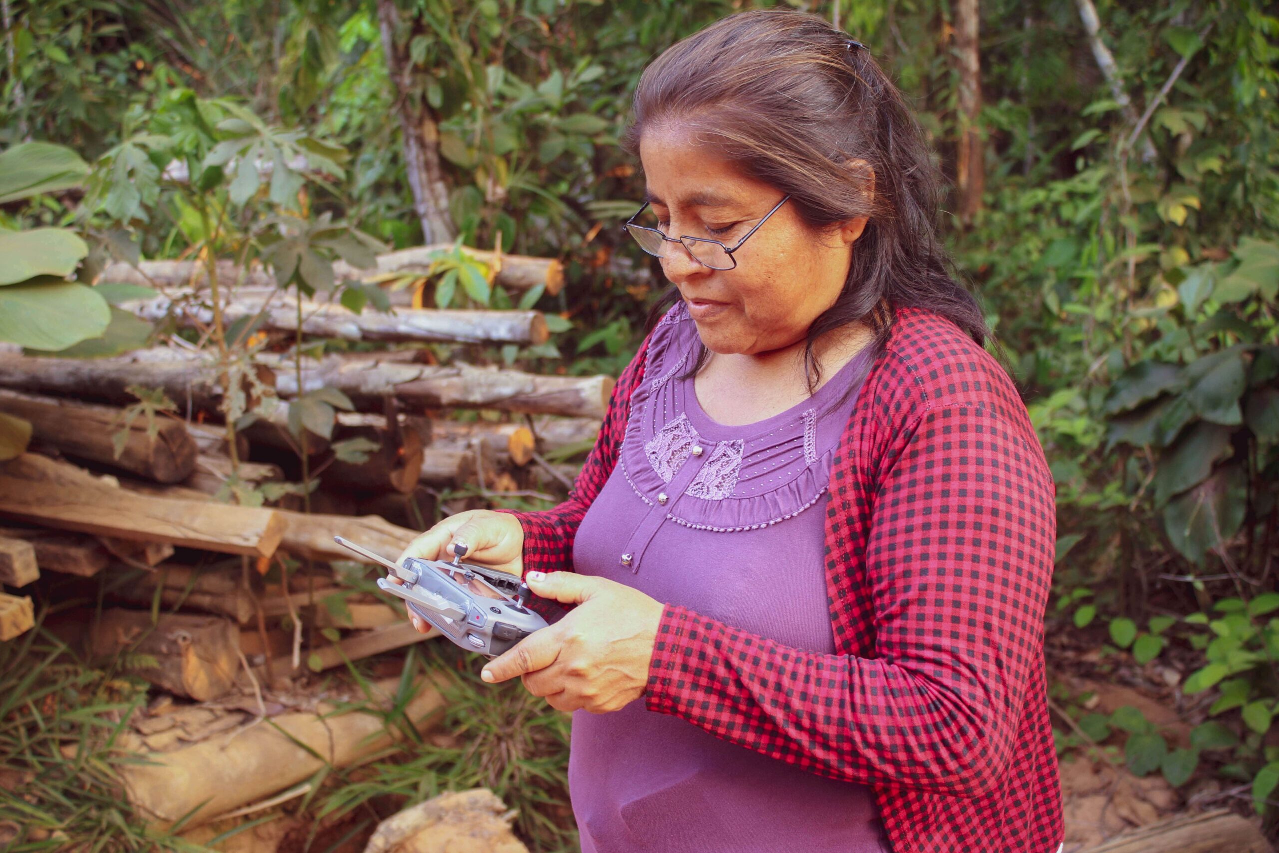
 received all the technology she needed to do regular surveillance of her forest remotely, including a Mavic 2 drone, an iPhone 7 plus to run satellite monitoring smartphone apps, a computer and a printer.
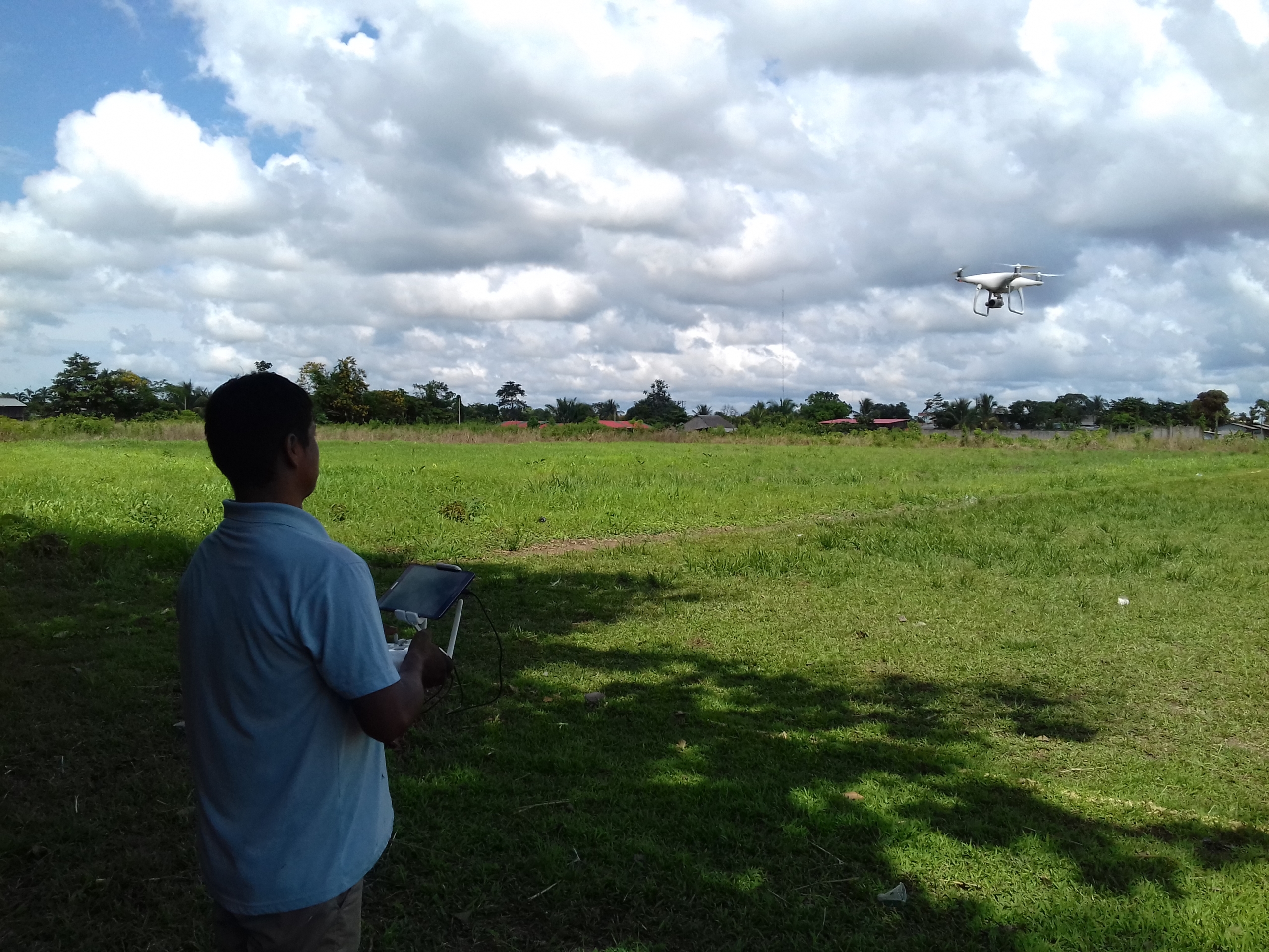
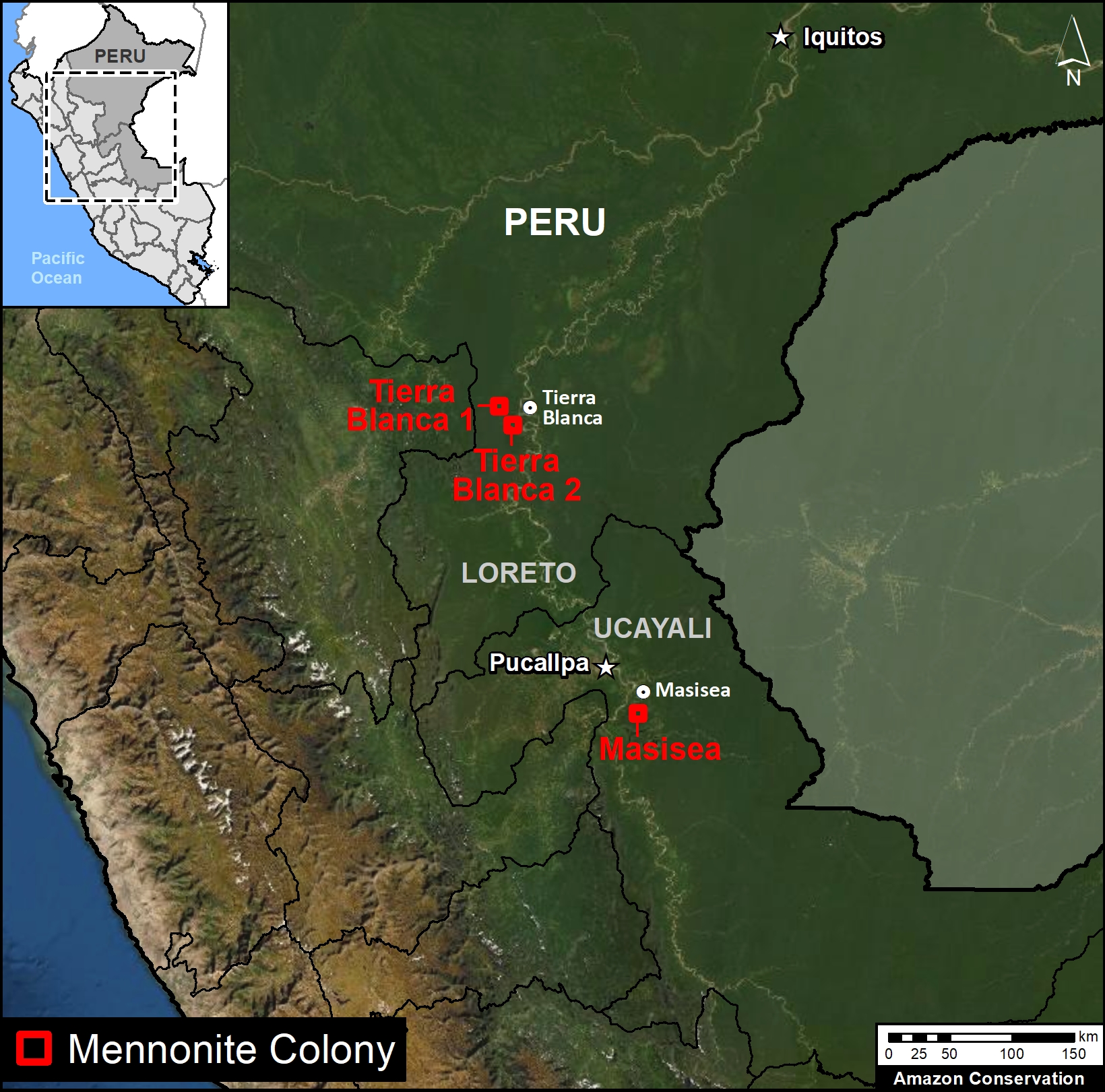
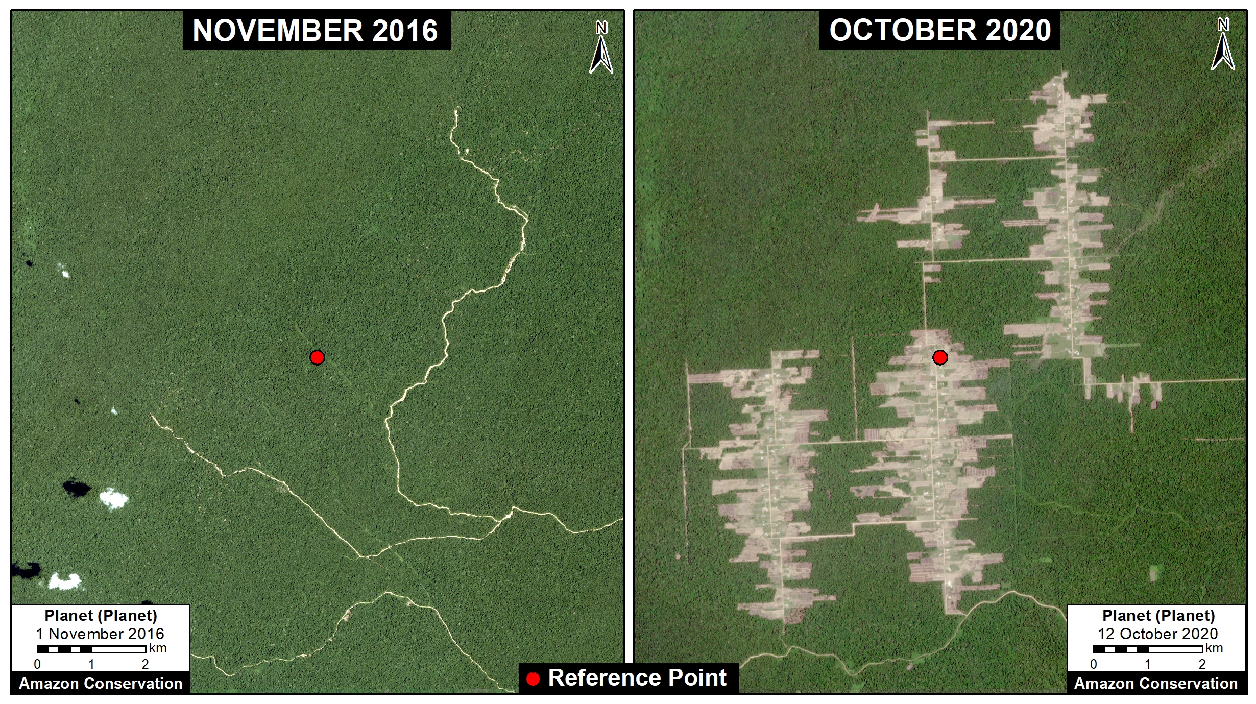
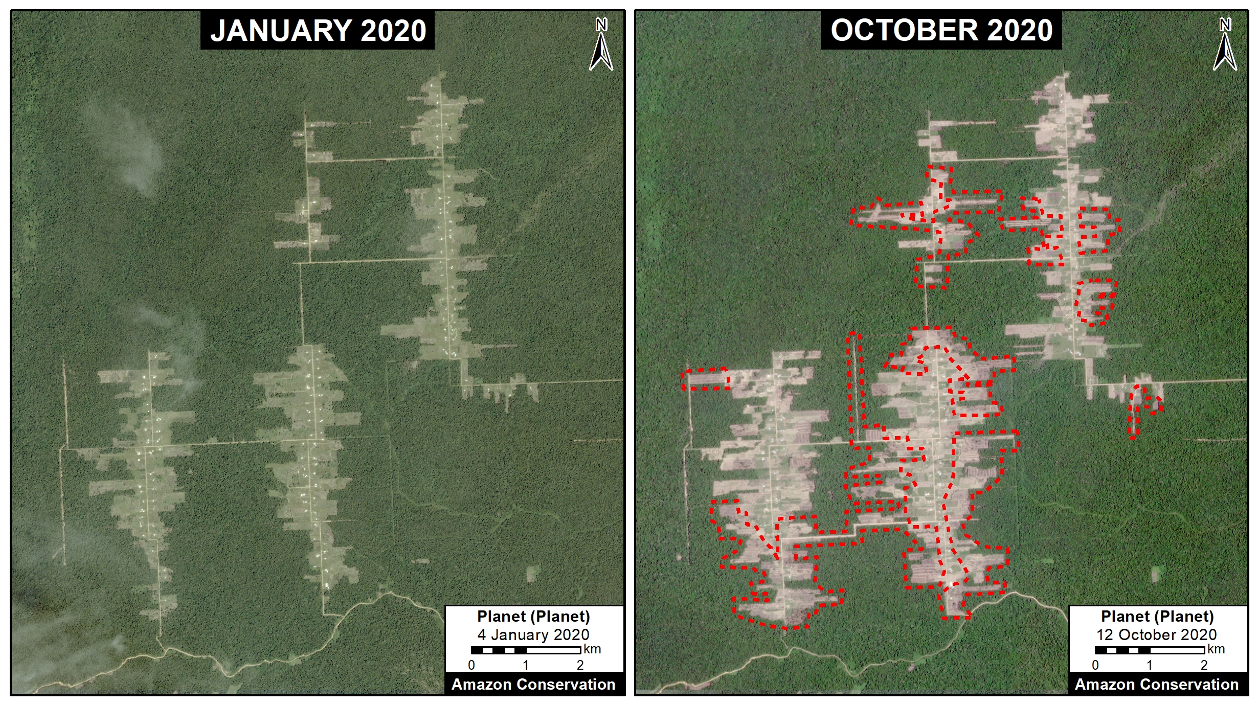
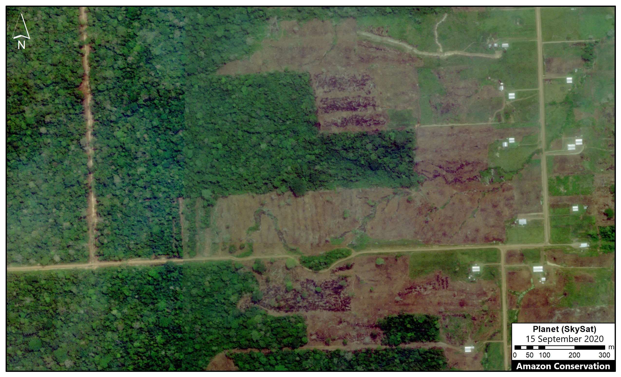
 This report was conducted with technical assistance from USAID, via the Prevent project. Prevent is an initiative that, over the next 5 years, will work with the Government of Peru, civil society, and the private sector to prevent and combat environmental crimes in Loreto, Ucayali and Madre de Dios, in order to conserve the Peruvian Amazon.
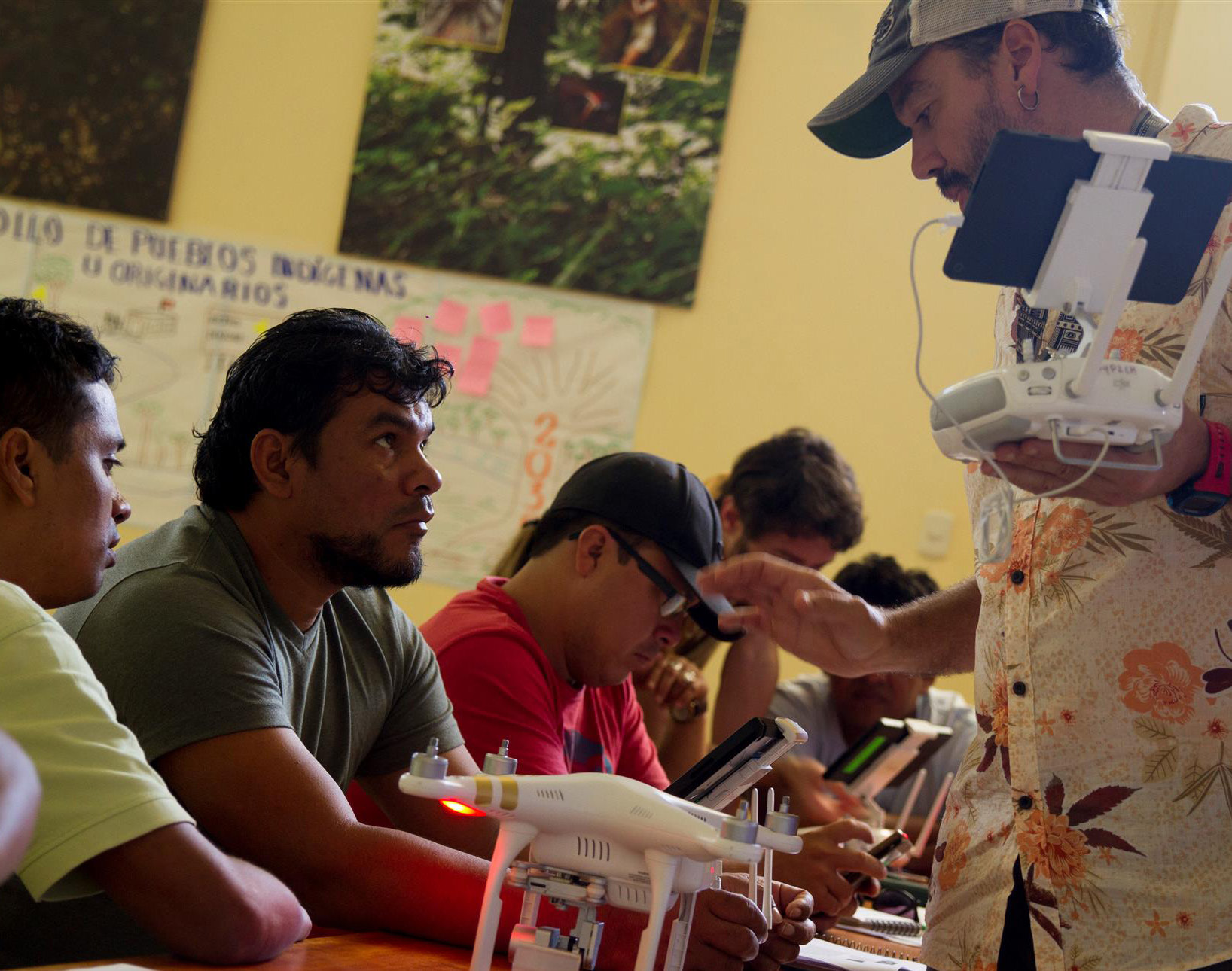

 Loading...


