
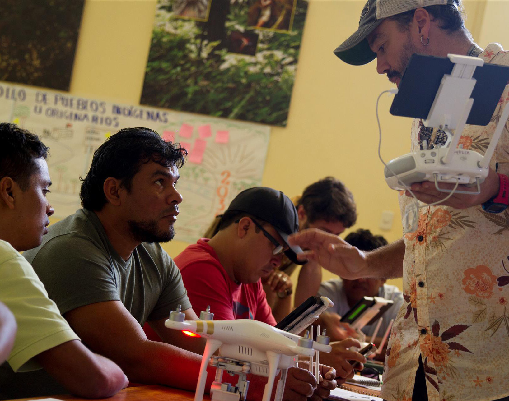
 Our Southwest Amazon Drone Center is training local landowners, forest users, indigenous communities, students, and government officials to use cutting-edge satellite, smartphone, and drone technology to monitor and stop deforestation. We provide local people with the technology, knowledge, legal support, and connections they need to safely and effectively take action.
In 2019, we trained and certified 89 individuals in using drones and smartphone apps to detect illegal activities in remote areas of their forests, and report them using drone imagery as legally-admissible evidence for law enforcement to be able to take action and prosecute offenders.
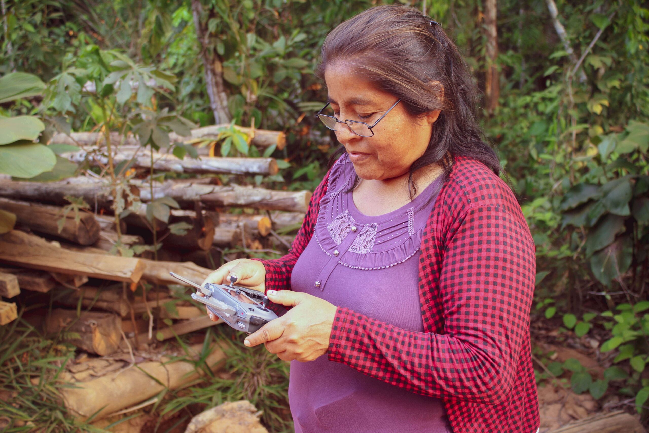 Sixteen of the new users were women, and their numbers continue to increase as we focus on their inclusion in this type of training. We also trained and helped the local association of forest users known as ACOMAT in carrying out 26 patrols using their newly-acquired technological capabilities (drones, satellite imagery and/or mobile applications). These patrols detected 16 incidents of illegal activity in 9 areas, and a total of 5 criminal complaints were filed with the local government of the Madre de Dios region of Peru, which are currently being addressed by the authorities. We were also able to hold six specialized trainings for volunteer community park guards (called Forest Custodians), who combine our technology with their traditional foot patrols inside protected areas.
Beyond directly providing the actual drone and smartphone technology to these communities and individuals, we also provide continued training, certifications, and drone maintenance workshops to support their long-term fight to keep forests protected. This approach has been become so successful that it is known as the “ACOMAT Model” in Peru, and, due to its high demand, we are beginning to replicate it in other areas of Peru in addition to making it available to other countries in the Amazon.
All in all, this work marks a key first step for communities to effectively engage the government and compel them to take action by providing clear evidence of illegal activities in a timely (meaning in real time – while the illegal activity is still going on), cost effective, high-tech way.
Click here to read how ACOMAT members were recently able to detect illegal logging via drones.
Special thanks to The Sheldon and Audrey Katz Foundation, the members of the Cloud Appreciation Society, the
Norwegian Agency for Development Cooperation, and all individuals and organizations whose generous support made this project possible.
 Amazon Conservation’s sister organization Conservación Amazónica – ACCA, with support from Google.org, just finished up a two-year initiative that trained community members to use cutting-edge satellite and field technologies to combat deforestation in the southern Peruvian Amazon, now protecting over 150,000 acres of lowland forests.
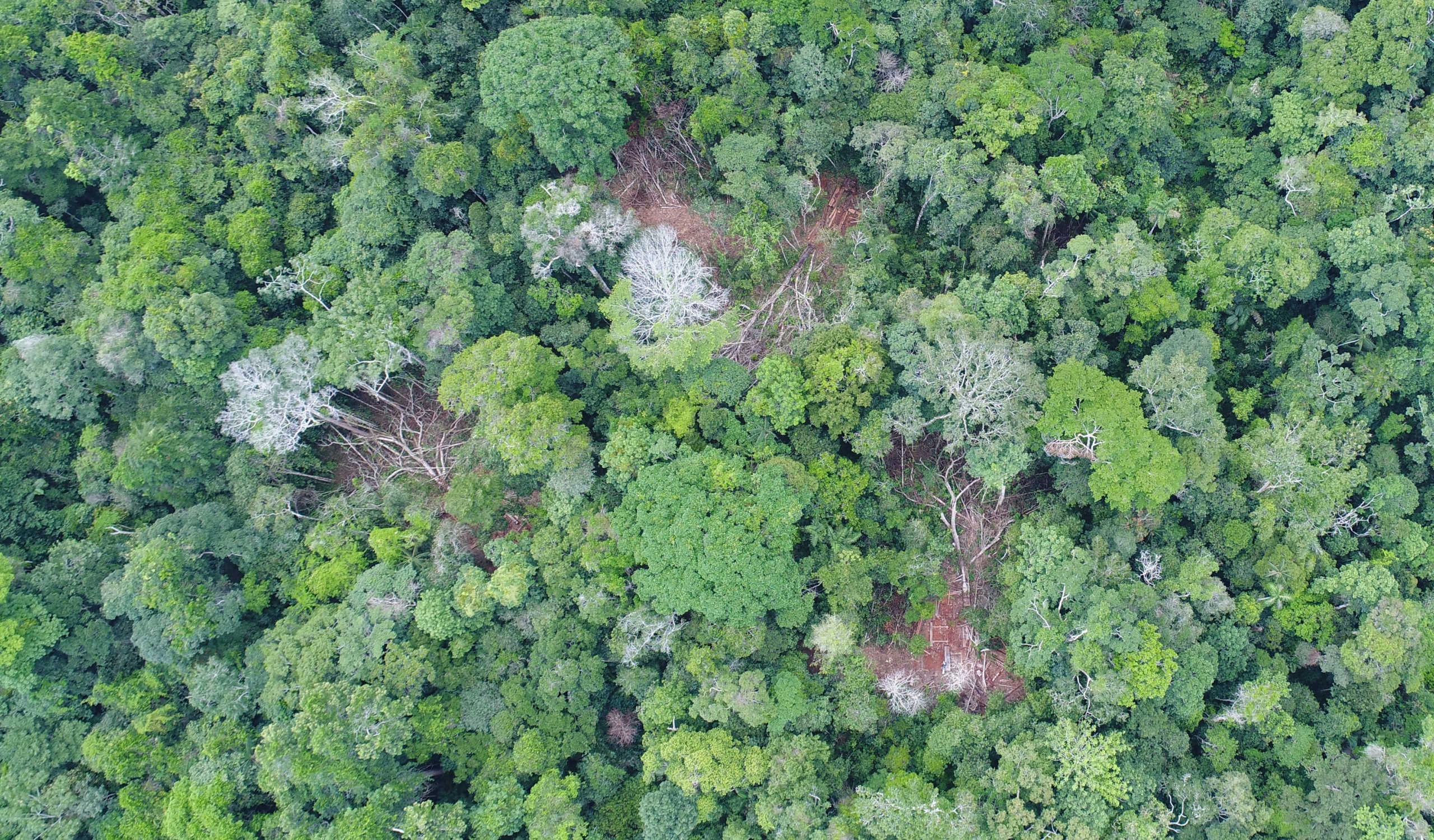
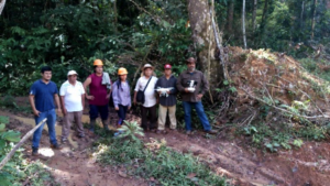 Before this program, concessionaires and their communities lacked capacity to monitor these large, remote areas and a way to rapidly and safely report deforestation in their territories. Our innovative methodology of combining real-time satellite imagery analysis and drone field technology (which includes smartapps and other technologies developed by Google) with legal training, gave concessionaires the ability to detect and report deforestation as it happened in their territory. This is a stark contrast from before, when the only way to monitor thousands of acres of forests was through foot patrols that took days to complete.
  Through this program, over 153,000 acres (62,000 hectares) of forests are now monitored and protected with technology by the local people we empowered. Moreover, technological kits were donated to each individual or local association, each containing a drone, a maintenance kit, a laptop and a printer, giving them the knowledge and tools needed to safeguard forests..
 The project, led by our director of our Southwest Amazon Drone Center, Carlos Castañeda, will continue to provide technical support to maintain the donated drones and training to reinforce what they learned, as well as be available to answer any questions that may arise during monitoring and surveillance of their concessions. Thus, the continuity of the project and its sustainability are ensured.
 Loading...


