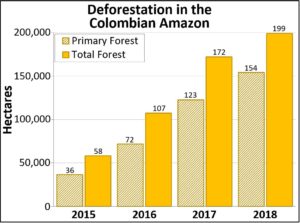
MAAP #93: Shrinking Primary Forests of The Peruvian Amazon

The primary forests of the Peruvian Amazon, the second largest stretch of the Amazon after Brazil, are steadily shrinking due to deforestation.

Base Map. Data: SERNANP, IBC, Hansen/UMD/Google/USGS/NASA, PNCB/MINAM, GLCF/UMD, ANA.

Here, we analyze both historic and current data to identify the patterns.

The good news: As the Base Map shows, the Peruvian Amazon is still home to extensive primary forest.* We estimate the current extent of Peruvian Amazon primary forest to be 67 million hectares (165 million acres), greater than the total area of France.

Importantly, we found that 48% of the current primary forests (32.2 million hectares) are located in officially recognized protected areas and indigenous territories (see Annex).**

The bad news: The Peruvian Amazon primary forests are steadily shrinking.

We estimate the original extent of primary forests to be 73.1 million hectares (180.6 million acres). Thus, there has been a historic loss of 6.1 million hectares (15 million acres), or 8% of the original. A third of the historic loss (2 million hectares) has occurred since 2001.

Below, we show three zooms (in GIF format) of the expanding deforestation, and shrinking primary forests, in the southern, central, and northern Peruvian Amazon.

A bird rarer than a Jaguar: An encounter with a Tiny Hawk

Bluish-fronted jacamar (Galbula cyanescens) located in bamboo at LABO. PC: Tom Matia

At the time of my encounter, I did not realize the rarity of the event. I was walking across an old channel of the Los Amigos River that is in its early successional stages. There are no tall trees, instead, there are many shrubs covered in vines. Bordering this channel are the towering trees of the floodplain forest, making this edge habitat an ideal location for a Tiny hawk (Accipiter superciliosus) (Global Raptor). I had just walked past a resting bluish-fronted jacamar (Galbula cyanescens) when my eye caught a glimpse of a bird careening through the vegetation. I followed the shadow through the vegetation and, in the clearing that the trail made behind me, watched a small flying raptor raise its feet forward and pin the bluish-fronted jacamar to its perch.

A photo taken through binoculars of the Tiny Hawk after pinning the jacamar to its perch. PC: Tom Matia

The small raptor (22-28cm/8-11in) is known to be a specialist at predating on avifauna and had the jacamar in its grip (Global Raptor). It seemed the attack would prove fatal as there was hardly a fight from the jacamar. The hawk soon took notice of my presence and, not wanting to disrupt its natural behavior and its success, I walked away from the scene. A few hours passed by the time I returned to investigate the scene; there was not a feather or scrap to be found. This could mean two things, the jacamar made it out the talons of the tiny hawk, however, due to the elongated nature of their talons, I choose to believe that the later, the jacamar left the scene in the grasp of the hawk.

When I returned to eat dinner, I learned that little is known about this species of raptor and that the sighting was very rare! Looking further into this species, I discovered that there is hardly any information on their populations. With the help of citizen science, specifically from eBird by Cornell University, I found that only 130 observations have been recorded in Peru over the past ten years. With such little documentation on this uncommon bird, it is alarming that they are estimated to lose 19-24% of suitable habitat in the next twenty-two years (BirdLife).

The Tiny hawk has an assumed population of 670-6,700 individuals and is currently listed as ‘least concern’ by the IUCN, and BirdLife, due to its expansive range (BirdLife). Hearing these statistics shocked me and I immediately searched population sizes of species that are rare to see. The jaguar (Panthera onca), an animal that is incredibly elusive, yet possibly more likely to be encountered, has roughly 15,000 individuals according to the WWF (Quigley). And so I thought, “a tiny hawk is not something you see every day”.


References:

Global Raptor Information Network. 2018. Species account: Tiny Hawk Accipiter superciliosus. Downloaded from http://www.globalraptors.org on 15 Sep. 2018
BirdLife International (2018) IUCN Red List for birds. Downloaded from http://www.birdlife.org on 16/09/2018.
Quigley, H., Foster, R., Petracca, L., Payan, E., Salom, R. & Harmsen, B. 2017. Panthera onca(errata version published in 2018). The IUCN Red List of Threatened Species 2017. Downloaded on 15 September 2018.

MAAP #92: New Deforestation Threats In The Peruvian Amazon (Part 2: Agriculture Expansion)

In this ongoing series, we describe major new projects that may lead to the rapid deforestation of large areas of primary Amazon forest.

The first report (MAAP #84) described the deforestation associated with the construction of the Yurimaguas – Jeberos road (see Base Map), which crosses extensive primary forest and a priority site for conservation in the Loreto region.

Base Map. Data: SERNANP, MAAP

The current report describes the deforestation associated with major agricultural expansion in three areas in the northern Peruvian Amazon, referred to here as the “Imiria,” “Orellana“, and “San Martin” cases.

These three cases are important because they present characteristics of large-scale, agro-industrial activities (linear plots organized around an extensive new access road network).

In all three cases, early warning alerts (GLAD/Global Forest Watch) initially detected the deforestation in 2017 (see MAAP #69) and their subsequent expansion in 2018. The total deforestation documented to date in these three cases is 3,600 acres.

Below, we show satellite images of the most recent deforestation due to agricultural expansion in these three areas. In these images, yellow circles indicate 2016-17 deforestation and red circles/arrows indicate the most recent 2018 deforestation.

MAAP #91: Introducing Perusat-1, Peru’s New High-Resolution Satellite

In September 2016, Peru’s first satellite, PeruSAT-1, launched. It is Latin America’s most powerful Earth observation satellite, capturing images at a resolution of 0.70 meters.

PeruSat-1. Credit: Airbus DS

The cutting-edge satellite was constructed by Airbus (France) and is now operated by the Peruvian Space Agency, CONIDA.

The organization Amazon Conservation was granted early access to the imagery to boost efforts related to near real-time deforestation monitoring.

Below, we present a series of PeruSAT images that demonstrate their powerful utility in terms of detecting and understanding deforestation in the Peruvian Amazon.

Following the ants

If you find yourself in the rainforest, it is almost impossible to miss the endless organized columns that army ants form. This group of ants are carnivorous and forage in swarms, raiding everything in their way. If you are not fast enough, you will fall prey to these voracious predators no matter how big you are. If you do outrun them, there are different predators waiting to trap you. Even if you are not an expert birder you probably have heard of Antbirds. This insectivorous group of birds belongs to the family Formicariidae and forage by following army ants. Eciton burchelli and less often Labidus praedator are the species of army ants that Antbirds follow. As simple as this may seem, the relationship is more complex than it sounds, as not all Antbirds are obliged to follow ants.

Hairy-crested Antbird (Rhegmatorhina melanosticta) perched above an army ant swarm | Photo by Will Sweet

This foraging behavior has no counterpart outside the tropics but within them, you can find ant-followers in different altitudes and elevationsDifferent species attend the raids with different frequencies. The species that regularly attend them and that in some cases depend entirely on the raiding to find their food are known as obligate, or true, Antbirds. A different name is given to the birds that follow the swarms but are also capable of foraging independently of them, they are referred to as regular followers. Lastly are the opportunistic followers, the species that are only seen foraging when the swarm crosses their territory, for which up to 70 species have been identified. In this grouping, there are some non-insectivorous species that opportunistically take advantage of the raid.

Obligate Antbirds, exclusively found in the Amazon region, are limited to the family Thamnophilidae, also known as typical Antbirds. 16 species have been recorded that completely depend on army ant swarms. They depend on army ant raiding swarms to such a degree that in patches of isolated forest where army ants disappear, the Antbirds are gone within a short period of time.  The hairy-crested Antbird (Rhegmatorhina melanosticta), a not easily seen Los Amigos resident, is an example of an obligate Antbird that depends solely on army ants year-round and can be seen in Terra Firme perching low to the ground feasting at the army ants expense.

Following the raids can provide more food than one individual can eat. But for obligate Antbirds, having developed such specialized foraging behavior has its shortcoming. The frequency, abundance, and distance away from their meals depend on the life cycle of army ants. Their life cycle alternates between periods of mobility and stillness, which makes their presence and location in a forest patch unpredictable. Due to army ants’ mobility, their nests are not as you may imagine. They don’t build a nest to live in; rather they sleep in bivouacs. Bivouacs are living ball-shaped nest made out of the workers that protect the queen and her brood.  They alternate between periods of low food ingestion needs and periods of activity every three-weeks, raiding to meet the food requirements of newly born larvae Because of the periods of ants’ stillness, obligate Antbirds have to wander off outside their home range looking for swarms to follow, as a result, they haven’t developed a strict territorial behaviour. In this case, evolution has favored birders; within a swarm raid you can observe several individuals of the same and different species. Make notice that individuals will defend their place along the raid, the closer to the front and the center they get the better the prey they could trap.

If you’re interested in birds, the next time you come to the tropics you might want to go for an early hike and look for the columns of army ants. If you wait patiently, you will be amazed by one of the greatest performances in the rainforest and see several species of highly adapted birds along the way.

Setting a new Big Day world record at Los Amigos!

Alex Wiebe Portrait

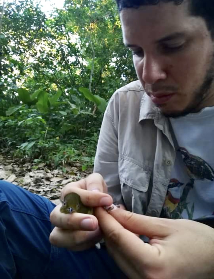
Picture of Rusty-Margin FlycatcherAlex Wiebe, a biologist and Jonathan Franzen Fellow at the Los Amigos Bird Observatory recently broke the world record for an on-foot Big Day, recording 347 species in a single day.

A Big Day is a competitive birding ‘race,’ in which the contestant attempts to see or hear as many different bird species as they can in one 24-hour period. In addition to breaking a world record, Will was also able to identify a species that is new to our Los Amigos lodge: the Rusty-margined flycatcher!

This means that we now know that Los Amigos is home to at least 598 species of birds. Congrats, Alex!

Inspiring the Conservation Heroes of Tomorrow

Environmental education in madre de dios, Peru - Photo by ACCA
Environmental education in madre de dios, Peru – Photo by ACCA

We expanded our environmental education initiative in the Madre de Dios region of Peru – an area heavily affected by illegal gold mining and deforestation. In 2018, we partnered with 5 educational institutions and have initially engaged 75 youth, between 10 to 16 years of age, in a unique environmental education program.

The program teaches kids how to use camera trap technology – from installation to data assessment – in order to understand the wildlife who share their forest home and dispel myths about them. Our local experts work with these young people to identify the species of animals they see on the camera traps and educate them on their significance and conservation value.

But the program doesn’t stop there. After analyzing information from camera trap images and videos, the kids create presentations on their findings and present them to others in their community including local government officials, helping them take a step to becoming true stewards of their forests.

By teaching kids about environmental protection early on, we not only inspire and train these conservationists of tomorrow, but they become the messengers of today by sharing this knowledge at home, affecting a change in attitude across all generations.

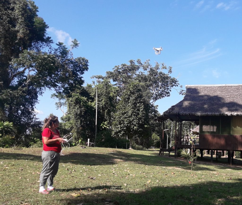
Maap #90: Using Drones To Monitor Deforestation And Illegal Logging

Drone types- helicopter and fixed-wing (plane)

For the past three years, the organization Amazon Conservation has been working to establish a sustainable, local-based drones program for environmental monitoring in the southern Peruvian Amazon (Madre de Dios region).

This program is based on two types of drones, multi-rotor (helicopter style) and fixed-wing (airplane style).

One of the main objectives is to improve the near real-time monitoring of deforestation and illegal logging.

The monitoring is currently focused on three priority areas: 1) Brazil nut concessions, 2) forestry concessions of the local association ACOMAT, and 3) along the Interoceanic Highway (see Base Map).

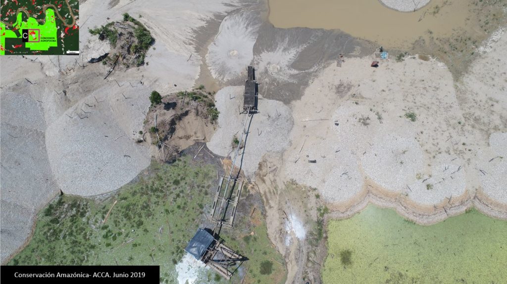
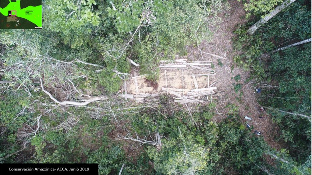
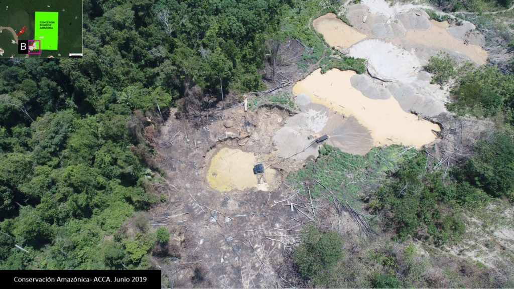
Below, we show a series of drone images that we have used to identify the drivers of recent deforestation events. These drivers include gold mining, agriculture, illegal logging, cattle pasture, and natural forest loss.
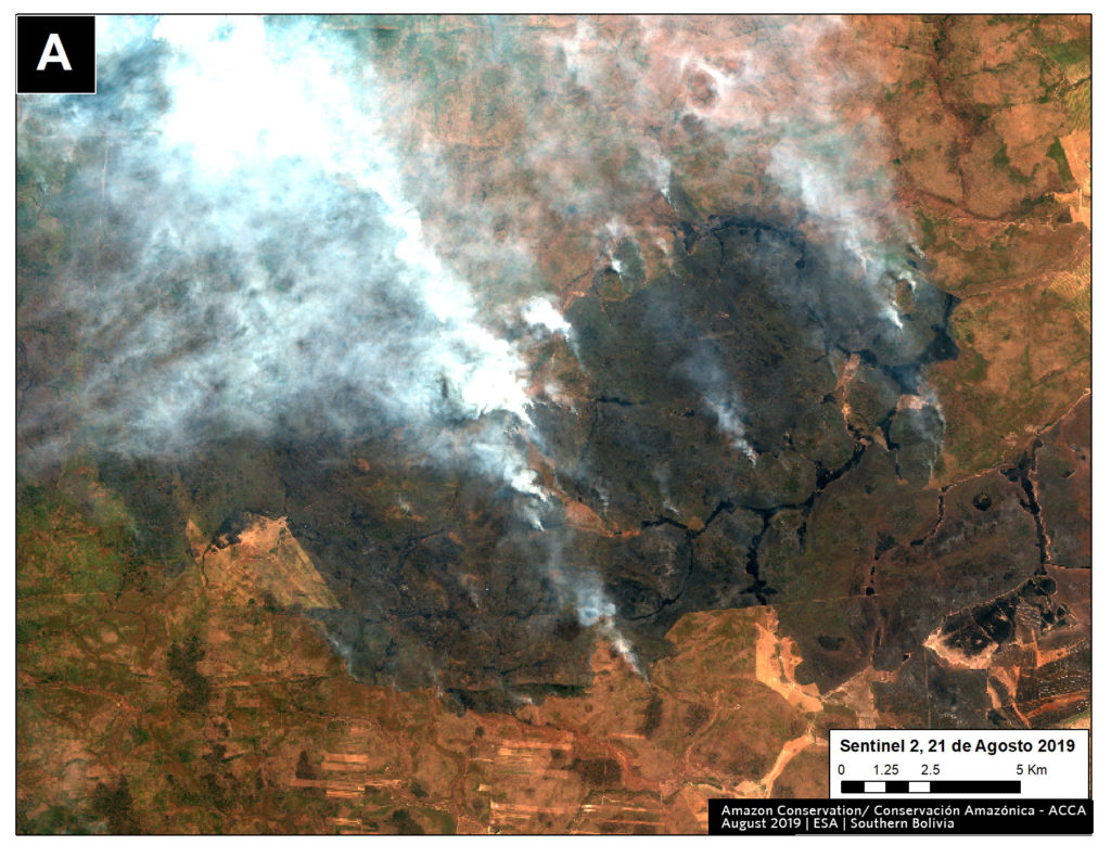
Base Map. Priority areas of the Amazon Conservation drones initiative.

Interoceanic Highway

In March 2018, in collaboration with the organization ProPurús, we realized drone flights along the Interoceanic Highway in an effort to demonstrate the possible threats of building a new road along the border with Brazil (see MAAP #76). The following images show the two main threats to the area: gold mining and small/medium-scale agriculture (<50 hectares).

Image A. Drone image- gold mining.
B. Drone image- Deforestation from agriculture (corn)

Brazil Nut Concessions

In 2018, Amazon Conservation launched a new project, funded by Google Challenge, to develop a monitoring program for Brazil nut concessions covering a million hectares (2.47 million acres) in southern Peru. For example, the following image shows the invasion of a papaya plantation that caused the recent deforestation of five acres inside a concession.

C. Drone image- Invasion of papaya in Brazil nut concession.

ACOMAT Forestry Concessions

Since 2017, Amazon Conservation has been working on a project, financed by the Norwegian Agency for Development Cooperation (NORAD), to improve the monitoring of forest concessions of the local association ACOMAT (Association of Timber and Non-Timber Forest Concessionaires of the Provinces from Manu and Tambopata). The following images show examples of forest loss and degradation due to illegal logging, cattle grazing, natural loss (windstorm), and gold mining.

D. Drone image- illegal logging.
E. Drone image- cattle pasture.
F. Drone image- natural forest loss from windstorm.
G. Drone image- gold mining.

Citation

Garcia R, Novoa S, Castañeda C, Rengifo P, Jimenez M, Finer M (2018) Using Drones to monitor Deforestation and Illegal Logging. MAAP: 90.

MAAP #89: Impacts Of Mining Project “Mirador” In The Ecuadorian Amazon

“Mirador” mining project in Ecuador.

The Ecuadorian Amazon is experiencing a growing number of conflicts directly related to oil and mining extraction projects.
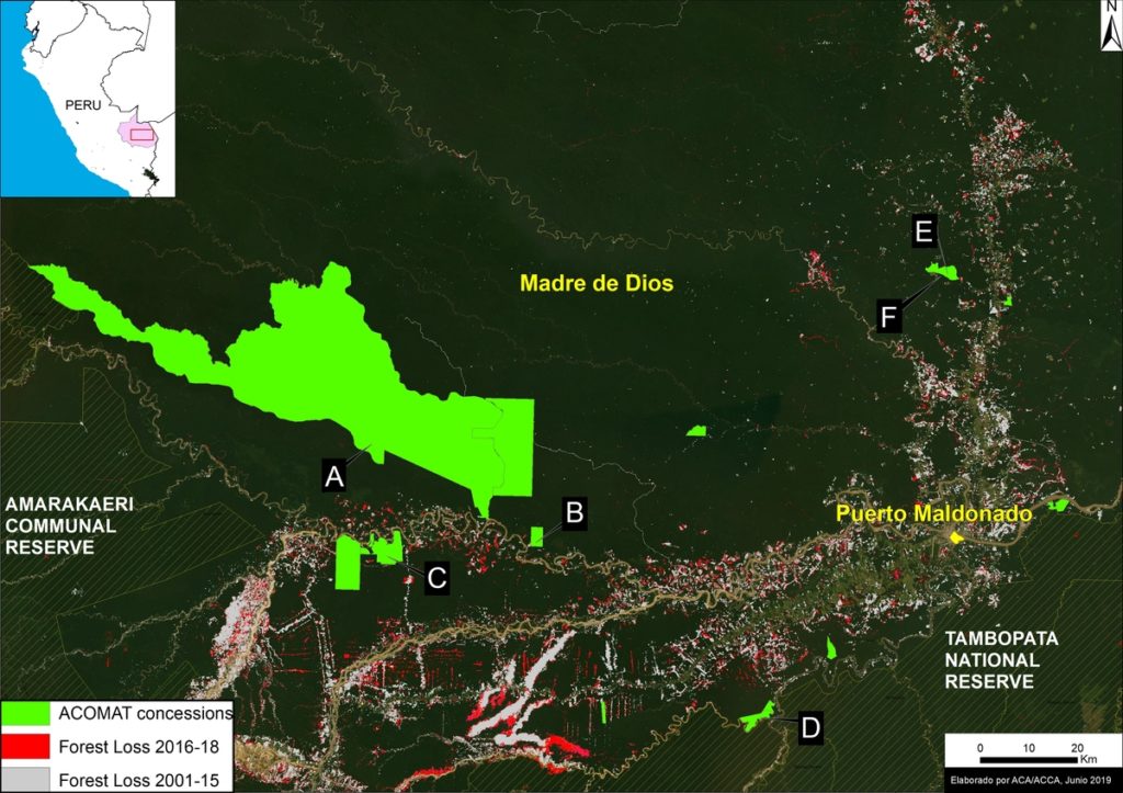
Here, we focus on the “Mirador” mining project, an open pit copper mine in the Cordillera del Cóndor, a mountain range along the Ecuador/Peru border that hosts a high level of endemism.

We show a series of satellite images that highlight both the environmental impacts, such as the deforestation of over 3,200 acres, and social impacts, such as the forced eviction of communities.
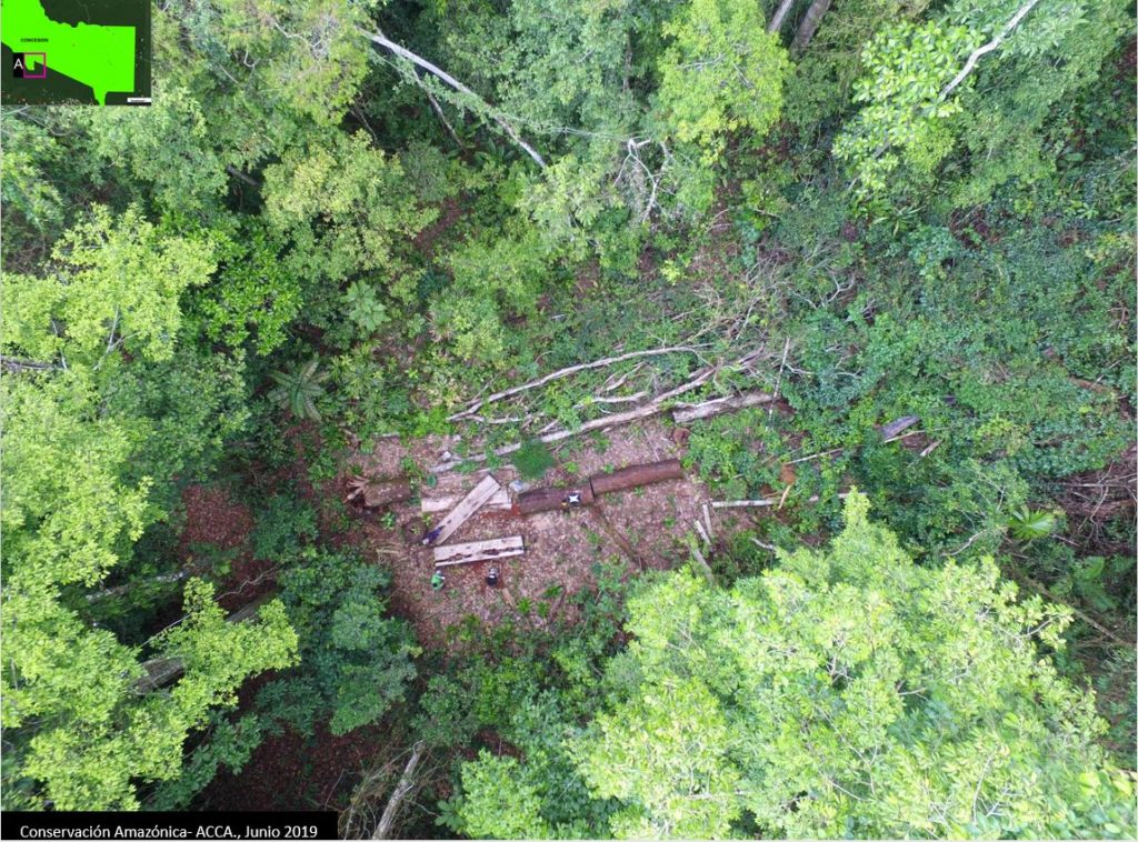
*The Ecuador series is a collaboration between Amazon Conservation, Amazon Conservation Team, and EcoCiencia, funded by the MacArthur Foundation.
https://maaproject.org/mirador-ecuador/