
Brazil is currently in high-profile negotiations with countries such as the United States and Norway for international compensation in exchange for improved action to address Amazon deforestation.*
While this may be a positive development diplomatically, on the ground extensive deforestation continues.
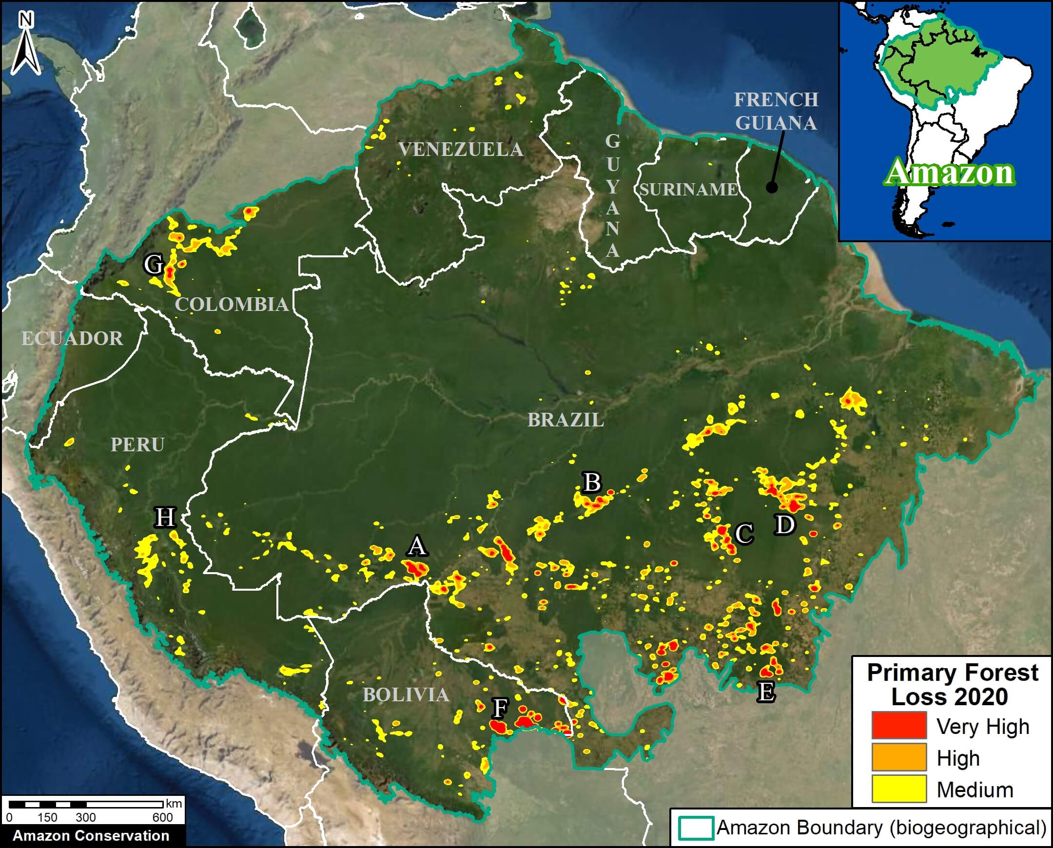
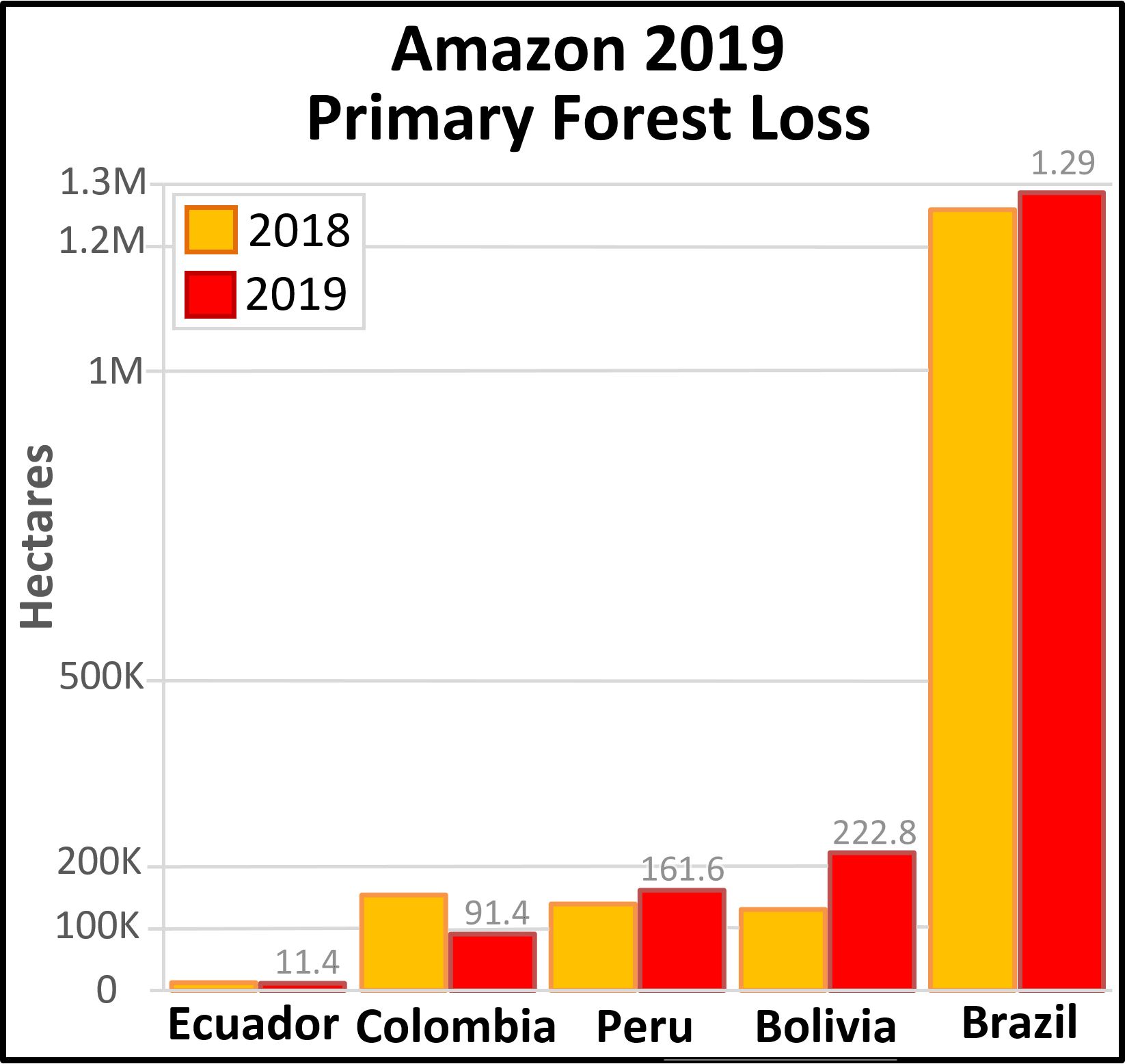
We recently reported that, in 2020, Brazil had the sixth-highest primary forest loss on record (1.5 million hectares) and a 13% increase from 2019 (MAAP #136).
Here we present a first look at 2021 Brazilian Amazon deforestation.
This early analysis is important because a) it provides real-time context for the negotiations, and b) these are the first areas that are likely to be burned in the upcoming fire season (see MAAP #129).
We first analyzed a new generation of early warning forest loss alerts, based on 10-meter resolution imagery (a major upgrade from the previous 30-meter alerts).* These alerts indicate the loss of over 175,000 hectares of primary forest thus far in 2021.
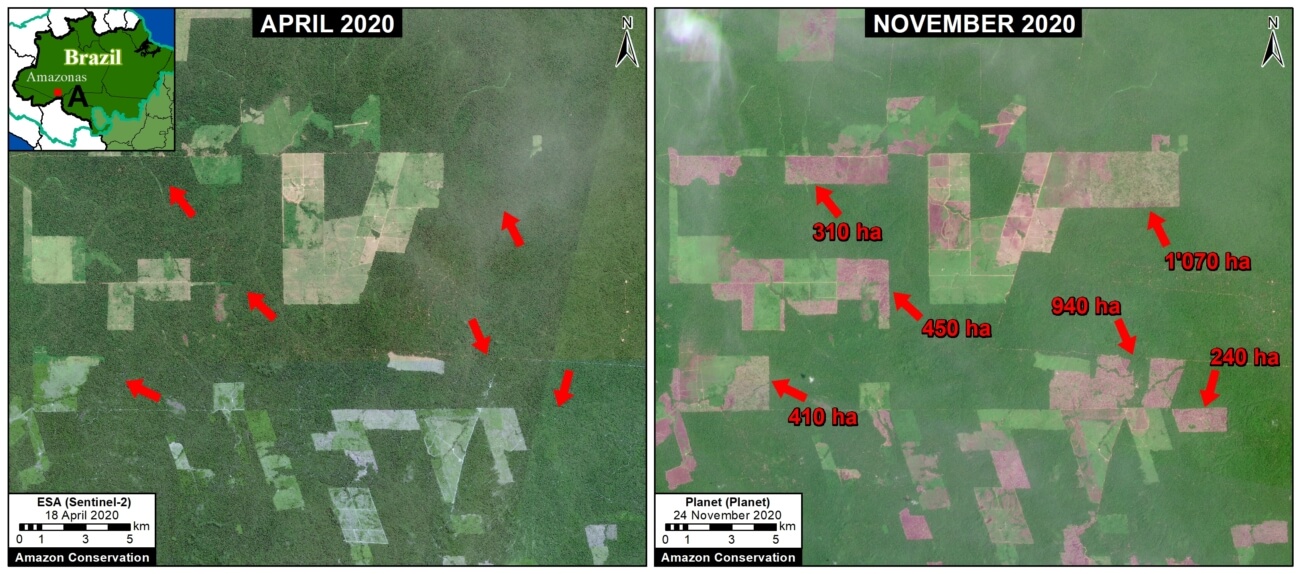
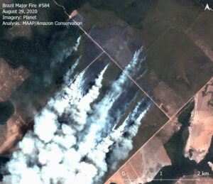
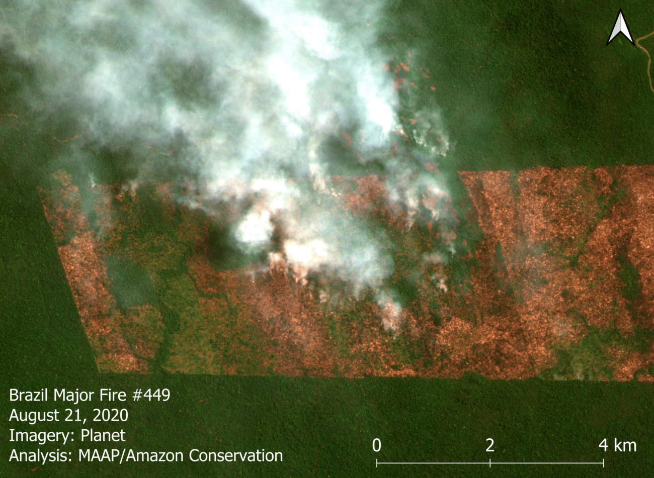
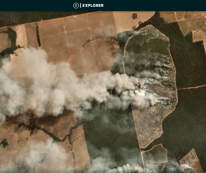
We then investigated the most urgent (large alert clusters) with even higher resolution (3 meters) satellite imagery from Planet.
Below, we present a series of high-resolution imagery videos showing key examples of 2021 Brazilian Amazon deforestation.
Forest Loss Alerts
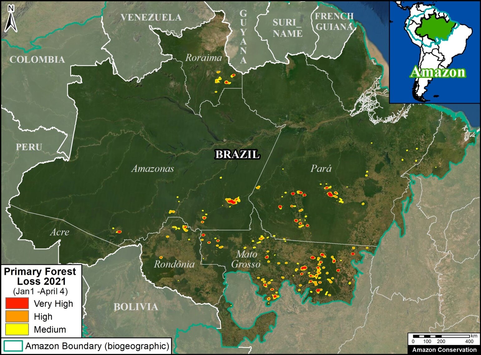
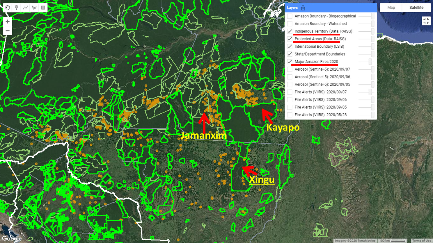
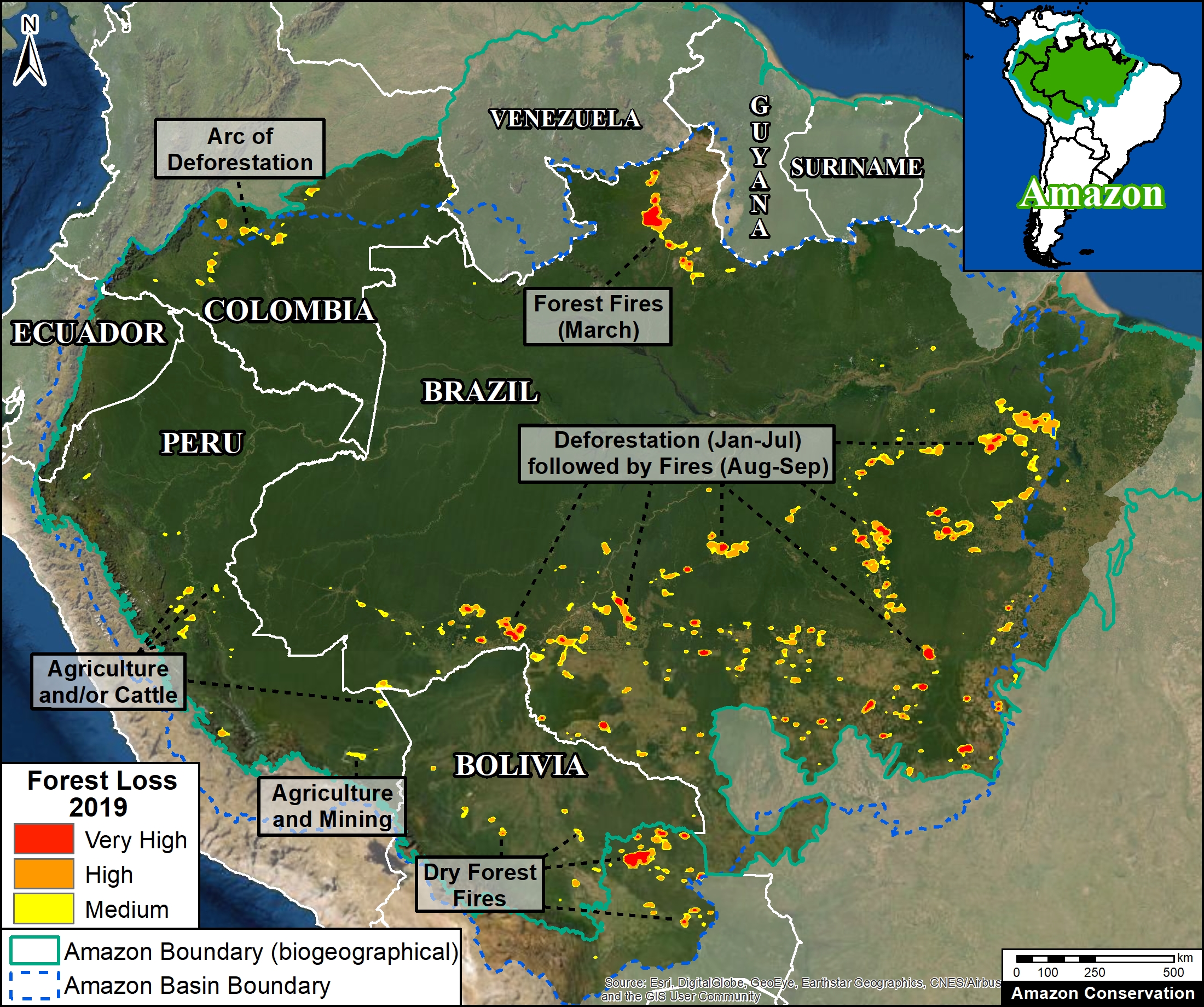
The alerts indicate the loss of 175,330 hectares of primary forest in the Brazilian Amazon between January 1 and April 4, 2021.
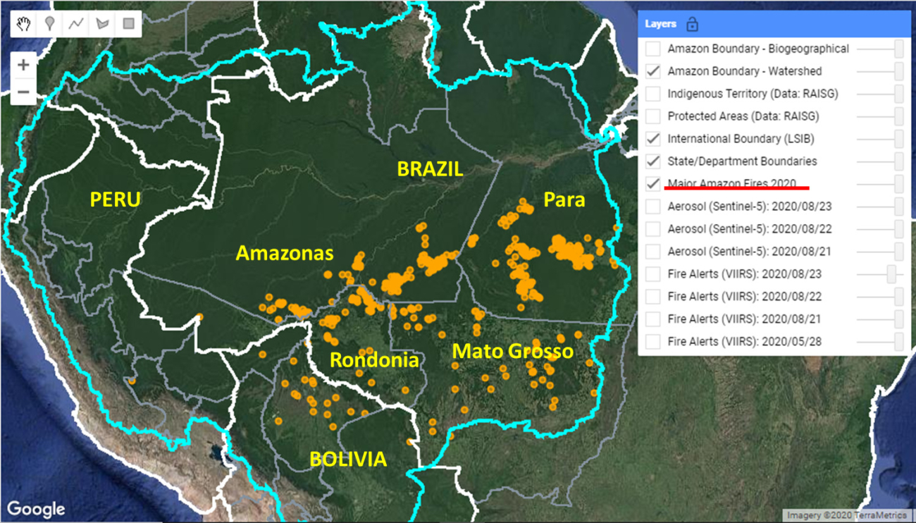
The Base Map illustrates where this deforestation has been concentrated.
Note the heavy concentrations in the states of Mato Grosso, Pará, and Amazonas, followed by Rondônia and Roraima.
High-resolution Imagery Videos
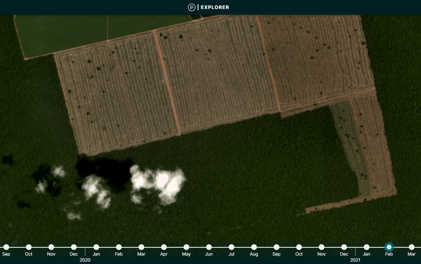
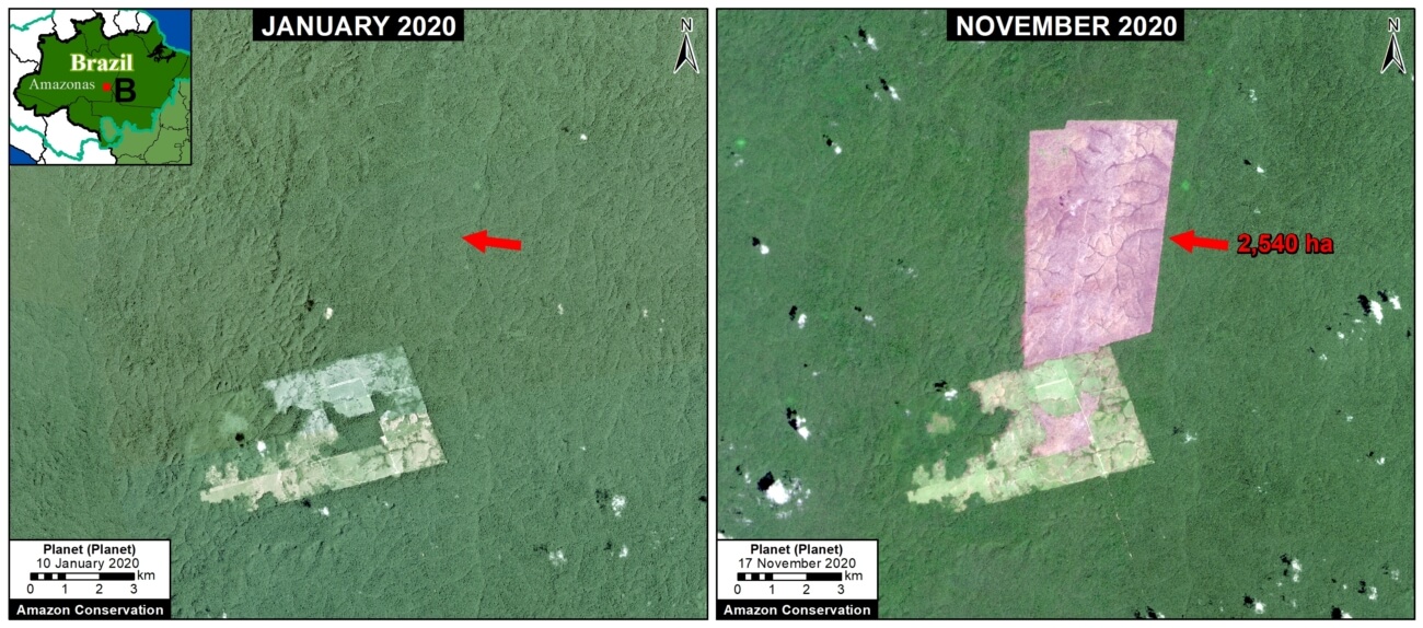
Mato Grosso
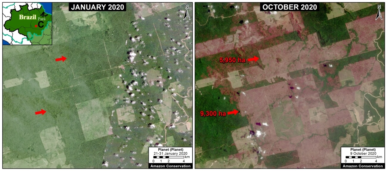
Pará
Mato Grosso
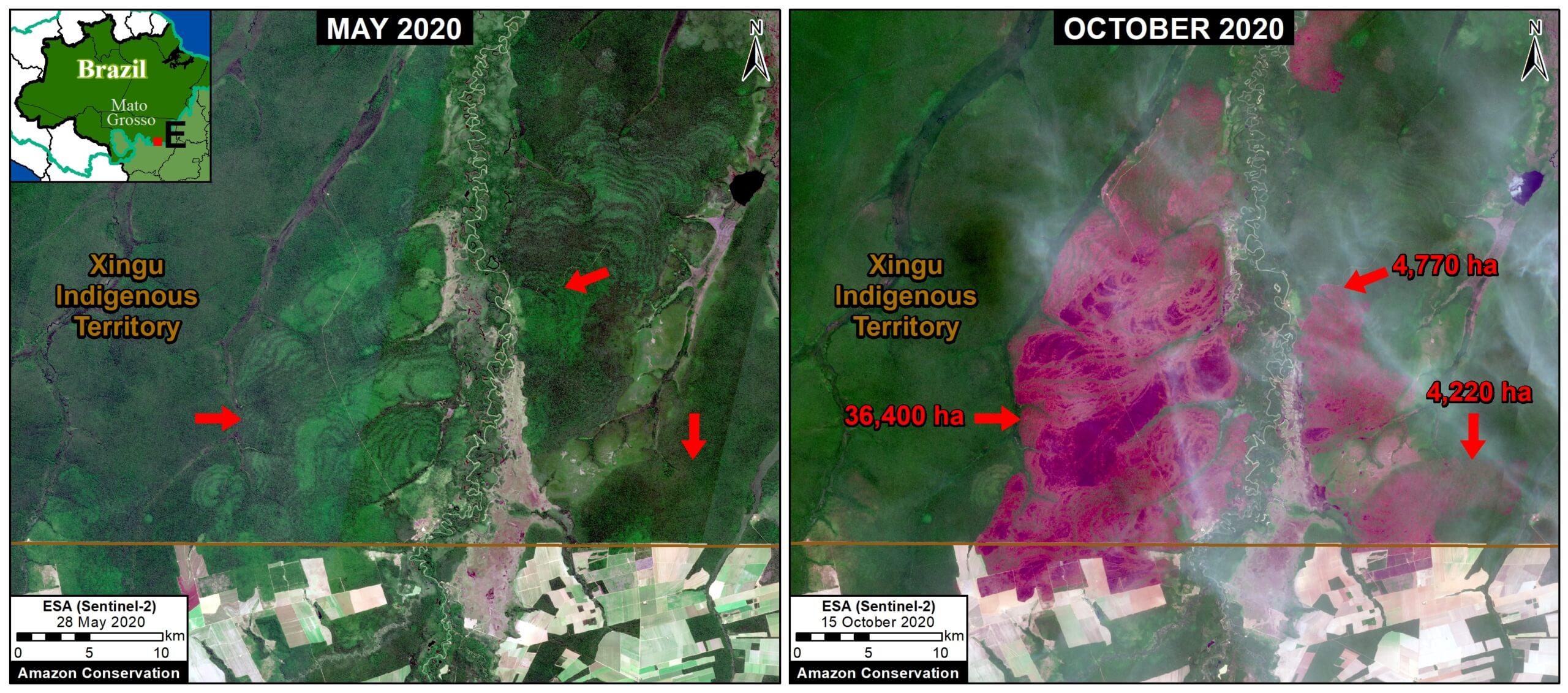
Rondônia
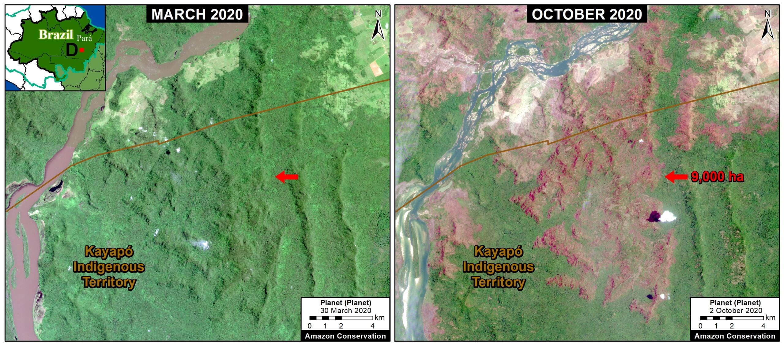
Munduruku Indigenous Territory (Pará)
*Notes
For more information on the negotiations between Brazil and both the United States and Norway, see the following links:
As climate summit unfolds, no Biden-Bolsonaro Amazon deal forthcoming
Mongabay
Brazil’s Bolsonaro, under U.S. pressure, vows climate neutrality by 2050
Reuters
Bolsonaro’s Sudden Pledge to Protect the Amazon Met With Skepticism
New York Times
Joe Biden’s billions won’t stop Brazil destroying the Amazon rainforest
Guardian
Brazil demand for U.S. to pay upfront stalls deal to save Amazon forest
Reuters
Brazil needs $10 bln a year in aid for carbon neutrality by 2050, minister says
Reuters
‘Negotiating with your worst enemy’: Biden in risky talks to pay Brazil to save Amazon
Guardian
Brazil’s promises to slash forest losses ’empty’, researchers say ahead of Biden summit
Reuters
Brazil must cut deforestation 15-20% a year to reach 2030 goal, says vice president
Reuters
Norway nixes support until Brazil reduces Amazon deforestation
Business Day
*Methods
The early warning forest loss alerts used in this report are produced by the University of Maryland (GLAD). They are the first alerts based on 10-meter resolution imagery obtained from the European Space Agency’s Sentinel-2 satellite. Previous alerts were based on 30-meter resolution imagery obtained from NASA/USGS Landsat satellites.
To identify the deforestation hotspots, we conducted a kernel density estimate. This type of analysis calculates the magnitude per unit area of a particular phenomenon, in this case forest cover loss. We conducted this analysis using the Kernel Density tool from Spatial Analyst Tool Box of ArcGIS. We used the following parameters:
Search Radius: 15000 layer units (meters)
Kernel Density Function: Quartic kernel function
Cell Size in the map: 200 x 200 meters (4 hectares)
Everything else was left to the default setting.
For the Base Map, we used the following concentration percentages: Medium: >10%; High: >15%; Very High: >25%.
Acknowledgments
We thank A. Folhadella (ACA) for their helpful comments on this report.
This work was supported by NORAD (Norwegian Agency for Development Cooperation) and ICFC (International Conservation Fund of Canada).

Citation
Finer M, Mamani N (2021) As Brazil negotiates with world, Amazon deforestation continues in 2021. MAAP: 138.


 Our novel
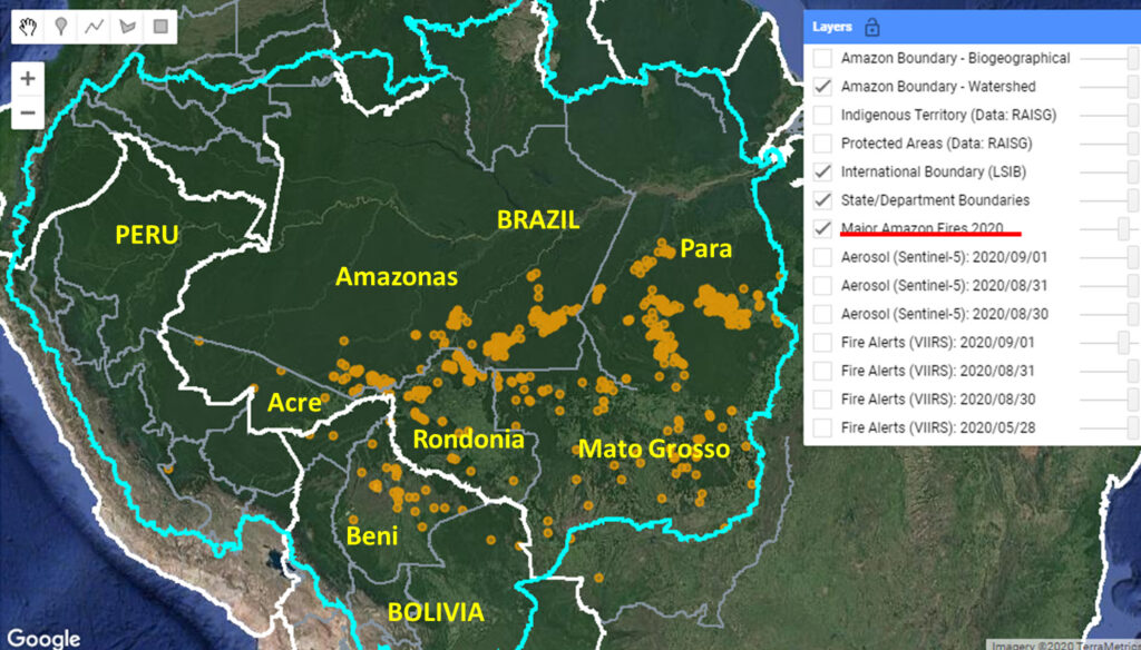
 Loading...


