The vultures of Los Amigos

Normally when you go out looking for birds, you look for the most colorful ones, or listen for those with the most beautiful songs. We often forget that cryptic birds have a beauty of their own. Vultures are not terribly eye-catching but they serve an important role in the ecosystem as the clean-up crew.

Vultures are scavengers, which means they eat dead meat. They are more efficient at finding carrion compared to other scavengers. You can see them soaring all around in their search for food. Their soaring behavior takes advantage of thermals, air currents warmed by the sun that allows them to reach great altitudes without beating their wings. Once they have found their meal, their extremely acidic stomach destroys any bacteria or viruses established in the carrion. This prevents diseases from proliferating and spreading to other animals and humans. Don’t think that because they are the ecosystem cleaners they are dirty birds; on the contrary, their featherless heads are an adaptation to stay clean while eating.

Turkey Vulture (Cathartes aura) soaring around in search of food. | Photo by Alex Wiebe

Although the many species of vultures all over the world serve the same role and have similar appearances, they are divided into two unrelated guilds: The Old World Vultures (Accipitridae) and The New World Vultures (Cathartidae). Los Amigos is home to four of the seven species in the Cathartidae family. The Black Vulture (Coragyps atratus), Turkey Vulture (Cathartes aura) and King Vulture (Sarcoramphus papa) are widely distributed in tropical forests, open savannahs, and grassland, while the Greater Yellow-headed Vulture (Cathartes melambrotus) is restricted to tropical forests. These four species are often seen interacting during lunchtime.

Due to their highly developed olfactory sense, finding carrion is easy for the Turkey and Greater Yellow-headed vultures. They can find their meal as early as an hour after it has been disposed. You may think that this gives them an enormous advantage over our other vulture residents, but the King and Black Vulture have found a way of benefiting from their neighbors’ awesome sense of smell. Since they themselves cannot track carcasses through their smell, they rely on reaching altitudes of 100 feet or more to be able to follow the Turkey and the Greater Yellow-headed vultures to the food source. This behavior is especially apparent in undisturbed forests where the latter is solely responsible for locating carrion and serving as a guide for the other species. This could be due to an even more developed sense of smell than the Turkey vulture or because its wing structure allows them to maneuver better over the tree canopy.

The Black Vulture (Coragyps atratus) waiting for its neighbors to find the meal. | Photo by Alex Wiebe

But what happens when all these species come together for lunchtime? Although a dominance hierarchy between species does exist, most of the time there is not a direct aggression between them. The interaction could result in different species feeding at the same time from the same resource or in individuals leaving when a more dominant species is approaching. More intense aggression has been identified between individuals of the same species. Furthermore, the differences between species in size and bill length and the postures they adopt while eating could be a factor allowing the presence of more than one species at a time. These differences enable them to forage from different tissues of the carcass simultaneously, which may reduce direct competition.

Close to Los Amigos, the main threats that vultures seem to face are the misperception of people. People believe they attack their cattle ranch or that they are dirty birds. But as described here, they feed on dead meat and they even prevent diseases from spreading. Despite their unattractive appearances, vultures are interesting and important birds in our ecosystem. Here at Los Amigos we are excited to have this array of species taking care of the health of our forest.
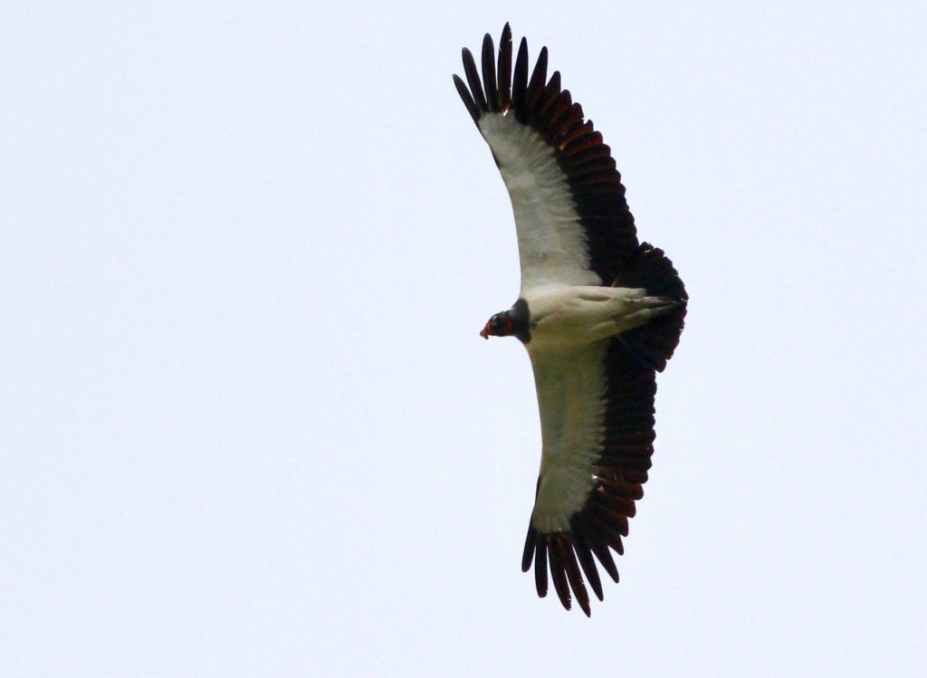
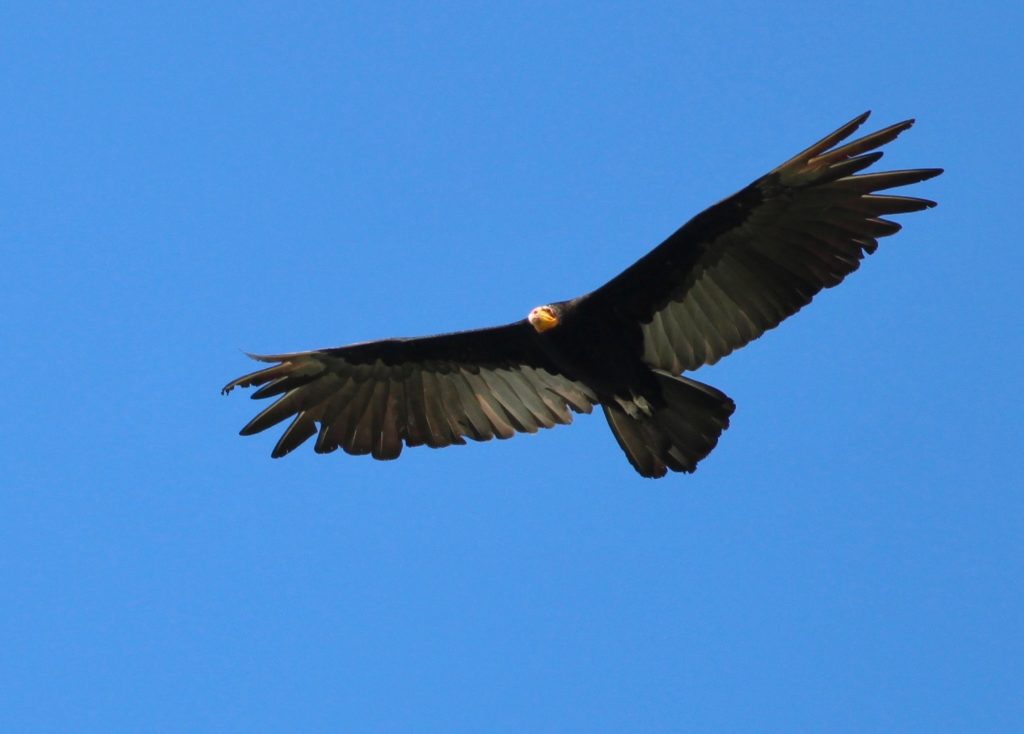
If you see the King Vulture (Sarcoramphus papa) and Greater Yellow-headed Vulture (Cathartes melambrotus) from far, you can tell them apart based on the color of their breast plumage. | Photos by Alex Wiebe

For more references:

  • Gomez, L.G., Houston, D. C., Cotton, P. and Tye, A. 2008. The role of Greater Yellow-headed Vultures Cathartes melambrotus as scavengers in neotropical forest. IBIS Journal 136: 193-196
  • Houston, D.C. 1987. Competition for food between Neotropical vultures in forest. IBIS Journal 130: 402-417
MAAP #87: Gold Mining Deforestation Continues In The Peruvian Amazon

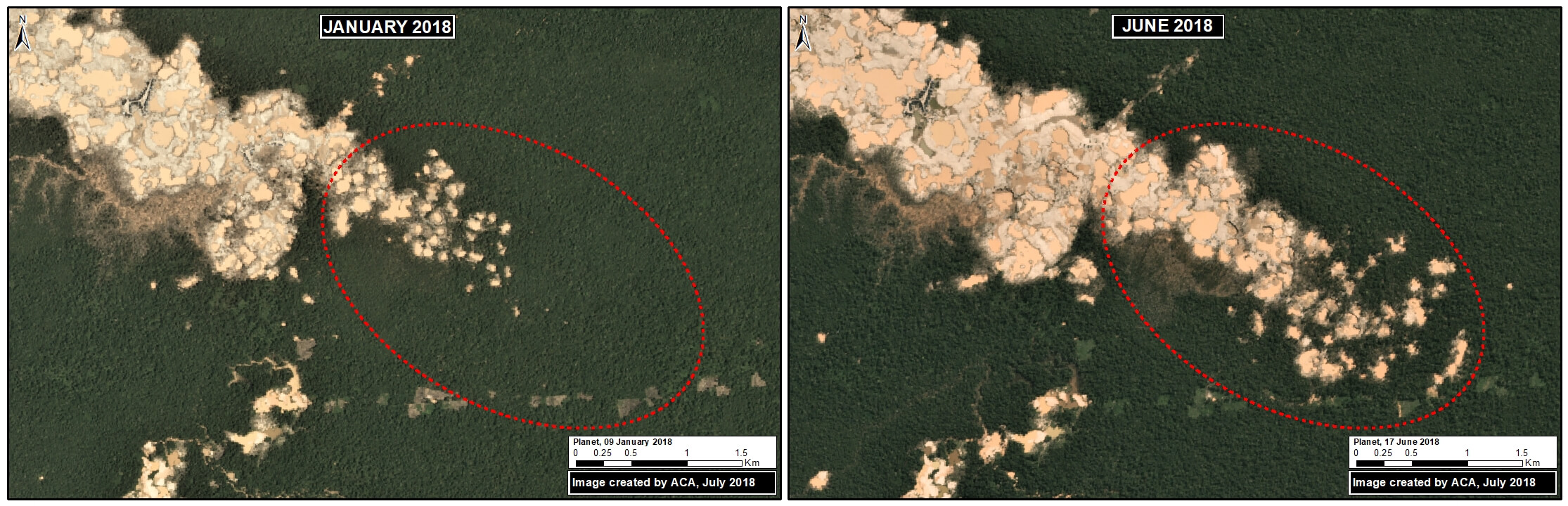
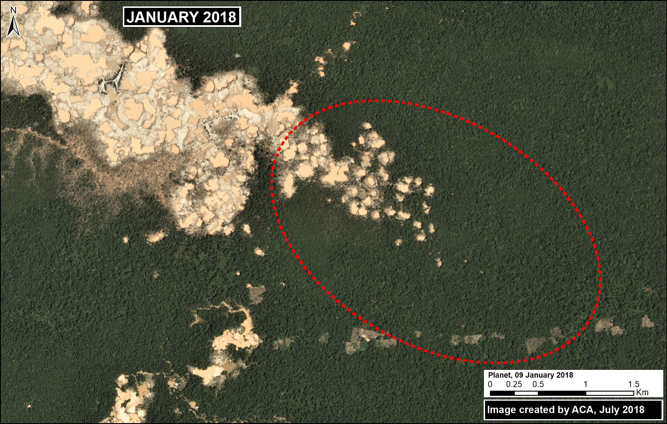
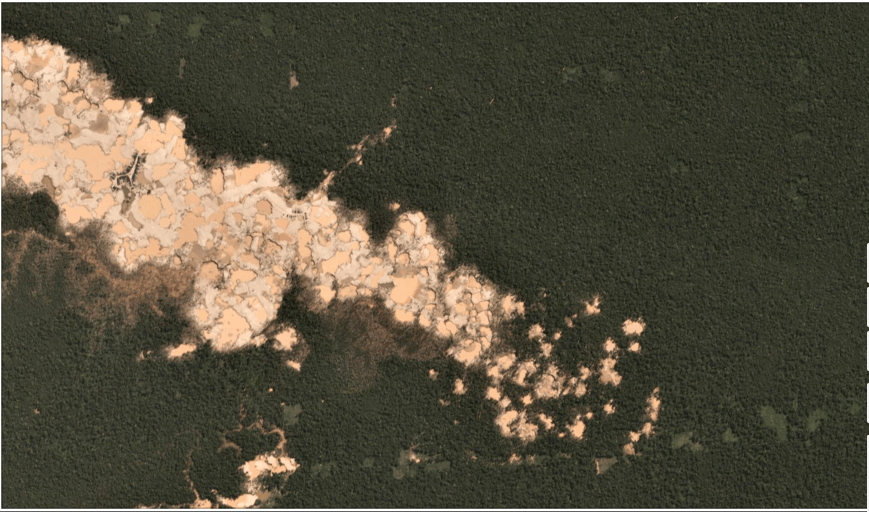
Eastward expansion of La Pampa gold mining. Source: Planet

We have reported extensively on the ongoing gold mining deforestation crisis in the southern Peruvian Amazon (see Archive), estimating the loss of over 17,500 acres in the five years between 2013 and 2017.

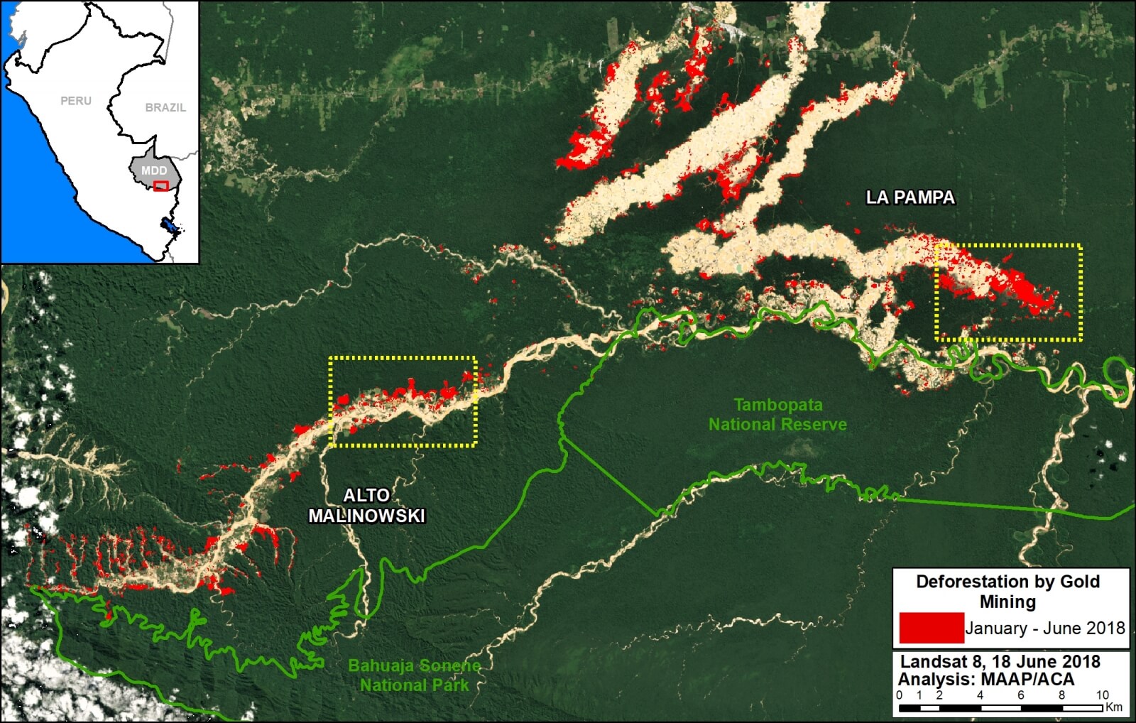
Here, we present new analysis showing that the destruction continues in 2018: we estimate an additional 4,265 acres during the first six months (January – June). This most recent deforestation is concentrated in two critical areas: La Pampa and Alto Malinowski. Most, if not all, of the mining appears to be illegal (see Annex).

This brings the total gold mining deforestation since 2013 to over 21,750 acres.

Next, we show a series of satellite images of the recent deforestation in La Pampa and Alto Malinowski.


Base Map

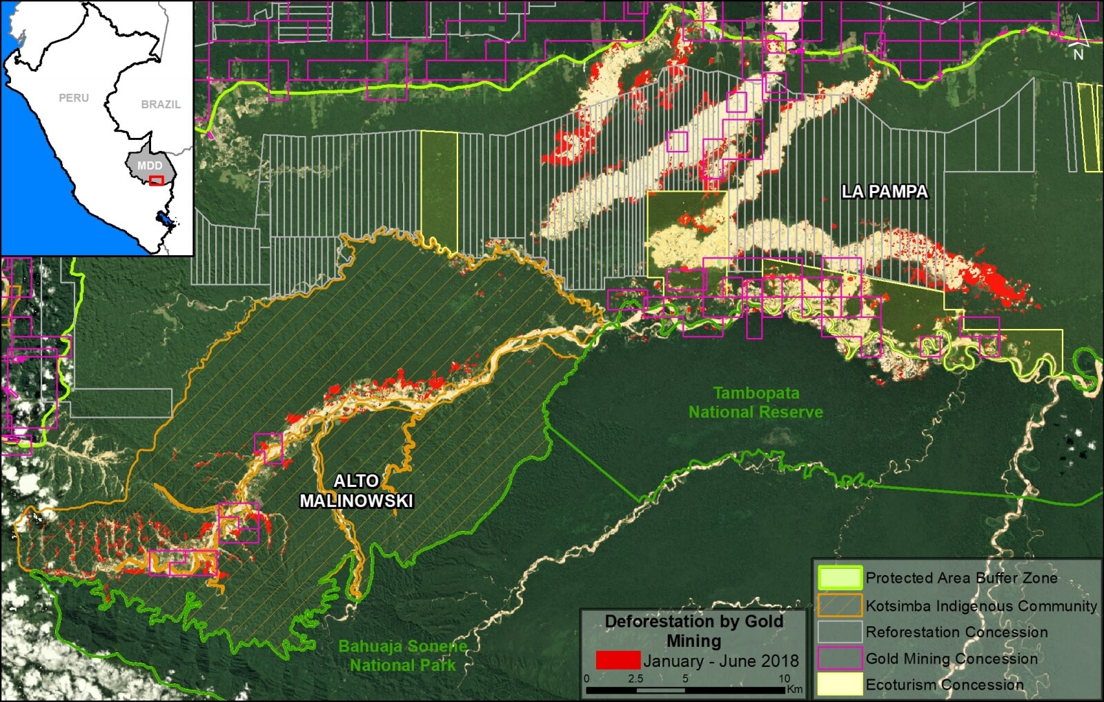
The Base Map highlights the most recent (2018) gold mining deforestation in red. We estimate this deforestation to be around 4,265 acres in the two most critical zones: La Pampa and Alto Malinowski. The yellow boxes indicate the location of the zooms described below. At the end of the article, in the Annex, we present the same base map but with all the overlapping land designations as well to illustrate the complexity of the situation.

Base Map. 2018 gold mining deforestation in southern Peruvian Amazon. Data- Planet, UMD:GLAD, MINAM:PNCB

La Pampa

The following images show the gold mining deforestation in the area known as “La Pampa” between January (left panel) and May (right panel) 2018. Note that the second image is in slider format.

Zoom de La Pampa. Datos- Planet, MAAP_1

Alto Malinowski

The following images show the gold mining deforestation in the area known as “Alto Malinowski” between January (left panel) and May (right panel) 2018. Note that the second image is in slider format.


Annex

We present the same base map as above, but also with relevant land designations.  Note that much of the deforestation is concentrated in forestry concessions (ironically, in “reforestation” concessions) and in the Kotsimba Native Community, both of which are outside the legal mining corridor and within the buffer zones of Tambopata National Reserve and Bahuaja Sonene National Park. Thus, most, if not all, of the mining activity appears to be illegal.

Citation

Finer M, Villa L, Mamani N (2018) Gold Mining continues to ravage the Peruvian Amazon. MAAP: 87.

From dung beetles to tinamous: A researcher’s time at Los Amigos

Last summer, I completed my first field season at the Los Amigos Biological Station. My research focused on sampling and identifying dung beetles across a variety of habitats. As an avid birder and student of ornithology, I spent my time off birding, and quickly realized I wanted to come back to the station to complete another project focusing on the birdlife there.

Living in “sympatry” with sympathy: a story of tamarins at Los Amigos!

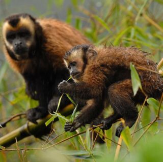
Their long and sometimes prehensile tails, and their capability to climb and jump among tree branches are a few of the key features of Neotropical primates. These highly arboreal organisms are perhaps one of the most charismatic groups in a tropical forest. Los Amigos harbors eleven primate species, from the largest and highly vulnerable spider monkey (Ateles chamek) to the smallest and very rare Goeldi’s tamarin (Callimico goeldii).

MAAP #86 Colombia: Chiribiquete – Deforestation Hotspots in The Colombian Amazon, Part 3

We present our third report* in a series investigating deforestation hotspots in the Colombian Amazon. Here, we focus on the “Chiribiquete-Macarena” hotspot, located between the Chiribiquete and La Macarena National Parks.

The Colombian government is finalizing plans to expand the boundaries of Chiribiquete National Park, an important step for conservation. However, we show (with high-resolution images) that deforestation is surging in the area and rapidly expanding towards these new boundaries. In fact, in 2018, deforestation has entered the newly expanded park.

MAAP #86: Deforestation Hotspots in the Colombian Amazon, part 3: Chiribiquete-Macarena

https://maaproject.org/chiribiquete/

Unveiling the presence of the rare Grey-bellied hawk at Los Amigos

Grey-bellied hawk at Los Amigos_ Fernando Angulo

The Grey-bellied hawk (Accipiter poliogaster) is a rare diurnal raptor of the Accipitridae family and is distributed throughout the Neotropics. BirdLife has it listed as a “near threatened” bird and, despite their wide distribution, it is one of the least known of the raptors. In Peru, it occurs in the eastern side of the country, mostly in lowland tropical forests, and has been also reported along forest edges, and fragmented forest. Since 2015, birders at Los Amigos have been able to observe and admire the beauty of this raptor. This represents a unique opportunity to learn and increase the scarce knowledge about this species. In this note, we recapped A. poliogaster sightings at Los Amigos (LA).

In June of 2015, a Peruvian researcher specializing on raptors (R. Piana), found a juvenile A. poliogaster hunting at the forest edge near the Los Amigos River, at LA. The following year, September of 2016, Fernando Angulo (LABO Advisory member) and R. Piana located a reproductive pair defending their territory located ~1 km away from the station. Both individuals were sighted in the same location on consecutive days after the first encounter. On April of last year, a Peruvian bird guide, identified a juvenile of this species around LA garden, close to the territory identified the previous year. Lastly, on mid-April of the present year (2018), two juvenile individuals were located on a nest situated on an emergent tree and in the same territory of the reproductive pair previously identified. These events prove that A. poliogaster is breeding and nesting within the Los Amigos Biological Station, making this place a unique study site for this species.

Juvenile Grey-bellied hawk on the nest _ Cesar Bollatty

The first recorded observation of the reproductive behavior and biology of A. poliogaster were described in Southern Brazil few years ago, where an adult female was observed incubating two eggs and an adult male was actively hunting. Only one nestling survived, and after ~49 days post-hatching the nestling left the nest. The fledging was fed by the female for ~90 days post-hatching. Given the importance of raptors in Neotropical forest, and LABO’s goal to increase the knowledge and conservation efforts of Neotropical avifauna, one of our Franzen fellows, Igor Lazo, will be assessing the ecology and natural history of A. poliogaster at LA, being the first study of this species in Peru. The information coming out from this project will create a firm foundation for further research on the Grey-bellied hawk!

For more references:

Boesing, A.L., Menq, W., Dos Anjos, L. 2012. First description of the reproductive biology of the Grey-bellied hawk (Accipiter poliogaster). The Wilson Journal of Ornithology, 124(4): 767-774.


Science Magazine Combating Deforestation: from Satellite to Intervention

A new policy article entitled “Combating deforestation: From satellite to intervention” was just published in Science, one of the leading journals in the world.

The authors include members of Amazon Conservation, World Resources Institute (Global Forest Watch), and Planet.

We first describe how rapidly improving satellite technology has created an unprecedented moment for near real-time monitoring.

Growing up in the rainforest: A Razor-billed curassow chick growth captured by a camera trap for over a month!

The razor-billed curassow (Mitu tuberosum) is one of the largest species of cracids (Galliformes:Aves) and a relatively uncommon bird in western Amazonian rainforest because of their low reproductive rates and highly vulnerable status due human disturbances such as hunting and habitat loss. These permanent threats have already driven one of the 24 species of Cracids, the Alagoas curassow (Mitu mitu), considered for many years a geographic variation of Mitu tuberosum, to extinction in the wild. Cracids’ presence is considered an indicator of healthy forests where hunting is absent or low, allowing them to play important ecological roles as seed dispersers and seed predators.

Los Amigos harbors 4 species of cracids, such as the Speckled chachalaca (Ortalis guttata), the Spix’s guan (Penelope jacquacu), Blue-throated piping guan (Pipile cumanensis), and the Razor-billed curassow (Mitu tuberosum), all of which have diurnal and terrestrial behavior. Camera traps have become an important tool to monitor and obtain ecological information about terrestrial birds. At the beginning of this year, LABO’s cameras registered the presence of a Razor-billed curassow chick, and what we believe to be its growth during a time lapse of over 40 days.

On January 4, one of our camera traps deployed in the interior of a bamboo patch captured the presence of two razor-billed curassows. The images indicate the occurrence of, perhaps, an adult male and female, based on the physical traits, specifically the size of their bills since males have a larger bill formation compared to females. Two weeks after, one individual was registered with a chick, walking right under the long terminal tail of the adult. The chick presented dark feathers, mostly black and brown coloration with some lighter patterns throughout the body and head, and a white belly. The characteristic laterally compressed and bright red bill of this species was not yet developed. After 42 days, the camera captured an adult individual with a visibly grown nestling walking again under the adult’s tail. Could it had been the same chick captured more than a month before? Perhaps yes! This time the immature offspring had body plumage coloration similar to an adult, mostly black, except the head; and the red bill was also noticeable, but not fully developed. In the video, the adult individual was feeding its offspring, confirming the probability of being the mother.

The razor-billed curassow, locally known as “paujil,” is a commonly hunted cracid in Amazonia. Despite the IUCN Red List considering it as “least concern”, there are not many studies or available literature that describes its biology and/or ecology. More studies on their population size, reproductive behavior, breeding and nesting information, are required to determine their current status. Cracids, in general, lay on average two eggs every year; hatchlings are exposed to high mortality rates during their first year, and reach maturity after the third year! This is a fairly long maturation period, but the wait is worth it just to admire a beautiful large terrestrial bird like the razor-billed curassow!

What are your guesses? Could this camera be showing us the growth of the same curassow chick?

MAAP #85: Illegal Logging in The Peruvian Amazon, And How Satellites Can Help Address It

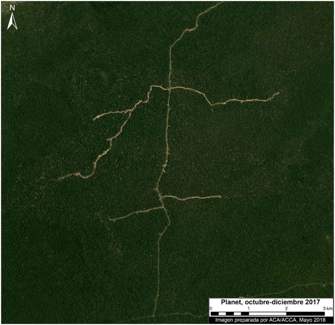
We propose a new tool to address illegal logging in the Peruvian Amazon: using cutting-edge satellites to monitor logging road construction in near real-time.

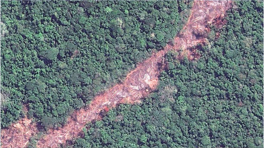
Example of new logging road in the Peruvian Amazon. Data: Planet

Illegal logging in the Amazon is difficult to detect because it is selective logging of individual valuable trees, not large clear-cuts.

However, a new generation of satellites can quickly detect new logging roads, which in turn may indicate the leading edge of illegal logging.

Here, we analyzed satellite imagery to identify all new logging roads built in the Peruvian Amazon over the past three years (2015-17).

We then show how it is possible to track logging road construction in near-real time, using three satellite-based systems: GLAD alerts, Sentinel-1 (radar satellites), and Planet (optical satellites).