Image 1. Example of a 2019 logging road with signs of illegality. Data: Planet.
In the Peruvian Amazon, the widespread illegal logging is difficult to detect with satellites because it is selective for high-value species (not clearcutting).
It is possible, however, to detect the associated logging roads.
In this report, we present a novel technique to identify illegal logging: analyze new logging roads in relation to detailed land use data available from government agencies.
Thus, our new method detects the crime in real-time and preventive action is still possible. This is important because when an intervention against illegal logging normally occurs, stopping a boat or truck with illegal timber, the damage is done.
This analysis has two parts. First, we identified the new logging roads built in the Peruvian Amazon during 2019, updating our previous work for 2015-18 (see Base Map).
Second, we analyzed the new logging road data in relation to governmental land use information in order to identify possible illegality.
This data is from 2019, but we are now applying this technique in real time during 2020.
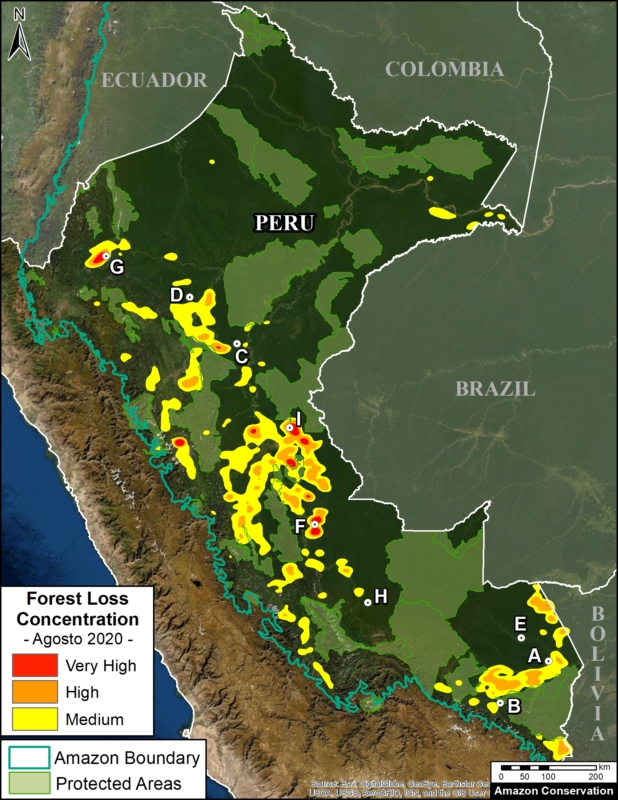
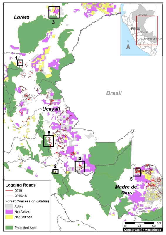
Base Map. 2019 Logging roads, in relation to 2015-18 logging roads. Data: MAAP.
Logging Roads 2019
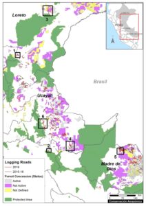
The Base Map illustrates the location of logging roads built in the Peruvian Amazon during the last 5 years.
Previously (MAAP #99), we documented the construction of 3,300 kilometers of logging roads between 2015 and 2018.
Here, we estimate the construction of an additional 1,500 kilometers in 2019 (see red).
Note that forest roads are mainly concentrated in the Ucayali, Madre de Dios and Loreto regions.
Below, we show three types of possible illegality that detected in 2019:
- Logging roads in areas without forestry concessions or permits (Cases 1-2).
.
- Logging roads in existing forest concessions, but whose current status is defined as “Non-Active or Undefined” (Cases 3-5).
.
- Logging roads in Native Communities (Case 6).
Cases of Possible Illegality
Logging roads in areas without forestry concessions or permits
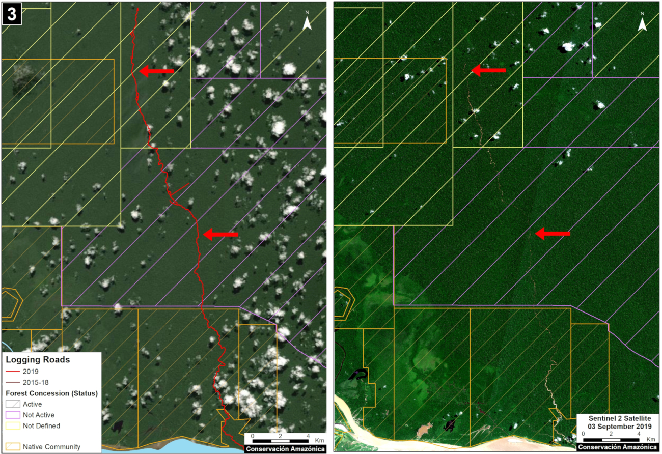
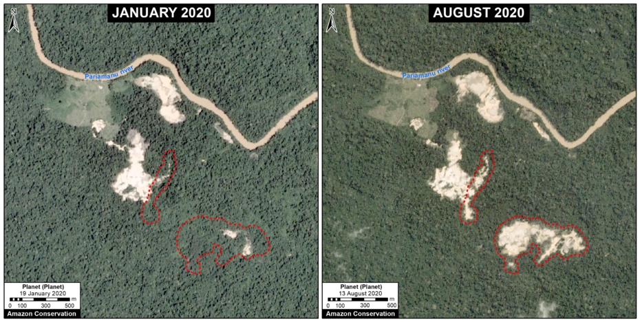
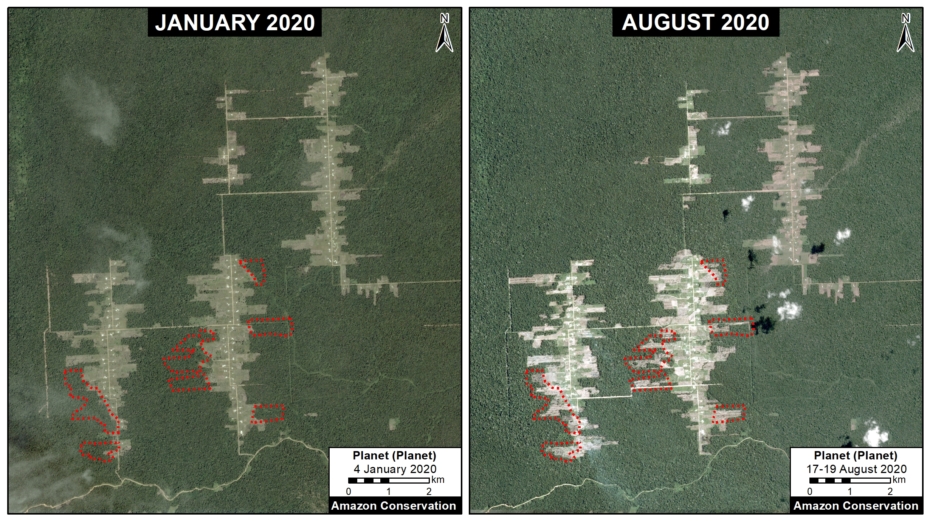
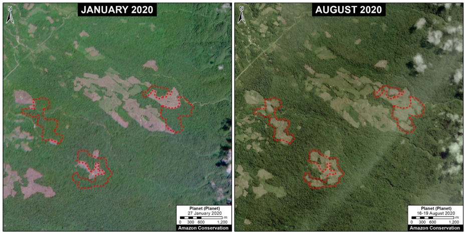
Case 1. We detected the opening of a new logging road network (55 km) in an area without forestry concessions or permits, between the limits of the Loreto and San Martín regions. The image shows the digitized logging roads (red, left panel), and non-digitized satellite image (right panel). The arrows provide reference points between panels.
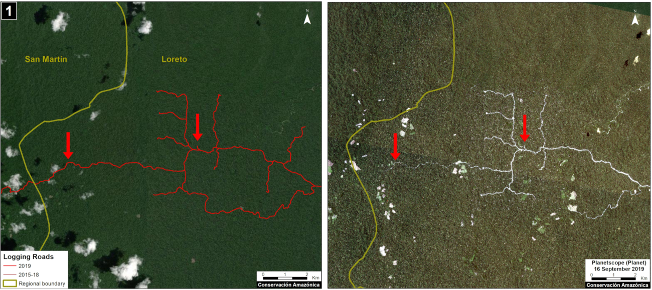
Case 1. Data: MAAP, Planet. Click to enlarge.
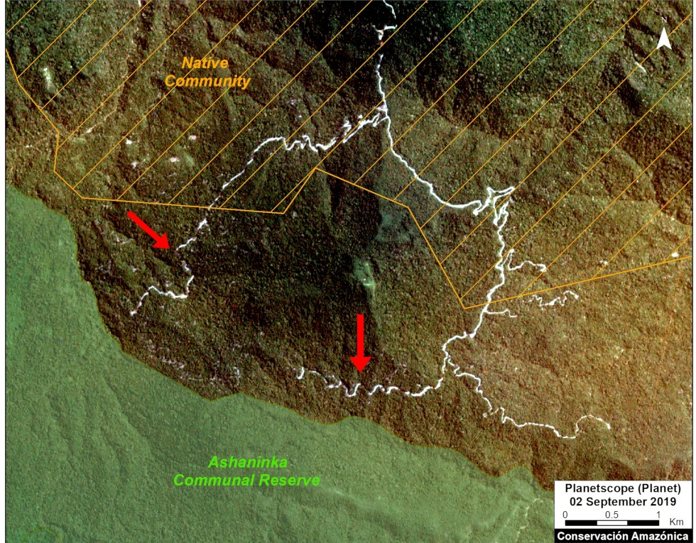
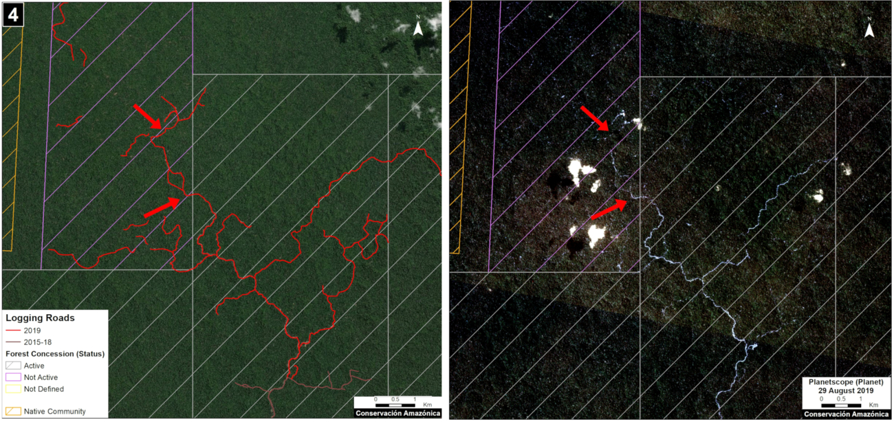
Case 2. We detected the construction of a new logging road network (5.8 km) in the buffer zone of Asháninka Communal Reserve, reaching only 300 meters from the protected area. The image shows the digitized logging roads (red, left panel), and non-digitized satellite image (right panel). The arrows provide reference points between panels.
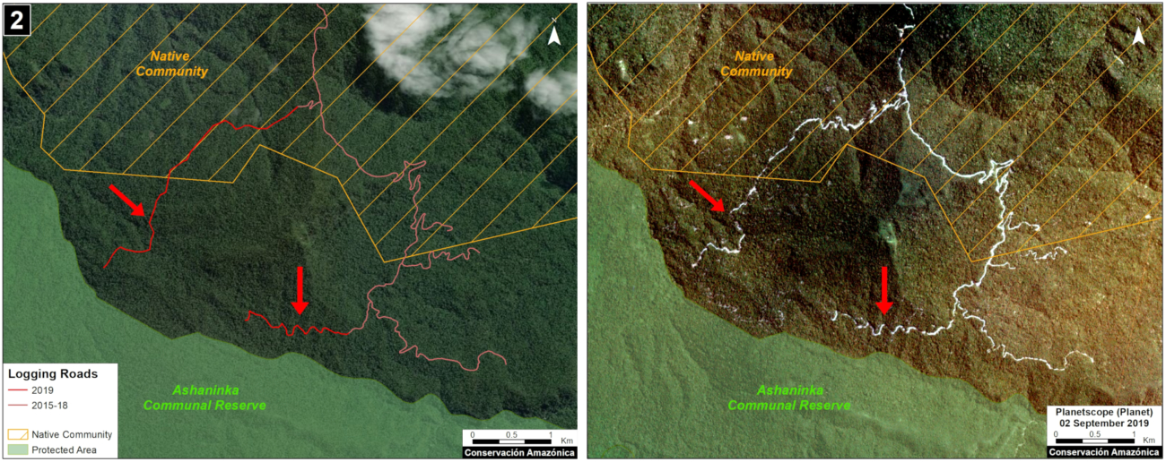
Case 2. Data: MAAP, Planet, IBC, SERNANP. Click to enlarge.
Logging roads in existing forest concessions, but whose current state is labelled as “Non-Active or Undefined”
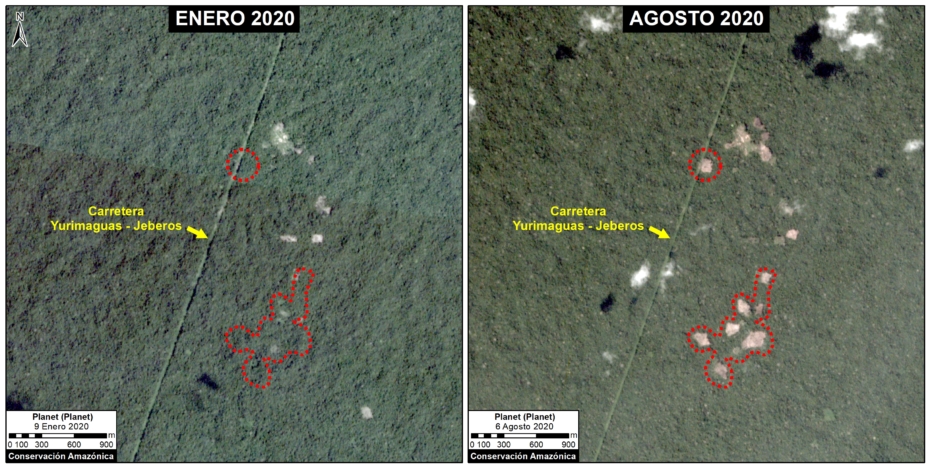
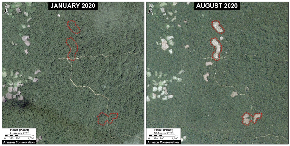
Case 3. We detected the construction of a new logging road (45.3 km) that crosses a native community and reaches a forest concession whose status is defined as “Undefined,” in the Loreto region just north of Pacaya Samiria National Reserve. The image shows the digitized logging roads (red, left panel), and non-digitized satellite image (right panel). The arrows provide reference points between panels.
Case 3. Data: MAAP, ESA, IBC, SERFOR. Click to enlarge.
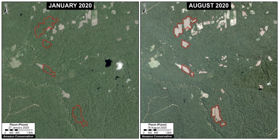
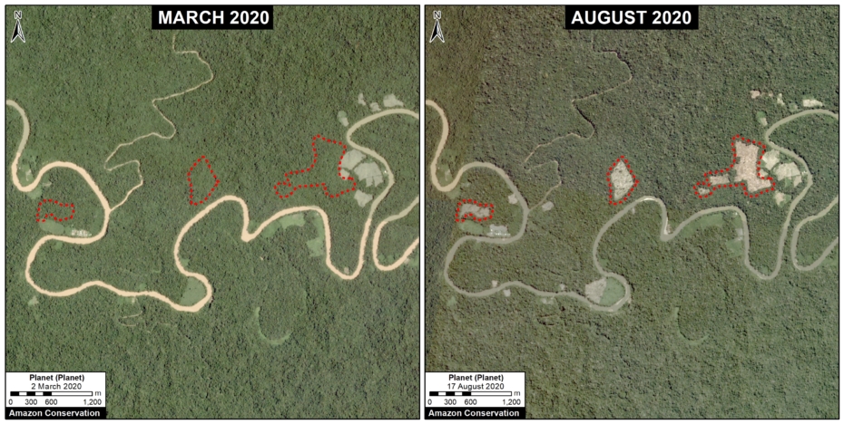
Case 4. We detected the construction of a new logging road network (53.2 km), of which nearly half (21.4 km) crosses a forest concession whose status is defined is “Non Active”, near the town of Sepahua in the Ucayali region. The image shows the digitized logging roads (red, left panel), and non-digitized satellite image (right panel). The arrows provide reference points between panels.
Case 4. Data: MAAP, Planet, IBC, SERFOR. Click to enlarge.
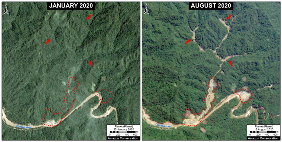
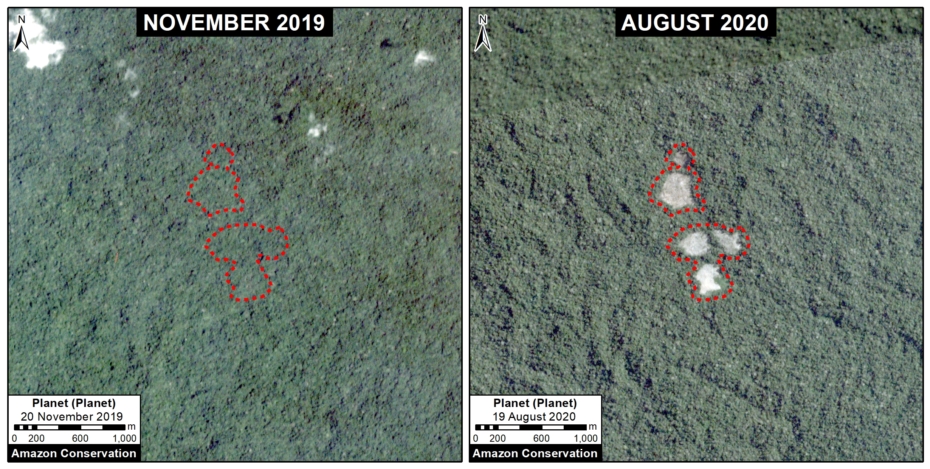
Case 5. We detected the construction of a new logging road (17.7 km) in a forestry concession whose current status is defined as “Non Active,” in the Madre de Dios region. The image shows the digitized logging roads (red, left panel), and non-digitized satellite image (right panel). The arrows provide reference points between panels.

Case 5. Data: MAAP, ESA, IBC, SERFOR. Click to enlarge.
Logging roads in Native Communities
Case 6. We detected the construction of a logging road (23.4 km) within an indigenous community in the Ucayali region. We did not find evidence of a permit for this activity. The image shows the digitized logging roads (red, left panel), and non-digitized satellite image (right panel). The arrows provide reference points between panels.
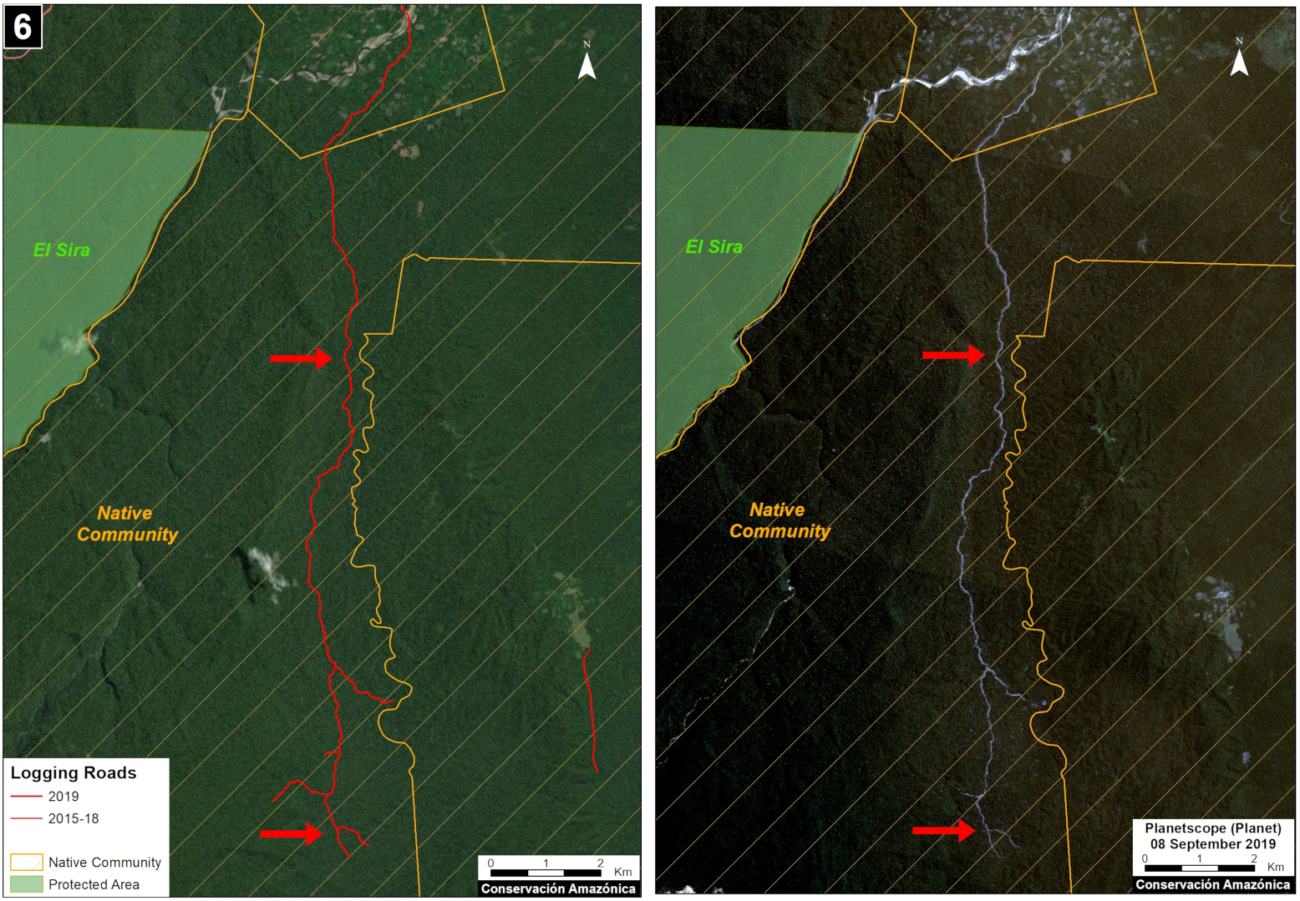
Case 6. Data: MAAP, Planet, SERNANP, IBC, SERFOR. Click to enlarge.
Methodology
Our analysis included two main steps:
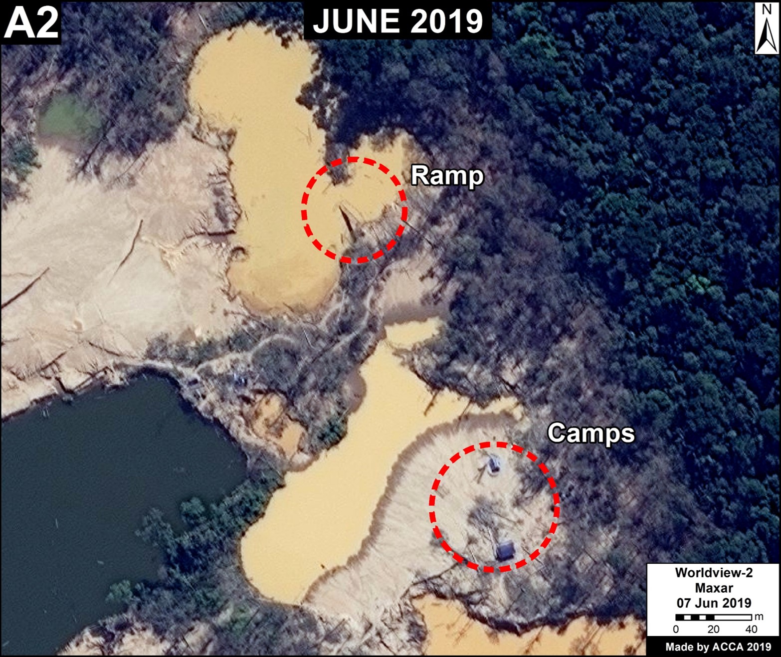
The first step consisted of evaluating linear patterns in the 2019 early warning and final forest loss data, available from Global Forest Watch (data from the University of Maryland) and Geobosques (data from the Peruvian Ministry of the Environment). From the linear patterns, we distinguished between logging access roads and other types of roads and highways. Logging roads tend to have linear patterns that branch into the interior of the forest where the commercial timber is found. Other types of roads have a more defined destination, such as towns or farms. Once logging roads were identified, we downloaded the associated high-resolution imagery (3 meters) from Planet Explorer and digitized the roads in ArcGIS. During this process, additional logging roads detected in the high resolution images were also digitized.
The second step focused on the legality analysis. The new logging road data were overlaid with other types of land use information, such as forestry concessions on the GeoSERFOR portal (SERFOR), permits and concessions on the SISFOR portal (OSINFOR), indigenous communities (IBC 2019), protected areas (SERNANP), population centers (INEI 2019), and official road networks (MTC 2018). For example, as shown above, this process identified logging roads near protected areas, within indigenous communities, and within non-active forest concessions.
We analyzed information on several websites now available from national and regional authorities, such as SISFOR (OSINFOR), GEOSERFOR (SERFOR), and IDERs (Spatial Data Infrastructure of Regional governments). These new resources provide valuable information, however may have limitations in ability to constantly update information on the status of concessions and forest permits, especially from regional governments.
References
Planet Team (2017). Planet Application Program Interface: In Space for Life on Earth. San Francisco, CA. https://api.planet.com
Acknowledgments
We thank R. Valle (OSINFOR), A. Felix (DAI), D. Suarez (ACCA), and G. Palacios for their helpful comments on this report.
This report was conducted with technical assistance from USAID, via the Prevent project. Prevent is an initiative that, over the next 5 years, will work with the Government of Peru, civil society, and the private sector to prevent and combat environmental crimes in Loreto, Ucayali and Madre de Dios, in order to conserve the Peruvian Amazon.
This publication is made possible with the support of the American people through USAID. Its content is the sole responsibility of the authors and does not necessarily reflect the views of USAID or the US government.

Citation
Finer M, Paz L, Novoa S, Villa L (2020) Detecting Illegal Logging in the Peruvian Amazon. MAAP: 123.

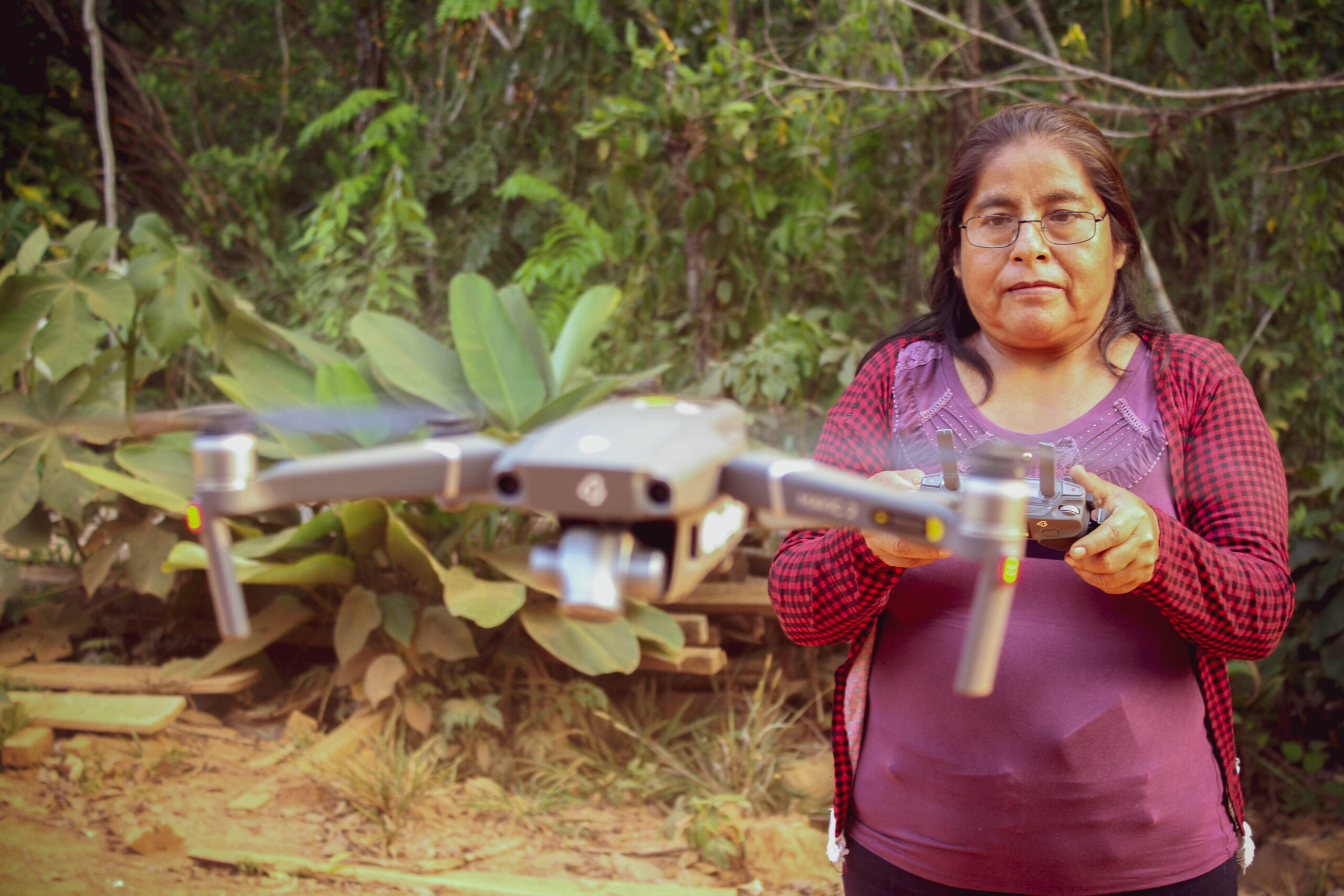
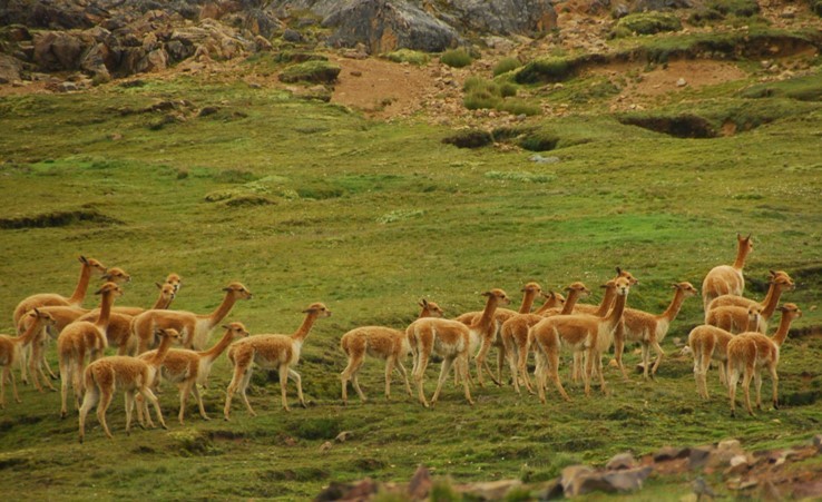
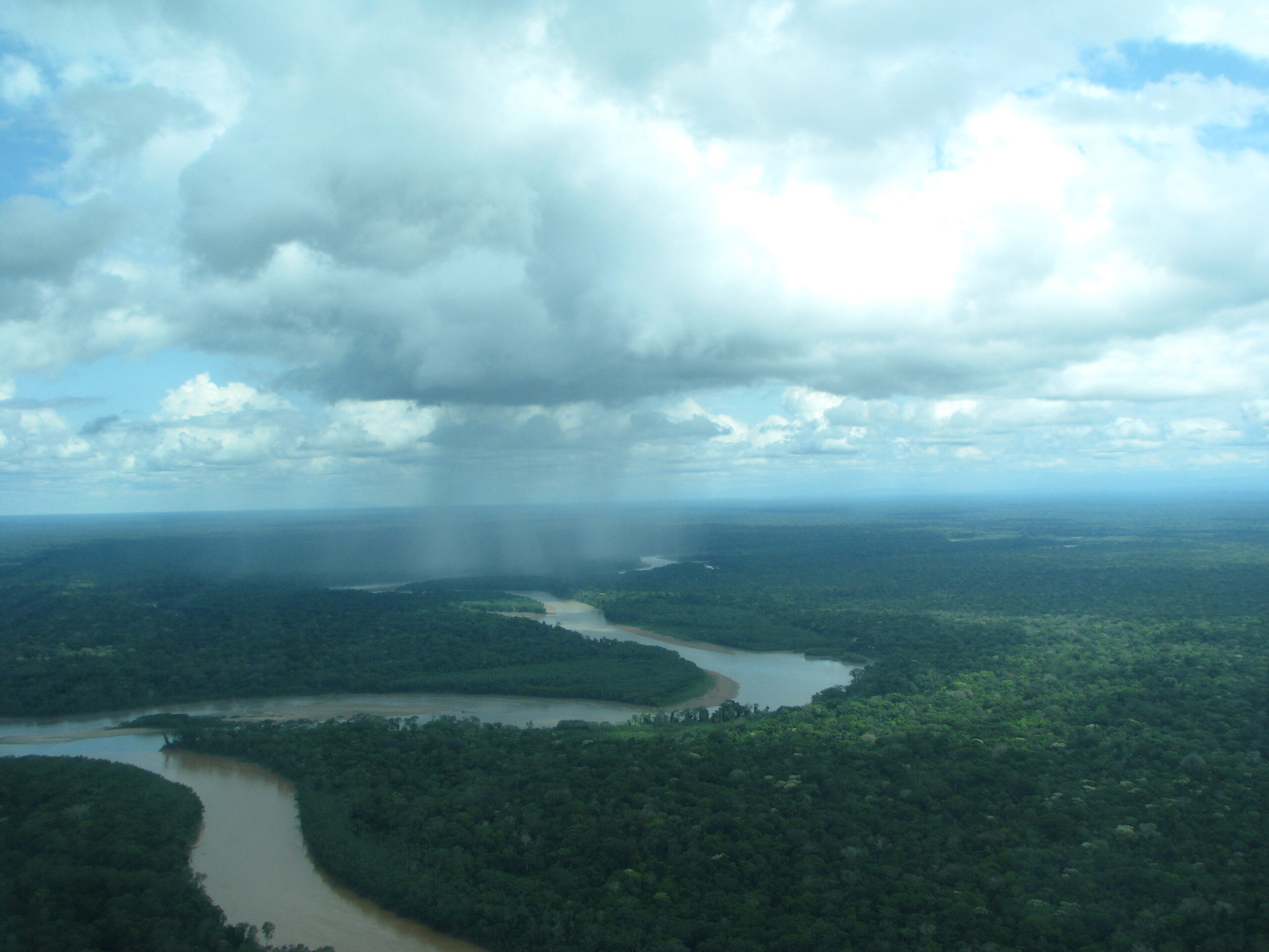
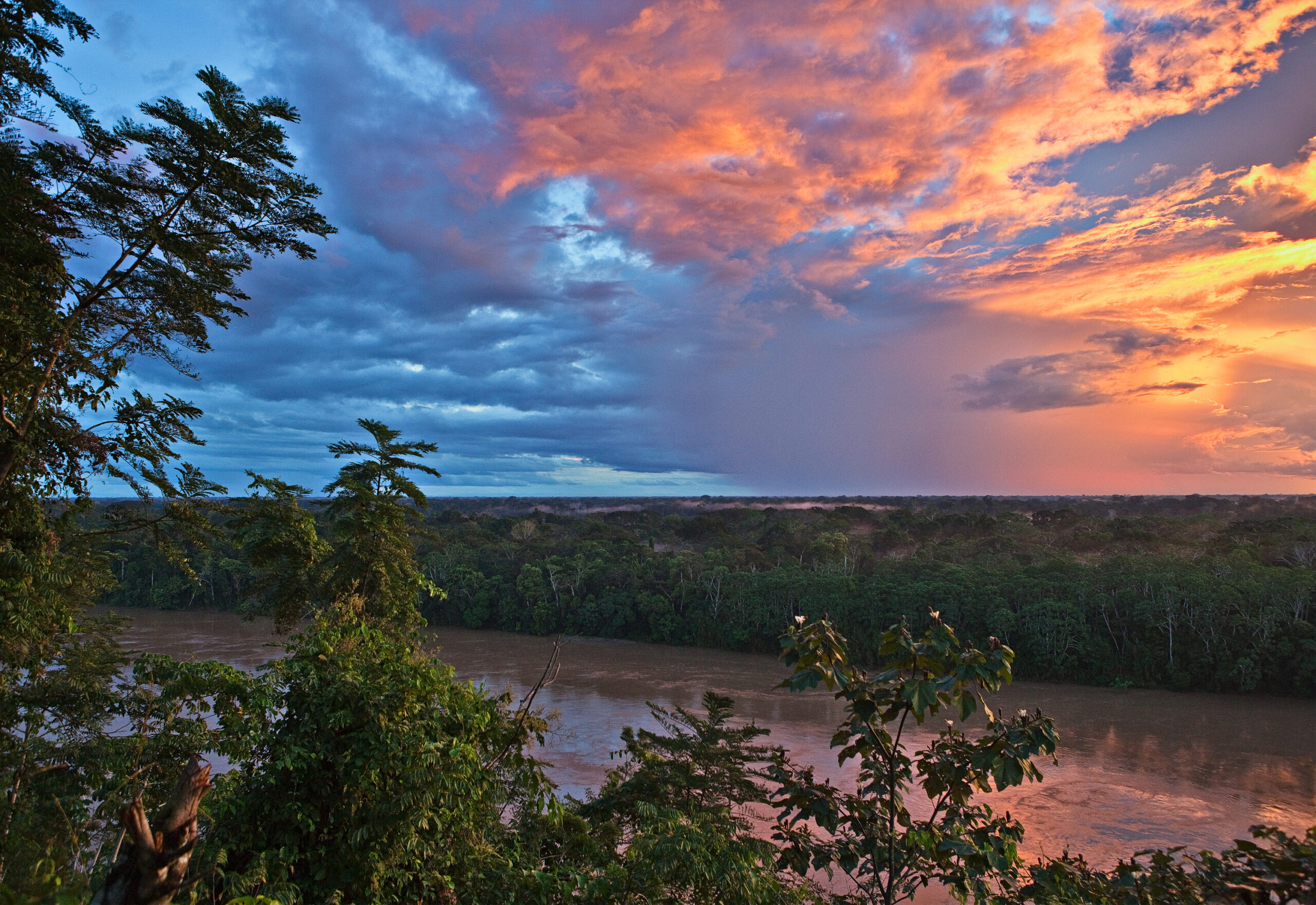
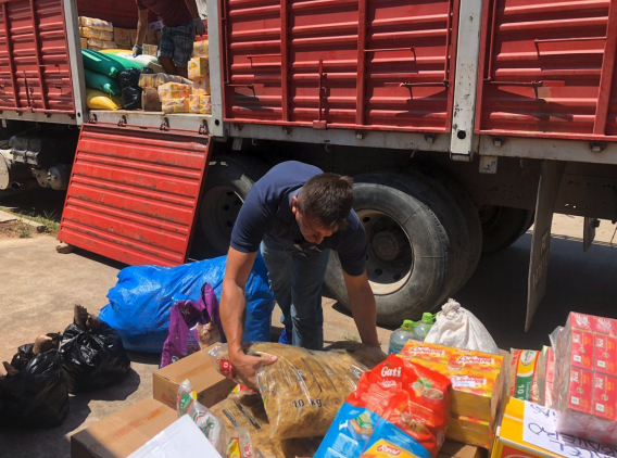
 The Amazon’s ecosystems provide an array of vital services to the region and the world as a whole, and they are home to millions of people who rely on the forest for their livelihoods. In Bolivia, we have been working closely with communities in and around the 420,000-acre Santa Rosa del Abuná conservation area who rely on harvesting Brazil nuts and açaí from their forests. Through improving their capacity to sustainably manage these highly productive forests and building the business side of their harvesting activities, we are helping the people of Santa Rosa and nature thrive.
 For the last few years we have helped Santa Rosa communities grow their sustainable production to 3 tons of açaí berries. These communities derive income from the açaí berry, the popular “super food” often found in juices and smoothies. Açaí is harvested each year from April to November, complementing the harvest of Brazil nuts that takes place from December to March. Mario Aguada, one of our local experts, heeds the economic importance of harvesting both products: “If one of the two has a poor season, families don’t lose their income for the year. It will be a harder year, but they can still earn some income harvesting the other.”
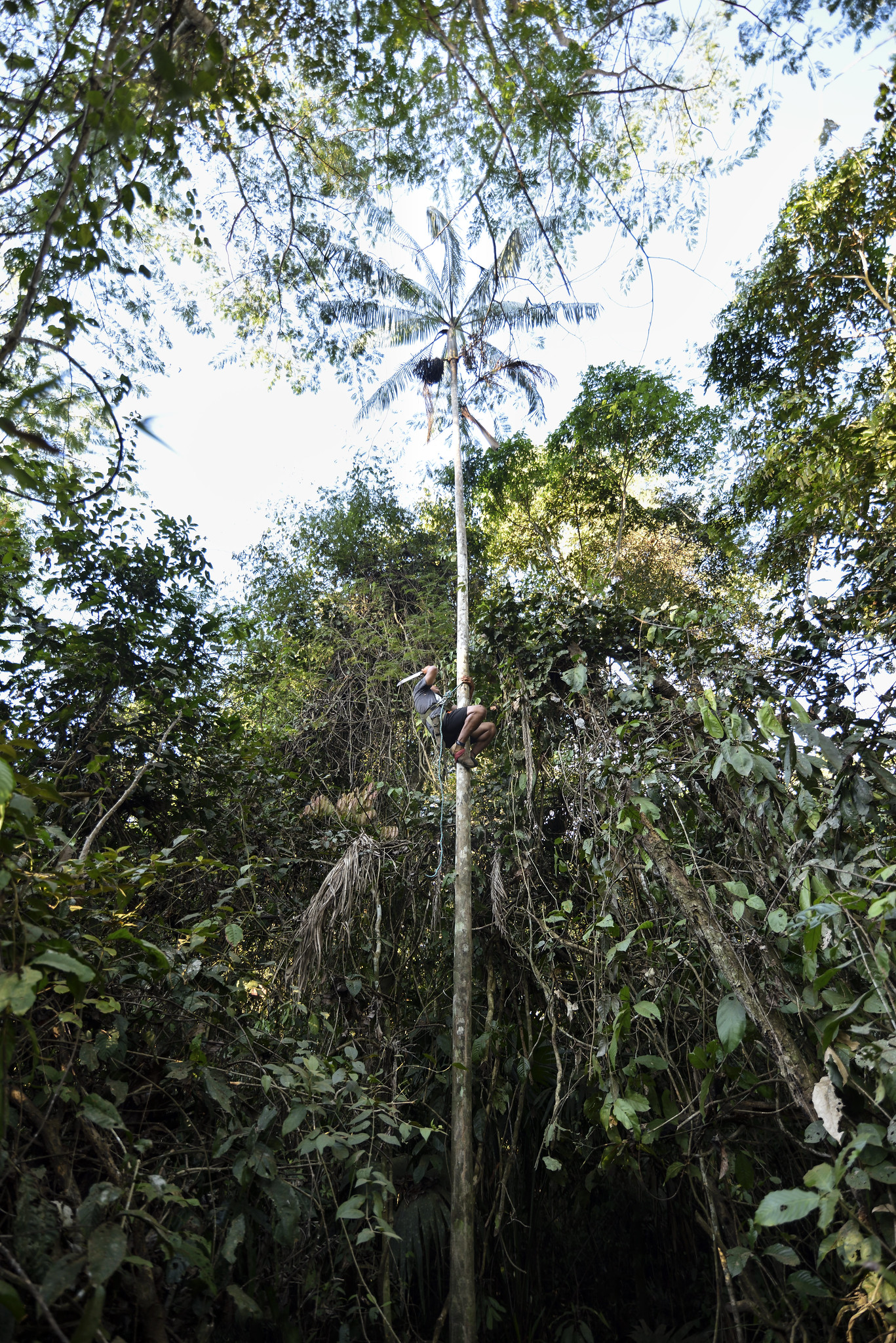 This year, we helped improve the processing and storage of açaí, which is increasing incomes and giving these small producers more control in the market. By improving the capacity to efficiently and sanitarily process the berries and then freeze them, they are able to sell directly to buyers instead of middle-men, leaving more money with the community.
 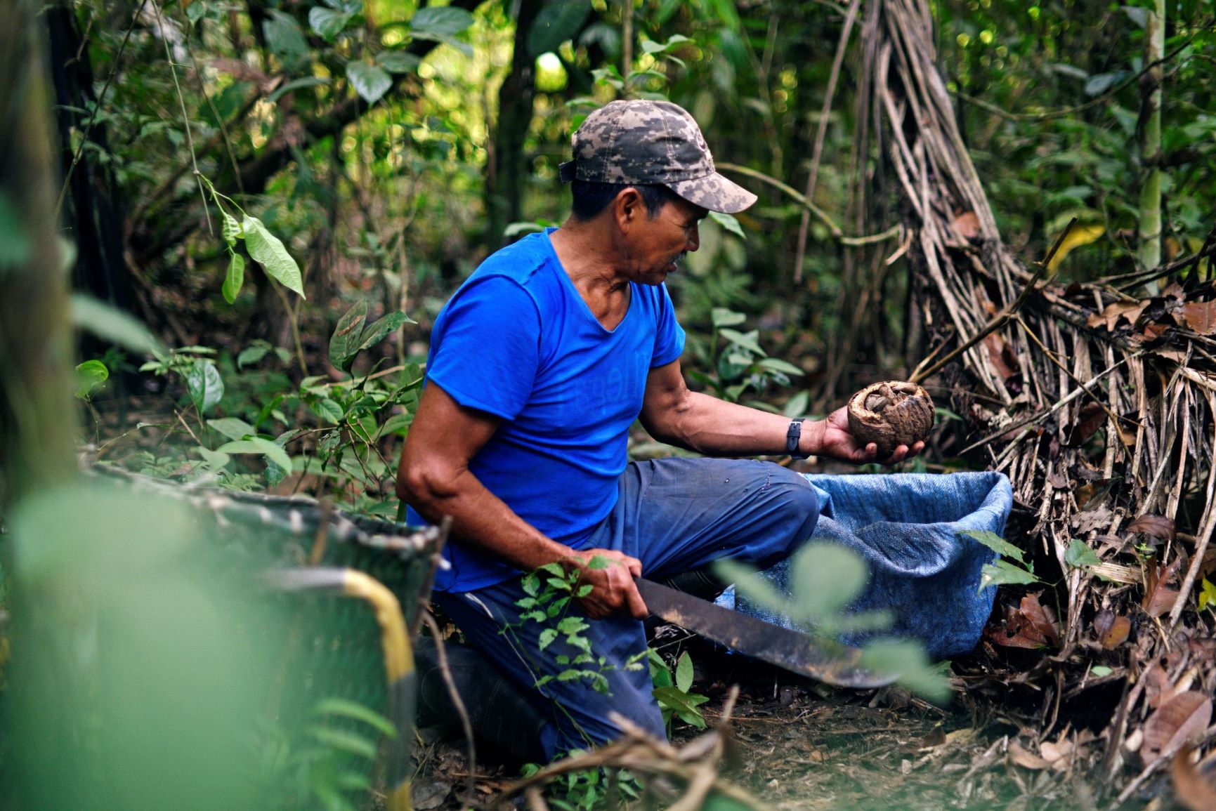 was stopped from hitting the ground where he would have faced severe injuries or possibly, death without it.
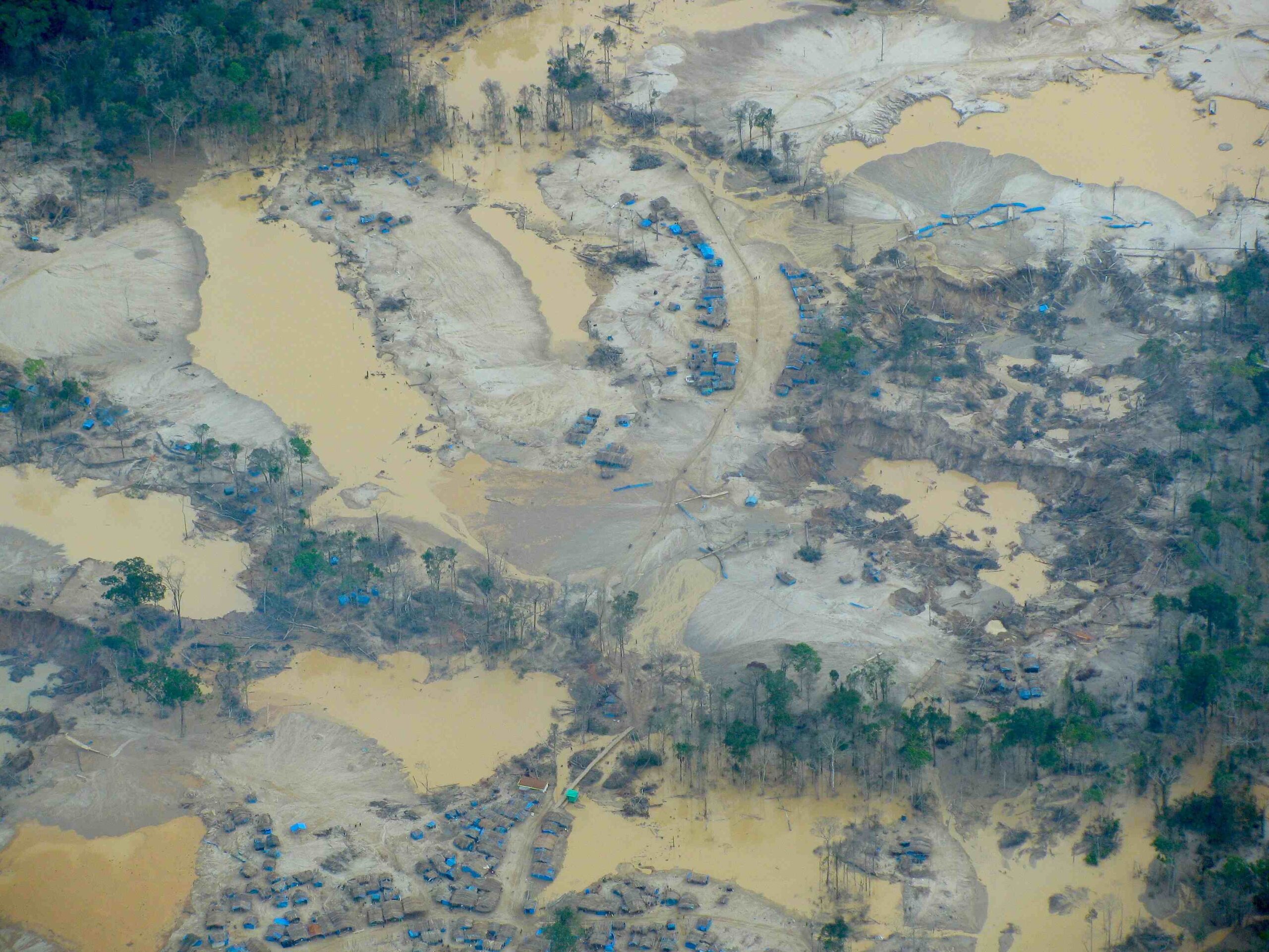

 Our novel
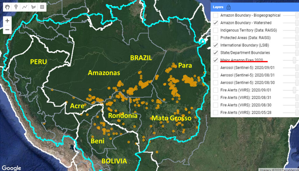
 Sincerely,


 Loading...


