MAAP #134: Agriculture And Deforestation In The Peruvian Amazon

Peru’s first National Agricultural Area Map. Source: MIDAGRI.

For the first time, Peru has a detailed National Agricultural Area Map.

This unique map, produced with high-resolution satellite imagery, was published by the Peruvian Ministry of Agrarian Development (MIDAGRI) in January.*

This map reveals that the agricultural area at the national level is 11.6 million hectares, as of 2018.

Here, we analyze this new information in relation to annual forest loss data, generated by the Peruvian Environment Ministry (Geobosques).

The goal is to better understand the critical link between agriculture and deforestation in the Peruvian Amazon.

Specifically, we analyze the agricultural area of 2018 in relation to the preceding forest loss between 2001 and 2017.

Below are two main sections:

First, we present our Base Map that illustrates the major results.

Second, we show a series of zoomed images of select areas to illustrate key results in detail. These areas include major deforestation events related to oil palm, cacao, and other crops.


Base Map showing our major results. Data: MAAP, MIDAGRI, MINAM/Geobosques. Double click to enlarge.

Major Results

  • We found that 43% (4.9 million hectares) of Peru’s total agricultural area in 2018 was located in the Amazon basin.
  • Of these Amazonian agricultural areas, more than 1.1 million hectares (24%) came from forest lost between 2001 and 2017 (indicated in red on the Base Map).
  • Expressed another way, over half (56%) of the forest loss in the Peruvian Amazon between 2001 and 2017 corresponds to an agricultural area in 2018.
  • The Base Map also shows, in brown, the agricultural area that is not linked to recent forest loss. The vast majority is located outside the Amazon basin (western Peru).
  • Finally, the Base Map shows, in black, the recent forest loss not linked to agriculture. Much of this loss corresponds to gold mining (southeastern Peru), logging roads, and natural loss such as landslides.

Zooms of Key Areas

A. United Cacao (Loreto)

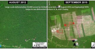
Image A shows the large-scale deforestation associated with the company United Cacao between 2013 and 2016, in the Loreto region  (MAAP # 128). The clearing, as the name indicates, was for the installation of Peru’s first and only industrial-style cacao plantation. In total, the deforestation for the plantation reached 2,380 hectares.

Zoom A. United Cacao (Loreto region). Data: MAAP, MIDAGRI, MINAM/Geobosques.

B. Oil Palm (Shanusi, Loreto)

Image B shows the large-scale deforestation of more than 16,800 hectares associated with oil palm plantations between 2006 and 2015, along the border of the Loreto and San Martin regions (MAAP #116). Of this total, the deforestation of 6,975 hectares was linked to two plantations managed by the company Grupo Palmas company. The remainder occurred in the private areas surrounding the company’s plantations.

Zoom B. Oil palm deforestation around Shanusi (Loreto region). Data: MAAP, MIDAGRI, MINAM/Geobosques.

C. Oil Palm (Ucayali)

Image C shows the large-scale deforestation of more than 12,000 hectares for two oil palm plantations between 2011 and 2015, in the Ucayali region (MAAP #41).

Zoom C. Oil palm deforestation (Ucayali region). Data: MAAP, MIDAGRI, MINAM/Geobosques.

D. Iberia (Madre de Dios)

Image D shows the expanding agriculture-related deforestation around the town of Iberia, near the border with Brazil and Bolivia (MAAP #75). The major cause, according to local sources, is the increase in corn, papaya, and cacao plantations. We have documented the deforestation of more than 3,000 hectares in this area since 2014.

Zoom D. Agriculture related deforestation around Iberia (Madre de Dios region). Data: MAAP, MIDAGRI, MINAM/Geobosques.

E. Zona Minera (Madre de Dios)

Finally, Image E shows deforestation in the gold mining hotspot known as La Pampa, in the Madre de Dios region. The non-agricultural deforestation in the center is the major illegal gold mining front. Around that area, and along the Interoceanic Highway, there is extensive agriculture-related deforestation.

Zoom E. Mining and agriculture deforestation in southern Peru (Madre de Dios region). Data: MAAP, MIDAGRI, MINAM/Geobosques.

*Notes and Methodology

According to MIDAGRI, the National Agricultural Area Map was “generated based on satellite images from RapidEye and later updated with satellite images from Sentinel-2 and the Google Earth platform, which allowed the mapping and precise measurement of the agricultural surface throughout the national territory.”

The data include “agricultural land with cultivation and without cultivation.” We assume that these data include cattle pasture.

The identification and quantification of deforested areas (2001-2017) that correspond to agricultural area in 2018 results from the analysis carried out in GIS by the superposition of both geospatial layers (MINAM and MIDAGRI).

Amazonian agricultural areas that came from forest lost between 2001 and 2017 = 1,185,722 hectares (indicated in red on the Base Map).

Acknowledgments

We thank E. Ortiz (AAF), S. Novoa (ACCA) and G. Palacios for their helpful comments on this report.

Citation

Vale Costa H, Finer M (2021) Agriculture and Deforestation in the Peruvian Amazon. MAAP: 134.

Establishing an Action Plan With Indigenous Partners to Conserve Three Areas in the Peruvian Amazon

In a meeting with representatives from the Amarakaeri Communal Reserve, an indigenous community in Peru, and the Puerto Azul Mberowe Native Community, we established a joint action plan to protect three key areas in the Peruvian Amazon: the Madre de Dios Territorial Reserve, the Amarakaeri Communal Reserve, and our Los Amigos Conservation Concession.


During the meeting Juan Loja, the Director of our sister organization’s (Conservación Amazónica – ACCA) Madre de Dios office, and the president of Amarakaeri’s leadership group, Walter Quertehuari, agreed there is a mutual need to join forces to reduce illegal activities, such as the illegal logging that threatens the three territories. They highlighted the importance of these efforts to strengthen the technology-based deforestation monitoring efforts in the region and promote sustainable economic activities in the ten indigenous communities that are partners of the reserve.


Asvín Flórez, head of the Amarakaeri Communal Reserve, noted that the collective work between the community, co-management, and Conservación Amazónica – ACCA will be important to continue strengthening livelihood of communities through conservation. Venancio Corisepa, another member of the community, said one of the first actions would be to establish boundaries between their community and the Los Amigos Concession. In addition, they proposed the continuation of strengthening and supporting community forest rangers that guard the forests.


Juan Loja also underlined the importance of consolidating this joint venture between three organizations, since the collaborative work with Puerto Azul will help us protect the proposed Madre de Dios Territorial Reserve where uncontacted indigenous peoples (referred to by the acronym PIACI in Spanish) reside.


Satellite Images of “Rivers of Gold” Raise Awareness of Major Deforestation in the Amazon

Image by International Space Station

An image provided by the International Space Station has been circulating around the internet showing an aerial view of cascading ‘rivers of gold’ in the Peruvian Amazon. These fascinating ‘rivers’ are in fact destructive and toxic pits that form as a result of illegal gold mining activities. Though these pits are a common sight for our GIS team, many media companies and the subsequent public were shocked by this unusual sight, inspiring a wave of recent news articles from around the world.


With the increase in illegal gold mining in the Peruvian Amazon come deforestation, mercury poisoning to community water sources, and social conflicts including prostitution and forced labor. As the demand for gold continues to increase, this illegal practice has expanded farther and farther into sensitive Amazonian ecosystems.


However, we’re keeping an eye on these activities from above, and then use this information to aid authorities working on the ground down below. Satellite imagery company Planet published an article about how we were using data from satellite imagery to crack down on illegal gold mining. “The vastness of the Amazon can be a major challenge to its conservation, but technology, especially satellites, have emerged as an extremely powerful tool,” says Dr. Matt Finer, our Senior Research Specialist and Director of their Monitoring of the Andean Amazon Project (MAAP).  “With the latest generation of satellites and related algorithms, we have been able to go from annual to more real-time monitoring. And it is this real-timeness that makes all the difference in linking this technology with effective policy action on the ground to reduce and avoid deforestation.”  


MAAP aims to document the most urgent deforestation cases in near real-time and identify the direct causes of deforestation in the Andean Amazon. In doing so, MAAP is able to better understand larger-scale deforestation patterns, hotspots, and drivers. With this information, MAAP is able to improve policy and conservation action based on this cutting-edge technical information. 


“Publishing this imagery is a new way to show the problem”, Matt Finer told Spanish news giant Agencia Efe. “It allows more people on a global scale to see it.”


“Paco” Fish Farms Advance Aquaculture in the Peruvian Amazon

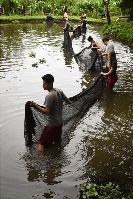
Photo of paco fish farm Amazon ConservationThis February saw the installment of a fish farm that will help generate sustainable livelihoods in the Peruvian Amazon and act as an important food source for local people. Located in the small district of Inambari, Madre de Dios near major conservation areas like the extensive National Tambopata Reserve, this initiative contributes to the development of aquaculture activities by offering low-cost fish feed for the different stages of cultivation of the Piaractus brachypomus fish – commonly known as “Paco” -, as well as other omnivorous Amazonian species. Paco are an important food source for local communities as it has a high protein content. The feed has been put through an ‘extrusion’ method, which means that it has gone through a cooking process that uses high temperatures and pressure for a short period of time.

The idea for this initiative began with a local association of aquaculturists (called Asociación de Acuicultores de Primavera Alta y Primavera Baja) when they saw the need to lower the costs of running sustainable fish farms to make them better alternatives to other forms of livelihoods that may destroy the rainforest. Thanks to financing by Amazon Conservation and the Peruvian government’s National Program for Innovation in Fisheries and Agriculture (PNIPA), this association is now able to feed their paco fish farms at a lower cost, also showing their neighboring communities that conservation and sustainable living can be done.

This is one of the many ways our Alliance is promoting sustainable livelihoods and food security for people who call the Amazon home. 


New Biodiversity Monitoring Projects at Los Amigos Conservation Hub

Camera trap photo of a white lipped peccary by Amazon ConservationResearchers Dr. Andy Whitworth and Dr. Henry Pollock from Osa Conservation began a new research project at our Los Amigos Conservation Hub to assess how many white-lipped peccaries are present in the world’s first conservation concession.  This species has a vulnerable status with the IUCN red list and was recorded to have almost disappeared in this region of Peru for 12 years until we began to see it again at Los Amigos with prior camera trap photography efforts.

The team has already installed 30 camera traps in a grid covering 3.7 square miles (6 square km) to monitor this type of peccary and try to understand how healthy the local population is. This continued effort to learn more about this species will help guide our conservation efforts to keep it from moving closer to extinction.

Not only are we tracking peccaries at Los Amigos, but during the next few months researchers led by our co-founder Dr. Adrian Forsyth,  Dr. Alejandro Lopera-Toro, and scientists from the local University of San Antonio Abad Del Cuzco will be conducting studies on the diversity of beetles in the different types of forests around this Conservation Hub. They will also conduct ecological and behavioral studies around beetle species, helping improve our knowledge of these important supporters of the rainforest’s ecosystems.

We are looking forward to the new discoveries of our researcher friends!


MAAP #133: Deforestation Continues In National Parks Of Colombian Amazon

Base Map. Deforestation 2020-21 in the National Parks of the Colombian Amazon. Data: MAAP.

As we have indicated in previous reports (MAAP #120), there is an “arc of deforestation” in the northwest Colombian Amazon, impacting numerous protected areas and indigenous reserves.

Here, we emphasize that this deforestation currently impacts four National Parks: Tinigua, Macarena, Chiribiquete and La Paya.

In the Base Map, the red circles indicate the areas most impacted by recent deforestation within these parks.

The letters (A-D) indicate the location of the high-resolution satellite images (Planet) below.

While Tinigua and Macarena continue as the most impacted National Parks, below we focus on the new deforestation fronts in Chiribiquete and La Paya.

Specifically, we show the most recent and urgent deforestation, since September 2020 to the present (February 2021).


Chiribiquete National Park

Chiribiquete National Natural Park lost more than 1,000 hectares (2,500 acres) in the last six months, in six different areas of the park (see Base Map above). Much of this deforestation appears to be associated with the conversion of primary forest to illegal cattle pasture. The following satellite images show deforestation in three of these areas (A-C) between September 2020 (left panel) and February 2021 (right panel). *It is important to note that immediately prior to this publication authorities carried out a major intervention to crack down on the illegal activity within the park (see news here).

Image A. Deforestation in Chiribiquete National Park, western sector 1. Reference coordinate: 1.05497 ° N, 74.26465 ° W. Data: Planet, MAAP.
Image B. Deforestation in Chiribiquete National Park, western sector 2. Reference coordinate: 1.57990 ° N, 73.78689 ° W. Data: Planet, MAAP.
Image C. Deforestation in Chiribiquete National Park, northern sector 1. Reference coordinate: 2.00975, -73.45541. Data: Planet, MAAP.


La Paya National Park

La Paya National Park lost more than 150 hectares (370 acres) in the last six months, in the northwest sector of the park (see Base Map above).
.
The following image shows an example of deforestation in this sector of the park between September 2020 (left panel) and January 2021 (right panel).

Image D. Deforestation in La Paya National Park, northern sector. Reference coordinate: 0.39677 ° N, 75.48505 ° W. Data: Planet, MAAP.

Fire Season

In addition, the fire season has started in the Colombian Amazon. Interestingly, now (February to March) is typically Colombia’s peak deforestation and fire season, in contrast with Brazil, Bolivia, and Peru, whose seasons peak between June and October.

The following very high-resolution images (Skyat) reveal the burning of recently deforested areas within Chiribiquete National Park.

Fire inside Chiribuete National Park (February 11, 2021) burning recently deforested areas. Data: Planet (Skysat).
Zoom of fire inside Chiribuete National Park (February 11, 2021) burning recently deforested areas. Data: Planet (Skysat).

Acknowledgmens

We thank R. Botero (FCDS) and G. Palacios for their helpful comments on this report.

Citation

Finer M, Mamani N (2021) Deforestation Continues in National Parks of Colombian Amazon. MAAP: 133.


Conservation Goes Virtual During Pandemic

Conservacion Amazonica ACEAA Virtual Conservation TrainingDespite the challenges of not being able to enter conservation areas and regularly meet with the communities that we partner with due to the ongoing COVID-19 pandemic, we’ve been able to adapt our conservation training programs to be delivered through online.

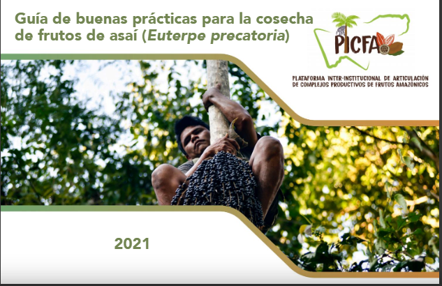
Recently, our sister organization in Bolivia, Conservación Amazónica – ACEAA, hosted a series of webinars on sustainable forest products. This included a webinar on açaí, a very important fruit that grows in the Amazon Rainforest. Families harvest these berries and sell them at local and regional markets as a key source of income. Because açaí cannot survive in a monoculture environment, that is, it can only grow in wild forests, local communities have the incentive of protecting their forests so that this valuable berry can thrive.

Additionally, from February 9 -11 Conservación Amazónica – ACEAA led a series of workshops on ways to improve how ecological data is used in Bolivia, in partnership with NatureServe and iDiv Biodiv Research. These virtual forums brought together nearly 90 experts from public and private organizations that specialize in the generation of biodiversity data and its applications to  conservation in the country as part of the TAO (Tropical Andes Observatory) Project. 

The groups aimed to find solutions for how biodiversity data is generated, integrated and delivered to decision makers in critical biodiversity points such as the tropical Andes so that they can be taken into consideration when policies are developed around conservation. Results and best practices developed in the workshop are now being compiled and will be distributed to partners in Peru, Ecuador, Spain and Germany for knowledge sharing and implementation in other areas. 


Celebrating our Incredible Women in Science 

Putting science at technology to work for conservation is one of our three core approaches to protecting the Amazon, and our conservation hubs serve as important research centers for scientists from around the world to conduct studies in rainforest environments. But according to data from the UNESCO Institute of Statistics, less than 30% of the world’s researchers are women, and environmental conservation has historically been known as a male-dominated field. This #WomenInScience Day, we highlight some of the impressive scientists in our organization that are reinforcing this career path for future young researchers interested in conservation.  


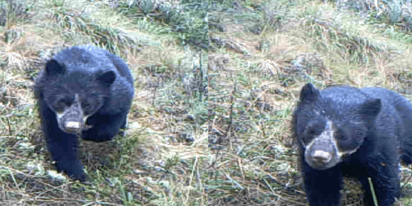
 Ruthmery Pillco, originally from a small village outside of Cuzco, Peru, is the coordinator for the Andean spectacled bear research project at our Wayqecha Biological Station. She is a trilingual speaker of Spanish, English, and Quechua, and has extensive experience as a field biologist, having written an undergraduate thesis on woolly monkeys and working on a master’s one about Andean plants and climate change. When asked why she chose biology as a career, Ruthmery replied that, “From a very young age I have always been curious, and wondered why things are [the way they are] and how to solve problems,” and cites her greatest scientific accomplishment as the propagation of the Costa Rican Pleodendron, which is an extremely rare tree species considered a “living dinosaur”. Only 5 mature trees are known in the world, and the seeds that she was able to plant is helping prevent the species from becoming extinct.  Regarding her Andean spectacled bear research at Wayqecha, she most looks forward to learning more about the ecology of this species and how it will be affected by climate change, telling us that, “Peru and the planet have an incredible biodiversity of plants and animals, many of which are disappearing due to human activity. As people, we have a considerable responsibility to preserve this great legacy, nature, and as a researcher, I want to support this important commitment.”


Over at our sister organization Conservación Amazónica – ACEAA in Bolivia, we highlight researcher Lucero Hernani Lineros, who coordinated with the Amazon University of Pando to conduct research on primates at our Tahumanu Biological Station in Bolivia. Lucero cites this experience as the start of her passion for studying primates, though her inclination towards a career in science began in her childhood. With science, she says, “I was able to follow my curiosity and desire to promote to greater society the vision of unity between humans and nature.” When asked about what she thought was her biggest achievement, she highlights a research project she conducted over a span of two years studying the effect of anthrophony on the behavior and physiology of grey titi (Plecturocebus donacophylus),a project that will be shared in the International Congress of Primatology of IPS – SlaPrim in Ecuador next year.


Lucía Castro, the Science Projects Coordinator at Conservación Amazónica – ACCA in Peru, recalls that since she was little, she was drawn to nature as it piqued her curiosity. “Over time,” she says, “I wanted to work to protect it.” As a Science Projects Coordinator, Lucia is always in contact with researchers, working together to implement technology that assists conservation studies. She also helps with forest conservation initiatives, assuring the local populations in Cusco and Madre de Dios have sustainable livelihoods. When asked about what her goal was, Lucia replies, “My intention is to help make available the scientific information compiled by Conservación Amazónica – ACCA in the tropical Andes, so that together with researchers and scientists from around the world, we can seek solutions to the environmental problems of today and tomorrow.”


Finally, Judith Westveer is our Science Director at Conservación Amazónica – ACCA and currently lives in Madre de Dios, Peru, which is a long way from her home in the Netherlands. Judith helps drive conservation forward by developing the science vision for our three conservation hubs in Peru, and wants to make sure that the Andean Amazon ecosystem is studied so that it can be better protected. Judith was drawn to pursuing a career in science because in addition to being naturally talented in math and biology in school, she believes that “nature is infinitely interesting, especially how all the plants and animals live together and depend on each other.” This, in part, led her to the field of conservation. She tells us, “I witnessed with my own eyes how nature is being destroyed on a large scale. The subjects I studied during my bachelor’s, master’s, and PhD were in sensitive areas that may no longer exist. I feel called to counteract this destruction, by the intrinsic value of nature.” Additionally, Judith feels her greatest scientific accomplishment is not her various publications on wetland restoration during her Ph.D, but the presentations and conversations she had with local communities, provincial working groups, and the Dutch government based on her scientific results. With this, “they understand how the results of my research could lead to action, and thus rivers and streams are now better managed and protected.”


Scientists like these incredible women take on important initiatives to protect forest, research critical conservation topics, and advance our knowledge of the Amazon. We are grateful for all the incredible work they do!


New Agrobiodiversity Zone Preserves Essential Biodiversity for Indigenous Communities

woman in marcapata ccollana agrobiodiversity zoneMarcapata Ccollana, an indigenous community of Quechua origin in Cuzco, Peru has just been established as an agrobiodiversity zone with the help of our sister organization, Conservación Amazónica – ACCA. More than 55,800 acres of vast agricultural genetic diversity and ancestral lands are officially protected, which preserves various types of endemic Andean root vegetables.

Located in the Quispicanchi province in Cusco, Marcapata Ccollana’s altitudinal gradient ranges from 9,100 ft -17,000 ft (2,800 m – 5,200 m) above sea level. These conditions favor the growth of more than 99 varieties of potatoes, 25 of corn, 56 types of unique root vegetables, and multiple varieties of quinoa, tarwi bean and kiwicha seed, which  are essential for the food security of 200 local families, especially in light of the COVID-19 pandemic.

Additionally, that Marcapata Ccollana is also “an important force of cultural diversity” is evidenced in the Quechuan “ayllu,” the communal structure that shapes the natural resource management of the area. This is in combination with other ancestral practices known to conserve agrobiodiversity, such as the Chuki, T’aya, and Wachu crop-rotation systems.

The recognition of Marcapata Ccollana as an agrobiodiversity zone was a community-driven effort with the support of our sister organization vegetables in marcapata ccollana agrobiodiversity zoneConservación Amazónica – ACCA, the Peruvian National Protected Areas Service (SERNANP), the United Nations Development Program (UNDP), and the Regional Government of Cusco.


Creating a Mosaic of Protected Areas 

The Marcapata Ccollana Agrobiodiversity Zone is connected to the Ccollasuyo Agrobiodiversity Zone, established in November 2020, and to the Ausangate Regional Conservation Area, established with our support in 2019. This mosaic of conservation areas allows us to safeguard biological diversity and the quality of ecosystem services for the well-being and sustainable development of indigenous Andean communities such as the Phinaya, Sallani, Ccollasuyo and Marcapata Ccollana. In a context of climate crisis, this action increases the resilience of these ancestral lands.


MAAP #132: Amazon Deforestation Hotspots 2020

We present a first look at the major hotspots of primary forest loss across the Amazon in 2020 (see Base Map).*

Base Map. Forest loss hotspots across the Amazon in 2020. Data: UMD/GLAD, RAISG, MAAP. The letters A-G correspond to the zoom examples below.

There are several major headlines:

  • We estimate over 2 million hectares (5 million acres) of primary forest loss across the nine countries of the Amazon in 2020.*
  • The countries with the highest 2020 primary forest loss are 1) Brazil, 2) Bolivia, 3) Peru, 4) Colombia, 5) Venezuela, and 6) Ecuador.
  • The majority of the hotspots occurred in the Brazilian Amazon, where massive deforestation stretched across nearly the entire southern region. Many of these areas were cleared in the first half of the year and then burned in July and August. In September, there was a shift to actual forest fires (see MAAP #129).
  • Several of the most intense hotspots were in the Bolivian Amazon, where fires raged through the dry forests (known as the Chiquitano) in the southeast region.
  • There continues to be an arc of deforestation in the northwestern Colombian Amazon, impacting numerous protected areas.
  • In the Peruvian Amazon, deforestation continues to impact the central region. On the positive, the illegal gold mining that plagued the southern region has decreased thanks to effective government action (see MAAP #130).

Below, we show a striking series of high-resolution satellite images that illustrate some of the major deforestation events across the Amazon in 2020 (indicated A-G on the Base Map).


Widespread Deforestation in the Brazilian Amazon

Zooms A-C show examples of a troublingly common phenomenon in the Brazilian Amazon: large-scale deforestation events in the first half of the year that are later burned in July and August, causing major fires due to the abundant recently-cut biomass. Much of the deforestation in these areas appears to associated with clearing rainforests for cattle pastures. The three examples below show the striking loss of over 21,000 hectares of primary forest in 2020.

Zoom A. Deforestation in the Brazilian Amazon (Amazonas state) of 3,400 hectares between April (left panel) and November (right panel) 2020. Data: ESA, Planet.


Zoom B. Deforestation in Brazilian Amazon (Amazonas state) of 2,540 hectares between January (left panel) and November (right panel) 2020. Data: Planet.


Zoom C. Deforestation in Brazilian Amazon (Para state) of 15,250 hectares between January (left panel) and October (right panel) 2020. Data: Planet.


Forest Fires in the Brazilian Amazon

In September, there was a shift to actual forest fires in the Brazilian Amazon (see MAAP #129). Zoom D and E show examples of these major forest fires, which burned over 50,000 hectares in the states of Pará and Mato Grosso. Note both fires impacted indigenous territories (Kayapo and Xingu, respectively).

Zoom D. Forest fire in Brazilian Amazon (Para state) that burned 9,000 hectares between March (left panel) and October (right panel) 2020. Data: Planet.
Zoom E. Forest fire in Brazilian Amazon (Mato Grosso state) that burned over 44,000 hectares between May (left panel) and October (right panel) 2020. Data: Planet.

Forest Fires in the Bolivian Amazon

The Bolivian Amazon also experienced another intense fire season in 2020. Zoom F shows the burning of a massive area (over 260,000 hectares) in the Chiquitano dry forests (Santa Cruz department).

Zoom F. Forest fire in Bolivian Amazon (Santa Cruz) that burned over 260,000 hectares between April (left panel) and November (right panel) 2020. Data: ESA.

Arc of Deforestation in the Colombian Amazon

As described in previous reports (see MAAP #120), there is an “arc of deforestation” concentrated in the northwest Colombian Amazon. This arc impacts numerous protected areas (including national parks) and Indigenous Reserves. For example, Zoom G shows the recent deforestation of over 500 hectares in Chiribiquete National Park. Similar deforestation in that sector of the park appears to be conversion to cattle pasture.

Zoom G. Deforestation in Colombian Amazon of over 500 hectares in Chiribiqete National Park between January (left panel) and December (right panel) 2020. Data: ESA, Planet.

Deforestation in the central Peruvian Amazon

Finally, Zoom H shows expanding deforestation (over 110 hectares), and logging road construction (3.6 km), in an indigenous territory south of Sierra del Divisor National Park in the central Peruvian Amazon (Ucayali region). The deforestation appears to be associated with an expanding small-scale agriculture or cattle pasture frontier.

Zoom H. Deforestation and logging road construction in Peruvian Amazon (Ucayali region) between March (left panel) and November (right panel) 2020. Data: Planet.

*Notes and Methodology

The analysis was based on early warning forest loss alerts known as GLAD alerts (30-meter resolution) produced by the University of Maryland and also presented by Global Forest Watch. It is critical to highlight that this data represents a preliminary estimate and more definitive data will come later in the year. For example, our estimate does include some forest loss caused by natural forces. Note that this data detects and classifies burned areas as forest loss. Our estimate includes both confirmed (1,355,671 million hectares) and unconfirmed (751,533 ha) alerts.

Our geographic range is the biogeographic boundary of the Amazon as defined by RAISG (see Base Map above). This range includes nine countries.

We applied a filter to calculate only primary forest loss. For our estimate of primary forest loss, we intersected the forest cover loss data with the additional dataset “primary humid tropical forests” as of 2001 (Turubanova et al 2018). For more details on this part of the methodology, see the Technical Blog from Global Forest Watch (Goldman and Weisse 2019).

To identify the deforestation hotspots, we conducted a kernel density estimate. This type of analysis calculates the magnitude per unit area of a particular phenomenon, in this case forest cover loss. We conducted this analysis using the Kernel Density tool from Spatial Analyst Tool Box of ArcGIS. We used the following parameters:

Search Radius: 15000 layer units (meters)
Kernel Density Function: Quartic kernel function
Cell Size in the map: 200 x 200 meters (4 hectares)
Everything else was left to the default setting.

For the Base Map, we used the following concentration percentages: Medium: 7-10%; High: 11-20%; Very High: >20%.

Acknowledgements

We thank E. Ortiz (AAF), M.E. Gutierrez (ACCA), and S. Novoa for their helpful comments on this report.

Citation

Finer M, Mamani N (2020) Amazon Deforestation Hotspots 2020. MAAP: 132.